The Canal and Étang Aumée in Fégréac

The landscape around Fégréac is characterised by three small valleys overlooked by the village. The first is home to the River Isac and the canal linking Nantes to Brest; the second is home to the Dréneuc stream and the marshes bordering it; and the third has been transformed into a large pond which once supplied the Aumée Mill. All converge on the River Vilaine, which can be seen at the Bellion lock. After passing through all these water-dominated spots, you return to the starting point by following the canal.

Details

n°3714635
Creation:
Last update:
Last review:
  • Walking
    Activity: Walking
  • ↔
    Distance: 8.27 mi
  • ◔
    Average duration: 4h 05 
  • ▲
    Difficulty: Moderate

  • ⚐
    Back to start: Yes
  • ↗
    Ascent: + 299 ft
  • ↘
    Descent: - 299 ft

  • ▲
    Highest point: 121 ft
  • ▼
    Lowest point: 10 ft
  • ⚐ Country: France
  • ⚐ City: Fégréac (44460)
  • ⚑
    Start/End: N 47.571656° / W 2.046288°
  • ❏
    IGN map(s): Ref. 1121SB
  • Hour-by-hour weather

Description of the walk

(S/E) With your back to the Maison du Canal, follow the towpath north-west for about 150 m, then turn right between two houses and head up towards Hôtel Menant (this is not an accommodation provider but the name of the village). When you reach the road that runs through it, turn left. After a circular bend to the right, the track climbs up onto the plateau and becomes a farm track. Ignore the first track branching off to the left, and turn left at the second one, which leads to Ballac.

(1) When you come out onto the road, turn right, pass the houses in the hamlet, then cross a side road to take the farm track that starts opposite. At the bottom of the descent, turn right, pass by a recently renovated fountain and washhouse, and head up to the left to reach the first houses of the village of Fégréac. Pass a mill on the left and turn right into Rue du Tertre. At the end, turn left. At the next junction, veer left and walk past the church on your right.

(2) At the corner by the church, turn left onto the street that runs alongside the Salle de la Danoterie (red and yellowGRP® markings). At the end, the street becomes a narrow path flanked by embankments. Cross Rue du Mottais and continue straight on along the path leading towards the marshes bordering the Ruisseau du Dréneuc.

(3) Cross the stream and leave the marshes.

(4) At the junction, go straight on (ignore the signpost directing you to the left). Cross the D35 (crossroads) and continue along a small road.

(5) When you reach the hamlet, turn left to cross it and carry on along a hedge. At the first path you come to, turn right to follow this lovely track flanked by two hedges. Further on, ignore the signpost directing you to turn right and carry straight on to La Basse Abbaye. As you pass, you’ll see the remains of an old oven on your left. When you come to the end of the path, turn right.

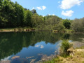
(6) Walk past the houses in the hamlet and turn left at the first crossroads. Again, ignore the path marked in yellow and follow the one that veers slightly to the left, behind the village houses. It leads into a fairly dense woodland until it reaches the road running alongside the pond. Cross the road and head slightly to the left onto the car park access road overlooking the pond, which continues as a path until it reaches the embankment surrounding the pond.

(7) When you reach the old mill, turn your back on the pond and walk up the road for about ten metres, before taking the first right at the cross. Follow the path that continues along the road until it joins a small road again. Let it pass you by, and turn immediately right to follow another path, lined with tall trees, which skirts the farmland and rejoins the road you encountered earlier.
Once back on this road, turn right and follow it to Pâtis Saint-Joseph.

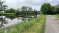
(8) After taking a look at the small chapel nearby, turn right and follow the small road until you reach the bridges over the railway line and then over the canal. Those who are curious are invited to continue to the right on the other side of the bridge to take a look at the lock and the River Vilaine.

(9) Turn left just before the bridge to join the towpath. Walk along the canal on your right-hand side. Walk back up to the level of the D124 bridge.

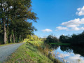
(10) Head back down the other side and continue along the towpath. Pass under the railway bridge and continue along the towpath back to the starting point (S/E).

Waypoints

  1. S/E : mi 0 - alt. 23 ft - Pont Miny – Maison du Canal
  2. 1 : mi 0.69 - alt. 98 ft - Ballac crossroads
  3. 2 : mi 1.65 - alt. 98 ft - Église Saint-Méréal (Fégréac)
  4. 3 : mi 2.07 - alt. 13 ft - Dréneuc Marshes
  5. 4 : mi 2.28 - alt. 46 ft - Junction
  6. 5 : mi 2.57 - alt. 95 ft - The Abbey of Le Puits
  7. 6 : mi 2.92 - alt. 82 ft - La Basse Abbaye
  8. 7 : mi 3.44 - alt. 36 ft - Dike of the - Étang Aumée
  9. 8 : mi 4.68 - alt. 69 ft - Le Patis Saint-Joseph
  10. 9 : mi 5.11 - alt. 23 ft - The Bellion - Canal de Nantes à Brest
  11. 10 : mi 6.68 - alt. 20 ft - Road bridge (D124)
  12. S/E : mi 8.27 - alt. 23 ft - Miny Bridge - Canal de Nantes à Brest

Notes

Although this route follows sections of signposted routes, you should not rely on the signposts you encounter, as the route frequently diverges from these routes, which, moreover, cross or overlap with one another. It can even happen that you take the same route in both directions.

Refreshments are available in the village of Fégréac, and toilet facilities are available at the Maison du Canal when it is open.

Worth a visit

Just above the Bellion lock lies the Carrière site. A hub for artistic expression, this spot is crowned by a very graceful wooden viewing platform, offering sweeping views of the surrounding marshes and the confluence of the canal with the Vilaine.
On the wooded hillock, opposite the other side of the Vilaine, stood Rieux Castle, of which only a few majestic ruins remain. It is now very difficult to imagine that a ford once crossed the river at this point. But that was back when the Vilaine was still subject to the tides.

Reviews and comments

4 / 5
Based on 2 reviews

Reliability of the description
4.5 / 5
Ease of following the route
3.5 / 5
Route interest
4 / 5
pierjac4477
pierjac4477

Overall rating : 4 / 5

Date of your route : May 17, 2026
Reliability of the description : ★★★★☆ Good
Ease of following the route : ★★★★☆ Good
Route interest : ★★★★☆ Good
Very busy route : No

A pleasant and varied route through the countryside, past a pond and along a towpath. The route description is clear, but we followed the GPS track, so we had no trouble finding our way. At Le Bellion, the short detour to the viewpoint is well worth it.

Machine-translated

ZENOP44
ZENOP44

Overall rating : 4 / 5

Date of your route : Jun 01, 2023
Reliability of the description : ★★★★★ Very good
Ease of following the route : ★★★☆☆ Average
Route interest : ★★★★☆ Good
Very busy route : No

It’s best to be online, as the route isn’t clearly signposted towards point 6 and we had to turn back. On the way back, we had the same problem near point 8: we ended up on the GR and didn’t follow the canal.

Machine-translated

Other walks in the area

For more walks, use our search engine .

The GPS track and description are the property of this route's author. Please do not copy them without permission.