From La Gacilly to the Chapel of Saint-Jugon via the Black Forest

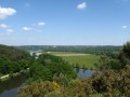
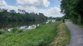
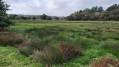
Starting from the marina, we begin by following the banks of the Aff, a charming little Breton river. Then, crossing the Forêt Neuve, we cross the Ruisseau des Brelles to enter the Forêt Noire. At the end of the path, we can stop for refreshments in the shade of the Chapelle Saint-Jugon.
The return journey is just as peaceful, taking the sunken lanes and ending up in the streets where the craftspeople's stalls are well worth stopping at.

Details

1241574
Creation:
Last update:
Last review:
  • Walking
    Activity: Walking
  • ↔
    Distance: 7.95 mi
  • ◔
    Average duration: 4h 00 
  • ▲
    Difficulty: Moderate

  • ⚐
    Back to start: Yes
  • ↗
    Ascent: + 436 ft
  • ↘
    Descent: - 410 ft

  • ▲
    Highest point: 305 ft
  • ▼
    Lowest point: 10 ft
  • ⚐ Country: France
  • ⚐ City: La Gacilly (56200)
  • ⚑
    Start/End: N 47.759927° / W 2.130046°
  • ❏
    IGN map(s): Ref. 1020SB, 1120SB
  • Hour-by-hour weather

Photos

Description of the walk

Car park near the rental boat pier.

(S/E) Leave the car park via the south exit (opposite the entrance/exit). Walk along Rue de l'Aff.
In front of the entrance to the water treatment plant, turn left to reach the riverbank, then turn right.
Walk along the river until the end of the path, where it meets the road.

(1) Cross the road and take the road opposite towards Les Planchettes (equestrian centre).
Continue along the path on the right which climbs up to the departmental road.

(2) Cross the D138, take the path opposite and, after 50 metres, follow the path on the right (not shown on maps). Initially heading west, it will veer north after a sharp right-hand bend. Continue straight ahead at the crossroads and then straight on after crossing the D777.

(3) Cross the Ruisseau des Brelles stream, then turn left. Follow the stream and, as soon as the path veers away from it, turn right to reach another path.

(4) Take this path on the left. When you reach the houses in Mabio, turn right and continue along the path heading due north. The climb is quite steep until you reach the end.

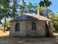
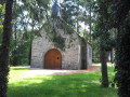
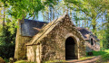
(5) Take the gravel road on the left that runs alongside four wind turbines. At the end of this service road, cross the D137. The Saint-Jugon Chapel is hidden among the trees.

(6) Leave the picnic area by taking the D137 on the left and after 50 metres, continue straight ahead on the path.
Cross the D8 and continue straight ahead. After the houses in La Corblaie, continue on the road to the right and join the D8, which you will follow to the left for 100 metres. (The hard shoulder on the right-hand side is suitable for walkers).

(7) At the end of the pedestrian area, follow the path on the right. Ignore a sunken path on the left and, 100 metres further on, take the path on the right. It ends at the access road to Haute Bardaie.

(8) At the end of the road, continue straight ahead, then turn right onto the second small road, which becomes a path after the houses. Continue eastwards on this path until you reach a gravel road.

(9) Follow this road to the right for 40 metres and then take a path on the left. At the end of the path, continue to the right, making a wide circular loop to the left. Continue straight ahead to the Croix Jacquary. Follow the road as it bends to the left.

(10) Turn right onto the path after the first building. Continue straight ahead to the roundabout next to the fire station.
Cross over and take the path that climbs alongside the road. Take Rue Saint-Vincent to the end.

(11) Turn right onto Rue Lafayette and continue on the left. Turn left onto Place de la Ferronnerie.
Cross it before the bridge to return to the car park via Rue de l'Aff. (S/E)

Waypoints

  1. S/E : mi 0 - alt. 23 ft - Port car park. Head towards the banks of the - Aff (rivière) - Affluent de l'Oust
  2. 1 : mi 0.9 - alt. 20 ft - Crossing the road
  3. 2 : mi 1.44 - alt. 197 ft - Crossing the D138.
  4. 3 : mi 1.91 - alt. 102 ft - Ruisseau des Brelles
  5. 4 : mi 2.22 - alt. 161 ft - Path on the left towards Mabio
  6. 5 : mi 2.75 - alt. 276 ft - Wide road on the left
  7. 6 : mi 3.95 - alt. 269 ft - Saint-Jugon Chapel
  8. 7 : mi 4.97 - alt. 144 ft - Path on the right
  9. 8 : mi 5.36 - alt. 171 ft - La Haute Bardaie.
  10. 9 : mi 5.97 - alt. 157 ft - Road on the right
  11. 10 : mi 6.98 - alt. 131 ft - Path on the right
  12. 11 : mi 7.63 - alt. 72 ft - Street on the right
  13. S/E : mi 7.95 - alt. 23 ft - Port car park

Notes

Toilets are available to the public near the starting point car park and near the chapel.
At the chapel, there is a picnic area (4 tables).

The legend of Saint-Jugon

Worth a visit

In La Gacilly, Rue Saint-Vincent and the Rue Lafayette neighbourhood are reserved for artisans from all guilds.
Near the starting point, the Yves Rocher house, immersive museum and restaurant: https://www.maisonyvesrocher.fr/fr/

Reviews and comments

4.3 / 5
Based on 19 reviews

Reliability of the description
4.2 / 5
Ease of following the route
4.2 / 5
Route interest
4.5 / 5
User 29365448

Overall rating : 4 / 5

Date of your route : May 18, 2026
Reliability of the description : ★★★★☆ Good
Ease of following the route : ★★★★☆ Good
Route interest : ★★★★☆ Good
Very busy route : No

A good route, but slippery in places in wet weather – make sure you wear suitable footwear

Machine-translated

Mapilland
Mapilland

I have hiked this trail three times and enjoy it every time. It is varied, with woods, shaded paths, sunken lanes and open stony paths.
The chapel is located in a green setting, ideal for a picnic stop.
A very beautiful hike that I will happily do again.

Machine-translated

GOGO
GOGO

Overall rating : 4.5 / 5

Date of your route : Jun 29, 2025
Reliability of the description : Not used / Not applicable
Ease of following the route : ★★★★★ Very good
Route interest : ★★★★☆ Good
Very busy route : No

A beautiful walk through forests and countryside, ending with an urban route where you can enjoy a magnificent outdoor photo exhibition in the town centre (check dates).

Machine-translated

Mapilland
Mapilland

Hello
This is the third time I've done this hike.
It's really lovely: it starts at the banks of the River Aff, continues through a wooded area, then arrives at the Saint-Jugon Chapel (ideal for a picnic), before continuing towards an open area with wind turbines, then on to a shady section that's a bit like a sunken lane. We make our way towards the centre of La Gacilly via the Rue des Artisans. And if you still have the energy, why not finish off this lovely walk with a visit to the photography festival, which runs from 21 June to 3 November.
Even after doing it three times, I still rediscover this walk when I share it with different people.
Enjoy your walk!

Machine-translated

MARCOO60
MARCOO60

Overall rating : 4.3 / 5

Date of your route : Jul 15, 2024
Reliability of the description : ★★★★★ Very good
Ease of following the route : ★★★★☆ Good
Route interest : ★★★★☆ Good
Very busy route : No

A beautiful route, pleasant and easy.

Machine-translated

Mapilland
Mapilland

Overall rating : 4.3 / 5

Date of your route : Jun 24, 2023
Reliability of the description : ★★★★☆ Good
Ease of following the route : ★★★★☆ Good
Route interest : ★★★★★ Very good
Very busy route : No

I'm not yet familiar with the application.
It was a bit complicated to follow
Luckily, I had printed out the map

Machine-translated

Y Christine
Y Christine

Overall rating : 4.3 / 5

Date of your route : Jun 30, 2022
Reliability of the description : ★★★★★ Very good
Ease of following the route : ★★★☆☆ Average
Route interest : ★★★★★ Very good
Very busy route : No

I had only printed out the map before setting off because I don't use phone apps.
On several occasions, the yellow markings were no longer visible, or the posts were broken and had not been put back in the right place.
Fortunately, after number 9, someone accompanied us to help us find the right path.
Otherwise, the picnic area at Chapelle St Jugon is very nice, but there are only two tables.
A very pleasant hike through the forest.

Machine-translated

tugny44
tugny44

Overall rating : 5 / 5

Date of your route : Jun 25, 2022
Reliability of the description : ★★★★★ Very good
Ease of following the route : ★★★★★ Very good
Route interest : ★★★★★ Very good
Very busy route : No

A pleasant route that takes us through woods and countryside along beautiful paths, avoiding paved roads as much as possible. With the Visorando app, there's no need to worry about the route.
The route ends magnificently through the streets of La Gacilly and its artisan craft shops.
I highly recommend this route.

Machine-translated

Robin M
Robin M

Overall rating : 4.3 / 5

Date of your route : Jun 01, 2022
Reliability of the description : ★★★☆☆ Average
Ease of following the route : ★★★★★ Very good
Route interest : ★★★★★ Very good
Very busy route : No

After point 9, it's not easy to get to the next point using only the description; I think you need a GPS. It's a shame because, as an old hiker, I prefer to look at nature rather than those damn screens!
Nevertheless, thank you to Visorando

Machine-translated

evy/hub
evy/hub

Overall rating : 5 / 5

Date of your route : Mar 24, 2022
Reliability of the description : ★★★★★ Very good
Ease of following the route : ★★★★★ Very good
Route interest : ★★★★★ Very good
Very busy route : No

a very beautiful hike, done during the week, which is why we didn't meet anyone.

Machine-translated

Magalio
Magalio

Overall rating : 3.7 / 5

Date of your route : Jan 24, 2022
Reliability of the description : ★★★☆☆ Average
Ease of following the route : ★★★★☆ Good
Route interest : ★★★★☆ Good
Very busy route : No

no signposts, but otherwise a lovely walk.

Machine-translated

FANFANBIHOREL
FANFANBIHOREL

Overall rating : 4.7 / 5

Date of your route : Jan 03, 2022
Reliability of the description : ★★★★★ Very good
Ease of following the route : ★★★★★ Very good
Route interest : ★★★★☆ Good
Very busy route : No

Beautiful hike, description and map essential

Machine-translated

On Ledit
On Ledit

Overall rating : 4.3 / 5

Date of your route : Jul 07, 2020
Reliability of the description : ★★★★☆ Good
Ease of following the route : ★★★★☆ Good
Route interest : ★★★★★ Very good
Very busy route : No

Pleasant walk, varied landscapes. Map essential.

Machine-translated

LuluH
LuluH

Overall rating : 4.3 / 5

Date of your route : Jun 30, 2020
Reliability of the description : ★★★★☆ Good
Ease of following the route : ★★★★★ Very good
Route interest : ★★★★☆ Good
Very busy route : Yes

Very few paved roads, beautiful panoramic views!!!

Machine-translated

Mich2605
Mich2605

Overall rating : 4 / 5

Date of your route : Jun 21, 2020
Reliability of the description : Not used / Not applicable
Ease of following the route : ★★★★☆ Good
Route interest : ★★★★☆ Good
Very busy route : No

Hello,
A pleasant little walk with very little road, mostly along paths through the woods
At point 5, you can leave the track and take the small forest path with the wind turbines on your right, then take the first path on the right to return to the track towards the third wind turbine.
At point 6, the Saint-Jugon chapel is a good place to stop for a snack or a break.

Machine-translated

Other walks in the area

For more walks, use our search engine .

The GPS track and description are the property of this route's author. Please do not copy them without permission.