Country:
 City:


The route starts from the small car park at the Étang Aumée leisure centre. If this is full, there are several car parks along the lake if you take the Route des Jaunais du Cas.
(S/E) From the car park, with the leisure centre behind you, take the path opposite (yellow and red markings forthe GRP® des Trois Rivières). After turning right, the path climbs towards a junction. Continue to the left, following the markings.
(1) At the next junction, continue along theGRP® by turning left. The path descends gently. At the bottom of the slope, turn sharply right, still following theGRP®. Walk uphill to the Château de la Cour de Rotz (private property).
(2) Carry on along the access road to the château, passing a small private chapel on your left.
(3) At the crossroads, turn left and continue along theGRP® des Trois Rivières. At the T-junction, turn left again (GRP®). Follow the road, pass the hamlet of Finetais and continue along a track (passing a bread oven on your left). Look out for a Yellow Cross indicating that you are leaving aPR® trail and continue along theGRP® which overlooks the railway line and the canal. You’ll come out onto a road; follow it to the right. Shortly afterwards, turn left onto a track suitable for vehicles which runs between two houses.
(4) At the next junction (greenhouses), take the track on the left. Caution: shortly afterwards, the track runs alongside the railway line at a distance of about 3 metres without any protective fencing: do not stray from the track! Then turn right with the track and stay on it through the woodland, ignoring a track on the right.
(5) Follow theGRP® sign onto thefirst path on the left. At the end, follow a road to the left. At the next junction, turn left and pass through the hamlet of Le Tertre. Cross the railway line at the level crossing and you will immediately come to a junction before the bridge over the canal.
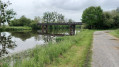
(6) Then follow the greenway to the left (do not take the bridge). N.B. The path on the opposite bank is not suitable as the footbridge you would need to use further on has been closed by municipal order. Follow the Nantes–Brest Canal on your right for about 3 km. After the Écluse des Bellions (junction with the Vilaine), cross a road. About 200 m further on, you’ll see the entrance to the Carrière du Bellion on the left.
(7) Enter the quarry and walk around it (the route is anti-clockwise). Climb up to the viewing point, which offers a stunning view of the region. Take your time exploring the site and discovering all its surprises, then return to the canal bank and the greenway.
(7) Continue along the canal (keeping it on your right) for about 5 km. Cross a road bridge, then a railway bridge.
(8) About 150 m before the next bridge (purple sign for “Oasis de l’Isac”), turn left onto the path leading towards L’Hôtel Ménant. At the junction, turn left (still following theGRP®).GRP® des Trois Rivières (signposted on a telephone pole). Pass a path on your left and you’ll come to a T-junction (marker 34). Turn left here.
(9) At the next junction, turn right and pass through the hamlet of Ballac. Cross the road at the next junction and continue straight ahead on the GRP®. After passing a farm on your left, you’ll reach a T-junction.
(10) Turn left and leave theGRP®, which heads off to the right. At the next junction (cross), go straight on. Then pass a path on your right.
(11) Before a bend, take the next path on the right. This path turns right then winds through or along the edge of a woodland. Pass a path on your right (marker 7) and reach a junction.
(12) Turn left onto Rue du Mottais. Take thefirst left and rejoin theGRP®. Walk down a steep slope, pass a path on your right, cross the Ruisseau du Dréneuc and walk gently uphill.
(13) At the junction, follow a road to the left towards Redon (note: the signposting may suggest you should go straight ahead). Then take thefirst left, towards La Guénelais. Pass the hamlet on your right. At the next junction (marker 7), take the path leading off to the left (GRP® signposting).
(14) At the hamlet of La Coquelinais, follow a road to the left and, after about fifty metres, turn right onto a track. At the end, follow a track suitable for vehicles to the left. You’ll come out onto a road; follow it to the left into the hamlet of Henrieux.
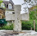
(15) Take thefirst road on the right, then immediately thefirst path on the left (follow theGRP®). Note a boundary cross erected at the end of theSecond World War (information board).
(16) Cross the D35 (chapel) and continue straight ahead (leaving theGRP® for a short while).
(17) At the corner by the castle, turn left. You’ll immediately come out onto another road; follow it to the right (joining theGRP® again). At La Gicquellerie, continue along the road which bends to the right.
(18) Take thefirst track on the left. This turns right twice before rejoining the road.
(19) Then take thefirst left, a track suitable for vehicles leading to the banks of the Étang Aumée.
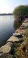
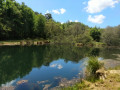
(20) Leave the road and follow a path opposite that runs alongside the lake. At the Fork in the road shortly afterwards, turn sharply left to stay as close as possible to the water. Pass a rest area (small beach) and join the road “Les Jaunais du Cas”.
(21) Follow the road to the left and ignore a road on the right.
(22) At the next junction, turn left onto a track suitable for vehicles (marked in yellow). Pass a path on your right and carry on.
(23) At the next junction, turn left and cross the bridge over the pond. Then take thefirst left onto Chemin du Rouet. Continue straight on for about 1.5 km. Cross a road and carry on straight ahead (dead-end road) until you reach a junction you passed on the way there.
(3) Then turn left. Cross a road and continue along a path. You’ll reach another junction you passed on the way out.
(1) Carry on straight ahead and, following the same route as on the way there but in the opposite direction, return to the starting car park (S/E).

 Visorando Member
 Moderate

 Easy