


Refine your search for walks in Juvigné
Juvigné walks
 Circuit des Mazures in Châtillon-en-Vendelais
 Local authority
 5.20 mi
 +174 ft
 -174 ft
 2h 35
2h 35
 Easy
Easy
 Departure from Châtillon-en-Vendelais (Ille-et-Vilaine)
This loop will take you through the countryside of Châtillon-en-Vendelais and Montautour.Can be done on foot or by mountain bike.
Roland’s Leap
 Visorando Member4.35 mi
+289 ft
-299 ft
2h 15
Easy
Departure from Dompierre-du-Chemin (Ille-et-Vilaine)
Visorando Member4.35 mi
+289 ft
-299 ft
2h 15
Easy
Departure from Dompierre-du-Chemin (Ille-et-Vilaine)
Le Saut Roland is the first designated area of natural beauty in the Marches de Bretagne. The steep cliffs rise to a height of 173 metres, and the wooded slopes stretching down to the valley floor form a landscape traversed from east to west by the Ruisseau Saint-Blaise.
Route du Champ Dolent to Saint-M’Hervé
9.78 mi
+387 ft
-361 ft
4h 50
 Moderate
Departure from Saint-M'Hervé (Ille-et-Vilaine)
Moderate
Departure from Saint-M'Hervé (Ille-et-Vilaine)
Walking alongside the Haute Vilaine reservoir for its entire length is the main attraction of this walk, which will also allow you to discover the charming little village of Saint-M’Hervé.
Circuit de la Paillardière à Saint-M'Hervé
6.07 mi
+240 ft
-240 ft
3h 00
Moderate
Departure from Saint-M'Hervé (Ille-et-Vilaine)
Discover the countryside around Saint-M'Hervé with this route, which takes you to the east of the village.
Montautour Rock
 8.00 mi
+390 ft
-367 ft
4h 00
Moderate
Departure from Montautour (Ille-et-Vilaine)
8.00 mi
+390 ft
-367 ft
4h 00
Moderate
Departure from Montautour (Ille-et-Vilaine)
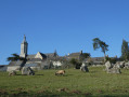
Here is a route for those who enjoy small, tarmac-surfaced country roads. Nevertheless, the verges are wide enough that, very often, you can walk on soft ground. It is also hilly enough to offer beautiful views of the surrounding countryside at certain points.
The Rocher route in the Vitré Communauté guidebook
From Châtillon-en-Vendelais to the hilltop village of Montautour
 9.80 mi
+676 ft
-673 ft
5h 05
Moderate
Departure from Châtillon-en-Vendelais (Ille-et-Vilaine)
9.80 mi
+676 ft
-673 ft
5h 05
Moderate
Departure from Châtillon-en-Vendelais (Ille-et-Vilaine)
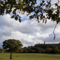
The famousGR® 34, which runs along the entire Breton coastline, also reveals a few inland sites with striking terrain, such as the wooded hills of Montautour and Châtillon-en-Vendelais.
The Bonant Route in Châtillon-en-Vendelais
 6.15 mi
+187 ft
-167 ft
3h 00
Moderate
Departure from Châtillon-en-Vendelais (Ille-et-Vilaine)
6.15 mi
+187 ft
-167 ft
3h 00
Moderate
Departure from Châtillon-en-Vendelais (Ille-et-Vilaine)
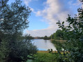
This route takes you through the countryside around Châtillon-en-Vendelais.
Suitable for walking or cycling.
Lake Haute Vilaine at La Chapelle-Erbrée
 8.66 mi
+249 ft
-249 ft
4h 10
Moderate
Departure from Saint-M'Hervé (Ille-et-Vilaine)
8.66 mi
+249 ft
-249 ft
4h 10
Moderate
Departure from Saint-M'Hervé (Ille-et-Vilaine)
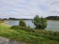
The Haute Vilaine Lake covers an area of 155 hectares and holds 8 million cubic metres of water, with a maximum depth of 13 metres.
Created in 1982, its purpose is to regulate winter floods on the Vilaine for Vitré and Rennes, located downstream.
Walking around the lake allows you to enjoy the lake and the forest paths.
The countryside around Chailland
9.16 mi
+617 ft
-620 ft
4h 45
Moderate
Departure from Chailland (Mayenne)
This route forms a figure of ‘8’; it can therefore be divided into two shorter circular loops: the upper circular loop is 9 km long, whilst the lower circular loop is just 5 km. It offers a lovely countryside stroll along quiet country lanes and very pleasant footpaths.
As far as Gué Guérin, following the Ernée
 9.02 mi
+358 ft
-335 ft
4h 25
Moderate
Departure from Montenay (Mayenne)
9.02 mi
+358 ft
-335 ft
4h 25
Moderate
Departure from Montenay (Mayenne)
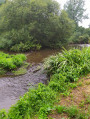
This route, known as the “Circuit des sentiers de l’Oscence”, originates in the Mayenne region.
It offers the pleasure of walking alongside the Ernée, a small river which flows into the Mayenne – a tributary of the Loire – as well as along some magnificent sunken paths.
Route de la Mine de Montbelleux à Luitré
 2.45 mi
+187 ft
-187 ft
1h 15
Easy
Departure from Luitré (Ille-et-Vilaine)
2.45 mi
+187 ft
-187 ft
1h 15
Easy
Departure from Luitré (Ille-et-Vilaine)
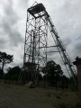
A short, easy route around the only remaining mine headframe in Brittany, with beautiful views of the region and the town of Fougères.
The Bois Février in Fleurigné
6.40 mi
+164 ft
-164 ft
3h 05
Easy
Departure from Fleurigné (Ille-et-Vilaine)
Two separate circular loops in the countryside around Fleurigné. Peace and quiet, greenery, shade and tranquillity are the hallmarks of these independent circular loops.
Le Relais des Vallées in La Chapelle-Janson
8.13 mi
+650 ft
-623 ft
4h 20
Moderate
Departure from La Chapelle-Janson (Ille-et-Vilaine)
Beautiful sunken lanes, hedgerow-lined countryside, patches of woodland, open countryside and quiet country lanes with very little traffic, offering views over the lush green valleys. A glimpse of the local heritage: the 16th-century Manoir de la Lande.
The Pouillé Copse in Larchamp
6.64 mi
+299 ft
-302 ft
3h 20
Moderate
Departure from Larchamp (Mayenne)
Unnoticeable to the hiker, this route has a unique feature: the waters encountered in the south feed into the Atlantic basin, whilst those in the north flow towards the English Channel.
It does, however, offer the chance to explore a site where woodworking was, for several centuries, the primary industry.
From L’Aumaillerie to Beaucé
3.69 mi
+66 ft
-75 ft
1h 45
Easy
Departure from La Selle-en-Luitré (Ille-et-Vilaine)
Apart from the section between (4) and (5), where the constant flow of cars and lorries can be a nuisance, this route on the outskirts of Fougères takes you along a greenway, beside a river, through sunken lanes and past a landscaped pond.
Discovering Fougères, a medieval town
 8.54 mi
+778 ft
-771 ft
4h 35
Moderate
Departure from Fougères (Ille-et-Vilaine)
8.54 mi
+778 ft
-771 ft
4h 35
Moderate
Departure from Fougères (Ille-et-Vilaine)
All the special features of the town of Fougères unfold before you throughout this urban walk: of course, you will walk around the castle with its 11 towers, but you will also discover it from the panoramic view of the Rocher Coupé or the Jardin Public. Speaking of gardens, the Parc des Orières, the Val Nançon and the Voie Verte are also on the programme. Finally, the upper town with its belfry, theatre and museums will allow you to explore the city centre.
The Green World circular in Mondevert
 6.32 mi
+102 ft
-102 ft
3h 00
Moderate
Departure from Mondevert (Ille-et-Vilaine)
6.32 mi
+102 ft
-102 ft
3h 00
Moderate
Departure from Mondevert (Ille-et-Vilaine)
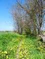
A circular route through the Mondevert countryside which also passes close to the Pertre Forest.
A stroll through Vitré
 4.81 mi
+194 ft
-194 ft
2h 25
Easy
Departure from Vitré (Ille-et-Vilaine)
4.81 mi
+194 ft
-194 ft
2h 25
Easy
Departure from Vitré (Ille-et-Vilaine)
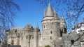
Whether you’re exploring this ‘City of Art and History’ or simply taking a stroll, here’s a short route that takes you through the historic quarter, past the castle, along narrow streets and through the Jardin du Parc.
The Pré des Lavandières route in Vitré
 2.84 mi
+174 ft
-148 ft
1h 30
Easy
Departure from Vitré (Ille-et-Vilaine)
2.84 mi
+174 ft
-148 ft
1h 30
Easy
Departure from Vitré (Ille-et-Vilaine)
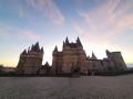
This route will take you on a timeless stroll through the medieval alleyways of old Vitré. You’ll also have the chance to explore the Pré des Lavandières and the Promenade du Val.
Signposted in a clockwise direction.
FFRP-certified route.
From Vitré to Argentré-du-Plessis via the Valière lake
 13.51 mi
+377 ft
-390 ft
6h 35
13.51 mi
+377 ft
-390 ft
6h 35
 Difficult
Departure from Vitré (Ille-et-Vilaine)
Difficult
Departure from Vitré (Ille-et-Vilaine)
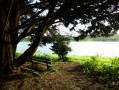
This route is the first stage of a 96 km circular through the Vitré countryside. Consisting mainly of sunken lanes, this route will take you, among other places, to the Château des Rochers-Sévigné and the Valière lake.
Around Genest-Saint-Isle
3.70 mi
+171 ft
-187 ft
1h 50
Easy
Departure from Le Genest-Saint-Isle (Mayenne)
An easy walk starting from Genest-Saint-Isle, with very little elevation gain. The paths are beautiful, and you may see deer. In rainy weather, two or three sections are flooded for a few metres, but you can get around this by walking along the edge of the adjacent field. A beautiful finish along a pretty little stream.
Around Fougères via Laignelet
5.34 mi
+413 ft
-400 ft
2h 50
Easy
Departure from Fougères (Ille-et-Vilaine)
Follow theGR®34through the countryside along sunken paths to reach the small village of Laignelet. Then, head into the Fougères Forest amongst the alders, firs and other tree species, following wide, natural paths to return to the starting point along the Ruisseau de Groslay via an educational trail showcasing the different tree species.
The forest and the northern districts of Fougères
5.30 mi
+305 ft
-295 ft
2h 40
Easy
Departure from Fougères (Ille-et-Vilaine)
After very quickly leaving the city’s noise behind whilst walking alongside the Ruisseau de Groslay and its arboretum, the walker enters the forest, where natural paths and well-maintained forest lanes combine, eventually crossing a residential area before returning to the starting point.
The Garenne Route north of Fougères
5.82 mi
+276 ft
-299 ft
2h 55
Easy
Departure from Fougères (Ille-et-Vilaine)
Although this route is mainly through suburban areas, it nevertheless offers some very interesting sections along sunken lanes or on a wooded hill, providing a magnificent view of the lower town of Fougères and the surrounding countryside.
From Nançon to Groslay via the Fougères Forest
5.72 mi
+305 ft
-302 ft
2h 55
Easy
Departure from Fougères (Ille-et-Vilaine)
An easy walk that combines the pleasures of the forest with the tranquillity of the riverbank.
As well as the majestic “Jumeaux”, it offers the chance to discover various species of trees, with information provided along the arboretum path.
Panoramic views of Fougères Castle
 3.12 mi
+305 ft
-312 ft
1h 40
Easy
Departure from Fougères (Ille-et-Vilaine)
3.12 mi
+305 ft
-312 ft
1h 40
Easy
Departure from Fougères (Ille-et-Vilaine)
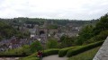
An urban walk offering various panoramic views of Fougères Castle, the belfry, and the churches of Saint-Léonard and Saint-Sulpice.
Route de la Valière, Vitré
 5.64 mi
+39 ft
-39 ft
2h 40
Easy
Departure from Vitré (Ille-et-Vilaine)
5.64 mi
+39 ft
-39 ft
2h 40
Easy
Departure from Vitré (Ille-et-Vilaine)
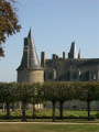
This reservoir, which has supplied drinking water since 1978, is also used to control flood peaks and maintain low water levels as required.
This route is FFRandonnée-certified. It can be enjoyed on foot or by bike.
The Chemin Mélouin in the Fougères Forest
6.91 mi
+351 ft
-367 ft
3h 30
Moderate
Departure from Fougères (Ille-et-Vilaine)
The Fougères State Forest is rich in Druidic sites: the Carrefour de la Serpe d’Or, the Cordon des Druides and the remains of the covered walkway at La Pierre Courcoulée. This route invites you to rediscover another aspect of the past, one closer to our own time: the Gate-sel and the Chemin Mélouin, a key route for smuggling in the Middle Ages between Brittany and the Kingdom of France.