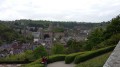
From L’Aumaillerie to Beaucé

Apart from the section between (4) and (5), where the constant flow of cars and lorries can be a nuisance, this route on the outskirts of Fougères takes you along a greenway, beside a river, through sunken lanes and past a landscaped pond.

Details

n°3005893
Creation:
Last update:
Last review:
  • Walking
    Activity: Walking
  • ↔
    Distance: 3.69 mi
  • ◔
    Average duration: 1h 45 
  • ▲
    Difficulty: Easy

  • ⚐
    Back to start: Yes
  • ↗
    Ascent: + 66 ft
  • ↘
    Descent: - 75 ft

  • ▲
    Highest point: 285 ft
  • ▼
    Lowest point: 240 ft

Description of the walk

Park in the car park on Rue Alfred Sauvy, on the right, in front of the garden centre and behind the Aumaillerie hall.

(S/E) From the car park, take the Voie Verte heading east. Cross a road and carry on straight ahead.
After 400 m, don’t miss the start of a path on the other side, signposted ‘Centre bourg’. Cross the road carefully and follow this path, which leads to a footbridge over the Couesnon.

(1) Immediately after the footbridge, turn right and walk alongside the Couesnon. Follow the path as it turns left, away from the river, heading north-east. Continue until you reach a road.

(2) Turn left onto this road and, after 50 m, keep left to walk past the holiday homes on your right. Enter the sports ground and walk past the two football pitches on your right. You will come out onto Allée des Acacias.

(3) You can choose not to walk around the pond – distance 1, km. Follow Allée des Acacias for 200, m and turn left, following the sign for “Étang des Vertes Rives”.

Ignore a road on the right, then as you approach the lake, turn right to walk round it anti-clockwise. Return to Rue des Vertes Rives, then turn right onto Allée des Acacias.

(3) Cross at the pedestrian crossing and head into the small square leading to the church and then the town hall. You’ll reach the edge of the N12.

(4) Turn left and walk along the pavement, which becomes a stony track as you leave the village.

(5) Leave the main road by turning left onto a path which becomes a road as you approach the houses.
Follow Rue de la Chaudronnerais as far as the bypass.

(6) Turn left onto the safe footpath that runs alongside the road and veers slightly away from it.
Continue to Rue Alfred Sauvy, which you must cross to return to the car park (S/E).

Waypoints

  1. S/E : mi 0 - alt. 249 ft - Car park in front of the garden centre
  2. 1 : mi 0.78 - alt. 240 ft - Footbridge over the > - Couesnon (fleuve)
  3. 2 : mi 1.57 - alt. 282 ft - Road on the left
  4. 3 : mi 1.95 - alt. 266 ft - Circular loop around the lake
  5. 4 : mi 2.64 - alt. 276 ft - Town hall and church along the N12.
  6. 5 : mi 3.08 - alt. 285 ft - Path on the left
  7. 6 : mi 3.48 - alt. 269 ft - Path alongside the ring road
  8. S/E : mi 3.69 - alt. 249 ft - Car park in front of the garden centre

Reviews and comments

4.2 / 5
Based on 2 reviews

Reliability of the description
4.5 / 5
Ease of following the route
4.5 / 5
Route interest
3.5 / 5
Patrick Davard
Patrick Davard

Overall rating : 4.7 / 5

Date of your route : Apr 20, 2026
Reliability of the description : ★★★★★ Very good
Ease of following the route : ★★★★★ Very good
Route interest : ★★★★☆ Good
Very busy route : No

A lovely little walk just outside Fougères; much of the route is through the countryside, though the only downside is crossing Beaucé along the RN12, which is very noisy

Machine-translated

asducpn35
asducpn35
• Edited:

Overall rating : 3.7 / 5

Date of your route : Jun 21, 2020
Reliability of the description : ★★★★☆ Good
Ease of following the route : ★★★★☆ Good
Route interest : ★★★☆☆ Average
Very busy route : No

A short, peaceful walk, apart from sections 4 and 5, which run alongside the RN 12 at the entrance to FOUGERES.

Machine-translated

Other walks in the area

For more walks, use our search engine .

The GPS track and description are the property of this route's author. Please do not copy them without permission.