The Bois Février in Fleurigné

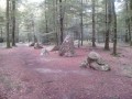
Two separate circular loops in the countryside around Fleurigné. Peace and quiet, greenery, shade and tranquillity are the hallmarks of these independent circular loops.

Details

1355911
Creation:
Last update:
Last review:
  • Walking
    Activity: Walking
  • ↔
    Distance: 6.40 mi
  • ◔
    Average duration: 3h 05 
  • ▲
    Difficulty: Easy

  • ⚐
    Back to start: Yes
  • ↗
    Ascent: + 164 ft
  • ↘
    Descent: - 164 ft

  • ▲
    Highest point: 456 ft
  • ▼
    Lowest point: 305 ft
  • ⚐ Country: France
  • ⚐ City: Fleurigné (35133)
  • ⚑
    Start/End: N 48.336386° / W 1.123758°
  • ❏
    IGN map(s): Ref. 1317SB
  • Hour-by-hour weather

Description of the walk

Car park in front of Fleurigné Town Hall along Avenue de Bretagne.

(S/E) Cross the avenue and head straight ahead towards the housing estate. Turn right onto Rue Mozart.
At the end of the street, turn left onto the path that runs behind the private properties.

(1) At the crossroads, carry straight on. Continue along this path until you reach the Ferme de l’Hourre.

(2) Turn right, then immediately left. The path curves to the left and becomes shaded. Carry on to the left, heading south-west.

(3) At the crossroads, turn left. Before reaching the houses at Bois Roux, the path goes round another property.

(4) Follow the road to the left, then take the first road on the right.
At a right-hand bend, carry on straight ahead along the path. You’ll reach the crossroads where the circular loops meet.

(1) Carry on straight ahead. Ignore the lane on the right leading to the Château du Bois Février and continue along the path.
In the distance, in certain places, you can see a beautiful residence: Château Montbrault.

(5) The path becomes a road as you approach Coulaines; carry on straight ahead to the right.
Reach the junction with the D17 and cross it.
Carry on straight ahead. Cross the Gambertière by turning left and continue along the track.

(6) When you reach a road, follow it to the left, cross the D17 again and carry on straight ahead. Continue along this path.

(7) At the fork in the road, keep right and follow the track as it bends to the left.

(8) Leave the main track, which turns left, by turning right; then, after 10 metres, turn left.
At the end of this track (which is poorly maintained), turn left.

(3) Carry on straight ahead to the right and follow the same route as before.

(4) Turn left onto the road, then take the first right.

(1) Turn right and, by turning right and then left, head for the Town Hall car park. (S/E)

Waypoints

  1. S/E : mi 0 - alt. 344 ft - Car park in front of the Town Hall
  2. 1 : mi 0.26 - alt. 354 ft - Junction of the circular loops
  3. 2 : mi 0.68 - alt. 364 ft - L’Hourre Farm: on the right
  4. 3 : mi 1.32 - alt. 341 ft - On the left
  5. 4 : mi 1.77 - alt. 341 ft - Road junction
  6. 5 : mi 2.98 - alt. 381 ft - Coulaines: heading north
  7. 6 : mi 3.71 - alt. 456 ft - Turn left onto the road
  8. 7 : mi 4.27 - alt. 335 ft - Turn right at the fork in the road
  9. 8 : mi 4.88 - alt. 322 ft - Turn right, then left
  10. S/E : mi 6.4 - alt. 344 ft - Car park in front of the Town Hall

Notes

The two circular loops are separate: the shorter one is 3.340 km long, whilst the longer one is 6.120 km.
To these two distances, you must add the return journey between (S/E) and (1), which is 410 metres, making a total of 820 metres.

Worth a visit

Saint-Martin’s Church, built inthe 17th century and inspired by Italian architectural styles, was listed by decree on 17 April 1913. It is an excellent example of the architecture of the reign of Louis XIV. Rebuilt by the de Langan family, it is shaped like a Latin cross, with the transepts featuring cut-off ends. The bell tower consists of superimposed domed belfries. The bell dates from 1569.

Montbrault Castle is a14th-century castle set within a 10-hectare park featuring plants, natural ponds and statues. It is privately owned but open as a guest house.

Built on the site of a former fortified castle, first mentioned as early as the12th century, the Château du Bois Février was constructed between 1730 and 1740, incorporating older structures. It was once surrounded by a curtain wall with towers and moats, exercised high justice over the market town, and was originally the feudal pledge of the sergentise of Fleurigné to the Baron of Fougères. It was elevated to a barony in 1658 and to a marquisate in 1674. The left wing, which was partially destroyed in 1795, was rebuilt in the second half ofthe 19th century in the Neo-Gothic style. The main building features a monumental staircase with straight flights and a large drawing room. It is also a private property and is not open to the public.

Reviews and comments

4.3 / 5
Based on 2 reviews

Reliability of the description
4.5 / 5
Ease of following the route
4.5 / 5
Route interest
4 / 5
big moustache
big moustache

Overall rating : 4.7 / 5

Date of your route : Mar 05, 2024
Reliability of the description : ★★★★★ Very good
Ease of following the route : ★★★★★ Very good
Route interest : ★★★★☆ Good
Very busy route : Yes

A fairly easy route with little elevation gain. Lovely paths on the whole, with the option of linking up with the
neighbouring villages.
The only snag: several sections completely covered in water (a very wet year), so best done on
fine weather

Machine-translated

OLVMALOU
OLVMALOU

Overall rating : 4 / 5

Date of your route : Jun 02, 2020
Reliability of the description : ★★★★☆ Good
Ease of following the route : ★★★★☆ Good
Route interest : ★★★★☆ Good
Very busy route : No

Plenty of shade for this time of year

Machine-translated

Other walks in the area

For more walks, use our search engine .

The GPS track and description are the property of this route's author. Please do not copy them without permission.