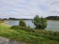
The Bonant Route in Châtillon-en-Vendelais

This route takes you through the countryside around Châtillon-en-Vendelais.

Suitable for walking or cycling.

Details

30167000
Creation:
Last update:
Last review:
  • Walking
    Activity: Walking
  • ↔
    Distance: 6.15 mi
  • ◔
    Average duration: 3h 00 
  • ▲
    Difficulty: Moderate

  • ⚐
    Back to start: Yes
  • ↗
    Ascent: + 187 ft
  • ↘
    Descent: - 167 ft

  • ▲
    Highest point: 476 ft
  • ▼
    Lowest point: 348 ft

Photos

Description of the walk

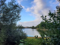
Start from the leisure centre car park, on the shores of the Étang de Châtillon.

YellowPR® signposting supplemented by green arrows marked with the number 1.

(S/E) From the car park, head towards the lake. At the lakeside, follow a path to the left and walk along the lake on your right-hand side.

(1) At the end of the lake, at a junction, turn right and, at the next junction, turn right again. Head uphill, stay on the road (D24) and pass the hamlet of L’Écoublère on your right. Ignore a road on the left and continue to the hamlet of Mauvel.

(2) Turn right onto a dirt track. You’ll come out onto a road; follow it to the right. Pass through the hamlet of Bonant and follow the road to the hamlet of Le Bois Tilleul.

(3) Turn right onto a small road. When the road bends to the right, carry on straight ahead along a track. Follow this track (north-west) until you reach a road (D108).

(4) Follow the road to the right, pass through the hamlet of Les Rues Jalesmes and ignore a road on the left.

(5) Shortly afterwards, turn right. Ignore a road on the right and carry on straight ahead (south). After a left-hand bend, you’ll reach a three-way junction at the hamlet of La Loirie.

(6) Then turn right, cross the hamlet and turn left onto the main road. Head downhill, cross a stream, go uphill again and pass under the bridge of a cycle path. Continue straight on until you reach a junction.

(7) Turn right and follow the D108 straight on to La Basse Epine.

(8) Then turn right. Cross the cycle path and immediately turn right onto the track running parallel to it. After about 150 m, turn left onto the track and go round a small copse. Reach the lakeside, turn left and continue straight on to the starting car park (S/E).

Waypoints

  1. S/E : mi 0 - alt. 348 ft - Car park at the leisure centre - Étang de Châtillon
  2. 1 : mi 0.31 - alt. 354 ft - Junction - Cantache (rivière)
  3. 2 : mi 1.09 - alt. 387 ft - Mauvel
  4. 3 : mi 2.48 - alt. 384 ft - Le Bois Tilleul
  5. 4 : mi 3.23 - alt. 476 ft - D108 road
  6. 5 : mi 3.55 - alt. 433 ft - Junction
  7. 6 : mi 4.32 - alt. 417 ft - The Loirie
  8. 7 : mi 4.75 - alt. 394 ft - Junction with the D108
  9. 8 : mi 5.44 - alt. 381 ft - La Basse Épine
  10. S/E : mi 6.15 - alt. 348 ft - Car park at the leisure centre - Étang de Châtillon

Notes

Car park and drinking water point near the start.

Worth a visit

Lake Châtillon-en-Vendelais.
Pedalos (in high season, run by the campsite).
Birdwatching centre.

Always be cautious and plan ahead when you're outdoors. Visorando and the author of this route cannot be held responsible for any accidents occurring on this route.

The GR® and PR® markings are the intellectual property of the Fédération Française de Randonnée Pédestre.

Reviews and comments

4.5 / 5
Based on 2 reviews

Reliability of the description
5 / 5
Ease of following the route
4.5 / 5
Route interest
4 / 5
User 9099562
• Edited:

Overall rating : 4.5 / 5

Date of your route : Aug 10, 2026
Reliability of the description : ★★★★★ Very good
Ease of following the route : ★★★★☆ Good
Route interest : Not used / Not applicable
Very busy route : No

Too many roads and uninteresting routes.

Machine-translated

Agapouack
Agapouack

Overall rating : 4.7 / 5

Date of your route : Jul 09, 2026
Reliability of the description : ★★★★★ Very good
Ease of following the route : ★★★★★ Very good
Route interest : ★★★★☆ Good
Very busy route : No

A lovely, pleasant route. In some places, there are magnificent sunken paths teeming with insect life. I was lucky enough to see lots of butterflies.
It’s still a bit frustrating, though, not to see much of the lake.

Machine-translated

Other walks in the area

For more walks, use our search engine .

The GPS track and description are the property of this route's author. Please do not copy them without permission.