Montautour Rock

Here is a route for those who enjoy small, tarmac-surfaced country roads. Nevertheless, the verges are wide enough that, very often, you can walk on soft ground. It is also hilly enough to offer beautiful views of the surrounding countryside at certain points.
The Rocher route in the Vitré Communauté guidebook

Details

n°3814787
Creation:
Last update:
Last review:
  • Walking
    Activity: Walking
  • ↔
    Distance: 8.00 mi
  • ◔
    Average duration: 4h 00 
  • ▲
    Difficulty: Moderate

  • ⚐
    Back to start: Yes
  • ↗
    Ascent: + 390 ft
  • ↘
    Descent: - 367 ft

  • ▲
    Highest point: 607 ft
  • ▼
    Lowest point: 390 ft
  • ⚐ Country: France
  • ⚐ City: Montautour (35210)
  • ⚑
    Start/End: N 48.203729° / W 1.148694°
  • ❏
    IGN map(s): Ref. 1317SB, 1318SB, 1417SB, 1418SB
  • Hour-by-hour weather

Photos

Description of the walk

Description written by “Le randonneur breton”.

The walk starts from the car park behind Montautour Town Hall.

The route described below is signposted by Vitré Communauté with Green Triangles bearing the number 40, ‘Route du Rocher’.

(S/E) From the rear of the town hall, take the path heading north. At the crossroads, turn left and, after a bend to the right, you’ll reach a road. Turn left. At the next T-junction, turn right and, at the end of the right-hand bend, join theGR® 34.

(1) Turn left onto theGR®. Follow it to the left, ignoring a path on the right, until you reach Le Pommier, where, at the T-junction, let theGR® continue straight ahead. Turn left, heading due north.

(2) Turn right towards Le Petit Pommier and continue to Mirligousse.

(3) At the left-hand bend, turn right onto a path and continue to the left at the fork. At the Grand Frênay crossroads, turn left towards Petit Frênay and continue right onto the D209.

(4) Before L’Hôtellerie, turn right and follow the road, ignoring all junctions to the right and left, until you reach Harault.

(5) Turn right and immediately follow the path to the left. At the end, turn right and carry on straight ahead along the road until you reach the crossroads where you rejoin theGR® 34.

(6) Turn left and, at La Pichotière, continue to the right.

(7) After 200 m, at a junction where theGR® heads left, turn right and you’ll reach the D24 county road.

(8) Follow it to the right and take a path on the right just before the sewage treatment works.

(9) In front of the houses at La Plissière, turn left. After 300 m, past the town boundary sign but before the houses, at the sign for “Rue de l’Épine”, take the path on the right.

(10) Head slightly to the right, then take thefirst path on the left which leads into Montautour. Continue to the left, then turn right onto Rue de Vitré. Turn left twice to join Rue de la Mairie, walk past the cemetery and return to the car park (S/E).

Waypoints

  1. S/E : mi 0 - alt. 584 ft - Town Hall car park – 1 Rue de la Mairie - Butte de Montautour
  2. 1 : mi 0.46 - alt. 541 ft - After the bend, take the GR to the left
  3. 2 : mi 1.13 - alt. 453 ft - Turn-off towards Le Petit Pommier
  4. 3 : mi 1.89 - alt. 443 ft - Mirligousse, path on the right. Near the - Pérouse (rivière) - Affluent de la Cantache
  5. 4 : mi 2.88 - alt. 594 ft - Before the Hôtellerie, turn right
  6. 5 : mi 4.38 - alt. 545 ft - Harault, turn right
  7. 6 : mi 5.24 - alt. 515 ft - At the crossroads, take the GR to the left
  8. 7 : mi 5.81 - alt. 522 ft - End of the GR
  9. 8 : mi 6.4 - alt. 436 ft - At the crossroads, take the road on the right
  10. 9 : mi 7.05 - alt. 463 ft - La Plissière
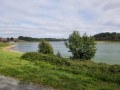
  11. 10 : mi 7.37 - alt. 522 ft - In front of the lake, take the path on the right
  12. S/E : mi 8 - alt. 584 ft - Town hall car park, 1 Rue de la Mairie - Butte de Montautour

Worth a visit

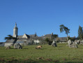
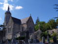
The Butte de Montautour is a listed site, rising to an altitude of 190 metres and dominated by the bell tower of the Church of Notre-Dame du Roc. It offers a magnificent panoramic view and a sight of 32 bell towers.

A wooden statue of the Virgin Mary, a nativity scene placed by hand within a rock, is the origin of the pilgrimage that takes place every second Sunday in July. Saint Louis, Louis XI and Louis XII are said to have made this pilgrimage.

Always be cautious and plan ahead when you're outdoors. Visorando and the author of this route cannot be held responsible for any accidents occurring on this route.

The GR® and PR® markings are the intellectual property of the Fédération Française de Randonnée Pédestre.

Reviews and comments

4 / 5
Based on 2 reviews

Reliability of the description
4 / 5
Ease of following the route
4 / 5
Route interest
4 / 5
bonchampois
bonchampois

Overall rating : 4 / 5

Date of your route : Mar 27, 2023
Reliability of the description : ★★★★☆ Good
Ease of following the route : ★★★★☆ Good
Route interest : ★★★★☆ Good
Very busy route : No

The marking is correct, but point 7 is open to dispute

Machine-translated

asducpn35
asducpn35

Overall rating : 4 / 5

Date of your route : Oct 11, 2020
Reliability of the description : ★★★★☆ Good
Ease of following the route : ★★★★☆ Good
Route interest : ★★★★☆ Good
Very busy route : No

A lovely walk around Montautour.
This undulating route takes you to one of the highest inhabited places in Ille-et-Vilaine.

Machine-translated

Other walks in the area

For more walks, use our search engine .

The GPS track and description are the property of this route's author. Please do not copy them without permission.