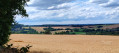
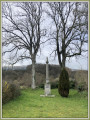
The countryside around Chailland

This route forms a figure of ‘8’; it can therefore be divided into two shorter circular loops: the upper circular loop is 9 km long, whilst the lower circular loop is just 5 km. It offers a lovely countryside stroll along quiet country lanes and very pleasant footpaths.

Details

3174420
Creation:
Last update:
Last review:
  • Walking
    Activity: Walking
  • ↔
    Distance: 9.16 mi
  • ◔
    Average duration: 4h 45 
  • ▲
    Difficulty: Moderate

  • ⚐
    Back to start: Yes
  • ↗
    Ascent: + 617 ft
  • ↘
    Descent: - 620 ft

  • ▲
    Highest point: 515 ft
  • ▼
    Lowest point: 279 ft
  • ⚐ Country: France
  • ⚐ City: Chailland (53420)
  • ⚑
    Start/End: N 48.223919° / W 0.870536°
  • ❏
    IGN map(s): Ref. 1417SB, 1418SB
  • Hour-by-hour weather

Description of the walk

Hike starting point: near the picnic area by the bridge over the Ernée in Chailland-en-Mayenne.

(S/E) Turn right onto Rue de l’Ancienne Gare, then right again onto Rue Saint-Germain and cross the bridge over the Ernée. Continue straight on along Rue de Saint-Hilaire.

(1) After No. 29 on the left-hand side of the street, turn right into Rue Roquet de Paradis. Pass through the hamlets of Le Paradis, Maisoncelles and then Le Châtelier until you reach a junction.

(2) Carry on straight ahead. Pass between La Basse Boullerie on the left and La Haute Boullerie on the right, and you’ll reach another crossroads.

(3) Turn right. Follow the road as it bends to the left and pass through Montermanger. Watch out for the dog ‘Maya’ on the right. The road becomes a track as you head towards La Bazonnière.

(4) After the hamlet, ignore the road on the right leading to La Gérardière and turn right at the next crossroads. Carry on, ignoring the turn-off to La Bardoulais on the right. Continue along the road.

(5) Turn right to walk alongside the road in the opposite direction and follow the path (not shown on IGN maps) which bends to the left. When you reach the crossroads, turn right and continue to La Guyardais until you reach the road.

(6) Follow the road to the right and continue due south to the hamlet of L’Hirondelle.

Red and yellow markings of theGRP® Tour des Marches de Bretagne

(7) Turn right. Turn left towards La Corbinière and continue southwards to reach La Gigoulais.

(8) Turn left, then at the T-junction, veer to the right. Pass La Boisardière and reach the tarmac road, Chemin des Maisons Neuves.

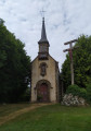
(9) Turn right into Ruelle du Vieux Cimetière, which ends at the church. Turn left to pass in front of the church entrance, then immediately right.

No further signposting

(10) Turn right again onto Rue du Bourg Moreau, which becomes Rue Roquet de Villeneuve (an 18 per cent incline) as you leave the town. Continue straight on along this road, ignoring La Multière on the left and then Villeneuve, until it ends at another road running at right angles.

(11) Turn left. Take the first road on the left towards La Pinière. After this hamlet, the road becomes a track that descends along the edge of the woods and joins the D 559 departmental road.

(12) Turn slightly to the left. Keep to the left and cross the Rau de Villeneuve, then follow the Ernée river before entering Chailland via the Quai D’Houdéot.

Once you can see the town hall on your left, cross the bridge over the Ernée on the right, then take the second street on the left to reach the car park (S/E).

Waypoints

  1. S/E : mi 0 - alt. 285 ft - Car park at the picnic area
  2. 1 : mi 0.39 - alt. 315 ft - At No. 29 – on the right
  3. 2 : mi 0.92 - alt. 387 ft - At the crossroads – go straight on
  4. 3 : mi 1.39 - alt. 423 ft - 2nd junction – turn right
  5. 4 : mi 2.12 - alt. 377 ft - La Bazonnière – straight ahead
  6. 5 : mi 2.93 - alt. 420 ft - Path on the right, forming a U-turn
  7. 6 : mi 3.65 - alt. 440 ft - La Guyardais – on the right
  8. 7 : mi 4.53 - alt. 463 ft - Junction with the GRP – turn right
  9. 8 : mi 5.14 - alt. 469 ft - La Cigoulais – on the left
  10. 9 : mi 5.59 - alt. 394 ft - Les Maisons Neuves – on the right
  11. 10 : mi 5.87 - alt. 285 ft - Street on the right
  12. 11 : mi 6.83 - alt. 367 ft - T-junction – turn left
  13. 12 : mi 8.14 - alt. 394 ft - Departmental Road D559 – turn left. Towards the - Ernée (rivière) à finaliser
  14. S/E : mi 9.16 - alt. 285 ft - Car park at the picnic area

Worth a visit

Chailland, which has been awarded the ‘Petite Cité de Caractère’ label, is well worth a visit, starting from the banks of the Ernée and the flower-bedecked bridge, near the old wheat mills and a washhouse with a movable floor.
There are four castles in the commune, all privately owned, each with different visiting arrangements.

To reach the Rocher de la Vierge, where the view over the Ernée valley is magnificent, you must pass through the terraced gardens of the former vicarage, on the right after the church.

Reviews and comments

4.3 / 5
Based on 2 reviews

Reliability of the description
4.5 / 5
Ease of following the route
4.5 / 5
Route interest
4 / 5
michelmf
michelmf
• Edited:

Overall rating : 4 / 5

Date of your route : Aug 10, 2026
Reliability of the description : ★★★★☆ Good
Ease of following the route : ★★★★☆ Good
Route interest : ★★★★☆ Good
Very busy route : No

A walk that begins with a gentle climb up to the church and ends in the village centre by the bridge. In the heart of the countryside, discover L’Ernée at the bottom of the valley, as well as
these few houses which would be well worth renovating into lodges, such is the tranquillity of the spot. Take a break surrounded by fields, horses and flowing water (a complete change of scenery). Watch out for the railings on the footbridge crossing the Ernée – DO NOT LEAN ON THEM or you’ll end up in the water. At the Hameau des Forges, walk round the large residential building, which has been beautifully restored.

Machine-translated

maussion catherine
maussion catherine

Overall rating : 4.7 / 5

Date of your route : Feb 21, 2021
Reliability of the description : ★★★★★ Very good
Ease of following the route : ★★★★★ Very good
Route interest : ★★★★☆ Good
Very busy route : Yes

Thank you for that lovely walk

Machine-translated

Other walks in the area

For more walks, use our search engine .

The GPS track and description are the property of this route's author. Please do not copy them without permission.