Route du Champ Dolent to Saint-M’Hervé

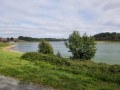
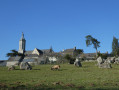
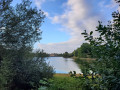
Walking alongside the Haute Vilaine reservoir for its entire length is the main attraction of this walk, which will also allow you to discover the charming little village of Saint-M’Hervé.

Details

3710091
Creation:
Last update:
Last review:
  • Walking
    Activity: Walking
  • ↔
    Distance: 9.78 mi
  • ◔
    Average duration: 4h 50 
  • ▲
    Difficulty: Moderate

  • ⚐
    Back to start: Yes
  • ↗
    Ascent: + 387 ft
  • ↘
    Descent: - 361 ft

  • ▲
    Highest point: 466 ft
  • ▼
    Lowest point: 292 ft

Description of the walk

Red and white markings forthe GR® 34
YellowPR® markings and green arrow no. 43

(S/E) Head south, passing in front of the church forecourt, and take the path between the buildings to follow Rue de la Mairie. After a left-hand bend, take the path on the right and continue southwards. Follow Allée des Vergers to the left to leave the village.

(1) Just before the ‘end of built-up area’ sign, turn right onto the footpath. It takes a sharp right-hand bend before widening into a broad stony track. This too heads due south.

(2) At a right-hand bend, continue along the path on the left. Turn right at a right angle to walk between two fields. When you reach a road, follow it to the right and then veer left to take the path that runs alongside the road, high up on the right-hand side.
The track veers to the left and continues between two fields.

No furtherGR® markings

(3) Leave theGR®, head right and continue to the left to reach the shores of the lake. Turn left to cross the Leisure Park using the path which has several flights of steps. Continue along the lake.

(4) Turn right to cross between the two lakes and then continue to the right, heading south. The path becomes a small track suitable for vehicles after the barrier. You’ll reach a T-junction.

(5) Carry on to the right and follow the shore of the lake. The path veers away from the shore, heading up into a woodland and joining a road. Follow it to the right to head back down.

(6) Turn right before reaching the houses and go through the barrier. You’ll reach the shores of the lake again. Pass the footbridge on your right, which links up with other routes. From the middle of the bridge, there’s a stunning view of both parts of the lake. Continue along the path heading north, then north-east.

(7) Follow the path as it bends to the left up a short slope, then continue to the right to descend gently alongside the lake. Carry on alongside the lake, ignoring the sign for the alternative route to the left. Continue along the path that runs alongside the lake until you reach the D24 road.

(8) Be sure to follow the signposting and the instructions below:
At the road, turn left before crossing and continue to the right behind the safety barriers.
Cross the embankment, taking shelter behind the barriers, and turn left towards the rest area. Walk along the other bank of the lake, heading north and then west. Look out for the wooden hut: a freely accessible observation point from which to view the lake’s wildlife (please follow the instructions for use carefully).

(9) Cross the road and continue straight ahead. The path leads back onto a road.
Take it to the left, skirting the buildings at Le Plessis. After the farm, the road becomes a track again until you reach Pont Troton.

(10) Turn left and cross the Vilaine. Ignore the houses at La Piverdière on your left and continue along the road for a few hundred metres.

(11) Turn left onto the footpath heading south-west. The footpath leads onto a road. Turn right and stay on this road all the way to Saint-M’Hervé, ignoring any turn-offs to the right or left.
At the end of this road, take the protected pavement on the left-hand side of the D777 to reach the church car park (S/E).


Waypoints

  1. S/E : mi 0 - alt. 387 ft - Car park at the Place de l’Église
  2. 1 : mi 0.36 - alt. 354 ft - Leaving the built-up area – take the path on the right
  3. 2 : mi 1.22 - alt. 351 ft - Path on the left
  4. 3 : mi 2.41 - alt. 328 ft - Towards the Plan d’Eau de la Haute - Vilaine (fleuve)
  5. 4 : mi 2.98 - alt. 299 ft - Between the two bodies of water
  6. 5 : mi 3.48 - alt. 315 ft - On the right – ignore the alternative route
  7. 6 : mi 3.94 - alt. 361 ft - Wooded path on the right
  8. 7 : mi 4.53 - alt. 308 ft - A short climb to the left
  9. 8 : mi 6.22 - alt. 315 ft - Crossing the RD24
  10. 9 : mi 6.93 - alt. 295 ft - Crossing a road
  11. 10 : mi 7.71 - alt. 305 ft - Turn left
  12. 11 : mi 8.33 - alt. 344 ft - Path on the left
  13. S/E : mi 9.78 - alt. 387 ft - Car park at the Place de l’Église

Notes

The description above and the attached notes were written by “Le Randonneur Breton”.

The entire route is signposted with signs featuring a Green Triangle bearing the number 43.
Please note that this route intersects with others that have the same markings but different numbers.

Worth a visit

The Haute Vilaine Reservoir: created in 1982, the reservoir is a vast freshwater body covering 155 hectares, containing 8 million cubic metres of water (6 km long, 0.3 km wide and with a maximum depth of 13 m). The pond’s purpose is to maintain the low-water level of the Vilaine and to provide flood control for Vitré and Rennes, which lie downstream.

Always be cautious and plan ahead when you're outdoors. Visorando and the author of this route cannot be held responsible for any accidents occurring on this route.

The GR® and PR® markings are the intellectual property of the Fédération Française de Randonnée Pédestre.

Reviews and comments

4.8 / 5
Based on 2 reviews

Reliability of the description
5 / 5
Ease of following the route
5 / 5
Route interest
4.5 / 5
DoMy53
DoMy53

Overall rating : 4.7 / 5

Date of your route : Nov 03, 2025
Reliability of the description : ★★★★★ Very good
Ease of following the route : ★★★★★ Very good
Route interest : ★★★★☆ Good
Very busy route : Yes

A very pleasant and varied walk we took in the autumn, listening to the sound of dead leaves crunching underfoot. Landscapes of meadows, hedgerows, sunken paths, lakes...
It's a shame that it ends with two sections of road.

Machine-translated

Bruf
Bruf

Overall rating : 5 / 5

Date of your route : Sep 05, 2020
Reliability of the description : ★★★★★ Very good
Ease of following the route : ★★★★★ Very good
Route interest : ★★★★★ Very good
Very busy route : No

A lovely route through woods and fields, passing by the water sports centre and then along the River Vilaine. There are tables available near Bourgon for a picnic. There’s quite a bit of tarmac towards the end, and you can stop for a drink in St M’Hervé.

Machine-translated

Other walks in the area

For more walks, use our search engine .

The GPS track and description are the property of this route's author. Please do not copy them without permission.