


Refine your search for walks in Eygalières
Eygalières walks


 Around the Calans from Eygalières
 Visorando Member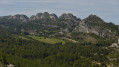
 6.44 mi
 +801 ft
 -771 ft
 3h 40
3h 40
 Moderate
 Departure from Eygalières (Bouches-du-Rhône)
This beautiful hike to discover the Calans starting from Eygalières is accessible to most people. We will first pass by Maset de la Lèque, where Jean Moulin took refuge after his parachute drop on 2 January 1942. Then, a path lined with boxwood will take us to the ridges and along the southern faces of Gros and Petit Calan.
The return to the village will be via theGR®6, lined with olive trees and beautiful properties.
This varied route offers beautiful views of the Alpilles, Luberon and Ventoux mountains, and allows you to discover the magnificent village of Eygalières.
Some steep and/or stony sections require sturdy footwear and walking sticks.
This route is not recommended after rain.
Circular loop around Eygalières with views of the Alpilles
 19.77 mi
+2,530 ft
-2,543 ft
11h 20
19.77 mi
+2,530 ft
-2,543 ft
11h 20
 Very difficult
Departure from Eygalières (Bouches-du-Rhône)
Very difficult
Departure from Eygalières (Bouches-du-Rhône)
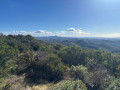
This is a long hike of over 30 km, starting from the beautiful village of Eygalières and leading to the ridges and the Plateau de la Caume, offering views on both sides of Mont Ventoux, the Luberon and the Crau plain. Then take the Chemin de Baume Brignolle via a DFCI track surrounded by nature and tranquillity to reach the watchtower above Aureille, with superb views of the Alpilles and the path you have just walked, the Crau plain and the sea in the distance. A little further on, you can see the Opies tower, before returning to Eygalières via Gros Calan. The advantage of this hike, apart from the fact that it offers a very broad view of the Alpilles, is that despite its distance, there are very few roads to walk along. The route mainly follows paths or DFCI tracks surrounded by nature.
The Saint Sixtus chapel and the "Tête du Long Jean"
 Association / Club / Walk leader
 6.44 mi
+384 ft
-361 ft
3h 20
Moderate
Departure from Eygalières (Bouches-du-Rhône)
6.44 mi
+384 ft
-361 ft
3h 20
Moderate
Departure from Eygalières (Bouches-du-Rhône)
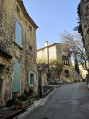
The route starts from a typical village of the Alpilles, takes you past a chapel famous for its beauty in a delightful setting, and continues round a hill with views of the north slope of the ridge and the plain of Mollégès. On the return leg, there is a superb view of the old village of Eygalières.
Romanin aerodrome via the Canal Septentrional des Alpines
 7.47 mi
+335 ft
-338 ft
3h 45
Moderate
Departure from Eygalières (Bouches-du-Rhône)
7.47 mi
+335 ft
-338 ft
3h 45
Moderate
Departure from Eygalières (Bouches-du-Rhône)
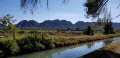
This hike from Eygalières will take you to the Mazet de Romanin aerodrome along the Canal Septentrional des Alpines. If the weather conditions are favourable and you are patient, you will be able to watch the gliders take off and land. The return route takes you through the forest at the foot of the Alpilles via theGR®653D(Via Domitia - Santiago de Compostela). You will also cross the Roman bridge over the Gaudre de Romanin.
Caume Circular Route
 10.24 mi
+1,526 ft
-1,509 ft
6h 00
10.24 mi
+1,526 ft
-1,509 ft
6h 00
 Difficult
Departure from Eygalières (Bouches-du-Rhône)
Difficult
Departure from Eygalières (Bouches-du-Rhône)
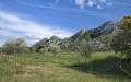
Circular route in the heart of the Alpilles that takes you along the ridges of the Caume. It offers unobstructed views stretching from the Crau plain to Mont Ventoux.
You will no doubt be flown over by gliders taking off from the small Romanin airport at the foot of the Caume
The Roman bridge and Romanin chapel
 4.22 mi
+131 ft
-135 ft
2h 05
4.22 mi
+131 ft
-135 ft
2h 05
 Easy
Departure from Eygalières (Bouches-du-Rhône)
Easy
Departure from Eygalières (Bouches-du-Rhône)
This is a short family hike that takes you to the foot of the Alpilles on a wide, easily accessible forest path.
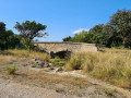
The path follows the old Roman road, of which nothing remains, and even the bridge dates back to the Middle Ages. However, the variety of landscapes along this circular route is very interesting.
The section near the Mazet de Romanin aerodrome offers the opportunity to watch gliders taking off, with some precautions.
Great crossing of the ridges of Petit and Gros Calan
 5.35 mi
+1,814 ft
-1,811 ft
4h 00
Difficult
Departure from Eygalières (Bouches-du-Rhône)
5.35 mi
+1,814 ft
-1,811 ft
4h 00
Difficult
Departure from Eygalières (Bouches-du-Rhône)
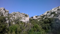
An aerial hike that includes exposed climbing passages not exceeding 3-.
The ridges are marked in yellow.
The difficulties are in the Petit Calan, but the Gros Calan is easier apart from a short steep final descent.
Do not underestimate this route: +5 hours.
Do not attempt in strong winds.
Warning: this hike includes some very challenging sections and is reserved for experienced mountaineers with some climbing technique and who are not prone to vertigo.
From January to June, please do not use this area.
The Petit Calan tour in Eygalières
 4.70 mi
+443 ft
-413 ft
2h 35
Easy
Departure from Eygalières (Bouches-du-Rhône)
4.70 mi
+443 ft
-413 ft
2h 35
Easy
Departure from Eygalières (Bouches-du-Rhône)
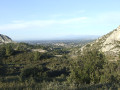
A short route to explore the surroundings of Petit Calan and the Badon arboretum.
Among the vines and olive trees of Domaine d'Éole in Eygalières
 1.98 mi
+39 ft
-39 ft
0h 55
Easy
Departure from Eygalières (Bouches-du-Rhône)
1.98 mi
+39 ft
-39 ft
0h 55
Easy
Departure from Eygalières (Bouches-du-Rhône)
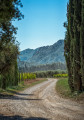
In the heart of Provence and the Alpilles, Domaine d’Éole, an organic vineyard since 1996, invites you to take a stroll amongst the vines and olive trees.
Le Gros Calan in the Alpilles
 5.68 mi
+659 ft
-656 ft
3h 10
Easy
Departure from Eygalières (Bouches-du-Rhône)
5.68 mi
+659 ft
-656 ft
3h 10
Easy
Departure from Eygalières (Bouches-du-Rhône)
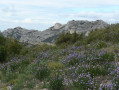
Short hike in the Alpilles, below Eygalières. Best done in autumn or winter.
The Quatre Termes and Baume Brignolle
 6.53 mi
+623 ft
-600 ft
3h 35
Moderate
Departure from Saint-Rémy-de-Provence (Bouches-du-Rhône)
6.53 mi
+623 ft
-600 ft
3h 35
Moderate
Departure from Saint-Rémy-de-Provence (Bouches-du-Rhône)
A hike in the Alpilles along good paths. A varied landscape ranging from pine forest to Mediterranean scrubland with fine views over the hills and valleys.
Aureille lookout tower
 5.06 mi
+617 ft
-630 ft
2h 50
Easy
Departure from Aureille (Bouches-du-Rhône)
5.06 mi
+617 ft
-630 ft
2h 50
Easy
Departure from Aureille (Bouches-du-Rhône)
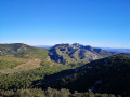
The highlight of the walk is the wonderful view from the lookout tower over the Alpilles range, giving superb photo opportunities!
The Alpilles plain
 6.72 mi
+679 ft
-679 ft
3h 40
Moderate
Departure from Orgon (Bouches-du-Rhône)
6.72 mi
+679 ft
-679 ft
3h 40
Moderate
Departure from Orgon (Bouches-du-Rhône)
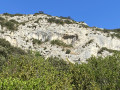
Located between Eygalières and Eyguiéres, this circular hike crosses a little-used plateau, from where you can see Les Opies to the south. Most of the route is through woodland, but the northern part and the plateau can be windy (Mistral).
17/07/2023 Moderator's note: the hike has been modified because the Roquemartine estate has closed all access from Saint Hubert to coast 169.
A GPS or the Visorando app seems necessary for this hike. See reviews
Aureille to Eygualières
 11.16 mi
+1,247 ft
-1,243 ft
6h 15
Moderate
Departure from Aureille (Bouches-du-Rhône)
11.16 mi
+1,247 ft
-1,243 ft
6h 15
Moderate
Departure from Aureille (Bouches-du-Rhône)
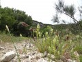
A pleasant walk through the Alpilles.
Not particularly difficult, this is a hike that is excellent for beginners.
Nevertheless, there are beautiful stretches, commanding views and surprising natural displays of surprise and vigour.
Aureille: through the olive groves
 6.64 mi
+308 ft
-302 ft
3h 20
Moderate
Departure from Aureille (Bouches-du-Rhône)
6.64 mi
+308 ft
-302 ft
3h 20
Moderate
Departure from Aureille (Bouches-du-Rhône)
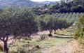
In the heart of the Alpilles Regional Nature Park, this circuit crosses vast olive groves, runs alongside a canal and an old sandpit, and passes close to a Vaudoret oil mill.
The Opies Watchtower
 5.12 mi
+1,168 ft
-1,168 ft
3h 20
Moderate
Departure from Aureille (Bouches-du-Rhône)
5.12 mi
+1,168 ft
-1,168 ft
3h 20
Moderate
Departure from Aureille (Bouches-du-Rhône)
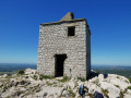
The shortest and easiest route to reach the highest point of the Alpilles, the Tour des Opies. Its rocky spur is reached via a path that climbs steadily, becoming increasingly challenging towards the end. But what a sight once you arrive: a 360° panorama offering a breathtaking view.
The Aureille Loop
 6.79 mi
+863 ft
-866 ft
3h 50
Moderate
Departure from Aureille (Bouches-du-Rhône)
6.79 mi
+863 ft
-866 ft
3h 50
Moderate
Departure from Aureille (Bouches-du-Rhône)
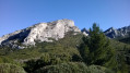
This pretty little loop runs alongside olive groves and the Civadières climbing cliffs, climbs up to the watchtower and then descends to the village via a track and a large valley crossed by theGR® 6 hiking trail. The route mainly follows wide, easy paths that allow you to admire the landscape. From the top of the watchtower, on a clear day you can see the Crau plain, the Mediterranean Sea and the Étang de Berre to the south, and the Calans mountain range silhouetted against the horizon to the north.
Les Caisses de Jean-Jean from Aureille
 10.18 mi
+627 ft
-627 ft
5h 15
Moderate
Departure from Aureille (Bouches-du-Rhône)
10.18 mi
+627 ft
-627 ft
5h 15
Moderate
Departure from Aureille (Bouches-du-Rhône)
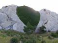
An easy, family-friendly walk in the south of the Alpilles mountains. Passes near the Caisses de Jean-Jean oppidum.
⚠️ 19/08/2025: Hike not suitable for dogs. Herds of 3 to 4 goats with guard dogs watching over them.
The hills above Les Mas
 6.31 mi
+666 ft
-666 ft
3h 30
Moderate
Departure from Aureille (Bouches-du-Rhône)
6.31 mi
+666 ft
-666 ft
3h 30
Moderate
Departure from Aureille (Bouches-du-Rhône)
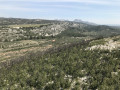
A circular route that mainly follows wide, easy paths, offering views of the unforgettable landscapes of the Alpilles. From the top of the hills, there is a sweeping 360° panorama over the Crau plain, the Étang de Berre, and the surrounding hills. The actual elevation gain is 240 m according to my altimeter.
La Tour des Opies without climbing and via the shortest route
 3.41 mi
+1,171 ft
-1,171 ft
2h 35
Moderate
Departure from Eyguières (Bouches-du-Rhône)
3.41 mi
+1,171 ft
-1,171 ft
2h 35
Moderate
Departure from Eyguières (Bouches-du-Rhône)
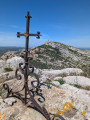
Hike to the Tour des Opies, the highest point of the Alpilles at 498 m, a round trip, taking the shortest route via the gentle path—the only one where you won’t need to use your hands. This walk offers a 360° panorama and a breathtaking view. On the way down, you can make a round trip to the Croix des Opies, situated in another valley, directly opposite the Tower, which offers a different panorama.
The Opies Tower
 8.47 mi
+1,375 ft
-1,368 ft
5h 05
Difficult
Departure from Eyguières (Bouches-du-Rhône)
8.47 mi
+1,375 ft
-1,368 ft
5h 05
Difficult
Departure from Eyguières (Bouches-du-Rhône)
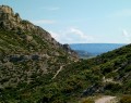
The Tour des Opies is the highest point in the Alpilles mountain range, rising to 498 m and offering a 360° panoramic view of the Durance plain, the Rhône, the Comtat Venaissin, the Camargue plain and the Crau plain as far as the Étang de Berre. The route, located in the Alpilles Natural Park, begins in the wooded valley of Les Glauges. It leads to the ruins of a Gallo-Roman villa. On the way back, a visit to the charming village of Aureille is a must.
The Happy Valley of Orgon
 6.70 mi
+604 ft
-600 ft
3h 35
Moderate
Departure from Orgon (Bouches-du-Rhône)
6.70 mi
+604 ft
-600 ft
3h 35
Moderate
Departure from Orgon (Bouches-du-Rhône)
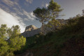
A very pleasant short hike with views of the Durance valley, Mont Ventoux, the Luberon, etc. No particular difficulty.
The Orgon plateau
 11.44 mi
+1,594 ft
-1,594 ft
6h 40
Moderate
Departure from Orgon (Bouches-du-Rhône)
11.44 mi
+1,594 ft
-1,594 ft
6h 40
Moderate
Departure from Orgon (Bouches-du-Rhône)
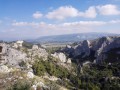
A route in the eastern Alpilles, starting with the Notre-Dame de Beauregard Chapel overlooking the Durance Valley, followed by a long loop around the Orgon plateau and its valleys.
The cliffs and ridges above Mouriès
 7.33 mi
+623 ft
-607 ft
3h 55
Moderate
Departure from Mouriès (Bouches-du-Rhône)
7.33 mi
+623 ft
-607 ft
3h 55
Moderate
Departure from Mouriès (Bouches-du-Rhône)
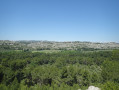
A pretty hike in this area of the Alpilles to discover the white cliffs of "Caisses de Jean Jean", the "Caisses de Servanne," the Castellas ridges and its viewpoints, and a walk along Servanne golf course in Mouriès.
The Opies and the ridges of Mont Menu from Eyguières
 6.35 mi
+1,972 ft
-1,959 ft
4h 40
Difficult
Departure from Eyguières (Bouches-du-Rhône)
6.35 mi
+1,972 ft
-1,959 ft
4h 40
Difficult
Departure from Eyguières (Bouches-du-Rhône)
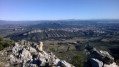
A beautiful, challenging circular route on stony terrain. A few easy technical sections add to the appeal of this route, as does the enjoyable passage through the Mont Menu cave. The Mont Menu ridge requires concentration and a good sense of direction as cairns are scarce.The view is always magnificent in all directions: Étang de Berre, the Crau plain, Aureille, the Alpilles, Ventoux, the Luberon and, of course, the cliffs of Mont Menu.
Tour des Trincades
 6.19 mi
+994 ft
-971 ft
3h 45
Moderate
Departure from Maussane-les-Alpilles (Bouches-du-Rhône)
6.19 mi
+994 ft
-971 ft
3h 45
Moderate
Departure from Maussane-les-Alpilles (Bouches-du-Rhône)
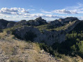
This is a circular hike on stony tracks and rocky paths, off the marked trails. If you enjoy solitude, this hike is for you! Be sure to bring plenty to drink, as there is no possibility of replenishing your water supply along the way.
The Vallon des Amants and a few tracks in the Alpilles
 8.17 mi
+1,260 ft
-1,227 ft
4h 50
Moderate
Departure from Saint-Rémy-de-Provence (Bouches-du-Rhône)
8.17 mi
+1,260 ft
-1,227 ft
4h 50
Moderate
Departure from Saint-Rémy-de-Provence (Bouches-du-Rhône)
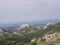
Circuit in the Alpilles that alternates between pleasant tracks and wilder trails.
The Mont Gaussier Ladder Trail
 2.39 mi
+820 ft
-820 ft
1h 50
Difficult
Departure from Saint-Rémy-de-Provence (Bouches-du-Rhône)
2.39 mi
+820 ft
-820 ft
1h 50
Difficult
Departure from Saint-Rémy-de-Provence (Bouches-du-Rhône)
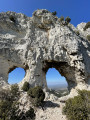
This circuit requires attention and caution. You should not be prone to vertigo and should avoid wet weather and strong Mistral winds. If these conditions are met, you can use the fully renovated ladders and a few small secure ledges (handrails). A splendid panorama of the Alpilles, the Luberon, the Ventoux and the surrounding plains will reward you for your efforts.
The Eagle's Step
 5.57 mi
+709 ft
-709 ft
3h 10
Easy
Departure from Saint-Rémy-de-Provence (Bouches-du-Rhône)
5.57 mi
+709 ft
-709 ft
3h 10
Easy
Departure from Saint-Rémy-de-Provence (Bouches-du-Rhône)
How do you get from the plain or the centre of the Alpilles to a place where you can see as far as the sea, nearly 50 km away, and in good weather, as far as the Cévennes? From the Pas de l'Aigle, with binoculars, you can see very far.
The Gaudre de Valmouriane via La Verdière
 9.73 mi
+981 ft
-981 ft
5h 20
Moderate
Departure from Saint-Rémy-de-Provence (Bouches-du-Rhône)
9.73 mi
+981 ft
-981 ft
5h 20
Moderate
Departure from Saint-Rémy-de-Provence (Bouches-du-Rhône)
This circuit starts in a pine forest in shady valleys. The return journey is along a ridge trail with panoramic views of the village of Les Baux de Provence, the Alpilles and the adjacent valleys to the north and south.
Warning: This hike has been modified from the one I originally described (due to a gate problem preventing access to part of the route). If you downloaded it before it was updated, please make sure you have the correct version.
The Lombards trail via the ridge
 4.71 mi
+617 ft
-600 ft
2h 40
Moderate
Departure from Saint-Rémy-de-Provence (Bouches-du-Rhône)
4.71 mi
+617 ft
-600 ft
2h 40
Moderate
Departure from Saint-Rémy-de-Provence (Bouches-du-Rhône)
A ridge walk starting off the beaten track, with views over the south of the Alpilles. A climb through an almost untouched valley to join the ridge trail, offering panoramic views of the north.
The Lombards trail to Vallon des Amants via Les Trincades
 11.92 mi
+1,207 ft
-1,204 ft
6h 30
Moderate
Departure from Saint-Rémy-de-Provence (Bouches-du-Rhône)
11.92 mi
+1,207 ft
-1,204 ft
6h 30
Moderate
Departure from Saint-Rémy-de-Provence (Bouches-du-Rhône)
This walk follows ridge and forest paths, some marked and some unmarked, allowing you to discover the rich panoramas of the Alpilles.
Le Rocher des Deux Trous (The Rock with Two Holes)
 4.30 mi
+827 ft
-804 ft
2h 40
Easy
Departure from Saint-Rémy-de-Provence (Bouches-du-Rhône)
4.30 mi
+827 ft
-804 ft
2h 40
Easy
Departure from Saint-Rémy-de-Provence (Bouches-du-Rhône)
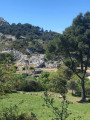
At the heart of the Alpilles Regional Nature Reserve, a small easy hike on good paths. The route takes you to the picturesque Rock with Two Holes painted by Van Gogh during his stay in Saint-Paul de Mausole from May 1889 to May 1890. It offers vast panoramic views over the two slopes of the Alpilles. To the south, in clear weather the view stretches to the Mediterranean, to the north over the Montagnette, the Gard, the Mont Ventoux, etc.
South valley of the Caume Plateau after the ridges and Mont Gaussier
 8.95 mi
+1,890 ft
-1,870 ft
5h 45
Difficult
Departure from Saint-Rémy-de-Provence (Bouches-du-Rhône)
8.95 mi
+1,890 ft
-1,870 ft
5h 45
Difficult
Departure from Saint-Rémy-de-Provence (Bouches-du-Rhône)
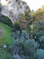
The southern slope of the Caume Plateau is very suitable for winter hiking. This slope benefits from late sunshine and provides protection from the rather cold mistral wind after walking along part of the ridges coming from the Montagne des Deux Trous.
(Please note) This route passes through the perimeter of the prefectural decree protecting the Caume biotope.
Rocher des Deux Trous, Mont Gaussier and Lac du Peirou via the ladders
 5.16 mi
+1,316 ft
-1,309 ft
3h 30
Moderate
Departure from Saint-Rémy-de-Provence (Bouches-du-Rhône)
5.16 mi
+1,316 ft
-1,309 ft
3h 30
Moderate
Departure from Saint-Rémy-de-Provence (Bouches-du-Rhône)
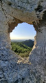
Pleasant walk in the Alpilles with magnificent panoramic views in places
Mont Gaussier - Rocher des Deux Trous - Lac de Peirou
 5.70 mi
+1,201 ft
-1,214 ft
3h 40
Moderate
Departure from Saint-Rémy-de-Provence (Bouches-du-Rhône)
5.70 mi
+1,201 ft
-1,214 ft
3h 40
Moderate
Departure from Saint-Rémy-de-Provence (Bouches-du-Rhône)
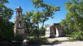
Randonnée qui passe par trois étapes essentielles qui sont le Mont Gaussier, le Rocher des Deux Trous et le Lac de Peirou.
Glanum and the Alpilles ridges
 4.80 mi
+853 ft
-843 ft
2h 55
Moderate
Departure from Saint-Rémy-de-Provence (Bouches-du-Rhône)
4.80 mi
+853 ft
-843 ft
2h 55
Moderate
Departure from Saint-Rémy-de-Provence (Bouches-du-Rhône)
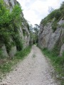
From the Antiques de Glanum site, a beautiful climb up the Saint-Clerg valley, which serves as a botanical trail, takes you to the ridges and back down to Lake Peirou (Peirou, on the IGN map).
Gaudre de Valrugue and Botanical Trail
 4.45 mi
+617 ft
-617 ft
2h 35
Easy
Departure from Saint-Rémy-de-Provence (Bouches-du-Rhône)
4.45 mi
+617 ft
-617 ft
2h 35
Easy
Departure from Saint-Rémy-de-Provence (Bouches-du-Rhône)
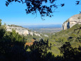
Take a short walk around the Glanum site, climbing up the Gaudre de Valrugue and then descending the Vallon de Saint Clerg botanical trail.
Mont Gaussier, Rocher des Deux Trous and Grotte des Peirou
 6.12 mi
+1,348 ft
-1,352 ft
4h 00
Difficult
Departure from Saint-Rémy-de-Provence (Bouches-du-Rhône)
6.12 mi
+1,348 ft
-1,352 ft
4h 00
Difficult
Departure from Saint-Rémy-de-Provence (Bouches-du-Rhône)
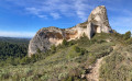
After admiring the Roman monuments of Les Antiques, hikers will set off on a short route through the Alpilles, featuring exposed sections and leading to small peaks offering breathtaking views.
The Alpilles ridge
 9.62 mi
+1,699 ft
-1,716 ft
5h 55
Moderate
Departure from Saint-Rémy-de-Provence (Bouches-du-Rhône)
9.62 mi
+1,699 ft
-1,716 ft
5h 55
Moderate
Departure from Saint-Rémy-de-Provence (Bouches-du-Rhône)
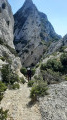
Nice walk between the wild and steep ridge of the Alpilles and the plains of Romanin.
The Tour des Opies- the Eyguières Alpilles
 9.95 mi
+1,348 ft
-1,348 ft
5h 45
Moderate
Departure from Eyguières (Bouches-du-Rhône)
9.95 mi
+1,348 ft
-1,348 ft
5h 45
Moderate
Departure from Eyguières (Bouches-du-Rhône)
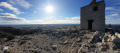
Hiking in the Alpilles, starting from the Eyguières bullring.
A quiet start among olive trees and cicadas at the foot of the Opies.
You'll discover the old Romanière sheep pens.
The ascent starts on a beautiful path through the maquis and ends with a little climb to finish at the Tour de Guet where a magnificent 360° view awaits you.
You can also visit the vestiges of Villa Gallo Romaine.
 The Alpilles Circuit
58.62 mi
+2,293 ft
-2,270 ft
7 hrs
Moderate
Departure from Eyguières (Bouches-du-Rhône)
A ride for lovers of road cycling and the beautiful landscapes of the Alpilles.
You’ll pass through the villages of Eygieres, Aureille, Eygalières, Mollégès, Saint-Rémy-de-Provence, Les Baux-de-Provence, Fontvieille, Daudet’s mill, Paradou, Maussane-les-Alpilles and Mouries.
This is a tour of all the beautiful villages of the Alpilles.
Remains of the past between Le Défens and Mont Menu
 12.74 mi
+2,087 ft
-2,073 ft
7h 40
Difficult
Departure from Eyguières (Bouches-du-Rhône)
12.74 mi
+2,087 ft
-2,073 ft
7h 40
Difficult
Departure from Eyguières (Bouches-du-Rhône)
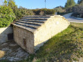
This walk in the Alpilles Regional Nature Park is located near Eyguières and Lamanon in the Bouches-du-Rhône. This circular route takes you to the foothills of the Défends and Mont Menu and will allow you to discover caves, a watchtower, a dovecote, and the remains of chapels and castles. Along the way, you will also enjoy beautiful, unobstructed views of the Crau plain, the Alpilles, the Luberon and Mont Ventoux.
Les Gillouses, at the foot of the Défens d'Eyguières
 2.12 mi
+423 ft
-423 ft
1h 20
Moderate
Departure from Eyguières (Bouches-du-Rhône)
2.12 mi
+423 ft
-423 ft
1h 20
Moderate
Departure from Eyguières (Bouches-du-Rhône)
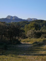
A short but fairly challenging hike at the foot of the Défens d'Eyguières.
Défens d'Eyguiéres – Lamanon – the Calès Caves
 8.20 mi
+1,079 ft
-1,079 ft
4h 45
Moderate
Departure from Eyguières (Bouches-du-Rhône)
8.20 mi
+1,079 ft
-1,079 ft
4h 45
Moderate
Departure from Eyguières (Bouches-du-Rhône)
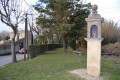
Hike starting from Eyguiéres, with its two fountains at Les Bormes and Gillouse.Walk in the Défens d’Eyguiéres, with beautiful views of the ruins of Roquemartine Castle, the Durance Valley and, in fine weather, Mont Ventoux.Visits to the Calès Caves are prohibitedReturn via the olive groves of the Défens d'Eyguières.__Warning! Due to the site’s geology (mollasse, which is crumbly) and its cliffs, certain areas are dangerous.There is currently a local by-law prohibiting access to these areas. Please take great care__
Défens d'Eyguiéres - Lamanon les Grottes de Calès (alternative route)
8.26 mi
+781 ft
-781 ft
4h 30
Moderate
Departure from Eyguières (Bouches-du-Rhône)
Alternative route for the Défens d’Eyguières – Lamanon to the Calès Caves hike. It bypasses the caves, which are closed to visitors, and passes by the chapel and the spring.Walk starting from Eyguiéres with its two fountains, Les Bormes and Gilouse.Walk through the Défens d'Eyguiéres, with beautiful views of the ruins of Roquemartine Castle, the Durance Valley and, in fine weather, Mont Ventoux.Return via the olive groves of the Défens d'Eyguières.
Saint-Jacques Hill
 3.99 mi
+738 ft
-738 ft
2h 30
Easy
Departure from Cavaillon (Vaucluse)
3.99 mi
+738 ft
-738 ft
2h 30
Easy
Departure from Cavaillon (Vaucluse)
Short walk on Saint-Jacques hill starting from the centre of Cavaillon.
More walks in Eygalières
Select a point of interest below: