


Refine your search for walks in Engelberg
Engelberg walks


 Aaschlucht from Engelberg
 Visorando Member
 5.50 mi
 +148 ft
 -1,562 ft
 2h 40
 Easy
 Departure from Engelberg (Obwalden)
A hike along the adventure trail through the beautiful Aa Gorge from Engelberg to Grafenort railway station. As the gorge is very shady, the route is perfect for hot summer days.
Please note: One bridge on the route is currently destroyed (noted on 27 May 2026). A well-signposted diversion is in place, but this makes the hike around 100 m steeper and 2 km longer.
Melchsee-Frutt
 6.88 mi
+1,335 ft
-1,345 ft
4h 20
 Moderate
Departure from Kerns (Obwalden)
A lovely walk in Switzerland with views of the Titlis.
The Klewenstock circuit
 1.85 mi
+846 ft
-997 ft
1h 35
Easy
Departure from Beckenried (Nidwalden)
A very simple hike that takes you around the Klewenstock mountain. This walk allows you to admire the scenery and the flowers, with lovely little signs to help you learn to identify them!
Sunniggrathütte – Arnisee
 6.23 mi
+1,640 ft
-3,658 ft
4h 20
Moderate
Departure from Gurtnellen (Canton of Uri)
The hike starts at the Sunniggrathütte (see Day 1) and follows the Hohenweg, which leads to the Leutschachhütte, before descending along the Leitschachbach to reach the Arnisee and the cable car
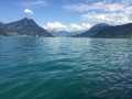
Along Lake Lucerne
 6.32 mi
+1,644 ft
-1,696 ft
4h 20
Moderate
Departure from Beckenried (Nidwalden)
A 10 km walk (one-way) along the lake and through the forest, returning by boat.
Beckenried – Seelisberg
 8.09 mi
+2,799 ft
-1,693 ft
6h 10
Moderate
Departure from Beckenried (Nidwalden)
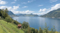
This sixth stage will take you from Beckenried (NW) to Seelisberg (UR). The route follows the road along the lake to Risleten. The path continues with a fairly steep climb through the Risletenschlucht gorge, where the Choltalbach rushes down to the lake, creating spectacular waterfalls. The route then crosses the Stützberg and passes through Volligen. The final stretch to Seelisberg involves one last climb across meadows.
Ascent to the Sunnig Grat from Arnisee
 4.52 mi
+2,365 ft
-2,346 ft
4h 10
Moderate
Departure from Gurtnellen (Canton of Uri)
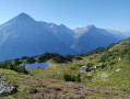
Hike up to the Sunnig Grat (2,034 m) from Lake Arnisee and enjoy the panoramic views of numerous peaks in the canton of Uri, stretching as far as Lake Lucerne and Lucerne itself. Stop at the Sunniggrathütte to leave your rucksacks and have a snack or spend the night. Return via the same route.
Circular walk around the Sunniggrat Hütte
 9.93 mi
+4,199 ft
-4,091 ft
2 days
 Difficult
Departure from Gurtnellen (Canton of Uri)
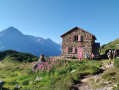
A two-day route in magnificent surroundings with stunning panoramic views of the peaks of the canton of Uri and Lake Lucerne.
The hike presents no major difficulties, with a few sections secured by chains on the second day, though these pose no difficulty in dry weather. There is also little shade.
Arnisee – Sunnigrathütte
3.70 mi
+2,559 ft
-433 ft
3h 55
Moderate
Departure from Gurtnellen (Canton of Uri)
A two-day hike with an overnight stay at the Sunniggrathütte. This route takes you up to the Sunniggrathütte along the Leitschachbach
The ascent suggested here is steady but offers little shade. A more direct but steeper ascent is possible by taking the path at the far end of the lake
From Flüelen to Vitznau on the shores of Lake Lucerne
 18.49 mi
+5,915 ft
-5,892 ft
2 days
Difficult
Departure from Canton of Uri
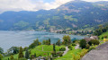
This two-day route will give you a glimpse of the beauty of Lake Lucerne. The route offers numerous viewpoints overlooking the lake. You will admire the Glockspiel de Tellsplatte, Switzerland's largest carillon. You will end this hike in Vitznau, a charming village and the starting point for the little train that climbs to the top of the Rigi.
Flüelen - Morschach
 7.34 mi
+3,481 ft
-2,848 ft
6h 25
Difficult
Departure from Canton of Uri
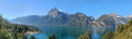
This first stage will take you from Flüelen to Morschach. Flüelen is located at the southern end of Lake Uri at the mouth of the Reuss. This route offers numerous views of the lake and the mountain ranges bordering it. On this route, you will discover the Glockspiel de Tellsplatte, the largest carillon in Switzerland. You will also admire the Tellskapelle chapel on the lake shore.
Renggpass - From Stansstad to Hergiswill
4.82 mi
+1,772 ft
-1,709 ft
3h 45
Moderate
Departure from Hergiswil (Nidwalden)
Starting from Stansstad railway station, you go straight up above the motorway, thus tackling the steepest part.
Then, along the ridge overview of the Alpnachersee lake for a good third of the way, glimpses of views and appreciating the 400-500m ascent: Probably a good time to rest for a lunch break before the Renggpass.
The final part is downhill all the way to the village and train station of Hergiswil, passing through fields of cows, farms & green pasture.
Alpnachstad – Bürgenstock
 9.79 mi
+3,159 ft
-1,729 ft
7h 15
Difficult
Departure from Alpnach (Obwalden)
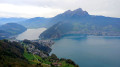
This fourth stage will take you from Alpnachstad (OW) to Bürgenstock (NW). The start of the stage passes through the meadows of the Alpnachstader Ried before descending to Stansstad via the Rotzlochschlucht gorge. After a visit to the town of Stansstad, taking in the Schnitzturm, the path runs alongside the lake to Harissen Bay. From there, the steep climb to the former resort of Fürigen begins. The gradient eases off towards Ober Schilt before the ascent to Bürgenstock begins.
Tour of the Göscheneralpsee - Descent via the Panorama trail
3.98 mi
+512 ft
-2,657 ft
2h 15
Moderate
Departure from Göschenen (Canton of Uri)
The second stage of this circuit starts at the Dammahütte and follows a "Panorama" trail through a glacial cirque, then continues along the northern shore of the lake.
Tour of the Göscheneralpsee via Damahütte
 7.23 mi
+3,199 ft
-3,215 ft
2 days
Difficult
Departure from Göschenen (Canton of Uri)
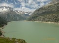
If you’re looking to hike in the high mountains and discover a beautiful Swiss glacial lake, here’s what you need: a walk around the Göscheneralpsee (a lake with a dam) and an overnight stay at the “Dammahütte”, a small, friendly mountain hut with 20 beds at an altitude of 2,440 metres..
Tour of the Göscheneralpsee - Ascent to the Dammahütte
 3.25 mi
+2,687 ft
-584 ft
3h 50
Difficult
Departure from Göschenen (Canton of Uri)
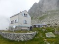
The first stage of this two-day circuit involves climbing up to the Damahütte via a path on the southern shore of the lake.
Bürgenstock – Beckenried
 7.73 mi
+1,837 ft
-3,228 ft
5h 10
Moderate
Departure from Ennetbürgen (Nidwalden)
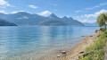
This fifth stage will take you from Bürgenstock (NW) to Beckenried (NW). The route follows the north face of the Bürgenstock cliff to Sankt Jost Church before descending towards the lake at Ennetbürgen. The rest of the route runs alongside the lake, passing through Buochs, and ends in Beckenried.
Seelisberg – Flüelen
10.74 mi
+2,395 ft
-3,438 ft
7h 00
Moderate
Departure from Canton of Uri
This seventh stage will take you from Seelisberg (UR) to Flüelen (UR). The route passes through the village of Seelisberg to Oberdorf, then climbs up to the Marienhöhe. The highlight of the day is near Beroldingen Castle. The descent towards the lake is quite steep. A final section, partly cobbled and featuring around 900 steps, leads to Bauen. The route then follows the lake’s shore, passing through the Harderband Tunnel , where light installations bring Swiss history to life. Once you reach the southern end of the lake, you’ll cross the Reuss, the main river feeding into Lake Lucerne
Vitznauerstock summit
 6.07 mi
+3,576 ft
-3,550 ft
5h 55
Difficult
Departure from Canton of Lucerne
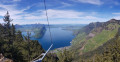
Starting in Vitznau, climb to the summit of the Vitznauerstock/Gersauerstock for a superb view of Lake Lucerne.
Tour of Lake Lucerne
 72.65 mi
+16,450 ft
-16,453 ft
7 days
Difficult
Departure from Canton of Lucerne
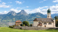
Lake Lucerne borders four historic cantons of Central Switzerland. The tour around the lake therefore passes through the cantons of Uri, Schwyz, Lucerne and the former canton of Unterwalden (now divided into two half-cantons: Nidwalden and Obwalden). The route takes you through the heart of Switzerland’s cradle. In 1291, representatives of the three founding cantons (Uri, Schwyz and Unterwald) gathered to take the oath of alliance that marked the birth of the Swiss Confederation. In 1332, the canton of Lucerne entered into a perpetual alliance with the three original cantons.
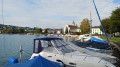
Vitznau – Küssnacht am Rigi
 11.25 mi
+2,270 ft
-2,290 ft
7h 10
Difficult
Departure from Canton of Lucerne
This first stage will take you from Vitznau (LU) to Küssnacht am Rigi (SZ). The start of the route is a long climb up numerous steps and ladders to Oberwilen. The route passes above Weggis and gradually descends towards the Hertenstein peak before turning towards Lake Küssnacht.
Morschach - Vitznau
11.12 mi
+2,457 ft
-3,045 ft
7h 15
Difficult
Departure from Canton of Schwyz
This second stage will take you from Morschach to Vitznau. As you cross Morschach, you can admire the Mythen, the two legendary peaks of the canton of Schwitz. This route offers many more views of the lake and the mountain ranges that surround it. At Brunnen, you will leave Lake Uri and follow the shores of Lake Lucerne. You will stop in the charming village of Vitznau, the departure point for the little train that climbs to the famous summit of the Rigi.
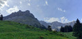
Pilatus - Fräkmüntegg - Malters via the Alpenpanorama Weg
 8.74 mi
+335 ft
-3,320 ft
4h 20
Moderate
Departure from Kriens (Canton of Lucerne)
After a night at the summit of Mount Pilatus and a last look at the Bernese Alps, you will descend towards the Alpenpanorama Weg. Before reaching the Petite Emme valley, you will have several more opportunities to admire the Pilatus massif.
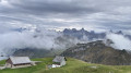
Circular route along the ridge between the Glingenstock and the Fronalpstock
 7.48 mi
+3,212 ft
-3,219 ft
6h 15
Difficult
Departure from Morschach (Canton of Schwyz)
A magnificent hike along the ridge between the Glingenstock and the Fronalpstock, at an altitude of 1,900 metres.
Stunning views over the eastern part of Lake Lucerne.
Circular route from the Stoos funicular, via Fronalpstock and Kligenstock
7.65 mi
+3,150 ft
-3,156 ft
6h 15
Moderate
Departure from Morschach (Canton of Schwyz)
A circular walk starting from the Stoos funicular, passing through Fronalpstock and then on to Kligenstock. This circular walk is done entirely on foot, but you can also take a chairlift from Stoos to go directly up to either Fronalpstock or Kligenstock.
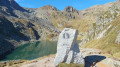
Vier Quellen Weg
 50.77 mi
+15,958 ft
-15,315 ft
5 days
Difficult
Departure from Tujetsch (Grisons)
This magnificent Four Springs Trail (Vier Quellen Weg) will take you to the headwaters of the Rhine, the Reuss, the Ticino and the Rhône. You’ll pass through the cantons of Uri, Graubünden, Ticino and Valais, crossing six major mountain passes: the Maighels Pass, the Sella Pass, the Gotthard Pass, the Lucendro Pass, the Nufenen Pass and the Furka Pass.
Oberalppass – Vermigel Hütte
8.47 mi
+2,612 ft
-2,621 ft
6h 10
Difficult
Departure from Tujetsch (Grisons)
This first stage of the Vier Quellen Weg will take you from the Oberalppass to the Capanna Vermigel. During the day, you’ll discover Lake Tuma, one of the sources of the Rhine. An engraved marker indicates this source. As you climb towards the Col de Maighels, you’ll walk alongside another branch of the Rhine (Rein da Maighels), which has its source at the Maighels Glacier.