Circular route along the ridge between the Glingenstock and the Fronalpstock

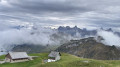
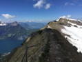
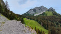
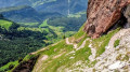
A magnificent hike along the ridge between the Glingenstock and the Fronalpstock, at an altitude of 1,900 metres.
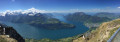
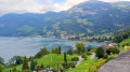
Stunning views over the eastern part of Lake Lucerne.

Details

9955870
Creation:
Last update:
Last review:
  • Walking
    Activity: Walking
  • ↔
    Distance: 7.48 mi
  • ◔
    Average duration: 6h 15 
  • ▲
    Difficulty: Difficult

  • ⚐
    Back to start: Yes
  • ↗
    Ascent: + 3,212 ft
  • ↘
    Descent: - 3,219 ft

  • ▲
    Highest point: 6,273 ft
  • ▼
    Lowest point: 4,265 ft

Photos

Description of the walk

Park in the Schwyz Stossbahn car park and take the funicular to the top station.

(S/E) On leaving the cable car building, turn left up the steps to reach the path. Keep left on this well-signposted path, pass a chalet on the left and continue on to Obertritt.

(1) Turn right and continue uphill. Pass the Metzg farm and keep to the right at the next junction to reach another junction with several routes.

(2) Carry on, turning right at a 90° angle, and continue the climb to reach the Rossboden ridge.

(3) Turn right here and carry on, enjoying the stunning views. You’ll reach the upper station of the Chlingenstock cable car. Continue for a few more steps to reach the summit of the Chlingenstock.
Take care on this section: do not get too close to the edge.

(4) Set off again opposite along the path downhill, but be careful: if there is snow, walking poles may be very useful on this section. Continue on and then take a short climb to reach the crossroads below the Huser Stock.

(5) Turn right onto the steps to visit the Huser Stock viewpoint.
Head back down the same path and continue walking along the ridge.
Reach the bottom of this short descent.

(6) Start the final climb here to reach the Fronalpstock. From the summit, continue for a few metres to reach the top station of the Fronalpstock cable car.

(7) Here you have two options:
- take the cable car to the Stoos intermediate station; see Note § Practical Information.
- walk down to the Stoss intermediate station.

(8) Take the correct path on the left and follow it until you reach the village of Stoos.
Walk through the village to reach the funicular station (S/E)

Take the funicular back to the Schwyz Stossbahn car park.

Waypoints

  1. S/E : mi 0 - alt. 4,288 ft - Funicular station
  2. 1 : mi 1.02 - alt. 4,967 ft - Obertritt
  3. 2 : mi 1.43 - alt. 5,118 ft - Crossroads with several directions
  4. 3 : mi 2.1 - alt. 5,928 ft - Rossboden Ridge
  5. 4 : mi 2.57 - alt. 6,240 ft - Chlingenstock
  6. 5 : mi 3.83 - alt. 6,083 ft - Huser Stock
  7. 6 : mi 4.4 - alt. 5,719 ft - Fronalpstock crossroads
  8. 7 : mi 5.3 - alt. 6,227 ft - Fronalpstock Cable Car
  9. 8 : mi 6.33 - alt. 4,954 ft - Fronalpstock midway station
  10. S/E : mi 7.48 - alt. 4,288 ft - Funicular station

Notes

The walk presents no particular difficulties, but do make sure you wear good walking boots and, if necessary, bring walking poles in case of snow.
(4) Chlingenstock summit: picnic tables.
(7) You can descend from the Fronalpstock to Stoos either on foot or by cable car. You can decide once you reach the top; the cable car ticket must be paid for after the journey, at the Stoos station.
There are plenty of picnic spots with tables all along the route.
Hike completed on 30 May 2021 in conditions with a fair amount of snow, which did not hinder the walk.

Worth a visit

To get to (S/E): The funicular that runs from the car park to the village of Stoos is the steepest in the world – an impressive experience at a modest cost by Swiss standards.

Reviews and comments

4.8 / 5
Based on 2 reviews

Reliability of the description
4.5 / 5
Ease of following the route
5 / 5
Route interest
5 / 5
Gilles 14
Gilles 14

Overall rating : 5 / 5

Date of your route : Jun 30, 2025
Reliability of the description : ★★★★★ Very good
Ease of following the route : ★★★★★ Very good
Route interest : ★★★★★ Very good
Very busy route : Yes

A magnificent circuit that we completed entirely on foot.

Machine-translated

alex_pier
alex_pier

Overall rating : 4.7 / 5

Date of your route : Aug 24, 2024
Reliability of the description : ★★★★☆ Good
Ease of following the route : ★★★★★ Very good
Route interest : ★★★★★ Very good
Very busy route : Yes

A beautiful route with magnificent views and aerial passages, but without any particular difficulty. We did it in the opposite direction to the one suggested in the description, i.e. Stoos-Fronalpstock-Klingenstock-Stoos. We were lucky, as 99% of hikers take the chairlift up to Klingenstock, hike along the ridge and then take the chairlift back down from Fronalpstock. So we passed an almost uninterrupted procession on this section, but hardly anyone in the same direction as us. Swiss, French, Germans, English, Italians, Americans, Japanese, Thais, Indians - a veritable Tower of Babel! There were so many people that 30 minutes before reaching Klingenstock, we took a little alpine path straight back down to Stoos. A must-do, but out of season!

Machine-translated

Other walks in the area

For more walks, use our search engine .

The GPS track and description are the property of this route's author. Please do not copy them without permission.