Ascent to the Sunnig Grat from Arnisee

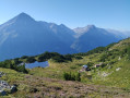
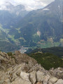
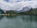
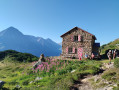
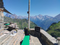
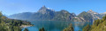
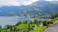
Hike up to the Sunnig Grat (2,034 m) from Lake Arnisee and enjoy the panoramic views of numerous peaks in the canton of Uri, stretching as far as Lake Lucerne and Lucerne itself. Stop at the Sunniggrathütte to leave your rucksacks and have a snack or spend the night. Return via the same route.

Details

102746648
Creation:
Last update:
Last review:
  • Walking
    Activity: Walking
  • ↔
    Distance: 4.52 mi
  • ◔
    Average duration: 4h 10 
  • ▲
    Difficulty: Moderate

  • ⚐
    Back to start: Yes
  • ↗
    Ascent: + 2,365 ft
  • ↘
    Descent: - 2,346 ft

  • ▲
    Highest point: 6,640 ft
  • ▼
    Lowest point: 4,465 ft

Description of the walk

The hike starts at the cable car terminus. Take the cable car from Intschi; there’s a pay-and-display car park directly opposite.

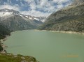
(S/E) You should then walk along the lake and not take the first signposted path towards the Sunniggrathütte, which is listed as a 2h40 walk. Continue along the lake until you reach the next junction.

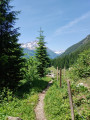
(1) Take the path that branches off to your left. The ascent is in the shade of the forest. It is well signposted and an easy path, but the climb remains steep and the path is covered in roots, before emerging from the forest.

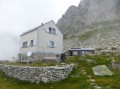
(2) Sunniggrathütte. You can take this opportunity to leave your rucksack behind and continue light-packed to the summit, which is a 15-minute walk away.

(3) Summit, with views of the surrounding peaks and Lake Lucerne. The return journey follows the same route back to the cable car station (S/E).

Waypoints

  1. S/E : mi 0 - alt. 4,465 ft - Cable car arrival point
  2. 1 : mi 0.29 - alt. 4,521 ft - Junction
  3. 2 : mi 1.94 - alt. 6,486 ft - Sunniggrathütte
  4. 3 : mi 2.27 - alt. 6,575 ft - Sunnig Grat summit
  5. S/E : mi 4.52 - alt. 4,465 ft - Cable car arrival point

Notes

It may be wise to leave the motorway before the traffic jams on the climb up to the Gotthard.

Take water with you. There is no drinking water along the route and it is expensive at the hut.

There is a restaurant at the cable car station.

This hike can be extended to include a circular route via the Leutschachhütte, but it is best to spend the night at one of the mountain huts.

Take care on the descent back down, especially in wet weather, due to the exposed roots.

Other walks in the area

For more walks, use our search engine .

The GPS track and description are the property of this route's author. Please do not copy them without permission.