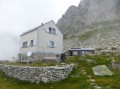
Sunniggrathütte – Leitschachbach

The hike starts at the Sunniggrathütte (see Day 1) and follows the Hohenweg, which leads to the Leutschachhütte, before descending along the Leitschachbach to reach the Arnisee and the cable car

Details

102862553
Creation:
Last update:
Last review:
  • Walking
    Activity: Walking
  • ↔
    Distance: 6.23 mi
  • ◔
    Average duration: 4h 20 
  • ▲
    Difficulty: Moderate

  • ⚐
    Back to start: No
  • ↗
    Ascent: + 1,640 ft
  • ↘
    Descent: - 3,658 ft

  • ▲
    Highest point: 7,270 ft
  • ▼
    Lowest point: 4,459 ft

Description of the walk

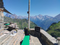
This hike follows on from the first stage, after spending the night at the Sunniggrathütte.

(S) From the Sunniggrathütte, follow the red and white signposted path taken the previous day uphill towards the summit until you reach the junction.

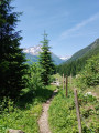
(1) Turn left onto the Hohenweg, a pleasant and well-signposted (red and white) path, heading towards the Leutschachhütte.

(2) Ignore the Alpinweg which branches off to the right and carry on straight ahead along the red and white path, which descends and then continues along a ridge.

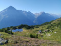
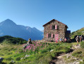
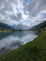
(3) Ignore the ascending path on the left and carry on straight ahead. The path climbs up to the Leutschachhütte (a very beautiful hut overlooking a small lake with turquoise waters. There is drinking water in the toilets).

(4) After taking in the view, take the downhill path at the end of the terrace, still signposted Red and White, to pass by the small lake, the Nidersee (the lake below). The path descends quite steeply at first, but the descent becomes much gentler further on. You’ll pass the junction with the path you took on the way up.

(5) Follow the path gently to the right until you come out onto a tarmac road

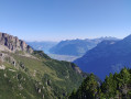
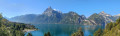
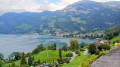
(6) Follow it to the left to quickly reach the Arnisee. Then turn right and keep straight ahead to reach the cable car for the return journey.

Waypoints

  1. S : mi 0 - alt. 6,483 ft - Sunniggrathütte
  2. 1 : mi 0.17 - alt. 6,624 ft - Junction leading to the summit of the Sunnig Grat
  3. 2 : mi 0.52 - alt. 6,667 ft - Junction with the Alpinweg
  4. 3 : mi 1.15 - alt. 6,339 ft - Junction with the ascent path
  5. 4 : mi 2.8 - alt. 7,178 ft - Leutschachhütte
  6. 5 : mi 4.17 - alt. 5,712 ft - Junction
  7. 6 : mi 5.73 - alt. 4,541 ft - Junction, tarmac road
  8. E : mi 6.23 - alt. 4,459 ft - Cable car

Notes

This hike follows on from the first stage, after spending the night at the Sunniggrathütte. Booking essential; small hut with 24 beds. No showers and no drinking water. You’ll need to buy bottled water, which is expensive.

Watch out for traffic jams (stau) during the summer months. Similarly, on the return journey, plan to arrive at the cable car station before 5 pm to avoid a long wait.

There is little shade along the entire route. Take plenty of water.

There are a few sections secured with fixed cables, which may be useful in wet weather

The Alpinweg (Blue and White) is a possible alternative route to the Leutschachhütte. However, it is reserved for experienced hikers. A ridge walk with climbing sections (III) secured by fixed ropes and cables. It is a very beautiful route but extremely vertiginous.

Other walks in the area

For more walks, use our search engine .

The GPS track and description are the property of this route's author. Please do not copy them without permission.