


Refine your search for walks in Dourges
Dourges walks


 Slag heaps 87 and 92 in Dourges
 Visorando Member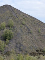
 3.15 mi
 +217 ft
 -220 ft
 1h 40
1h 40
 Easy
Easy
 Departure from Dourges (Pas-de-Calais)
A route that will take you to the Sainte-Henriette slag heap, the landmark that marks the entrance to the mining basin when approaching from Paris, visible from the TGV line and the A1 and A21 motorways. You’ll climb its neighbouring ‘little brother’ and enjoy a superb view. Not to be missed.
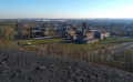
Madame Declercq’s trail
 5.56 mi
+364 ft
-361 ft
2h 50
5.56 mi
+364 ft
-361 ft
2h 50
 Moderate
Departure from Oignies (Pas-de-Calais)
Moderate
Departure from Oignies (Pas-de-Calais)
Located in the heart of the mining basin, the Bois des Hautois in Oignies is a preserved site where hiking trails wind their way between slag heaps, ponds and pastures. The suggested route is situated in the immediate vicinity of the former 9-9 bis pithead, listed as a UNESCO World Heritage Site since 30 June 2012, and whose metal headframe is never far from view, helping you to find your way along the route.
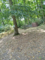
The two spoil heaps from Oignies
 Association / Club / Walk leader
 6.19 mi
+305 ft
-308 ft
3h 05
Moderate
Departure from Oignies (Pas-de-Calais)
6.19 mi
+305 ft
-308 ft
3h 05
Moderate
Departure from Oignies (Pas-de-Calais)
This walk, starting from the 9-9bis Mining Centre, will take you across both slag heaps without much difficulty, offering beautiful views of the slag heap range. The walk follows very good wooded paths on the first slag heap of the route. It is advisable to do the walk in the morning. You can extend the walk by crossing the Bois des Hautois, but there are a great many fallen trees.
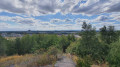
Slag heaps 116–117, 10 in Oignies
 3.63 mi
+141 ft
-141 ft
1h 45
Easy
Departure from Oignies (Pas-de-Calais)
3.63 mi
+141 ft
-141 ft
1h 45
Easy
Departure from Oignies (Pas-de-Calais)
A route that takes you from the former 9-9bis pit in Oignies, with its renovated buildings that will transport you back several decades. You will then cross the Bois de Gosse and stop at the wildlife observatory. The landscape will take on a more lunar appearance as you climb the slag heap, before finally returning to the pit via the old mining sidings (rail tracks).
Sentier des Fumerolles and Bois de Florimond
 3.55 mi
+118 ft
-118 ft
1h 45
Easy
Departure from Harnes (Pas-de-Calais)
3.55 mi
+118 ft
-118 ft
1h 45
Easy
Departure from Harnes (Pas-de-Calais)
Slag heaps are not just piles of dead rocks; reactions are still taking place at their core. As evidence of these reactions, gaseous fumaroles escape from them. To see this for yourself, head to Harnes, starting from the Bois de Florimond, and make your way towards the slag heap. Then follow the signposted path known as the “Sentier des Fumerolles” (Fumaroles Trail), marked by concrete posts, which will take you to Slurry Heap 230. It is a surprising journey offering a wide variety of landscapes and points of interest: views of fumaroles, a viewpoint over the south-east of the mining basin, a viewpoint over the canyon, and more.
Slag Heaps 83 and 94 - Fouquières marshes
 5.57 mi
+308 ft
-308 ft
2h 50
Easy
Departure from Harnes (Pas-de-Calais)
5.57 mi
+308 ft
-308 ft
2h 50
Easy
Departure from Harnes (Pas-de-Calais)
A route that takes you through the Fouquières marshes. You'll climb the wooded slag heap 83, offering a view of a mysterious artificial valley. You'll then head for slag heap 94 (staircase slag heap), passing the schlamm bins (storage of mining waste) and the Harnes fishing pond. Return along the path that runs alongside the Lens canal.
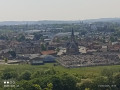
Le Bois de Florimond et les terrils
 6.21 mi
+246 ft
-249 ft
3h 05
Easy
Departure from Harnes (Pas-de-Calais)
6.21 mi
+246 ft
-249 ft
3h 05
Easy
Departure from Harnes (Pas-de-Calais)
Belle randonnée à faire en famille entre terrils, étangs et points de vue.
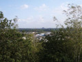
Right at the top of the slag heap *
 7.76 mi
+390 ft
-367 ft
3h 55
Moderate
Departure from Carvin (Pas-de-Calais)
7.76 mi
+390 ft
-367 ft
3h 55
Moderate
Departure from Carvin (Pas-de-Calais)
Climbing a slag heap offers the chance to gain a bird’s-eye view and appreciate the ever-changing nature of the surrounding landscape, whilst observing the traces of both the past and the present.
This circular route, linking Parc de l’Horloge and Terril 107 in Carvin to Parc du Téléphérique and Terril 115 in Libercourt, allows you to explore two protected natural areas, developed around two spoil heaps, which symbolise the regeneration of the Nord-Pas-de-Calais mining basin.
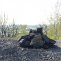
Terril 107, The Little Clock Tower Walk
 2.39 mi
+223 ft
-223 ft
1h 15
Moderate
Departure from Carvin (Pas-de-Calais)
2.39 mi
+223 ft
-223 ft
1h 15
Moderate
Departure from Carvin (Pas-de-Calais)
The route takes you first past the water point at the Carvin leisure centre. You’ll then enter a woodland just before the climb up the slag heap (a fair climb). From the top, you’ll have a view over the mining basin.
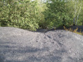
Slag heap 107, the large clock tower
 3.92 mi
+223 ft
-226 ft
2h 00
Moderate
Departure from Carvin (Pas-de-Calais)
3.92 mi
+223 ft
-226 ft
2h 00
Moderate
Departure from Carvin (Pas-de-Calais)
A route that will take you to the summit of slag heap 107, a fully wooded slag heap. You will follow old mining sidings, which are former railway tracks. You will walk alongside ponds with a bucolic charm, then cross through wild woods or farm tracks with unobstructed views.
The 108 and 122 slag heaps in Leforest and Ostricourt
 4.12 mi
+174 ft
-171 ft
2h 05
Easy
Departure from Leforest (Pas-de-Calais)
4.12 mi
+174 ft
-171 ft
2h 05
Easy
Departure from Leforest (Pas-de-Calais)
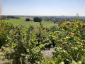
This route will first take you through the Offlarde and Phalempin forests. The landscape then becomes more lunar as you skirt around slag heap 108 and climb slag heap 122 (viewpoint over the mining basin).
Bois de l'Offlarde
 9.15 mi
+177 ft
-164 ft
4h 20
Moderate
Departure from Leforest (Pas-de-Calais)
9.15 mi
+177 ft
-164 ft
4h 20
Moderate
Departure from Leforest (Pas-de-Calais)
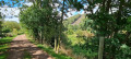
This walk, starting from Leforest, passes around two slag heaps and along the greenway (GR® 121B). It is well shaded for the first two-thirds of the route (Phalempin National Forest). It is an ideal walk during the hot summer months; however, the paths can become muddy on rainy autumn or winter days.
The route also offers a chance to admire the “ladder tree” in the Bois de l’Offlarde, which served as a German observation post during theFirst World War.
Slag heap 115 (known as "Téléphérique" - “The Cable Car”)
 3.61 mi
+112 ft
-131 ft
1h 45
Easy
Departure from Libercourt (Pas-de-Calais)
3.61 mi
+112 ft
-131 ft
1h 45
Easy
Departure from Libercourt (Pas-de-Calais)
The route begins in the forest, with birdwatching available from observation posts. Then the landscape becomes more undulous as you climb Slag heap 115 (viewpoint over the coalfield) and return via the miners' cottages.
The necropolis from Étang du Brochet
 7.11 mi
+220 ft
-207 ft
3h 30
Moderate
Departure from Noyelles-sous-Lens (Pas-de-Calais)
7.11 mi
+220 ft
-207 ft
3h 30
Moderate
Departure from Noyelles-sous-Lens (Pas-de-Calais)
Starting from Étang du Brochet, this hike will take you up Terril du Lavoir, before crossing the Méricourt mining village and then the necropolis of 10 March 1906, a memorial site following the mining disaster that claimed 1,099 lives.
The Necropolis of 10 March 1906 via the canal
7.21 mi
+69 ft
-66 ft
3h 25
Moderate
Departure from Noyelles-sous-Lens (Pas-de-Calais)
This walk, starting from the Étang du Brochet, will take you through the Cité du Moulin and then past the former 6/14 trench at Courrières. You will then arrive at the necropolis and follow the Path of Remembrance.
Around the golf course, slag heap and Leforest lake
 8.64 mi
+259 ft
-272 ft
4h 10
Moderate
Departure from Moncheaux (Nord)
8.64 mi
+259 ft
-272 ft
4h 10
Moderate
Departure from Moncheaux (Nord)
This hike from Moncheaux passes by the Thumeries golf course, slag heap 122, Leforest lake, and then the greenway. It is fairly shaded, especially in the first part.
Moncheaux barren lands route
 13.32 mi
+213 ft
-243 ft
6h 20
13.32 mi
+213 ft
-243 ft
6h 20
 Difficult
Departure from Moncheaux (Nord)
Difficult
Departure from Moncheaux (Nord)
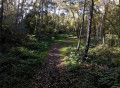
This circular allows you to admire the rich natural landscapes and mining heritage of the region. During this walk in the great outdoors, you will follow "les cavaliers", the old railway tracks of the Compagnie des Mines that connected all the mine shafts and slag heaps in the region when mining was in full swing. An excursion combining nature and history, to be discovered without delay!
Cinq Tailles and Thumeries
 8.12 mi
+98 ft
-98 ft
3h 50
Easy
Departure from Moncheaux (Nord)
8.12 mi
+98 ft
-98 ft
3h 50
Easy
Departure from Moncheaux (Nord)
A walk through the countryside around Mons-en-Pévèle, the Cinq Tailles bird sanctuary, and the town of Thumeries.
Match carriers in the Offlarde woods
 8.70 mi
+276 ft
-279 ft
4h 15
Moderate
Departure from Raimbeaucourt (Nord)
8.70 mi
+276 ft
-279 ft
4h 15
Moderate
Departure from Raimbeaucourt (Nord)
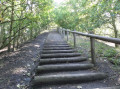
There is nothing monotonous about this route: you run or walk across a huge site, skirting an agricultural area here, old paths lined with sweet peas and wild blackberries there, sheltered by undergrowth or alongside a large pond.
And without even noticing, you arrive at the foot of the old conical slag heap on the border between Nord and Pas-de-Calais.
To reach the top, it takes a little more effort, but it's worth it because once you're at the top, the view is exceptional!
 The Haute Deûle, between canals and marshes
 25.23 mi
+30 ft
-30 ft
3 hrs
Moderate
Departure from Pont-à-Vendin (Pas-de-Calais)
25.23 mi
+30 ft
-30 ft
3 hrs
Moderate
Departure from Pont-à-Vendin (Pas-de-Calais)
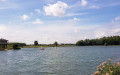
Explore the Parc de la Deûle by mountain bike. This is a suburban park built around the Canal de la Haute-Deûle. It was created to protect the irreplaceable water-capturing fields in the south of the Lille metropolitan area.Numerous facilities welcome visitors, encouraging them to respect the fragile environments.A pleasant ride along the Deûle and the Wavrin Marshes. An easy route offering a mix of riding on stony paths, towpaths and through the park.
A stroll around Douai’s marina
2.95 mi
+23 ft
-23 ft
1h 25
Easy
Departure from Douai (Nord)
A short walk along the River Scarpe and the marina. There are a few pieces of street art to discover.
Around the Scarpe in Douai
 6.67 mi
+20 ft
-20 ft
3h 05
Moderate
Departure from Douai (Nord)
6.67 mi
+20 ft
-20 ft
3h 05
Moderate
Departure from Douai (Nord)
This walking route follows the Scarpe bypass and the River Scarpe. It ends with a tour of some of Douai’s historic monuments:
- The Douai Belfry (10): a UNESCO World Heritage Site, offering magnificent views if you’re up for climbing its steps.
- Saint-Pierre Collegiate Church (11): an impressive church with remarkable Gothic architecture.
- The Palace of Justice (former Parliament of Flanders) (12): a historic monument steeped in history.
Walks through the legends of the Phalempin Forest
 6.75 mi
+98 ft
-98 ft
3h 10
Moderate
Departure from Phalempin (Nord)
6.75 mi
+98 ft
-98 ft
3h 10
Moderate
Departure from Phalempin (Nord)
A few kilometres from Lille lies a green oasis: the Phalempin Forest. Although modest in size (670 hectares), this forest is a rejuvenating place for hiking. Despite its small size, the forest boasts great biodiversity and legends. Once upon a time, in the village of La Neuville, on the edge of the Phalempin Woods, there was an inn called Leu Pindu with an unusual sign. It's up to you to discover the rest!
Around Phalempin and its forest
 9.48 mi
+98 ft
-98 ft
4h 25
Moderate
Departure from Phalempin (Nord)
9.48 mi
+98 ft
-98 ft
4h 25
Moderate
Departure from Phalempin (Nord)
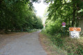
15 Km circuit in and around the Phalempin Forest. Start from the carpark opposite the Phalempin church.
La Voie du Sucre (Sugar Way)
 6.92 mi
+177 ft
-180 ft
3h 20
Moderate
Departure from Mons-en-Pévèle (Nord)
6.92 mi
+177 ft
-180 ft
3h 20
Moderate
Departure from Mons-en-Pévèle (Nord)
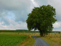
Follow part of the old railroad line. Promenade du Préfet, Voie du Sucre from Mons-en-Pévèle.This new version takes into account suggestions made by users. Many thanks to them.
Riez Circular Route
 6.62 mi
+20 ft
-20 ft
3h 05
Moderate
Departure from Bauvin (Nord)
6.62 mi
+20 ft
-20 ft
3h 05
Moderate
Departure from Bauvin (Nord)
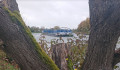
The Boucle des Riez is situated in the commune of Bauvin in northern Hauts-de-France, on the edge of the Pas-de-Calais.This pleasant route takes you along the Deûle Canal, through the two Riez marshes and past the Île aux Saules. Numerous picnic tables await walkers along the banks of the ponds.
Route through the heart of the schools in Provin and Bauvin
4.35 mi
+16 ft
-16 ft
2h 00
Easy
Departure from Provin (Nord)
Circular hike organised for pupils from Étienne Dolet Secondary School and pupils from schools in Provin and Bauvin as part of the “Parcours du cœur” event. A circular hike passing through three villages—Provin, Annœullin and Bauvin—and following paths and roads. This route is particularly suitable for school groups.
Le Corne Bœuf from Wingles
 6.43 mi
+46 ft
-46 ft
3h 00
Moderate
Departure from Wingles (Pas-de-Calais)
6.43 mi
+46 ft
-46 ft
3h 00
Moderate
Departure from Wingles (Pas-de-Calais)
This hike, starting from the Leisure Centre on Rue du Clair, will take you past the surrounding ponds and woods with their rich biodiversity and a few climbs, not to mention the Flot de Wingles.
The seven lakes at Wingles
 4.57 mi
+16 ft
-16 ft
2h 05
Easy
Departure from Wingles (Pas-de-Calais)
4.57 mi
+16 ft
-16 ft
2h 05
Easy
Departure from Wingles (Pas-de-Calais)
A very beautiful walk set amidst lush greenery and water.
La base nautique et ses alentours à Wingles
6.23 mi
+69 ft
-72 ft
2h 55
Moderate
Departure from Wingles (Pas-de-Calais)
Cette randonnée à partir de la base nautique et de loisirs vous fera passer par le Parc Alexis et les marais à la découverte de la biodiversité sur la commune de Wingles. De nombreux oiseaux sont à découvrir.
La trace gpx peut s'avérer utile au vu des nombreux chemins présents.