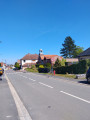
La base nautique et ses alentours à Wingles

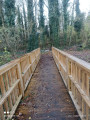
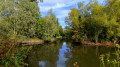
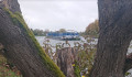
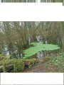
Cette randonnée à partir de la base nautique et de loisirs vous fera passer par le Parc Alexis et les marais à la découverte de la biodiversité sur la commune de Wingles. De nombreux oiseaux sont à découvrir.

La trace gpx peut s'avérer utile au vu des nombreux chemins présents.

Details

n°72011834
Creation:
Last update:
Last review:
  • Walking
    Activity: Walking
  • ↔
    Distance: 6.23 mi
  • ◔
    Average duration: 2h 55 
  • ▲
    Difficulty: Moderate

  • ⚐
    Back to start: Yes
  • ↗
    Ascent: + 69 ft
  • ↘
    Descent: - 72 ft

  • ▲
    Highest point: 115 ft
  • ▼
    Lowest point: 59 ft

Description of the walk

Start from the harbour master’s office car park on Rue René Clair.

(S/E) Leave the car park onto Rue René Clair, first turn left then right, then take the first track on the left and continue straight on until you reach the road.

(1) Carry on straight ahead, then take the track on the left after passing the old railway line, then turn right just before the pond and carry on straight ahead.

(2) Turn right, then turn left at the end, and carry on straight ahead until you reach a Fork in the road.

(3) Head straight ahead and carry on straight on until you reach Rue de la Canarderie.

(4) Cross it, then head straight ahead; at the end, turn right and carry on straight ahead.

(5) Turn left; at the end, take the path on the left before carrying on to the end.

(6) Turn right, then right again, and walk round the pond on your left-hand side.

(7) Turn right, then take the second path on the right, and carry on straight ahead until you reach Rue Auguste Catene. Follow this road to the right until you reach a fork.

(8) Go straight on, and after the bend to the right, cross over to the left and walk alongside the pond.

(9) Carry on straight ahead, then turn left along the Flot de Wingles Amont, cross the road and carry on straight ahead until you reach a fork in the road.

(10) Turn left, carry on straight ahead until you reach Rue Léo Lagrange. Cross it and first turn right then left until you reach a junction.

(11) Turn right, then turn right again at the end and carry on straight ahead until you reach the D165E2.

(12) Cross it carefully by turning left then right and carry on straight ahead until you reach the first fork, which leads off to the right into a wood.

(13) Turn right towards the woods, carry on straight ahead, cross the Flot de Wingles Amont and continue to the junction you passed on the way there.

(10) Carry on straight ahead, in the opposite direction to the outward journey, until you reach another junction which you also passed on the outward journey (car park 3).

(9) Turn left onto the ascending path and carry on straight ahead (ignore the paths to the left and right) until you reach a slight descent. At the Fork in the road, turn left and carry on straight ahead until you reach a crossroads.

(14) Turn left and stay on the left-hand path until the end. Keep to the right until you reach the road.

(15) Turn right, head back along Rue René Clair and take the path on the right to reach the pond. At the end, keep left twice, and head for the car park (S/E).


Waypoints

  1. S/E : mi 0 - alt. 69 ft - Harbour Master’s Office car park
  2. 1 : mi 0.34 - alt. 75 ft - Head straight ahead
  3. 2 : mi 0.67 - alt. 82 ft - Fork
  4. 3 : mi 0.98 - alt. 98 ft - Fork
  5. 4 : mi 1.26 - alt. 72 ft - Rue de la Canarderie
  6. 5 : mi 1.48 - alt. 82 ft - Crossroads
  7. 6 : mi 1.68 - alt. 89 ft - End of the path
  8. 7 : mi 2.18 - alt. 62 ft - Junction towards the ponds
  9. 8 : mi 2.5 - alt. 66 ft - Head straight ahead
  10. 9 : mi 2.95 - alt. 66 ft - Car park 3. Junction used for both outbound and return journeys
  11. 10 : mi 3.34 - alt. 82 ft - Wingles stream. Shared junction for out-and-back route
  12. 11 : mi 3.95 - alt. 66 ft - Crossroads
  13. 12 : mi 4.26 - alt. 66 ft - D165E2
  14. 13 : mi 4.77 - alt. 75 ft - Junction towards the woods
  15. 14 : mi 5.64 - alt. 98 ft - Crossroads
  16. 15 : mi 5.93 - alt. 75 ft - Road
  17. S/E : mi 6.23 - alt. 69 ft - Harbour Master’s Office car park

Notes

Pas de point d'eau

Worth a visit

Water sports centre

Marais

Reviews and comments

4.6 / 5
Based on 3 reviews

Reliability of the description
4.7 / 5
Ease of following the route
4.3 / 5
Route interest
4.7 / 5
souchez rando
souchez rando

hello, thank you for your feedback on the application. Despite numerous paths being added, we are able to access it without any issues

Machine-translated

Michel D2.
Michel D2.

Overall rating : 4 / 5

Date of your route : Aug 25, 2025
Reliability of the description : ★★★★☆ Good
Ease of following the route : ★★★☆☆ Average
Route interest : ★★★★★ Very good
Very busy route : No

A wonderful discovery of the Wingles lakes. A smartphone is essential for the first part of the route to Marcel Park Lake, as there are no signs to help you find your way along the numerous paths.

Machine-translated

souchez rando
souchez rando

Thank you for your feedback. We wish you all the best on your future hikes.

Machine-translated

Marquilly
Marquilly

Overall rating : 4.7 / 5

Date of your route : Jul 01, 2025
Reliability of the description : ★★★★★ Very good
Ease of following the route : ★★★★★ Very good
Route interest : ★★★★☆ Good
Very busy route : No

Very pleasant hike.

Machine-translated

souchez rando
souchez rando

Good evening. Thank you for your feedback. I wish you all the best on your future hikes.

Machine-translated

michel tout court
michel tout court

Overall rating : 5 / 5

Date of your route : Apr 24, 2025
Reliability of the description : ★★★★★ Very good
Ease of following the route : ★★★★★ Very good
Route interest : ★★★★★ Very good
Very busy route : No

A lovely, varied walk. Almost entirely on paths.
GPS essential

Machine-translated

Other walks in the area

For more walks, use our search engine .

The GPS track and description are the property of this route's author. Please do not copy them without permission.