


Refine your search for walks in Dommarien
Dommarien walks


 Le Creux de la Chaudière depuis Dommarien
 Visorando Member
 9.20 mi
 +574 ft
 -568 ft
 4h 45
4h 45
 Moderate
 Departure from Dommarien (Haute-Marne)
This route invites you to discover the heritage of the village of Dommarien. You will then continue through the Bois de la Côte Aubert to return to your starting point, crossing the plain and passing close to the village of Chassigny.Along the way, you’ll discover Dommarien’s bridge, wash houses and ‘patouillets’.
The three communes of the Montsaugeonnais
 10.47 mi
+797 ft
-804 ft
5h 30
Moderate
Departure from Montsaugeon (Haute-Marne)
10.47 mi
+797 ft
-804 ft
5h 30
Moderate
Departure from Montsaugeon (Haute-Marne)
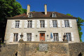
The Montsaugeonnais Community of Communes. Established by a prefectural decree of 19 November 2015, it was formed from the merger of the three communes of Montsaugeon, Prauthoy and Vaux-sous-Aubigny, which became delegated communes. Its administrative centre is in Prauthoy.
The route of the three municipalities will take you through the Montanson woods, which are very popular when the daffodils are in bloom from March to the end of April. You will also be able to explore the vineyards of the Montsaugeonnais.
Villegusien to Domarien circular loop
 10.51 mi
+541 ft
-545 ft
5h 20
Moderate
Departure from Villegusien-le-Lac (Haute-Marne)
10.51 mi
+541 ft
-545 ft
5h 20
Moderate
Departure from Villegusien-le-Lac (Haute-Marne)
An idyllic walk through the woods and countryside of southern Haute-Marne.
With a bit of exploration to discover the paths through the woods.
The Prauthoy Massif
 3.59 mi
+315 ft
-246 ft
1h 55
3.59 mi
+315 ft
-246 ft
1h 55
 Easy
Departure from Vaux-sous-Aubigny (Haute-Marne)
Easy
Departure from Vaux-sous-Aubigny (Haute-Marne)
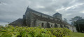
The walk starts not far from Aubigny Church and takes you on a lovely, easy circular route entirely through the Prauthoy Forest. Ideal for hot days. At the start or finish, enjoy the view from Aubigny Church of Mont Poupet and Mont Blanc, weather permitting.
The short circular loop of the Grandes Charmes
4.30 mi
+535 ft
-528 ft
2h 25
Moderate
Departure from Vaux-sous-Aubigny (Haute-Marne)
A lovely walk offering superb panoramic views, leafy arches and, depending on the season, birdsong.
A walk in the Montsaugeonnais at the crossroads of three provinces
 11.02 mi
+804 ft
-814 ft
5h 45
Moderate
Departure from Vaux-sous-Aubigny (Haute-Marne)
11.02 mi
+804 ft
-814 ft
5h 45
Moderate
Departure from Vaux-sous-Aubigny (Haute-Marne)
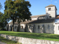
On the borders of Champagne, Burgundy and Franche-Comté, the Domaine du Muid Montsaugeonnais covers 13 hectares, spread across the territories of four communes: Chatoillenot, Montsaugeon, Rivière-les-Fosses and Vaux-sous-Aubigny.
Abandoned since the outbreak of phylloxera in the late 19th century, the vineyard was revived in 1988 thanks to the Chevaliers du Montsaugeonnais.
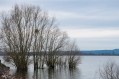
Tour of Lake Vingeanne
 5.31 mi
+23 ft
-23 ft
2h 30
Easy
Departure from Villegusien-le-Lac (Haute-Marne)
5.31 mi
+23 ft
-23 ft
2h 30
Easy
Departure from Villegusien-le-Lac (Haute-Marne)
Discover the wild flora and fauna in the heart of the Pays des 4 Lacs.
From Sacquenay to the Canal between Champagne and Burgundy
 10.04 mi
+312 ft
-312 ft
4h 55
Moderate
Departure from Sacquenay (Côte-d'Or)
10.04 mi
+312 ft
-312 ft
4h 55
Moderate
Departure from Sacquenay (Côte-d'Or)
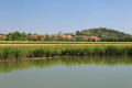
A walk in the Vingeanne area that will take you to discover the 15th-century fountains in Sacquenay as well as the canal between Champagne and Burgundy. Diverse landscapes and a well-preserved environment.
Foncegrive and Selongey as seen from Boussenois
 10.98 mi
+869 ft
-866 ft
5h 50
Moderate
Departure from Boussenois (Côte-d'Or)
10.98 mi
+869 ft
-866 ft
5h 50
Moderate
Departure from Boussenois (Côte-d'Or)
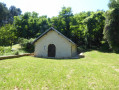
From Boussenois, head towards Foncegrive, partly through the woods; pass through Foncegrive and continue to Selongey, also via a small woodland path; pass through Selongey and head back up via the Sainte-Anne Chapel to return to Boussenois.
Between Boussenois and Rivière-les-Fosses
 9.41 mi
+787 ft
-758 ft
5h 00
9.41 mi
+787 ft
-758 ft
5h 00
 Difficult
Departure from Boussenois (Côte-d'Or)
Difficult
Departure from Boussenois (Côte-d'Or)
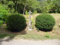
A walk between Boussenois and Rivière-les-Fosses via La Montagne and the woods of Grand Maisonnais
From Boussenois to Vernois-lès-Vesvres in the Chamberceau Forest
 10.09 mi
+787 ft
-791 ft
5h 20
Moderate
Departure from Boussenois (Côte-d'Or)
10.09 mi
+787 ft
-791 ft
5h 20
Moderate
Departure from Boussenois (Côte-d'Or)
A circular walk starting from Boussenois and heading to Vernois through the woods.
La Pâturie, Le Prélot and the “Sentier des Pierres sèches” in Champlitte
 6.79 mi
+413 ft
-390 ft
3h 30
Moderate
Departure from Champlitte (Haute-Saône)
6.79 mi
+413 ft
-390 ft
3h 30
Moderate
Departure from Champlitte (Haute-Saône)
A pleasant little walk through the vineyards and the heritage of Franche-Comté.
A tour of Selongey’s chapels
 5.39 mi
+404 ft
-384 ft
2h 50
Easy
Departure from Selongey (Côte-d'Or)
5.39 mi
+404 ft
-384 ft
2h 50
Easy
Departure from Selongey (Côte-d'Or)
Selongey takes its name from a Roman estate once situated at the ‘Champ de Mars’. Centuries of history have left it with some remarkable monuments: a 13th-century church housing a carillon of 48 bells, listed as a historic monument, and a 19th-century organ, the Chapel of Saint Gertrude (1530) and the Chapel of Saint Anne (1637). There are also a few old houses dating from the 15th and 16th centuries.
The Gency to Selongey Trail
 Association / Club / Walk leader
 4.96 mi
+377 ft
-394 ft
2h 35
Easy
Departure from Selongey (Côte-d'Or)
4.96 mi
+377 ft
-394 ft
2h 35
Easy
Departure from Selongey (Côte-d'Or)
The area around Selongey, the birthplace of the Seb pressure cooker, invites you to explore its Gency walking trail. Its name is taken from one of the three hills overlooking the village. This easy, signposted trail will take you through the forest that covers much of this hill.You’ll cross the Venelle before reaching the hill. You’ll finish this walk by passing near the pressure cooker factory.
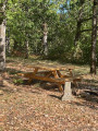
The valley on either side of the Venelle between Selongey and Foncegrive
 7.36 mi
+755 ft
-738 ft
4h 00
Moderate
Departure from Selongey (Côte-d'Or)
7.36 mi
+755 ft
-738 ft
4h 00
Moderate
Departure from Selongey (Côte-d'Or)
This signposted route is one of four trails starting from the Courvelles Sports Complex in Selongey. It will take you from the home of the pressure cooker to Foncegrive, a small village nestled at the bottom of its valley. You’ll return to Selongey via the beautiful Gency Forest. This route is not particularly difficult. Only a short, steep 100-metre stretch will set your heart racing a little faster.
The Tertre Trail in Selongey
 Local authority
 6.98 mi
+591 ft
-577 ft
3h 45
Moderate
Departure from Selongey (Côte-d'Or)
6.98 mi
+591 ft
-577 ft
3h 45
Moderate
Departure from Selongey (Côte-d'Or)
The Selongey area, home to the SEB pressure cooker, invites you to explore its Tertre hiking trail. Its name comes from the woodland you will pass through during this hike, which reaches a highest point of 415 m.
You will pass by the statue of the Virgin Mary, along the Tille and Venelle wind farm, before descending into the village. You will continue the walk along Rue du Mont and pass by the Church of Saint-Rémy de Foncegrive on your return to Selongey.
Short version of the Tertre hike from Selongey
 4.93 mi
+449 ft
-436 ft
2h 40
Easy
Departure from Selongey (Côte-d'Or)
4.93 mi
+449 ft
-436 ft
2h 40
Easy
Departure from Selongey (Côte-d'Or)
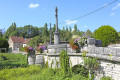
The Selongey area, home to the SEB pressure cooker, invites you to explore its Tertre hiking trail. Its name comes from the woodland you will pass through during this hike, which reaches a highest point of 415 m.You’ll pass by the statue of the Virgin Mary, along the Tille and Venelle wind farm, before descending a beautiful path to join the track that will take you back to Selongey. You’ll finish this hike by passing near the pressure cooker factory.
The Valley at Selongey
 7.32 mi
+696 ft
-715 ft
4h 00
Moderate
Departure from Selongey (Côte-d'Or)
7.32 mi
+696 ft
-715 ft
4h 00
Moderate
Departure from Selongey (Côte-d'Or)
Gradually leave Selongey behind as you climb higher to discover the Venelle valley from a different perspective.
This circular route links Selongey to Foncegrive, alternating between country lanes, woodland paths and village crossings. After an initial section through the woods, the route reaches the heights of Foncegrive and its viewpoint. The walk then passes through the village before gaining altitude again via the paths and woods of Gency.
The return journey to Selongey offers one final change of scenery. The natural landscapes gradually give way to the urban and industrial heritage of a town closely linked to the history of SEB and the famous Cocotte-Minute.