Le Creux de la Chaudière depuis Dommarien

This route invites you to discover the heritage of the village of Dommarien. You will then continue through the Bois de la Côte Aubert to return to your starting point, crossing the plain and passing close to the village of Chassigny.
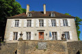
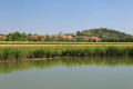
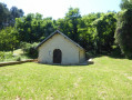
Along the way, you’ll discover Dommarien’s bridge, wash houses and ‘patouillets’.

Details

25244184
Creation:
Last update:
Last review:
  • Walking
    Activity: Walking
  • ↔
    Distance: 9.20 mi
  • ◔
    Average duration: 4h 45 
  • ▲
    Difficulty: Moderate

  • ⚐
    Back to start: Yes
  • ↗
    Ascent: + 574 ft
  • ↘
    Descent: - 568 ft

  • ▲
    Highest point: 1,165 ft
  • ▼
    Lowest point: 886 ft
  • ⚐ Country: France
  • ⚐ City: Dommarien (52190)
  • ⚑
    Start/End: N 47.685877° / E 5.344526°
  • ❏
    IGN map(s): Ref. 3120SB, 3121SB, 3220SB, 3221SB
  • Hour-by-hour weather

Description of the walk

Park at the Dommarien municipal nature area, beside the D7 road.

(S/E) Leave the car park by carefully following the D7 road towards the village. On your right, you’ll see a wash house below the road, before crossing the Vingeanne via a humpback bridge. There’s a lovely view of the wash house just after the bridge if you turn round.
Follow the D7 road, which turns right (Rue des Hêtres). At the right-angled bend to the left, take Rue du Moulin opposite, which heads south-east. Leave the village. Rue du Moulin gives way to the path known as Chemin du Grand Viau.

(1) When you reach the farm buildings on the right, take the path on the left. Follow it to the next crossroads, just before the woods.

(2) Turn right onto the track leading towards La Combe au Bœuf and enter the Bois de Côte Aubert, climbing the hillside it covers. Continue straight on until you reach the southern edge of the woodland; follow the edge, with the hamlet of Fromentelle off to your right, until you reach a road.

(3) Follow it to the left, then enter the forest and look for a path on the left after walking for about 300 metres.

(4) Take this path to the left, heading north, and descend into the Bois de Côte Aubert. The path joins a small road. Follow it to the left until you reach a path on the right at the sign for the Chassigny Aisey Communal Forest.

(5) Turn right onto the flat path. When you reach the edge of the woods, turn left onto a grassy path.

(6) At the next crossroads, turn left. The path curves widely through the fields of La Grande Pelle, then heads north through the Champs Parent area before joining the D7.

(7) Turn left and follow the D7 road carefully for about three hundred metres before turning right onto a farm track.

(8) At the three-way junction in the path, take the path on the right which leads to the D149 through the Champ Riot area. When you reach the road, turn left and follow it carefully for about five hundred metres.

(9) Turn left onto the farm track which runs alongside a plot of land on the left-hand side, where a small patch of woodland remains. Turn onto the track on the right shortly afterwards, about seven hundred metres from the D149. The track leads towards the Bois de Sarrigny, which covers the hillside.

(10) Enter the woods at L’Échalement and follow the path which winds its way straight down the hillside towards La Combe au Maire, meandering between the trees. Cross the seasonal stream known as the Ruisseau du Chassigny and continue along the white track.

(11) At the next crossroads, turn left onto the path that runs alongside the Boulet and Combe Crousot areas. At Les Mouillerants, the path descends the hill towards Dommarien. Turn right at each of the two crossroads.

(12) Take the Chemin des Zudelets on the right and continue straight on until you enter Dommarien via Rue des Groseillers. Follow this road until it meets Rue du Vernois. There, cross Rue du Vernois carefully and take the path opposite, which leads to the village’s second washhouse on the banks of the Vingeanne.

(13) Cross the river via a footbridge and, a little further on, turn left into Impasse de la Vingeanne to reach the D7. Cross the road carefully to return to the car park (S/E).

Waypoints

  1. S/E : mi 0 - alt. 909 ft - Park next to the campsite entrance. Near the - Canal entre Champagne et Bourgogne
  2. 1 : mi 0.49 - alt. 915 ft - Junction
  3. 2 : mi 1.04 - alt. 932 ft - Farm track x path on the right
  4. 3 : mi 2.38 - alt. 1,161 ft - D190
  5. 4 : mi 2.99 - alt. 1,063 ft - Path on the left
  6. 5 : mi 3.88 - alt. 991 ft - Forest track x minor road
  7. 6 : mi 4.66 - alt. 948 ft - Junction
  8. 7 : mi 5.73 - alt. 1,047 ft - D7
  9. 8 : mi 6.04 - alt. 1,056 ft - Crossroads
  10. 9 : mi 6.66 - alt. 1,070 ft - D149 x path on the left
  11. 10 : mi 7.23 - alt. 997 ft - Entrance to the woods
  12. 11 : mi 7.6 - alt. 965 ft - Crossroads at La Combe au Maire
  13. 12 : mi 8.65 - alt. 974 ft - Chemin des Zudelets x Chemin des Riottes
  14. 13 : mi 9.01 - alt. 902 ft - Footbridge over the Vingeanne
  15. S/E : mi 9.2 - alt. 906 ft - Parking is available next to the campsite entrance

Notes

The car park is located next to the entrance to the Dommarien Municipal Nature Campsite, on the side of the D7 road near the junction with Rue du Port.
Access: from Langres, take the D974 southwards. On leaving Longeau-Percey, turn left onto the D67 and, at Chassigny, turn right onto the D7. Drive straight through Dommarien towards the Marne–Saône Canal.

This walk across varied terrain requires suitable footwear.

This walk follows the “Le Creux de la Chaudière” route, the guide to which is published by the Haute-Marne Tourist Office. In addition, it is advisable to follow the directions in the description and on the map, whilst paying close attention to the landscape. The waypoints (with their GPS coordinates and the distance from the starting point) serve as aids for walkers exploring the route for the first time.

Further information:
This route passes through long stretches of flat countryside. Signposting is therefore more sparse in these areas and the sun is very strong. Please refer to the Visorando description and make sure you bring a cap or hat, particularly for children and vulnerable people.

Worth a visit

The bridge
An old stone bridge, listed as a Historic Monument, spans the Vingeanne. On 15 July 1760, the village mayor, Thibaut Yenveux, summoned all the villagers with the ringing of the bell: it was acknowledged that the old bridge was falling into ruin on all sides. The contract for the work was awarded to Mr Jean Baptiste Menne, a stonemason from Langres, on 9 July 1774 for the sum of 4,200 livres. It ultimately cost 4,578 livres. The new bridge was built using stones quarried at Courcelles Val d’Esnoms. The villagers were required to pay 2,736 livres over two years; the remainder was funded by the parish selling land and woodland. It appears that no government grants were received!

The wash houses and ‘patouillets’ of Dommarien
On 21 June 1826, a royal decree authorised the creation of iron ore washing pits at the lower mill (the ‘patouillets’). These were used to separate the iron ore from the earth. The ore came from Dommarien and the Auberive region. The muddy water from the ‘patouillets’ was initially discharged into the river, but following protests from residents of the downstream villages who used the river to water their livestock, the water was subsequently channelled into sinkholes. There are no further mentions of the ‘patouillets’ after 1860.
Today, the waters of the Vingeanne disappear entirely into the ground at the edge of the village. These holes, known as ‘andouzoirs’, appear to correspond to the former drainage wells of the ‘patouillets’. Research has not been able to prove, as some claim, that the waters re-emerge at the Creux Janin in Cusey

The Church of Notre-Dame de l’Assomption in Chassigny
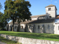
This Gothic church dates from the 12th century; it was fortified in 1371. Its single nave is separated from the choir, which is situated lower down and is narrower, by a pointed triumphal arch. The transverse arches rest on engaged columns in the nave and on pilasters in the ante-choir. Its imposing bell tower has a spire covered with shingles.
Inside the building, there is a 17th-century altarpiece, banners and a 19th-century painted and embroidered tapestry. The decoration of the ante-choir is reminiscent of that of Saint-Mammès Cathedral in Langres.

The Dommarien Canal Bridge
The Dommarien Canal Bridge is a structure enabling the Marne–Saône Canal to cross the River Vingeanne.
Source: ‘Le Creux de la Chaudière’ walking guide published by the Haute-Marne Tourist Office

Reviews and comments

3.2 / 5
Based on 2 reviews

Reliability of the description
3.5 / 5
Ease of following the route
2 / 5
Route interest
4 / 5
Denis26
Denis26 ★

Thank you for your comments; I’ve just amended the itinerary accordingly.

Machine-translated

Mumu52800
Mumu52800

Overall rating : 2.7 / 5

Date of your route : Aug 02, 2026
Reliability of the description : ★★★☆☆ Average
Ease of following the route : ★☆☆☆☆ Very disappointing
Route interest : ★★★★☆ Good
Very busy route : No

The walk I did today has become impassable; no maintenance has been carried out and the signposting is virtually non-existent

Machine-translated

morgamelia2017
morgamelia2017

Overall rating : 3.7 / 5

Date of your route : Jan 08, 2024
Reliability of the description : ★★★★☆ Good
Ease of following the route : ★★★☆☆ Average
Route interest : ★★★★☆ Good
Very busy route : No

Between numbers 3 and 4, there are no paths.
After number 3, take the first path on the right, follow it until you reach the white path, then turn right to rejoin the route.
The rest of the route is perfect

Machine-translated

Other walks in the area

For more walks, use our search engine .

The GPS track and description are the property of this route's author. Please do not copy them without permission.