


 Country:
 City:
City:


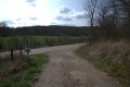
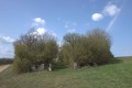
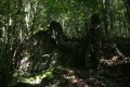
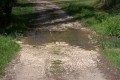
Park at the edge of the Halte Fluviale in front of an old silo in Villegusien.
(S/E) Head north along Rue Derrière l’Olivette and continue to the junction with the D292.
(1) Turn right onto the D292 and follow it to the junction with Chemin aux Cartiers.
(2) Turn right onto this track, pass under a power line and follow it to its end. Continue along the small path through the meadow that follows it to the woods opposite.
(3) Enter the woodland. Follow the path branching off to the right which joins the farm track. Walk down to the Ru de Chassigny.
(4) Ford the stream, walk 100m and head up the path through the woods. At an old hunting lodge, turn right. Continue along the path through the woods. At the collapsed wall, turn right to head back down towards the road leading to Chassigny.
Alternative route: This section can be avoided by following the path from the Ru de Chassigny to the water intake station.
Cross the ford at the Ru Premier and follow the road for about 200 metres.
(5) Take a small path on the right which climbs into the woods.
Please note that the entire section that follows does not follow any path marked on a map.
At the Fontaine des Ermites, turn right and then left to head up into the woods.
Follow the paths to a passage that winds its way up between the rocks. Keep going straight on at every junction.
The path is very distinctive as it is man-made. Complete the ascent to the Trou aux Fées.
To cross the Bois de Mourie, follow the small paths, keeping to the GPS track. You’ll reach a large hairpin bend.
(6) Turn right. Continue on to reach another hairpin bend.
Alternative route: You can continue straight on to join the D149 at (9)
(7) Turn left, go downhill for 10 metres, then turn right and follow the mountain bike track until you reach the vicinity of the Ferme du Ru.
(8) Follow the farm track to the D149.
(9) Cross the D149 and take the track opposite until you reach a tarmac road.
(10) Walk through the woods, heading down towards the Ru de Chasigny.
Follow the path back up to the Combe au Maire crossroads.
(11) Turn left, pass through Combe Crousot and continue on to Dommarien. Walk down Rue des Groseilliers until you reach Rue du Calvaire.
(12) Turn right onto Rue du Calvaire and leave Dommarien heading north up the hill. You’ll reach a crossroads 50 metres before Notre-Dame du Bon Souvenir.
(13) Turn left into the woods and follow the track to a dirt track suitable for vehicles, which leads uphill to the junction with a white track.
(14) Turn left onto this track and join the D128. Turn right onto it and follow it as far as the Bise l’Assaut quarry.
(15) At the quarry, turn left (do not cross the quarry) and head down towards the Canal between Champagne and Burgundy. Turn right and follow the canal to the Villegusien car park (about 4 km) (S/E).



 Visorando Member
 Easy
Easy 
 Difficult
