Refine your search for walks in Camoël
Camoël walks
Between the Vilaine and the Étang du Pont de Fer
To the south of the Vilaine estuary, the gentle terrain encourages the intermingling of wetland and agricultural environments. The village of Camoël is built on a slight rise overlooking both the river and the marshes situated upstream of Pont Mahé Bay.
The proposed route allows you to explore the river where its estuary begins and one of the streams feeding the Étang du Pont de Fer, a hidden nature reserve that can be glimpsed when the foliage is not too dense.
From one port to another along the Vilaine
Running along the left bank of the Vilaine, this path follows the riverbank closely, linking the two ports of Arzal and La Roche-Bernard, and offering a multitude of landscapes and views of the Basse-Vilaine. In summer, you can also return by boat or canoe.
Vieille Roche Route
In the past, the Vilaine was crossed by ferry downstream of La Roche-Bernard. This was the case between Vieille Roche in Camoël and Arzal. The construction of the dam in the 1970s significantly changed these practices, as a fixed link now allows people to cross from one bank to the other. The suggested route allows you to explore the dam and the paths along the left bank of the Vilaine around Camoël.
From the Arzal dam to La Roche Bernard along the left bank of the Vilaine
Walk starting from the Arzal Dam, following the Vilaine upstream on the left bank, circular route via the two bridges and finishing at the port of La Roche-Bernard. The scenery along the Vilaine is breathtaking.
Circular Vilaine Route via the Arzal Dam and the Roche-Bernard Bridge
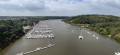
A pleasant, easy walk along the banks of the Vilaine through wooded countryside, forests and small villages.
The path is fully signposted in white and red by theGR®39(left bank) andGR®349(right bank).
The Vilaine and the countryside around Arzal
During this hike, discover a variety of landscapes: the river, the ocean and the countryside.
De Lantiern à la Vilaine
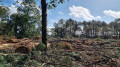
A country walk between Cosca, a stone's throw from the Arzal dam, and the Templar village of Lantiern.This walk along beautiful tree-lined paths and a few small roads connects the banks of the Vilaine estuary to the beautiful Saint-Jean-Baptiste Chapel, through pleasantly rolling countryside.The end of the route follows the botanical trail.The trail has been modified after the point (1), following the clear-cutting of the wooded area it used to cross, which made the trail disappear.
A walk around the Férel bell tower
Situated about ten kilometres inland from the coast, on a plateau sloping down from the banks of the Vilaine to the first marshes of Briéron, the commune of Férel has managed to preserve its bocage landscape and a network of paths offering a wide range of walking options. This route offers an almost constant view of the bell tower, which, being tall and sharply pointed, is one of the area’s main landmarks.
Between bocage and Vilaine in Arzal
The village of Arzal stretches from the foot of the church's pointed bell tower to the edge of the dam. Upstream, the river has become a huge body of water where thousands of boats are moored, while downstream, the maritime character of the estuary remains. The proposed route allows you to discover both aspects of the river and the bocage that overlooks it.
A walk through wooded countryside and forests south-west of Marzan
As is often the case in Brittany, the landscape is not the result of tectonic forces, which would have created a few sharp-peaked mountains, but rather the result of numerous watercourses that have carved their way through the plateaus. The proximity of the Vilaine, which flows here through a narrow, steep-sided valley, has led secondary watercourses to cut through the moorland to join the river. Starting on the wooded plateau, the proposed route soon winds its way through these valleys, which, due to the decline of agriculture or the low value of this poor soil, have been left to more or less spontaneous woodland growth. The result is a undulating route that runs mostly in the shade of tall, beautiful trees, whilst connecting the countless hamlets that dot this lovely countryside.
Pénestin in the countryside
In Pénestin, far from the hustle and bustle of the coast, you can stroll in complete tranquillity along quiet paths that criss-cross the countryside between the Tréhudal marshes and those of Pont Mahé.
This walk is best enjoyed on sunny days, when it’s pleasant to walk in the shade.
Tour de Larmor in Pénestin
Pénestin is just a stone's throw away from being an island. Although its ocean side faces the Atlantic, it is only connected to the hinterland by a strip of land wedged between two marshes. The suggested route takes you through the southern part of the area, formerly known as Larmor, between the Pont Mahé marshes and the cliffs of Lanchale and Le Bile.
Between land and sea at Pont Mahé
This route forms a circular loop between Pont Mahé Bay and Pen Bé Bay.
The Herbignac Potters’ Trail
Passing through clay extraction sites and former pottery villages, this route pays tribute to one of Herbignac’s traditional trades, which continued until the mid-20th century.
Tour of Haut Pénestin
The Pointe du Halguen marks the southern limit of the Vilaine estuary. This promontory overlooking the ocean is also the northern end of the ochre cliffs that line the ocean front of Pénestin. A lovely walk is available around the village of Haut Pénestin, where long stretches of sandy beach precede secluded coves and abandoned salt marshes.
From Maresclé beach to Haut-Pénestin along the coast and other paths
This hike starts at the car park of the Mine d’Or beach, along the coast north to Haut-Pénestin, to return by internal paths to reach the sea at Maresclé beach and then the starting point.
Circular route through coastal and countryside scenery between La Mine d'Or and Loscolo
As well as its magnificent coastal path stretching over 14 km, Pénestin boasts a multitude of trails criss-crossing the local area. The circular route allows you to explore some of these paths as far as the edge of the Pont Mahé Marshes, before returning to the coast via the coastal path. And if the weather and season permit, do make the most of the lovely beaches that line this route.
Pen Bé Tower
The Pointe de Pen Bé juts out like a ship between Pont Mahé Bay and the Pen Bé and Rostu straits. While its maritime location is undeniable at high tide, it changes completely at low tide, as the sea then deserted the coastal areas. Whether at high or low tide, this is a route that is worth exploring at any time, as the landscape is so changeable.
From the Pont Mahé marshes to those of Le Mès
The Pointe de Pen Bé juts out with its ochre cliffs between the Traict de Rostu and Pont Mahé Bay. These two stretches of sea, which are revealed at low tide, form the foreground to the marshes – one a salt marsh, the other a freshwater marsh – which extend behind the coastal sandbars.
The circular walk that links them offers a lovely glimpse of this coastal countryside.
Walk along the Billiers Megalith Trail
This is a circular route running along one side of the Étier de Billiers, Plage des Barges and Plage des Granges, not forgetting a walk around the Penn Lann Lighthouse.
In a single day, you can combine sightseeing, swimming and a walk, either on your own or with the family.
The trail follows, for the most part, the Chemin des Mégalithes between the marshes and the ocean.
Around La Roche-Bernard
Although La Roche-Bernard is an urban centre that locals refer to as a ‘town’, its area (40 ha) and population (approx. 700 inhabitants) make it one of the smallest county towns in France. It is surrounded by the communes of Nivillac, Herbignac and Férel, across which the majority of the urban area is spread. The proposed route takes you around the area.
La Brière océane
To the west of the Brière Regional Nature Park, the Brière coast stretches from Pont Mahé beach to the Pen Bé strait. It offers a varied landscape of beaches, shorelines, wild coastlines, moors and salt marshes. A return trip connects to this route for a foray into Morbihan to Pointe du Bile.
The banks of the Vilaine
A very pretty route which starts in the countryside and forest and then follows the course of the Vilaine river.
The start and finish are at the very pretty port of La Roche-Bernard.
La Roche-Bernard bridge loop
An hour-and-a-half circuit with a few tricky sections. This pleasant walk alternates seamlessly between passages at water's edge and ridge-climbing, and also spans two bridges some 50 m above the Vilaine. The bridge circuit allows you to discover a small section of the river as it crosses the Sillon de Bretagne. Get your calves ready!
Pont Mahé Bay and Dunes
Straddling the departments of Morbihan and Loire-Atlantique, Pont Mahé Bay is a vast sandbank at low tide and a renowned spot for board sports once the sea has returned. Connecting the two headlands that mark its boundaries is a pleasant way to cross administrative borders
From Ranrouët Castle to La Brière
The Château de Ranrouët is a medieval gem nestled on the edge of the marshes. Here, there is no fortified rock, but a slight elevation in the greenery. The marshes that surround it provided protection, and the proposed route winds through the surrounding countryside where land and water constantly mix.
The Vilaine river, right bank and left bank at La Roche-Bernard
As you approach La Roche-Bernard, the Vilaine river winds its way through the geological folds of southern Armorica. The result is a rugged, wooded landscape that is very pleasant to walk through.
Route of the Mills in Marzan
Located opposite La Roche-Bernard, on the other bank of the Vilaine, the commune of Marzan stretches across a plateau overlooking the river. On these heights, exposed to sea winds, the remains of several windmills can still be seen. Streams have carved out the rock and flow at the bottom of the valleys. Where it was possible to dam them, water mills were built. The proposed route takes you from one to the other through varied and pleasant countryside.
La Cour aux Loups
Although Herbignac is not the commune in Brière with the most thatched cottages, the villages along this route offer some fine examples.
Le Rostu in the heart of the Mès salt marshes
This hike is located in Mesquer, in the hamlet of Rostu.
The Bassin du Mès is an area where salt marshes have been created for centuries and were once highly developed. They are fed with seawater by channels leading from the "Merquel - Rostu - Pen-Bé" traicts, which are an enclave of the sea between the Pointe de Pen-Bé and the Pointe de Merquel. Oyster and mussel farming have also developed in this area. There are some beautiful views to be discovered.
Between the countryside and the sea, leaving from Billiers.
A pretty walk between the countryside and the seaside. The Pointe de Penn Lann stands guard over the Vilaine Estuary.
Between the countryside and the sea in Billiers (long version)
A beautiful walk along the banks of the Vilaine and inland.
Walk in the marshes around Kercabellec
Mesquer has a coastline opening onto the Bay of Vilaine and the open sea, but around Kercabellec, a small port between the village and Quimiac, there is a much more secret route between the marshes and the Merquel and Rostu tidal flats. Immerse yourself in this unique landscape where salt and shellfish farming are closely intertwined.
Mesquer - Quimiac
This route connects the three main areas of the municipality: Mesquer, Quimiac and Kercabellec. It allows you to discover the diversity of the area, first the marshes, then the countryside and the sea, which is particularly present around the Pointe de Mesquer.
Long route east of Péaule
The Péaule countryside has a rather unique network of paths. Land consolidation has not been destructive here, and large, beautiful hedges still line the roads.
Elsewhere, the Vilaine and its tributary streams have carved into the rocky plateau to create a generally wooded landscape where you can take a stroll.
The long route on offer allows you to enjoy these different but always interesting landscapes, which follow one another during a beautiful day's walk.
From Fescal to the Vilaine
North of La Roche-Bernard, the Vilaine has carved its bed into a rocky plateau, and the streams that join it have also settled in fairly steep valleys. The remains of windmills on the heights and watermills along the streams mark this route, which winds around the former estate of Fescal Castle. This route runs mainly through wooded areas, interspersed with wooded hedgerow landscapes.
A circular route starting from Nivillac
On either side of La Roche-Bernard, the Vilaine flows through the South Armorican Fold, the first range of hills behind the coastline. Here, the river has carved out a steep-sided valley, and the proposed route allows you to explore the section immediately upstream of the Morbihan Bridge. The wooded slopes, varying in steepness, line the mirror-like surface formed by the dark waters of the Vilaine.
Quimiac, between sea and marsh (2)
One-third salt marsh, one-third countryside and one-third sea: a superb recipe for a salty cocktail!
Quimiac, between sea and marsh
The hike begins with three beaches and ends at Pointe de Merquel, which marks the entrance to the Bassin du Mès, famous for its salt marshes, mussels and oysters. The landscapes are magical, whether on the sea or marsh side.
Pointe de Merquel
This is a hike to undertake when other trails are impassable in winter.
Les Faillies Brières and Les Crolières de Gras
The Mès, a small coastal river in the north of the Guérande peninsula, flows through a low, wide valley consisting mainly of marshes, draining the water into the ocean.
The proposed route allows you to discover the upper part of these marshes and cross them via the Gras bridge, an ancient stone footbridge.
This route should only be attempted when the water level in the marshes allows the paths surrounding them to be used.
The banks of the Brière at Marlais
This route runs between the Brière and Mès marshes. These two protected wetlands are home to numerous birds, which you may spot along the way.
Circular route through the marshes: Étier de Boulay, Île de Rostu, Kercabellec
A walk through a varied landscape where the marshes tell the story of their distant origins, shaped by the earth and the ocean, with low, undulating vegetation carved out by small streams, and their domestication by man, with salt marshes and oyster beds, not to mention the iconic cabanes à carrelet (fishing huts).
From Tréambert to Sorloc via the marshes and coastline
Between Mesquer and Quimiac, the marsh sinks deep between two rocky hills. The embankments form a canvas in which the old shellfish beds are set and, further back, the salt marshes that are still in use.
This bird paradise has undergone extensive restoration work, which the sheep help to maintain by grazing on the vegetation.
A walk through the streets of Quimiac takes you to the coast, opening up the landscape to the Bay of Vilaine.
Around the Pen Mur Pond
Finally! After years of land negotiations, the elected representatives of Muzillac have succeeded in bringing to fruition a project that has been in the works for more than a decade: creating a footpath that goes all the way around the Étang de Pen Mur. This long stretch of water, held back by the Moulin de Pen Mur dam, occupies the bottom of the valley where the Ruisseau de Saint-Éloi stream used to flow. It is now possible to walk along the lake to the Chapelle du Moustéro chapel and return via the other bank. Although the eastern bank is less wooded than its counterpart, the entire route runs under the canopy of trees that line the banks of the lake. And the icing on the cake is that the improvements made, which are fairly minor and will soon be invisible, have preserved natural sections and stairways that prevent motorised vehicles and even mountain bikes from using the path. Walkers, grab your walking sticks!
Tour of the thatched-roof villages of Saint-Lyphard
Remnants of a time when much of what enabled the people of Bréca to make a living was extracted from the marsh, thatched cottages are still very much in evidence around Saint-Lyphard. There are said to be no fewer than 500 of them.
To discover this exceptional heritage, why not hop on your bike and explore the narrow roads and farm tracks that criss-cross the Saint-Lyphard area? A complete change of scenery is guaranteed!
From the Vieux Doyenné to the chapels of Saint-Leufroy and Saint-André
Following the suggested route is a lovely way to explore the northern part of the commune of Péaule. Whilst the first few kilometres of this route simply take you through beautiful, undulating countryside with little variation in elevation, the landscape changes completely once you reach the Ruisseau du Pesle, to the north of the commune.
And along the way, you can admire some fine examples of local architecture, such as old mills or the chapels of Saint-Leufroy and Saint-André, as well as many other civil buildings.
Saint-Cornely route
Saint Cornely is the patron saint of horned animals. It is therefore fitting that his chapel is located in a very agricultural part of Péaule. But during this walk, which criss-crosses the plateau above the Vilaine, you will have other things to do than count cows and other quadrupeds. Keep your eyes open, there is much to see in this meander of the Vilaine
Circuit de Trévineuc
Le port de Foleux marque la limite occidentale des marais de Redon. À cet endroit, la Vilaine se resserre et se fraie un passage entre les reliefs du Sillon de Bretagne. Le circuit proposé permet de découvrir la rive Sud de ce goulet. Il parcourt le bord de l'eau et joue aux montagnes russes à travers le relief assez accidenté de Nivillac.