


Refine your search for walks in Arbéost
Arbéost walks


 Soum de Grum route from Arbéost
 Visorando Member
 9.57 mi
 +4,062 ft
 -4,065 ft
 7h 55
7h 55
 Difficult
 Departure from Arbéost (Hautes-Pyrénées)
Ascent to the Soum de Grum, a beautiful viewpoint, via a circular route that follows the ridge for part of the way, starting from the village of Arbéost.
Lac de Soum from the Col du Soulor
 3.56 mi
+459 ft
-446 ft
2h 00
3.56 mi
+459 ft
-446 ft
2h 00
 Easy
Departure from Arrens-Marsous (Hautes-Pyrénées)
Easy
Departure from Arrens-Marsous (Hautes-Pyrénées)
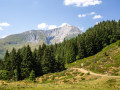
This is an easy walk along the border between the Pyrénées Atlantiques and Hautes Pyrénées departments, suitable for walkers. You will encounter sheep, horses and cows, admire birds of prey soaring overhead and enjoy views of peaks such as the Pic du Midi de Bigorre and the Gabizos, as well as beautiful landscapes (the Ouzom and Arrens Marsous valleys).
Pic du Grand Gabizos
 6.57 mi
+4,518 ft
-4,521 ft
7 hrs
6.57 mi
+4,518 ft
-4,521 ft
7 hrs
 Very difficult
Departure from Béost (Pyrénées-Atlantiques)
Very difficult
Departure from Béost (Pyrénées-Atlantiques)
Magnificent views across the entire Pyrenees range, from the Néouvielle to the Pic du Midi d’Ossau.
Soum de Grum
 Tourist office
 3.45 mi
+627 ft
-636 ft
2h 10
3.45 mi
+627 ft
-636 ft
2h 10
 Moderate
Departure from Béost (Pyrénées-Atlantiques)
Moderate
Departure from Béost (Pyrénées-Atlantiques)
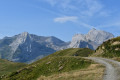
A short, easy outing to a remarkable viewpoint.
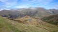
Grum, Andreyt and Laudège ridges
 5.96 mi
+1,152 ft
-1,138 ft
3h 45
Moderate
Departure from Béost (Pyrénées-Atlantiques)
5.96 mi
+1,152 ft
-1,138 ft
3h 45
Moderate
Departure from Béost (Pyrénées-Atlantiques)
This is a short hike with little elevation gain and no difficulty in clear weather. The view from the ridges of all the surrounding peaks and villages is magnificent all along the way. From the Gros huts, the return trip along the trail is very easy.
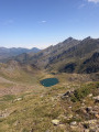
Lakes Uzious and Anglas from Gourette
 7.26 mi
+3,530 ft
-3,527 ft
6h 25
Difficult
Departure from Eaux-Bonnes (Pyrénées-Atlantiques)
7.26 mi
+3,530 ft
-3,527 ft
6h 25
Difficult
Departure from Eaux-Bonnes (Pyrénées-Atlantiques)
A lovely loop from Gourette that takes you past numerous lakes. Best undertaken in good weather. Part of the route is unmarked. The GPX track may prove very useful.Follow the directions in this description. You must ascend via the water channel.Classified as difficult due to a tricky (but safe) section on the old penstockReported on 08/09/2024: very recently, a handrail (chain) has been installed along the entire length of the penstock
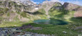
Lake Anglas from Gourette
 4.36 mi
+2,297 ft
-2,297 ft
4h 00
Moderate
Departure from Eaux-Bonnes (Pyrénées-Atlantiques)
4.36 mi
+2,297 ft
-2,297 ft
4h 00
Moderate
Departure from Eaux-Bonnes (Pyrénées-Atlantiques)
The Lac d'Anglas hike is one of the must-do routes starting from Gourette.
It offers a varied mountain landscape where waterfalls, cliffs and lakes enhance the magnificent scenery of the high-altitude summer pastures you will be crossing.
Pic Sanctus and discovery of the old Anglas mines
 7.84 mi
+4,232 ft
-4,229 ft
7h 15
Difficult
Departure from Eaux-Bonnes (Pyrénées-Atlantiques)
7.84 mi
+4,232 ft
-4,229 ft
7h 15
Difficult
Departure from Eaux-Bonnes (Pyrénées-Atlantiques)
A beautiful circular route above Gourette with the ascent of Pic Sanctus (2,482 m), which offers a stunning panorama, particularly of Pic de Ger and the Vignemale and Gabizos massifs. The return route via Lac d'Anglas is dotted with the remains of the old zinc mine.
 Haugarou refuge from the Col de Couraduque (1367m)
 4.38 mi
+502 ft
-525 ft
2.5 hrs
Easy
Departure from Aucun (Hautes-Pyrénées)
4.38 mi
+502 ft
-525 ft
2.5 hrs
Easy
Departure from Aucun (Hautes-Pyrénées)
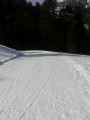
Short, easy winter hike. This is a standard hike in the Argelès-Gazost region.
A wide, well-marked trail leads hikers from the mini winter sports resort of Col de Couraduque to the Refuge du Haugarou, which is actually a beautiful mountain hotel.
In winter, this route is best done on snowshoes (even though it is generally well groomed and possibly passable in shoes)!
In summer, as the route follows a road, you may encounter cars...
From the Col de Couraduque to the Col du Soulor via Lac de Soum
 5.01 mi
+1,083 ft
-738 ft
3h 15
Moderate
Departure from Aucun (Hautes-Pyrénées)
5.01 mi
+1,083 ft
-738 ft
3h 15
Moderate
Departure from Aucun (Hautes-Pyrénées)
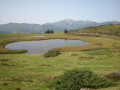
An easy walk with some lovely views. Using two cars (one at Couraduque and one at Soulor) makes this walk accessible to everyone. Otherwise, you can return via the same route in the opposite direction.
Lac de Soum from the Col de Couraduque
 9.49 mi
+1,319 ft
-1,302 ft
5h 30
Moderate
Departure from Aucun (Hautes-Pyrénées)
9.49 mi
+1,319 ft
-1,302 ft
5h 30
Moderate
Departure from Aucun (Hautes-Pyrénées)
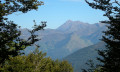
This is an easy route as there are no steep slopes, although its length could classify it as 'moderate'. It takes you around Lac de Soum via the Col de la Serre, the yellow house, the Col de Bazès and the Cantau hut. A picnic break by the lake will make this route even more accessible.
Pic de Bazès from the Col de Couraduque
 4.01 mi
+1,565 ft
-1,545 ft
3h 10
Moderate
Departure from Aucun (Hautes-Pyrénées)
4.01 mi
+1,565 ft
-1,545 ft
3h 10
Moderate
Departure from Aucun (Hautes-Pyrénées)
A pleasant little summit easily accessible from the large car park at Col de Couraduque. Thefirst part to Col de Bazès is on easy forest tracks. However, thesecond part to the summit of Pic de Bazès is more technical. At the summit, there is a beautiful view of the surrounding mountains.
Pic de Berbeillet
 4.71 mi
+807 ft
-797 ft
2h 50
Moderate
Departure from Aucun (Hautes-Pyrénées)
4.71 mi
+807 ft
-797 ft
2h 50
Moderate
Departure from Aucun (Hautes-Pyrénées)
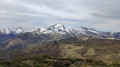
Pic de Berbeillet is a small, easily accessible peak which, thanks to its location, offers a stunning 360° panoramic view.
Pointe de Surgatte
 8.70 mi
+2,969 ft
-2,963 ft
6h 35
Moderate
Departure from Arrens-Marsous (Hautes-Pyrénées)
8.70 mi
+2,969 ft
-2,963 ft
6h 35
Moderate
Departure from Arrens-Marsous (Hautes-Pyrénées)
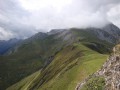
A lovely rocky outcrop accessible from Arrens-Marsous.
Col and Lac de Soum - Col de Cantau from Marsous
 6.54 mi
+2,411 ft
-2,415 ft
6 hrs
Difficult
Departure from Arrens-Marsous (Hautes-Pyrénées)
6.54 mi
+2,411 ft
-2,415 ft
6 hrs
Difficult
Departure from Arrens-Marsous (Hautes-Pyrénées)
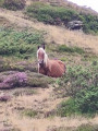
A very pretty snowshoe circular loop off the beaten track. In the snow and away from permanent markings, it is important to follow the route description carefully. Your efforts will be rewarded with a snow-covered landscape stretching as far as the eye can see.This hike can also be undertaken when there is no snow.
Arrens-Marsous to Estaing via the old pastoral paths
 7.88 mi
+2,789 ft
-2,782 ft
6h 05
Moderate
Departure from Arrens-Marsous (Hautes-Pyrénées)
7.88 mi
+2,789 ft
-2,782 ft
6h 05
Moderate
Departure from Arrens-Marsous (Hautes-Pyrénées)
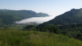
A lovely, fairly challenging route offering views of the Pic d'Arrens and the high mountains in the background.A path linking the Tech Dam valley to the Lac d'Estaing valley via the mountain pastures.
Around the Gave d'Azun from the village of Marsous
 4.36 mi
+495 ft
-512 ft
2h 25
Easy
Departure from Arrens-Marsous (Hautes-Pyrénées)
4.36 mi
+495 ft
-512 ft
2h 25
Easy
Departure from Arrens-Marsous (Hautes-Pyrénées)
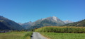
This is a hike that is accessible to everyone. The entire return journey is in the open at the bottom of the valley and, weather permitting, you can admire the flying wings in flight and the peaks of the Soum de la Pène to Grand Gabizos mountain range (north to north-west).
The Soum d'Andorre and the Soum de Conques via the ridges
 5.64 mi
+2,339 ft
-2,316 ft
4h 40
Difficult
Departure from Salles (Hautes-Pyrénées) (Hautes-Pyrénées)
5.64 mi
+2,339 ft
-2,316 ft
4h 40
Difficult
Departure from Salles (Hautes-Pyrénées) (Hautes-Pyrénées)
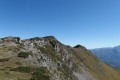
A very pretty circular reserved for very good walkers who are not afraid of heights. The hike is classified as difficult because of the passage over a ridge, but there are no particular dangers anda good sense of direction is essential. (¹)
Part of the return route is quite steep, after the Col de Las Escures.
This hike should only be attempted in the absence of snow and rain.
The GPX track is essential for this route.
The valleys of Yerse and Aguée via Arriousec to Peyras
 10.62 mi
+4,695 ft
-4,678 ft
8 hrs
Very difficult
Departure from Asson (Pyrénées-Atlantiques)
10.62 mi
+4,695 ft
-4,678 ft
8 hrs
Very difficult
Departure from Asson (Pyrénées-Atlantiques)
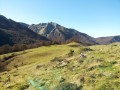
On the forgotten trails of Saint-Pé-de-Bigorre No. 5A long journey from the Ouzom Valley, through Les Aoules, to the Génies Valley, in the unfathomable Saint-Pé massif.In all seasons, the landscapes and forests are impressive and majestic.Its main attraction lies in the beauty of the two valleys crossed from end to end: the Yerse and the Aguée, sites of ancestral pastoralism where shepherds and their flocks lived from June to October. There are still many traces of this to be found.
Pas de Broc and Merdanson peaks loop from Durrieu
8.81 mi
+3,458 ft
-3,448 ft
7h 05
Difficult
Departure from Louvie-Juzon (Pyrénées-Atlantiques)
Circular route in the foothills of the Béarn Pyrenees. Beautiful views over the plains of Bruges Nay and, further afield, towards Pau. If Ossau is not visible, Durban, Montdragon and Moulle de Jaut beckon, as if inviting us to climb them soon. This hike can be completed as a round trip in 5½ to 6½ hours, including stops.
Pic Sanctus from the Tech dam
 9.80 mi
+4,321 ft
-4,324 ft
8h 15
Difficult
Departure from Arrens-Marsous (Hautes-Pyrénées)
9.80 mi
+4,321 ft
-4,324 ft
8h 15
Difficult
Departure from Arrens-Marsous (Hautes-Pyrénées)
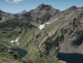
Pic Sanctus is the destination of the hike.Reaching the Col d'Uzious is a great achievement in itself.Descending to the lakes (Lavedan and Uzious) is also a lovely alternative.
Please note: this hike should only be undertaken when there is no snow (from late May until the first snowfall) and when the weather is stable.
Lake Auseilla from the Tech Dam
 8.36 mi
+3,301 ft
-3,301 ft
6h 45
Moderate
Departure from Arrens-Marsous (Hautes-Pyrénées)
8.36 mi
+3,301 ft
-3,301 ft
6h 45
Moderate
Departure from Arrens-Marsous (Hautes-Pyrénées)
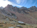
Pretty lakes at the bottom of a little-visited cirque (altitude 2,192 m) in the pretty valley of the Ruisseau de Labas.Marmots, chamois and vultures are often seen in the Bouleste valley.Please note: in spring, when the snow melts, it is sometimes impossible to cross the Ruisseau de Labas at the WPT (3).
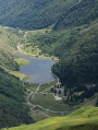
The Col de Paloumère 2187m
 5.95 mi
+3,356 ft
-3,360 ft
5h 40
Moderate
Departure from Arrens-Marsous (Hautes-Pyrénées)
5.95 mi
+3,356 ft
-3,360 ft
5h 40
Moderate
Departure from Arrens-Marsous (Hautes-Pyrénées)
A climb to a pass starting from the Tech Dam, offering views of two truly renowned valleys.
On one side: the Tech Dam; on the other, Lake Estaing.
From Les Aoules to Ferrières via the Soum de Souste and the Soum d’Arangou
4.42 mi
+2,241 ft
-1,962 ft
4h 00
Moderate
Departure from Arthez-d'Asson (Pyrénées-Atlantiques)
This walk is only suitable for walkers who are comfortable with steep and long climbs. This rarely used route offers a peaceful walk in absolute silence in the shade of the Monbula woods. You must first leave a car at the finish point on the D126, on the left-hand side of the road, and then walk to the Aoules car park. The walk can be done in either direction, but the descent towards Ferrières will be easier.
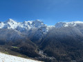
La Montagne Verte from Aas
 5.82 mi
+1,821 ft
-1,834 ft
4h 15
Moderate
Departure from Eaux-Bonnes (Pyrénées-Atlantiques)
5.82 mi
+1,821 ft
-1,834 ft
4h 15
Moderate
Departure from Eaux-Bonnes (Pyrénées-Atlantiques)
La Montagne Verte is a plateau at a moderate altitude (1,200 m) but offers superb views of Eaux-Bonnes and the peaks of the Ossau Valley. The route starts in the village of Aas, known for its whistling shepherds. You can extend the walk to Mont Larive, adding an extra hour for the return journey.
A circular route to the Pic du Merdanson from Arthez-d’Asson
8.93 mi
+3,855 ft
-3,865 ft
7h 30
Difficult
Departure from Arthez-d'Asson (Pyrénées-Atlantiques)
An excellent way to climb the Merdanson whilst remaining almost entirely under tree cover, which is very pleasant in summer. No technical difficulties during the summer months. There is also the option of climbing the Pic de Pas de Broc.
=> Map and GPX track are very useful.
Couscouilha hut from Port de Castet
 6.22 mi
+1,798 ft
-1,824 ft
4h 25
Moderate
Departure from Castet (Pyrénées-Atlantiques)
6.22 mi
+1,798 ft
-1,824 ft
4h 25
Moderate
Departure from Castet (Pyrénées-Atlantiques)
A fairly easy hike leading to a vast summer pasture area.Water is plentiful in this area.It is suitable for families, as a simple return trip to the hut. This hike can be done on snowshoes using a GPX track.The entire circular hike requires a basic sense of direction.The GPX track is essential.
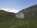
 Couscouilha Hut
 9.63 mi
+1,949 ft
-1,946 ft
2.5 hrs
Difficult
Departure from Castet (Pyrénées-Atlantiques)
9.63 mi
+1,949 ft
-1,946 ft
2.5 hrs
Difficult
Departure from Castet (Pyrénées-Atlantiques)
A trail ride, some sections of which are very steep, followed by a meandering route through the valley towards Soum de Quiala. A trail has recently been marked out to the Cabane de Couscouilha. It is significantly less steep than the ‘classic’ walking route, which involves a steep climb once you leave the trail. It is therefore suitable for e-MTBs without the need to carry your bike.
Tour of Rey Mountain from Castet
 6.49 mi
+2,654 ft
-2,648 ft
5h 20
Difficult
Departure from Castet (Pyrénées-Atlantiques)
6.49 mi
+2,654 ft
-2,648 ft
5h 20
Difficult
Departure from Castet (Pyrénées-Atlantiques)
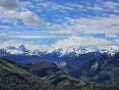
Montagne du Rey, whose highest point is Soum de las Picarras (1,349 m), is the first peak in the Ossau valley and offers a superb 360° panoramic view from the Pau plain to the Pic du Midi d'Ossau.
Sommet du Rey from Port de Castet
2.94 mi
+1,755 ft
-1,739 ft
2h 55
Moderate
Departure from Castet (Pyrénées-Atlantiques)
A fairly short but steep hike in places, well marked, with superb views of the foothills, the towns of Pau, Tarbes, Oloron, and also the peaks: Pic du Midi d'Ossau, Pic de Ger, etc.
The lakes and ruins of Liantran from Lac d'Estaing
 9.50 mi
+2,369 ft
-2,375 ft
6h 25
Moderate
Departure from Estaing (Hautes-Pyrénées) (Hautes-Pyrénées)
9.50 mi
+2,369 ft
-2,375 ft
6h 25
Moderate
Departure from Estaing (Hautes-Pyrénées) (Hautes-Pyrénées)
This hike will take you to the bottom of the Estaing Valley to discover the Liantran Lakes and pastoral remains.
You will discover the Lac d'Estaing, then the Lac de Langle (sometimes dry in summer), the Lac du Plaa de Prat, and finally the Lacs de Liantran.
There are no difficulties from May onwards, although in spring there may still be some snow drifts, so caution is advised.
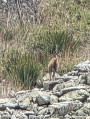
Pyrenean ibex and chamois are often spotted here.
Lake Nère and Lake Long as seen from Lake Estaing
 10.97 mi
+4,265 ft
-4,249 ft
8h 45
Difficult
Departure from Estaing (Hautes-Pyrénées) (Hautes-Pyrénées)
10.97 mi
+4,265 ft
-4,249 ft
8h 45
Difficult
Departure from Estaing (Hautes-Pyrénées) (Hautes-Pyrénées)
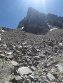
A challenging hike that takes you safely to two high-altitude lakes (2,326m).
The Barbat lake
 5.35 mi
+2,717 ft
-2,687 ft
4h 50
Moderate
Departure from Estaing (Hautes-Pyrénées) (Hautes-Pyrénées)
5.35 mi
+2,717 ft
-2,687 ft
4h 50
Moderate
Departure from Estaing (Hautes-Pyrénées) (Hautes-Pyrénées)
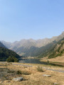
In the Val d'Azun, away from the shores of Lake Estaing
the Barbat huts and Lake Barbat are perfect for a day out.
Soum de la Génie Braque circular loop via Cabanes d'Isarce and d'Aülhet
 9.88 mi
+4,364 ft
-4,364 ft
8 hrs
Difficult
Departure from Saint-Pé-de-Bigorre (Hautes-Pyrénées)
9.88 mi
+4,364 ft
-4,364 ft
8 hrs
Difficult
Departure from Saint-Pé-de-Bigorre (Hautes-Pyrénées)
An exceptional and magnificent circular route on the heights of Saint-Pé-de-Bigorre, in the Tres-Croutz forest, then along the ridge of the Soums de Maletaule. This route circles the Génie Braque torrent, which supplies water to the village below. On the mountain pastures, the landscapes are magical in both summer and winter, on the northern side (St-Pé) and the southern side (the main Pyrenees range).
The Génie Braque torrent and return via the Aülhet
 6.85 mi
+3,360 ft
-3,360 ft
6h 05
Difficult
Departure from Saint-Pé-de-Bigorre (Hautes-Pyrénées)
6.85 mi
+3,360 ft
-3,360 ft
6h 05
Difficult
Departure from Saint-Pé-de-Bigorre (Hautes-Pyrénées)
A lovely, challenging and demanding route through the Très-Croutz forest, passing along the bed of the La Génie Braque torrent.The circular route returns via the Aülhet ridge (and its hut, open all year round) after passing through the mountain pastures of the Bat de Haü cirque, clearly visible from the Gave de Pau valley and Saint-Pé-de-Bigorre.
Paybou Chasm circular loop via Calihourc and the Sentier de Gatès
 4.52 mi
+2,697 ft
-2,684 ft
4h 25
Difficult
Departure from Saint-Pé-de-Bigorre (Hautes-Pyrénées)
4.52 mi
+2,697 ft
-2,684 ft
4h 25
Difficult
Departure from Saint-Pé-de-Bigorre (Hautes-Pyrénées)
Visiting the gaping maw of the impressive Gouffre de Paybou, lost deep within the steep forest, is just one of the reasons to undertake this splendid hike in the heart of the Très-Croutz Forest, in the Saint-Pé Massif.Here, we follow in the footsteps of Abbé Bernard Abadie, who brought fame not only to this chasm – which he ‘invented’ – but also to the remarkable and eerie site of Calihourc, where he posed for posterity, pipe in hand, beret firmly perched on his head and a mischievous look in his eyes…
Warning!This walk takes place in the heart of the wilderness in a rather challenging environment: steep slopes, rocky outcrops, cliffs, thorny undergrowth, and at times a complete lack of signposting, or even a lack of a proper path… This is why it is reserved for experienced, fit walkers with a good sense of direction. A GPS device may also prove very useful.
Meadows of Garrapit and Bénac on the slopes of the Araü
 5.24 mi
+1,903 ft
-1,903 ft
4h 05
Moderate
Departure from Saint-Pé-de-Bigorre (Hautes-Pyrénées)
5.24 mi
+1,903 ft
-1,903 ft
4h 05
Moderate
Departure from Saint-Pé-de-Bigorre (Hautes-Pyrénées)
On the forgotten trails of Saint-Pé-de-Bigorre No. 6
The Araü is the mountainous ridge jutting out from the Massif de Saint-Pé down to the Gave de Pau at the foot of the village. Its imposing, entirely wooded silhouette conceals pretty clearings, once meadows, some well-known paths and others forgotten, used only by hunters and hiking enthusiasts beneath the tall trees of the forest.
Its summit, towering arrogantly over the village, is the Soum de las Toupiettas (1,357m).