Country:

 City:
City:


On leaving Arrens-Marsous, turn off the road to Lac d’Estaing and take the road to the Tech Dam. After about 500 m, park in a small car park on the left-hand side of the road (D105), just past the chapel at Pouey Laün.
Red and white markings forthe GR®10
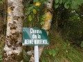
(S/E) From the car park, head north-west along theGR®10(Chemin de la Reine Hortense).
Walk past two drinking water reservoirs. You’ll come to a road. Continue straight on along this road, which climbs and continues north-west, then veers west for 300 m before heading north-west again.
Leave the road and take a path that climbs to the left. Pass three well-maintained buildings. Now follow a track that heads due west. All along this track you can see magnificent restored and well-maintained barns.
(1) At the end of the track, cross the Ruisseau de Bernet. Climb up the left bank of the stream through the mountain pastures, still heading due west.
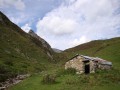
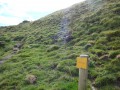
(2) You can now see the Col de Saucède. Continue along theGR®10and, 200 metres before the pass, after passing a hut in a sorry state, there should normally be a sign indicating: Pointe de Surgatte.
(3) In any case, turn sharply left. Cross the stream and head south-east up through the mountain pastures.
Follow the well-marked path, which now heads due south, climbing steeply.
(4) Continue in the same direction, crossing several torrents and streams. At an altitude of around 1,700 m, the path heads due east for 300 metres and then turns due south.
(5) The path curves slightly downwards and heads due east, running along the edge of some cliffs, protected by wire fencing.
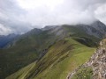
Continue eastwards to reach the Pointe de Surgatte, taking care to avoid the crags and tussocks, which require particular caution over a short stretch.
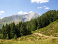
A magnificent 360° panorama unfolds before you. There is nothing dangerous as such, but those who are afraid of heights may wish to stop 30 metres short.
A restorative break is welcome.
(6) Descend from the summit heading due west for about 700 metres.
(5) At the bend in the path, turn left and head uphill. Then keep to the hillside, heading due west, towards the unnamed hut (alt. 1,800 m).
(7) The path heads due north, crossing several streams. You’ll reach a grassy spur.
(8) Descend in a series of hairpin bends, heading north-east. Join the path you took on the way up, turn left and follow it for 300 m.
(4) Head off to the right towards the east, aiming for the path you took on the way up. You’ll join it at an altitude of around 1,530 m,
(2) Turn right and follow theGR®10in the opposite direction to the way up, thus reaching the car park (S/E).



 Visorando Member

 Easy
Easy 
 Difficult