Soum de Grum route from Arbéost

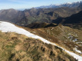
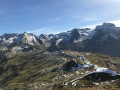
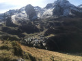
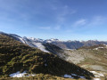
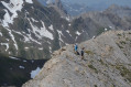
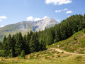
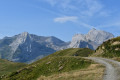
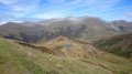
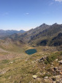
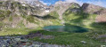
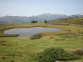
Ascent to the Soum de Grum, a beautiful viewpoint, via a circular route that follows the ridge for part of the way, starting from the village of Arbéost.

Details

4298489
Creation:
Last update:
Last review:
  • Walking
    Activity: Walking
  • ↔
    Distance: 9.57 mi
  • ◔
    Average duration: 7h 55 
  • ▲
    Difficulty: Difficult

  • ⚐
    Back to start: Yes
  • ↗
    Ascent: + 4,062 ft
  • ↘
    Descent: - 4,065 ft

  • ▲
    Highest point: 6,112 ft
  • ▼
    Lowest point: 2,379 ft
  • ⚐ Country: France
  • ⚐
    Area: Pyrenees
  • ⚐ City: Arbéost (65560)
  • ⚑
    Start/End: N 42.990958° / W 0.291844°
  • ❏
    IGN map(s): Ref. 1546ET, 1647ET, 1647OT, 1647OTR
  • Hour-by-hour weather

Photos

Description of the walk

In the village of Arbéost, at the church square, turn right towards the hamlet of Les Bourinquets. Walk through the hamlet, continue along the track and park at the end, next to a hydroelectric power station.

(S/E) Take the track opposite the car park (fence), then at the first bend, take the path opposite.

(1) At the fork, keep to the right, cross the Pas de Tartas and you’ll reach another junction.

(2) Go straight on, leaving the wide path you have been following until now. Head up through the field, go through the fence, then join the yellow-marked path towards the Cirque du Litor. Follow it to the right and join theGR®10.

(3) Follow theGR® to the right, turn right onto the path after crossing the torrent and join the Route de l’Aubisque (D918).

(4) Cross the road with care and continue on the other side along the GR®°°° until you reach the junction for the Col de l’Arbaze.

(5) Follow the yellow markings to the right towards the Col d’Arbaze and reach the pass.

(6) Follow the path along the hillside to the right towards the Col d’Aubisque.

(7) Turn right to take a shortcut leading directly to the pass.

(8) Cross the road, then the car park, and pass between the two buildings to follow the path towards the Soum de Grum.

(9) Turn right to gain direct access to the summit by following the ridge.

(10) Soum de Grum: continue north-east along the ridge.

(11) Turn right, heading east, and descend off-trail to a junction of tracks.

(12) Go straight on to rejoin a path that continues in the same direction (do not follow the tracks). Then continue off-trail to the Col de Bouhaben.

(13) Continue along the wooded ridge towards the Col du Tech (the route is somewhat difficult to follow due to fallen trees). Reach the Soum de l’Articole.

(14) Carry on to the Col du Tech (large beech trees).

(15) From the pass, a path climbs north-eastwards slightly up the right-hand slope, then runs along the left-hand side of a spur with a sheer drop to the right. Stay on the wooded ridge until you reach an unnamed pass (alt. 1,004 m).

(16) Turn right onto a steep, sometimes narrow path, then cross the torrent via the Baudés footbridge to return to the car park (S/E).

Waypoints

  1. S/E : mi 0 - alt. 2,385 ft - Hydroelectric power station - Ouzoum (rivière)
  2. 1 : mi 0.92 - alt. 3,189 ft - Junction, turn right
  3. 2 : mi 1.76 - alt. 3,655 ft - Junction, straight ahead
  4. 3 : mi 2.48 - alt. 3,763 ft - Junction with GR°°®°°10
  5. 4 : mi 3.46 - alt. 4,557 ft - D918
  6. 5 : mi 3.95 - alt. 5,187 ft - Col d’Arbaze junction
  7. 6 : mi 4.44 - alt. 5,889 ft - Col d'Arbaze (1799m)
  8. 7 : mi 5.45 - alt. 5,607 ft - Turn right at the fork
  9. 8 : mi 5.85 - alt. 5,607 ft - Col d'Aubisque
  10. 9 : mi 6.36 - alt. 5,823 ft - Path on the right
  11. 10 : mi 6.56 - alt. 6,102 ft - Soum de Grum
  12. 11 : mi 6.68 - alt. 5,948 ft - Turn right at the fork, off-trail section
  13. 12 : mi 6.97 - alt. 5,505 ft - Crossroads of trails
  14. 13 : mi 7.31 - alt. 5,190 ft - Col de Bouhaben (1594m)
  15. 14 : mi 7.67 - alt. 4,905 ft - Soum de l’Articole
  16. 15 : mi 8.1 - alt. 4,193 ft - Col du Tech (1250m)
  17. 16 : mi 8.88 - alt. 3,327 ft - Unnamed pass 1,004 m
  18. S/E : mi 9.57 - alt. 2,385 ft - Hydroelectric power station

Notes

This walk includes sections off the beaten track and is therefore suitable for walkers who know how to find their way and have mountain experience.

Always be cautious and plan ahead when you're outdoors. Visorando and the author of this route cannot be held responsible for any accidents occurring on this route.

The GR® and PR® markings are the intellectual property of the Fédération Française de Randonnée Pédestre.

Reviews and comments

3.6 / 5
Based on 5 reviews

Reliability of the description
3.4 / 5
Ease of following the route
3.2 / 5
Route interest
4.2 / 5
PJP64
PJP64
• Edited:

Overall rating : 2.7 / 5

Date of your route : Jun 14, 2026
Reliability of the description : ★★☆☆☆ Disappointing
Ease of following the route : ★★☆☆☆ Disappointing
Route interest : ★★★★☆ Good
Very busy route : No

The first section up to the summit of Soum de Grum is magnificent and you simply can’t get lost.
However, after Soum, it’s a disaster... No path, a gruelling descent through vegetation that you’re forced to trample, brambles, and sections right on the edge of the precipice along the ridges. I really couldn’t see the end of it. I’d set off with 2 litres of water, but that proved to be far from enough. Scratches all over my legs.

Machine-translated

SMB64
SMB64

Overall rating : 3.7 / 5

Date of your route : Oct 09, 2023
Reliability of the description : ★★★★☆ Good
Ease of following the route : ★★★☆☆ Average
Route interest : ★★★★☆ Good
Very busy route : No

A walk undertaken by two keen walkers on 8 October 2023. We were drawn to the prospect of doing a circular walk, whilst being aware from the reviews that the final section through the forest wouldn’t be easy; however, the most recent reviews were over two years old, so we wanted to see for ourselves.
The entire first part of the route is very beautiful, with varied scenery and a gradual yet steady climb (the ‘difficult’ rating is spot on). The section crossing the Cirque du Litor off the GR trail doesn’t add much, other than wading through the marsh. It’s better to follow the path that leads to the same spot below the Col de l’Aubisque road. The rest of the route up to the Son de Grum is fantastic, with stunning views of the Gourmette, the Santus, the Pic de Jer and other peaks… Things get trickier after the Soum, where you leave the marked trails; it becomes a bit more complicated but still doable. However, the final section through the woods is a complete mess! There’s no path, it’s very difficult to navigate and impossible without a GPS track.
In summary, this is a hike to be avoided entirely, but as a return trip to Son de Grum – why not?

Machine-translated

miky33
miky33

Overall rating : 3 / 5

Date of your route : May 30, 2022
Reliability of the description : ★★★☆☆ Average
Ease of following the route : ★★☆☆☆ Disappointing
Route interest : ★★★★☆ Good
Very busy route : No

A lovely route, though the route isn’t always straightforward – we got lost on the way to Aubisque, so GPS was a must! Not to mention the numerous fallen trees blocking part of the route.

Machine-translated

Gerardjean64
Gerardjean64

Hello,

It’s true that on the way back from this hike – which isn’t too busy! – there isn’t much of a path! It’s best to do it in good weather! And avoid it when there’s a lot of snow on the section towards the Col d’Arbaze and the descent down the Soum

There are some trees (they weren’t there in May and are likely to stay there for a while) blocking a short section of the return route through the woods; you’ll need to step over or go round them, though it’s not too difficult!
In May, there are fields of gentians at the exit of the Cirque du Litor!

Machine-translated

Gerardjean64
Gerardjean64
• Edited:

Hello,

It’s true that descending on this side of the Soum du Grum in winter can be risky.
In that case, it’s best to head down towards the Col d’Aubisque and take the track to the right of the pass, which leads to the ridge at an altitude of 1,680 metres between the Soum and the Col de Bouhaben
This is a hike best undertaken in late spring

Machine-translated

Fural
Fural

Overall rating : 4 / 5

Date of your route : Mar 23, 2021
Reliability of the description : ★★★★☆ Good
Ease of following the route : ★★★★☆ Good
Route interest : ★★★★☆ Good
Very busy route : No

Best avoided in winter as you’ll encounter snow slides of varying sizes along the ascent route.
From the Soum de Grum onwards, it is difficult to follow the route due to snow cornices.
Furthermore, the section along the ridges, before the descent to Arbéost, is littered with uprooted trees.

Machine-translated

tuquoquemifili
tuquoquemifili

Overall rating : 4.7 / 5

Date of your route : Feb 24, 2021
Reliability of the description : ★★★★☆ Good
Ease of following the route : ★★★★★ Very good
Route interest : ★★★★★ Very good
Very busy route : No

From Soum de Grum, the descent to Arbeost is difficult not only because the path is not marked out, but above all because of the countless enormous trees felled by the storm that block the way, forcing you to cross areas of
scrub

Machine-translated

Other walks in the area

For more walks, use our search engine .

The GPS track and description are the property of this route's author. Please do not copy them without permission.