Pic du Grand Gabizos

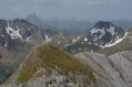
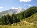
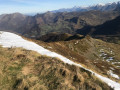
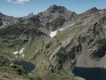
Magnificent views across the entire Pyrenees range, from the Néouvielle to the Pic du Midi d’Ossau.

Details

3749257
Creation:
Last update:
Last review:
  • Walking
    Activity: Walking
  • ↔
    Distance: 6.57 mi
  • ◔
    Duration according to the author: 7 hrs 
  • ▲
    Difficulty: Very difficult

  • ⚐
    Back to start: Yes
  • ↗
    Ascent: + 4,518 ft
  • ↘
    Descent: - 4,521 ft

  • ▲
    Highest point: 8,730 ft
  • ▼
    Lowest point: 4,403 ft
  • ⚐ Country: France
  • ⚐
    Area: Pyrenees
  • ⚐ City: Béost (64440)
  • ⚑
    Start/End: N 42.953871° / W 0.28689°
  • ❏
    IGN map(s): Ref. 1546ET, 1647ET, 1647OT, 1647OTR
  • Hour-by-hour weather

Photos

Description of the walk

Park between the Soulor and Aubisque passes, on the D918 road before the first tunnel when coming from the Soulor. There is a small car park (for 2–3 vehicles) about a hundred metres further up towards the Soulor, at the Arriou de l’Escala.

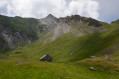
(S/E) Take the road towards the tunnel, then join the path marked by a cairn at the side of the road. Begin a steep climb. Cross the Arriou de l’Escala stream and follow its right bank. Reach the Larue hut, built in the middle of a flat, flower-filled meadow

(1) Continue the ascent, following the cairns in a direction almost due south. You’ll reach a junction of paths.

(2) Carry on to the left, making a slight circular loop to the left to emerge at another junction of paths at the foot of the Col de Pène Blanque.

(3) Turn left and head for the pass.

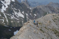
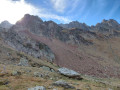
(4) Take the splendid ridge, following it along the crest, first over beautiful, exposed slabs of white limestone, then via an easy climb over reddish-brown rocks to the summit of the Grand Gabizos.

(5) Retrace your steps along the ridge to return first to the pass and then to the junction below it.

(3) Then keep left to descend to thefirst junction of the paths.

(2) Take the path you followed on the way up to return to the car park on the D918 road (S/E).

Waypoints

  1. S/E : mi 0 - alt. 4,462 ft - Car park on the D918. Near the - Ouzoum (rivière)
  2. 1 : mi 1.26 - alt. 6,460 ft - Cabane de Larue
  3. 2 : mi 1.73 - alt. 7,001 ft - First junction of paths
  4. 3 : mi 2.46 - alt. 8,196 ft - Second junction of paths
  5. 4 : mi 2.56 - alt. 8,356 ft - Col de Pène Blanque
  6. 5 : mi 3.11 - alt. 8,711 ft - Summit of the - Pic des Taillades (2691m)
  7. S/E : mi 6.57 - alt. 4,459 ft - Car park on the D918 road

Notes

Steep climb at the start.
A few snowfields at the start of the season.
Exposed section along the ridge.
An easy climbing section where you need to use your hands.
This hike is not recommended in foggy or rainy weather, or if there is snow on the ridge.

Worth a visit

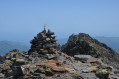
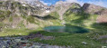
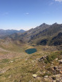
(5) Summit of the Grand Gabizos: The view is truly enchanting: the Vignemale, the Pics d’Enfer and the Pic du Midi d’Ossau are within easy reach.

Reviews and comments

4.4 / 5
Based on 3 reviews

Reliability of the description
4.3 / 5
Ease of following the route
4.3 / 5
Route interest
4.7 / 5
Paikan64
Paikan64
• Edited:

Overall rating : 4.3 / 5

Date of your route : Aug 07, 2023
Reliability of the description : ★★★★☆ Good
Ease of following the route : ★★★★☆ Good
Route interest : ★★★★★ Very good
Very busy route : No

A flock of sheep is situated below the shepherd’s hut (which is unoccupied) on a very steep section where it is not possible to leave the path to go round the flock, which is flanked by 12 dogs (10 Pyrenean Mountain Dogs, 2 Anatolian Shepherds) that are not exactly friendly. Take care; this walk should be avoided during the summer grazing season: staying calm and keeping my cool allowed me to get past without being bitten, but the semicircle of growling and barking dogs around me reminded me of wolves surrounding their prey......

Machine-translated

pdlp64
pdlp64

Overall rating : 4.3 / 5

Date of your route : Oct 10, 2022
Reliability of the description : ★★★★☆ Good
Ease of following the route : ★★★★☆ Good
Route interest : ★★★★★ Very good
Very busy route : No

A beautiful, fairly challenging climb. A breathtaking view stretching from the Pic de Midi de Bigorre to the Pic de Midi d’Ossau. Towards the end, you mustn’t be too afraid of heights. You’ll need to use your hands frequently to reach the summit. Definitely not to be attempted in the rain, as it becomes very slippery.
Abbé Paul +, parish priest of the parishes of the Pays de Nay

Machine-translated

Michel Berdou
Michel Berdou

Overall rating : 4.7 / 5

Date of your route : Aug 02, 2022
Reliability of the description : ★★★★★ Very good
Ease of following the route : ★★★★★ Very good
Route interest : ★★★★☆ Good
Very busy route : No

A lovely walk with a magnificent ridge. Not recommended if you’re prone to vertigo. A flock of sheep grazing in the summer pastures near the hut, guarded by five Patou dogs. We had to go round them and take a cairn-marked path to the right – towards the Louesque – to get back onto the main route and reach the pass.

Machine-translated

Other walks in the area

For more walks, use our search engine .

The GPS track and description are the property of this route's author. Please do not copy them without permission.