Country:

 City:
City:


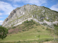
The route starts at the Col de Couraduque, situated 7 km north of the village of Aucun. Large free car park. Just past the restaurant, look for the sign marking the start of thePR® “Pic de Bazès” trail.
(S) Head west along the yellow-marked path, passing a reservoir. Climb through the woodland to the Col de la Serre.
(1) At the pass (crossroads), turn left. After about fifty metres, stay on the path on the left.
(2) At the junction, head up to the right. After about 100 metres, at a Fork in the road, turn right again. Pass close to the Fontaine de la Taillade and come out onto a wide path. Follow this path to the right until you reach a crossroads.
(3) Then take thefirst path on the left and follow theGR®101(red and white markings), which you should stay on until you reach Soulor. After about 1 km, the path turns sharply right (90°) (west). Ignore a path branching off to the left and continue westwards. When a path joins from the left, carry on straight ahead until you reach a crossroads (shelter).
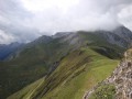
(4) Then take thesecond path on the left. Walk along the ridge, heading south-south-west. Pass a summit and descend to the Col de Soum.
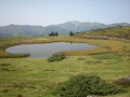
(5) Continue along the path opposite (slightly to the right) and leave Lac de Soum on your right. Stay on the main signposted path, ignoring any side trails.
(6) At the Col de Mauben, continue west-south-west. At the Fork in the road, turn right. Go round the Cap d’Aout on the right. The path then turns sharply to the left. Continue south to the Col du Soulor (E).

 Visorando Member
 Easy
Easy 
 Difficult