Refine your search for walks in Dinan
Dinan walks


 The Green Belt of Dinan and the Rance Valley
 Visorando Member

 6.14 mi
 +449 ft
 -472 ft
 3h 15
 Moderate
 Departure from Dinan (Côtes-d'Armor)
A town of art and history, Dinan is a place of great beauty. Its historic centre takes us back to the Middle Ages and from the top of its ramparts, visitors can look out over the Rance valley and the road viaduct which, with its 10 arches and 50-metre height, spans the Rance.
To this, we must add a stroll through the magnificent town centre of Léhon and finally a romantic walk along the Rance.
Route du patrimoine et de la nature de Dinan
 Association / Club / Walk leader5.03 mi
+269 ft
-253 ft
2h 35
Moderate
Departure from Dinan (Côtes-d'Armor)
The route takes you through the old town of Dinan and past several points of interest, then down into the Rance valley. It passes through Léhon, a picturesque little village, and ends along the Rance and the port of Dinan. For the tour of the walls, see the map on the Dinan Agglo website (see practical information). The journey time does not include breaks and stops for visits or sightseeing!
Estuary Left bank of the Rance - Loop starting from Dinan
 15.83 mi
+725 ft
-702 ft
7h 55
 Difficult
Departure from Dinan (Côtes-d'Armor)
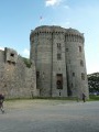
Loop around Dinan between Rance and Pays du Poudouvre via the Écluse du Châtelier to La Moinerie in the commune of Plouër-sur-Rance.
 Dinan – Paramé
 23.62 mi
+906 ft
-909 ft
4 hrs
Difficult
Departure from Dinan (Côtes-d'Armor)
The second stage in the Saint-Malo region, this section links the medieval town of Dinan to the Paramé district, just past the pirate town of Saint-Malo. From the canalised banks of the Rance to Rochebonne beach, you follow the Rance valley – first along the river and then along the coast – until it meets the English Channel. After Saint-Servan, the walk becomes more urban, whilst still offering an almost unbroken view of the sea. In Paramé, it’s a truly luxurious seaside experience!
The Rance and the historic heart of Dinan
3.95 mi
+292 ft
-292 ft
2h 05
 Easy
Departure from Lanvallay (Côtes-d'Armor)
Wind your way along the banks of the Rance, stopping off at the Abbaye Sainte-Magloire-de-Léhon to visit the fortified heights and historic heart of Dinan.
From Lehon Abbey to Saint-Pern
 15.55 mi
+587 ft
-322 ft
7h 40
Moderate
Departure from Léhon (Côtes-d'Armor)
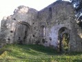
A long hike for experienced walkers, from Lehon (Côtes-d'Armor), starting at the old Saint-Magloire Abbey (founded in the 9th century) to Saint-Pern (Ille-et-Vilaine), the mother house of the Little Sisters of the Poor. A page of history and religious life waiting to be discovered.
Tressaint on the banks of the Rance
 6.59 mi
+558 ft
-564 ft
3h 30
Moderate
Departure from Lanvallay (Côtes-d'Armor)
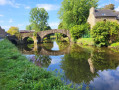
First, enjoy a breathtaking view of the Dinan viaduct with two passages under the arches, then stroll along the canalised Rance to reach the village of Tressaint and its woods. This route offers peace and serenity, even though it is very close to a popular tourist destination.
The banks of the Rance near Saint-Samson and the Menhir de la Pierre Longue
4.80 mi
+190 ft
-213 ft
2h 20
Easy
Departure from Saint-Samson-sur-Rance (Côtes-d'Armor)
From the village of Saint-Samson, make your way to the Rance at Le Petit Lyvet via the Voie Verte and the Gallo-Roman track. Take a short detour to the menhir known as ‘La Pierre Longue’: standing 8.5 metres tall, it has stood there since 2,500 to 3,000 years before our era.
The Ruisseau de Coutances via the Bois de la Tiemblais
3.11 mi
+125 ft
-125 ft
1h 30
Easy
Departure from Saint-Samson-sur-Rance (Côtes-d'Armor)
Starting from the town hall in Saint-Samson-sur-Rance, set off to explore the Menhir de la Pierre Longue, a testament to the town’s rich history . Your route will then take you through the countryside and woodland, in a peaceful, unspoilt setting. As you walk, you’ll cross the Ruisseaude Coutances before reaching the Étangde Coutances, a true haven of tranquillity in the heart of nature. The route then continues round the village, offering a different perspective on Saint-Samson-sur-Rance, before returning to the starting point. This walk allows you to discover the area’s heritage, nature and rural landscapesas you make your way along the paths .
Exploring the Calorguen countryside
9.15 mi
+328 ft
-302 ft
4h 30
Moderate
Departure from Calorguen (Côtes-d'Armor)
This walk allows you to explore the typical villages of the Pays des Faluns along stony paths. The towpath of the Ille and Rance Canal will take you past its lock-keeper’s houses and lead you to the old watermills on the River Rance.
The Beauséjour walk
4.11 mi
+171 ft
-171 ft
2h 00
Moderate
Departure from Saint-Samson-sur-Rance (Côtes-d'Armor)
From the village of Saint-Samson-sur-Rance, set off to explore the Menhir de la Pierre Longue (car park at 48.49315 N, 2.01793 W) for a varied route through the countryside and along the banks of the Rance – first the river and then the sea. Walk through the Saint-Samson countryside and its granite hamlets, then follow the River Rance to admire the old fishing huts, the Lessard Bridge, a riverside forest and an oak plantation. A route rich in scenery and heritage, ideal for a nature walk in Brittany.
The Étang du Val as seen from Trélivan
 7.46 mi
+200 ft
-207 ft
3h 35
Moderate
Departure from Trélivan (Côtes-d'Armor)
This route will take you through the countryside along lovely paths and tracks with very little tarmac. The stretch through the hamlet of Le Férulais is sure to make an impression. After skirting the Étang du Val and following some very pretty little paths through the woods, you’ll reach the village of Trélivan at the Val Drouet park, where old houses and a small pond lend it an undeniable charm.
The Prat and Livet paths in La Vicomté-sur-Rance
 8.01 mi
+367 ft
-364 ft
4h 00
Moderate
Departure from La Vicomté-sur-Rance (Côtes-d'Armor)
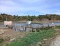
Throughout this route, there are no fewer than five viewpoints from which you can admire this small coastal river, famous for its mouth between Saint-Malo and Dinard thanks to the tidal power plant dam. After following it first through fresh water and then salt water, you will end your route by taking sunken paths that will lead you to a monument dating back five thousand years.
Coëtquen Castle and its forest
 5.42 mi
+164 ft
-197 ft
2h 40
Easy
Departure from Saint-Hélen (Côtes-d'Armor)
The highlight of this walk is exploring the remains of the feudal motte and Coëtquen Castle, built in the 15th century (private property). The route takes in small roads and beautiful forest paths.
The name Coëtquen can be translated as ‘white forest’. The Coëtquens were lords who became part of a branch of the Dinan family.
Mordreuc - La Vicomté-sur-Rance circular loop
6.24 mi
+479 ft
-453 ft
3h 15
Moderate
Departure from Pleudihen-sur-Rance (Côtes-d'Armor)
A beautiful circular walk along the banks of the Rance, from the slipway at Mordreuc to La Vicomté-sur-Rance, passing by the charming Moulin du Prat, and returning through the countryside to explore the banks of the Rance.
The banks of the Rance at Mordreuc
 6.81 mi
+217 ft
-207 ft
3h 20
Moderate
Departure from Pleudihen-sur-Rance (Côtes-d'Armor)
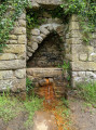
This route has two circular sections, allowing it to be completed in two stages. Both sections highlight the banks of the Rance and allow you to discover the hinterland, the former lands of the gabarriers and Cap-Horniers.
From the Mordreuc tide mill to the Prat tide mill
 3.63 mi
+220 ft
-200 ft
1h 50
Easy
Departure from Pleudihen-sur-Rance (Côtes-d'Armor)
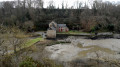
From the Mordreuc tide mill, follow the shaded cliffs along the banks of the Rance, which will take you to the Prat tide mill. You will pass an old lime kiln and see the village of La Moinerie in Plouër-sur-Rance through the trees. On the mudflats, you will see common shelducks.
At the end of the Moulin du Prat pond, you will see Quincourbe Castle and its dovecote. You will pass by the ferruginous fountain.
The Chapelle and Moulin du Prat circular in Mordreuc
 5.00 mi
+240 ft
-226 ft
2h 30
Easy
Departure from Pleudihen-sur-Rance (Côtes-d'Armor)
A circular route starting from the Mordreuc slipway via La Chapelle and Le Moulin du Prat. This route is not difficult and follows the banks of the Rance to begin and end its loop via country paths. Along the route, you will discover two tide mills as well as some beautiful houses and manor houses.
A walk around the Étang de Bétineuc
 1.93 mi
+3 ft
-3 ft
0h 55
Easy
Departure from Saint-André-des-Eaux (Côtes-d'Armor)
This is a route suitable for families, even with pushchairs, as the path is accessible to people with reduced mobility.
You’ll walk around this beautiful Costarmoricain lake, with a short detour onto the peninsula to feel as though you’re right in the middle of the water.
Plouër-sur-Rance in shades of green and blue
 8.63 mi
+653 ft
-656 ft
4h 30
Easy
Departure from Plouër-sur-Rance (Côtes-d'Armor)
A lovely walk along the banks of the Rance and through the beautiful Bois de Rochel forest. This walk combines various routes suggested by Plouër-sur-Rance Town Hall.
It begins as a blue trail along the banks of the Rance, where the landscapes and views change with every tide. After passing through hamlets with traditional stone houses, it continues as a green trail through the forest, where beech and chestnut trees over 25 metres tall never fail to impress and where sunken paths await the walker.
Take care in winter, as some sections may be damp. But in summer, don’t hesitate – with its open, airy and shaded route, it offers a chance to enjoy a pleasant coolness in the heart of nature.
The Druid Cemetery at Pleslin-Trigavou
 3.92 mi
+174 ft
-200 ft
1h 55
Easy
Departure from Pleslin-Trigavou (Côtes-d'Armor)
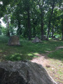
Legend has it that fairies, who were supposed to deliver these stones to Mont Saint-Michel but were too tired, abandoned them here in the Champ des Roches, where the druids used to gather.Sixty-five menhirs dating from 2000 BC are gathered here, forming Brittany’sthird-largest megalithic site, which has been a listed site since 1887.The site has been planted with 60 different species of oak.
Tour of the Évran Locks
 4.41 mi
+135 ft
-125 ft
2h 10
Easy
Departure from Évran (Côtes-d'Armor)
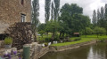
A lovely walk starting and ending in Évran (22), taking in the landscapes of romantic Brittany with its valleys, winding canal and locks.
Le Val Hervelin, the valley and the Manor of Saint-Meleuc
 5.39 mi
+272 ft
-272 ft
2h 45
Easy
Departure from Pleudihen-sur-Rance (Côtes-d'Armor)
A pleasant walk that takes you through the charming valley of the Ruisseau de Coëtquen, also known as the Val Hervelin – which is also the name of the village – on a return trip. The route is generally very pleasant and the path runs largely through woodland. It also offers the chance to discover a few old houses, particularly in St-Méleuc and La Forge. It takes you to a megalithic site in the Tougeais forest, north of the hamlet known as ‘Les Rouchiviers’. There are no significant difficulties, but the valley floor may be very wet during wet weather and the stream may even burst its banks.
In the footsteps of the Rance bargemen
 6.68 mi
+220 ft
-223 ft
3h 15
Moderate
Departure from Pleudihen-sur-Rance (Côtes-d'Armor)
For centuries, right up until the 1920s, the Rance bargemen supplied the bread ovens of Saint-Malo with bundles of firewood. They built stone-paved crossings across the Rance so that they could load their barges.
These little paths leading out into the Rance will allow you to discover the village of Les Bas Champs from a unique perspective.
Tour of the banks of the Rance via the Saint-Hubert and Pont du Châtelier bridges
 16.48 mi
+1,047 ft
-1,063 ft
8h 30
Difficult
Departure from Pleudihen-sur-Rance (Côtes-d'Armor)
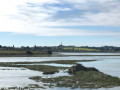
A lovely day’s hike, taking you around the Rance Maritime as far as the Chatelier lock, the boundary between the Rance Fluviale and the Rance Maritime. On the itinerary: exploring the flora and fauna along the banks of the Rance, magnificent views, small coves and anchorages, and lush valley floors. Depending on the tide, you’ll alternate between shallow waters and mudflats. Please note: some sections along the banks of the Rance are only accessible at low tide and can be quite slippery.
The banks of the Rance from Ville Ger to Mordreuc
 4.08 mi
+79 ft
-79 ft
1h 55
Easy
Departure from Pleudihen-sur-Rance (Côtes-d'Armor)
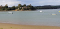
This hike will allow you to discover the flora and fauna of the Rance estuary.
The Rance is a wintering ground for migratory birds.
Mordreuc's mascot, seal L 214, will let you take photos with him if the water level allows him to lounge on the slipway. Otherwise, look in the water to see if a whiskered snout is peeking out.
In Mordreuc, if you continue 100 metres along the shore, you will discover the old lime kiln.
Langrolay-sur-Rance route starting from the Souhaitier Chapel
 8.34 mi
+528 ft
-525 ft
4h 20
Moderate
Departure from Plouër-sur-Rance (Côtes-d'Armor)
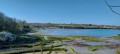
This hike follows the Rance river and the valleys around Langrolay-sur-Rance. It starts at the foot of the Souhaitier Chapel and follows a north-south route offering beautiful views of the Rance and the opposite bank, Saint-Suliac and Mont Gareau. The route is also dotted with some very pretty stone houses. The route follows a branch of the GR®34 to GR®37 trail.
Loop between Rance and Terre, from Pont Saint-Jean to Pointe du Puits
 11.39 mi
+518 ft
-541 ft
5h 40
Easy
Departure from La Ville-ès-Nonais (Ille-et-Vilaine)
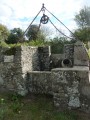
Walk in the Pays Malouin between the sea and the Rance around one of the most beautiful villages in France. To be done at low tide, check before you go.
The medieval walls from Ville-es-Nonais
 4.11 mi
+171 ft
-177 ft
2h 00
Easy
Departure from La Ville-ès-Nonais (Ille-et-Vilaine)
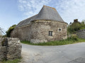
Did the Vikings settle in the Rance valley at the foot of Mont Garot? Nothing is less certain, but in any case, this is a theory put forward by the guides. From La Ville-es-Nonais, along the right bank of the Rance, make your way to the site of the supposed Viking camp. At low tide, you can see the site, covered in short vegetation.
L’Anse des Bas Champs, the bridges over the Rance from La Ville-ès-Nonais
 4.55 mi
+282 ft
-279 ft
2h 20
Easy
Departure from La Ville-ès-Nonais (Ille-et-Vilaine)
The Anse des Bas Champs in La Ville-es-Nonais is a coastal marsh whose reed beds are home to numerous species of birds. Nestled at the far end of the cove is the peaceful hamlet of La Chapelle Saint-Magloire.
This section ofthe GR® Tour du Pays Malouin takes you to the foot of the two iconic bridges of the Rance Valley: the Pont Saint-Hubert and its counterpart, the Pont Chateaubriand. Both span the Rance where it narrows, linking Plouër-sur-Rance (Côtes d’Armor department) to La Ville-ès-Nonais (Ille-et-Vilaine department).