Country:
 City:
City:




Start at the Place de l’Église in Trélivan. Signpost marking two trail ‘starts’: one in yellow and the other in dark blue.
Yellow and dark blue markings
(S/E) With the church on your right, take the footpath on the left heading south. Follow the road to the right, then cross the D61 and continue along the path opposite.
(1) When you reach the road, turn left into the Bois de Noé. Continue left along the road and keep left at the junction. Head south, passing the first farm, and continue on to the Ferme de la Chesnaie.
(2) Take the sunken track opposite heading south-west. At the end of the track, turn right and stay on the road until you reach the cross.
(3) Follow the path to the left. Ignore a path on the right, pass under a medium-voltage power line and turn left onto the road. Ignore a road on the right (Yellow route) and reach the D61 county road.
(4) Carry on straight ahead, ignoring the path on the left.
No further signposting
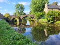
Continue along the path leading to Pont de Bigault,
(5) At Gué Bigault, do not take the steps on the right but continue uphill to the left. Carry on straight ahead along the road and, at the bend, do not head towards La Morinais but carry on straight ahead. Cross another stream and come out onto a road.
(6) Turn left and pass through the hamlet of La Pirotais, then La Ville aux Vielles. Just at the end of the hamlet, cross a stream, ignore a road on the right and follow the path on the left which climbs northwards.
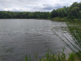
(7) After 150 m, turn left onto the path which descends steeply and cross the stream again, keeping to the right. Walk alongside thefirst pond of the Val on your right. Cross the path between the two bodies of water. Continue left for 70 m, then turn right and pass under the medium-voltage power line for a second time.
(8) Turn right onto the road and, after 200 m, turn left between two fields towards La Rivonnais. At the end of the road, turn right. Ignore the return route of the Dark Blue trail on the left.
Dark blue markings
(9) At the bend, continue along the path that runs straight on. Take the path on the right and walk along the edge of the Étang du Val.
No further signposting
(10) Cross the road to the left and take the “Chemin Citoyen” opposite (not shown on IGN maps). Follow it to the end and cross the small road.
(11) Carry on straight ahead along the “Chemin de Beau Soleil” (also not shown on IGN maps) until you reach the Route de la Renaudais. Follow this road to the left.
(12) Before the bridge, turn right onto the footpath. Cross the road at the roundabout and carry on straight ahead. At the next street, turn left. Then turn left twice to take Rue de la Souche heading west-north-west and pass the cemetery.
(13) At the next T-junction, when you see the Town Hall on your right, turn left. Turn left onto the first street, go up the steps to pass behind the church and reach the Place de l’Église (S/E).


 Association / Club / Walk leader
 Visorando Member
 Difficult
  Easy
Easy