Country:
 City:
City:


Start at Place de la Mairie.
(S/E) Take the road to the left of the church (Route de Dinan) and walk past the War Memorial. Walk alongside the cemetery on your right.
(1) On leaving the village, at a place called Le Bos, take the path on the right.
(2) At the end, follow the stony track on the right. Ignore a turn-off on the left, then cross a small road and follow the sunken track opposite. Turn right onto another road and you’ll immediately reach the village of Le Pin.
(3) Cross the D26 and continue along the road that passes through Bois Gory.
(4) At a place called Tréliger, turn right towards Boutron.
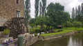
(5) When you reach the Boutron lock, head due south and follow the Ille and Rance Canal on your left. Follow the canal for about 3.3 km, passing the Mottay lock.
(6) At the first bridge after the lock, take the road on the right. Cross a small road, pass through the hamlet of Les Rompais and continue until you reach a T-junction.
(7) Then turn right onto another road. Pass through the hamlet of Le Gros Chêne and turn left with the road. Cross the D26 after La Boulais.
(8) In the middle of the hamlet of La Giraudais, take a stony track on the left. Ignore a turn-off on the right and follow the track to La Roussais.
(9) Follow the D78 for about 300 metres and take the first road on the left into the village. Cross a road running at right angles and head south.
(10) After about 250m, turn right onto a grassy track between the fields. At the end, follow the D12 to the right for about 250m.
(11) At the junction, turn right onto the D78. Then take the first road on the left. Continue straight on through the hamlet of La Noë.
(12) Shortly after passing a path on the left (heading west), take a grassy path on the left (north). Cross a small road and return to a junction you passed on the way there.
(2) Then turn right.
(1) At a place called Le Bos, turn left to return to the starting point (S/E).




 and we managed to find our way back
 Visorando Member

 Easy
Easy  Association / Club / Walk leader
 Difficult