In the footsteps of the Rance bargemen

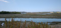
For centuries, right up until the 1920s, the Rance bargemen supplied the bread ovens of Saint-Malo with bundles of firewood. They built stone-paved crossings across the Rance so that they could load their barges.

These little paths leading out into the Rance will allow you to discover the village of Les Bas Champs from a unique perspective.

Details

8536073
Creation:
Last update:
Last review:
  • Walking
    Activity: Walking
  • ↔
    Distance: 6.68 mi
  • ◔
    Average duration: 3h 15 
  • ▲
    Difficulty: Moderate

  • ⚐
    Back to start: Yes
  • ↗
    Ascent: + 220 ft
  • ↘
    Descent: - 223 ft

  • ▲
    Highest point: 95 ft
  • ▼
    Lowest point: 13 ft

Photos

Description of the walk

Park in the car park at Ville Ger Beach.

(S/E) As you leave the car park, turn right onto the road leading to the village of Villes Morvues.

(1) At the exit, turn left onto the small road leading towards the Rance. After about 50 metres, take the steps on the right and walk along the river. At the road, turn left onto the path that runs between the houses and leads to the Moulin du Pont de Cieux.

(2) Turn left onto the road and follow it to the end of the bridge.

(3) As soon as you’ve crossed the bridge, turn left onto the path that runs alongside the Rance and continue to the village of Les Bas Champs.

(4) Turn left onto the stony path that leads into the grassland. Stay on the path. At the end, turn round and head back to the embankment. Turn left again onto the path above the embankment.

(5) Take the stony path that leads into the grassland. Stay on the path. At the end, retrace your steps.

(5) Continue along the path that heads off to the left (north).

(6) Go down the steps and follow the path which leads back up towards Ville Abel.

(7) Take the road on the right.

(8) At the fork in the road (crossroads), there are two options:
- either carry on straight ahead and reach the Pont de Cieux via the road (route),
- or take the road to the right and head towards La Coquenais. You’ll rejoin the path you took on the way there along the banks of the Rance, which will take you back to the Pont de Cieux.

(3) From this point, the route is the reverse of the outward journey, omitting the circular loop along the banks of the Rance at the end.
Carry on straight ahead to the Plage de la Ville Ger car park (S/E).

Waypoints

  1. S/E : mi 0 - alt. 30 ft - Ville Ger Beach car park - Rance (fleuve)
  2. 1 : mi 0.5 - alt. 30 ft - The Morvues Towns
  3. 2 : mi 1.39 - alt. 26 ft - Moulin du Pont de Cieux
  4. 3 : mi 1.5 - alt. 30 ft - Path at the exit of the - Pont de Cieux
  5. 4 : mi 2.56 - alt. 20 ft - La Coquenais – Gabariers Breakwater 1
  6. 5 : mi 3.11 - alt. 20 ft - Digue 2 des Gabariers
  7. 6 : mi 4.17 - alt. 26 ft - Steps
  8. 7 : mi 4.42 - alt. 69 ft - La Ville Abel
  9. 8 : mi 4.71 - alt. 72 ft - The Ville Abel Cross
  10. S/E : mi 6.68 - alt. 30 ft - Ville Ger Beach car park

Notes

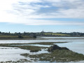
The section of the walk, starting from points (4) and (5), which runs through the salt marshes, is only accessible at ebb tide and when there is no spring tide on the Rance. Do not venture off the path. For information on water levels, visit the EDF power station website: https://www.edf.fr/usine-maremotrice-ran....

There is a bar at Ville Ger Beach, as well as dry toilets.

The path is signposted ‘Sentier du Littoral’ in green along the entire stretch running alongside the Rance.

Worth a visit

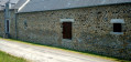
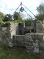
(2) Former tide mill. There used to be another, older mill on the sea wall.

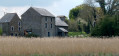
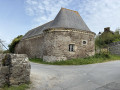
At Bas Champs: you’ll notice that several houses along the sea wall have their doors about 80 cm above the ground. This is because, before the sea wall was built, the sea reached right up to the foot of the houses and rose to this height.

Nearby, you can visit the Cider Museum on the Route de Miniac Morvan, the “Cul de Paumelle” brewery in Lourmel, Pleudihen-sur-Rance, and the Moulin du Prat in La Vicomté-sur-Rance.

Reviews and comments

4.2 / 5
Based on 3 reviews

Reliability of the description
4.7 / 5
Ease of following the route
4.3 / 5
Route interest
3.7 / 5
BRARD
BRARD

Overall rating : 3.7 / 5

Date of your route : Apr 19, 2026
Reliability of the description : ★★★★☆ Good
Ease of following the route : ★★★★☆ Good
Route interest : ★★★☆☆ Average
Very busy route : No

Hello, we went for a walk along a tarmac section, which was a bit too much for my liking. Still, it’s a lovely walk. Thank you
Best regards

Machine-translated

JPED
JPED

Overall rating : 4.3 / 5

Date of your route : Jul 15, 2024
Reliability of the description : ★★★★★ Very good
Ease of following the route : ★★★★☆ Good
Route interest : ★★★★☆ Good
Very busy route : No

An interesting walk through an area with a rich history of trades linked to the River Rance.
Do take the time to stop off at the hamlet of Les Bas Champs and find out how this place came to be.

Machine-translated

Beud's
Beud's

Overall rating : 4.7 / 5

Date of your route : May 23, 2021
Reliability of the description : ★★★★★ Very good
Ease of following the route : ★★★★★ Very good
Route interest : ★★★★☆ Good
Very busy route : No

A family walk taking around 3 hours.
No difficulty; the directions and signposting are accurate.
A varied route (in terms of scenery and terrain).
There are information boards explaining the history of the Gabariers of the Rance.
In short, it’s a lovely walk.

Machine-translated

Other walks in the area

For more walks, use our search engine .

The GPS track and description are the property of this route's author. Please do not copy them without permission.