Country:
 City:
City:


The starting point is situated between the village of Saint-Samson-sur-Rance and La Hisse, on the D57 (coordinates: 48.49315 N, 2.01793 W). There is a green space leading to the menhir where you can park.
(S/E) With your back to the car park, cross the D57 road with care, then take the small road opposite. After 700 m, at the end of the third bend, leave the farmhouse on your right and take the stony track on the right heading south.
(1) Follow this track until you reach the D12.
(2) Cross it carefully and take the road opposite for 150 m. Turn left, then after 200 m, turn right. Pass the campsite entrance and take the tree-lined path on your left. Continue alongside the campsite.
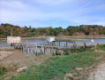
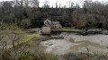
(3) At the campsite’s swimming pool, turn right onto the path that runs alongside the woods. After 20 m, turn onto the first path on the left (caution: steep slope and slippery ground in wet weather). Walk down to the Rance towpath. Follow this path to the left, keeping the Rance on your right, until you reach the Écluse du Châtelier car park and the D57.
(4) From the car park entrance, cross the departmental road carefully and take the path on the left. Then continue along the banks of the Rance on your right.
(5) At Les Carrelets, take the path on the left for 20 metres, then turn into the first path on the right. Walk uphill through the woods to the Pont de Lessard, cross it, and carry on straight ahead. Then walk alongside the railway line on your left, followed by an oak plantation on your right, until you reach the D12.
(6) Once you reach the departmental road, take the path that runs alongside the oak plantation and follow it for 170 metres. Then turn onto the first small road on the left. Follow it for 1.3 km until you cross the railway line.
(7) After 100 m, take the path on your right. At the end of the path, turn left onto the track that leads into the chestnut woodland and follow it to the menhir. After 100 m, you will return to the starting point (S/E).

 Visorando Member
 Easy
Easy 
 Association / Club / Walk leader