


mikelitos

 Visorando Member
 Premium user
 - Location: Baden (56870)
- Gender: man
Sign up:
Published route(s)
 Le Bono via the Becquerel chapel
 3.91 mi
 +59 ft
 -59 ft
 1h 50
1h 50
 Easy
Easy
 Departure from Morbihan
Beautiful hike which, in its first part, follows the Bono river then crosses countryside and undergrowth to return to the starting point.
Very few roads, nice path.
Le Bono via Baie de Kerdrean
 5.65 mi
+190 ft
-207 ft
2h 45
Easy
Departure from Morbihan
5.65 mi
+190 ft
-207 ft
2h 45
Easy
Departure from Morbihan
Start from the old bridge at Le Bono, down along the river to the bay "Baie de Kerdréan".
The hike is partly along the gulf and partly in the countryside.
It starts with the Tumulus de Kernourz and runs halfway along the Manoir de Kerdréan.
From Besse-et-Saint-Anastaise to Murol
 8.79 mi
+948 ft
-1,575 ft
4h 50
8.79 mi
+948 ft
-1,575 ft
4h 50
 Average
Departure from Besse-et-Saint-Anastaise (Puy-de-Dôme)
Average
Departure from Besse-et-Saint-Anastaise (Puy-de-Dôme)
First stage of a 5-day route.
This stage takes you through the mountain pastures to the medieval town of Murol. A very pretty route ending near Lake Chambon.
Between Puy de Sancy and Monts Dore
 44.98 mi
+8,816 ft
-8,520 ft
5 days
Average
Departure from Besse-et-Saint-Anastaise (Puy-de-Dôme)
44.98 mi
+8,816 ft
-8,520 ft
5 days
Average
Departure from Besse-et-Saint-Anastaise (Puy-de-Dôme)
A very beautiful route that takes you along the ridges of Sancy and through the medieval villages of Besse and Murol, betweenGR®4andGR®30.
This route can be done in stages, staying in hotels or lodges. The addresses where we stopped will be indicated in the stage descriptions.
From Murol to Pessade
 11.50 mi
+2,290 ft
-1,181 ft
7h 15
Average
Departure from Murol (Puy-de-Dôme)
11.50 mi
+2,290 ft
-1,181 ft
7h 15
Average
Departure from Murol (Puy-de-Dôme)
Stage 2 of the 5-day route.
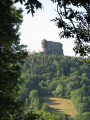
This stage takes you to theGR®4trail through the countryside. You can visit Murol Castle at the start of the stage, then the troglodyte caves of Chautignat.
From Pessade to Mont-Dore
10.10 mi
+2,313 ft
-2,723 ft
6h 40
Average
Departure from Saulzet-le-Froid (Puy-de-Dôme)
Stage 3 of the "Between Puy de Sancy and Monts Dore" route.
A very pretty stage, starting with a route at the bottom of the valley and ending with passages along the ridges of the various puys before Mont-Dore.
From Mont-Dore to Super Besse
 7.21 mi
+2,306 ft
-2,073 ft
5h 20
7.21 mi
+2,306 ft
-2,073 ft
5h 20
 Difficult
Departure from Mont-Dore (Puy-de-Dôme)
Difficult
Departure from Mont-Dore (Puy-de-Dôme)
Stage 4 of the 5-day route.
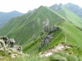
This stage takes you from Mont Dore to Super Besse via the summit of Sancy. A very steep climb from Mont Dore, ending with a descent to the resort of Super Besse.
See Practical information regarding certain restrictions.
From Besse-et-Saint-Anastaise to Lac Pavin
7.38 mi
+958 ft
-968 ft
4h 15
Average
Departure from Besse-et-Saint-Anastaise (Puy-de-Dôme)
Starting from the Le Clos hotel in Besse-et-Saint-Anastaise, this loop takes you around Lac Pavin using the discovery trail and theGR®30.
From Pomper Mill to Pointe d'Arradon
 8.38 mi
+141 ft
-112 ft
4h 00
Average
Departure from Arradon (Morbihan)
8.38 mi
+141 ft
-112 ft
4h 00
Average
Departure from Arradon (Morbihan)
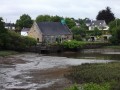
A very pleasant walk from the old Pomper Mill, now converted into an antique shop, to Pointe d'Arradon. The route starts along the coast of the Gulf of Morbihan and returns through the countryside. Discover the village of Le Moustoir with its old farmhouses.
From Baden to Le Bono via Kerdrean Bay
 9.67 mi
+328 ft
-341 ft
4h 45
Average
Departure from Baden (Morbihan)
9.67 mi
+328 ft
-341 ft
4h 45
Average
Departure from Baden (Morbihan)
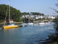
After the villages of Meriadec and Le Parun, where we will discover old houses and cottages, this walk will take us along the Auray River (Loc'h) and then the Bono River (Bono) to the small port.
A very pretty walk, partly through woodland and partly along the coast.
The Pointe de Locmariaquer
 4.99 mi
+30 ft
-30 ft
2h 20
Average
Departure from Locmariaquer (Morbihan)
4.99 mi
+30 ft
-30 ft
2h 20
Average
Departure from Locmariaquer (Morbihan)
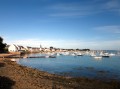
Leaving from Locmariaquer, this hike takes in the coastline of the Golfe du Morbihan, the entrance to the gulf with a view of Port Navalo, and then on to the coast and even the ocean.
Along the way, you'll discover numerous dolmens and megalithic sites (including the famous Table des Marchands).
⚠️Several problems on this hike, see reviews.
From the chapel of Sainte-Avoye to Saint-Goustan
 8.68 mi
+151 ft
-171 ft
4h 05
Average
Departure from Morbihan
8.68 mi
+151 ft
-171 ft
4h 05
Average
Departure from Morbihan
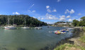
Starting from Le Bono, this walk takes you along the coast of the Le Bono inlet to the chapel of Saint-Avoye. Then, crossing the countryside, you’ll follow the Auray river inlet to Saint-Goustan.There is little road and a lovely path runs alongside the two rivers (on the right-hand side of the Gulf of Morbihan).Message from the moderator: route amended on 21/06/2023 from point 5 to follow theGR®® and avoid going round the Kerplouz secondary school, which is private (fence in place).
Saint-Vincent-sur-Oust Day 1/2
 11.26 mi
+387 ft
-361 ft
5h 30
Average
Departure from Saint-Vincent-sur-Oust (Morbihan)
11.26 mi
+387 ft
-361 ft
5h 30
Average
Departure from Saint-Vincent-sur-Oust (Morbihan)
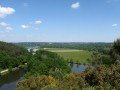
This first day of a two-day route will take us up the River Oust via the upper reaches. We’ll be walking above the river, offering lovely views of Île aux Pies.
The final stretch will be mainly through woodland and meadows.
From Les Moulins to Camp de César in Saint-Avé
 12.13 mi
+633 ft
-650 ft
6h 10
Average
Departure from Saint-Avé (Morbihan)
12.13 mi
+633 ft
-650 ft
6h 10
Average
Departure from Saint-Avé (Morbihan)
This hike near the town of Saint-Avé allows you to discover a landscape of moors and forests in the first part. In the second part, we follow rivers to discover the old mills. It is very varied, with lots of ups and downs.
The banks of the Vilaine
 11.32 mi
+614 ft
-614 ft
5h 45
Average
Departure from La Roche-Bernard (Morbihan)
11.32 mi
+614 ft
-614 ft
5h 45
Average
Departure from La Roche-Bernard (Morbihan)
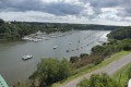
A very pretty route which starts in the countryside and forest and then follows the course of the Vilaine river.
The start and finish are at the very pretty port of La Roche-Bernard.
Tour of Houat Island
 9.37 mi
+180 ft
-167 ft
4h 30
Average
Departure from Morbihan
9.37 mi
+180 ft
-167 ft
4h 30
Average
Departure from Morbihan
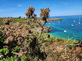
Houat Island, the island with two faces. Overrun by tourists in summer, it offers beaches and a rocky coastline. In the quieter winter months, you can discover its true identity.
See its lobster hatchery.
Marla - Roche Plate
 5.15 mi
+1,037 ft
-2,726 ft
3h 15
Average
Departure from Saint-Paul (La Réunion) (Réunion)
5.15 mi
+1,037 ft
-2,726 ft
3h 15
Average
Departure from Saint-Paul (La Réunion) (Réunion)
Stage 3 of the 6-day route in the Cirque de Mafate.
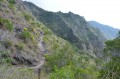
On this stage, we’ll make our way from Marla to Roche Plate via the superb site of the 3 Roches. It is here that the Galets River disappears into an impressive crevasse.
The Roche Plate site is situated directly below the Maïdo viewpoint.
Roche Plate – Grand Place
 6.56 mi
+2,897 ft
-4,016 ft
5h 30
Average
Departure from Saint-Paul (La Réunion) (Réunion)
6.56 mi
+2,897 ft
-4,016 ft
5h 30
Average
Departure from Saint-Paul (La Réunion) (Réunion)
Stage 4 of the 6-day route in the Cirque de Mafate.
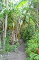
On this stage, we set off from Roche Plate and head for Grand Place les Hauts, passing through the hamlets of Les Orangers, Les Lataniers and Cayenne.
At a place known as La Brèche, we’ll cross the path leading up to Le Maïdo.
Baden and Larmor Baden via the Pointe de Locmiquel
 10.28 mi
+151 ft
-157 ft
4h 50
Average
Departure from Baden (Morbihan)
10.28 mi
+151 ft
-157 ft
4h 50
Average
Departure from Baden (Morbihan)
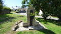
Circular route from Baden to Larmor-Baden allowing you to discover the Toulvern Dolmen, the Pointe de Locmiquel and views of the islands of Er Runio, Grand Veïzit and Radenec.At low tide, it is possible to circumnavigate the “7 Islands”.
Corsica Stage 3: Albertacce to Col de Vergio
 9.60 mi
+2,533 ft
-735 ft
6h 35
Average
Departure from Albertacce (Haute-Corse)
9.60 mi
+2,533 ft
-735 ft
6h 35
Average
Departure from Albertacce (Haute-Corse)
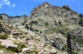
This third stage takes us to the Col de Vergio, the highest point of the day, which marks the start of the descent to Porto.
We will pass by the beautiful Radule waterfall and its pools, which are perfect for swimming.
Corsica Stage 2: Refuge de A Sega to Albertacce
 7.82 mi
+1,768 ft
-2,795 ft
5h 10
Average
Departure from Corte (Haute-Corse)
7.82 mi
+1,768 ft
-2,795 ft
5h 10
Average
Departure from Corte (Haute-Corse)
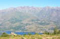
Second day of the hike between Corte and Porto.
The trail begins by climbing up to Bocca Arinella, where we discover our destination: after Lake Calacuccia, the village of Albertacce.
From Lake Melo to the Brèche de Capitello
 12.47 mi
+4,265 ft
-4,239 ft
9h 25
12.47 mi
+4,265 ft
-4,239 ft
9h 25
 Very difficult
Departure from Corte (Haute-Corse)
Very difficult
Departure from Corte (Haute-Corse)
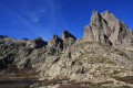
This is a very beautiful hike that allows you to discover the two lakes of Melo and Capitello with a view of the Brèche de Capitello. The view from the breach allows you to discover both sides of the massif.
20/05/2024: The Restonica Valley is no longer accessible by car! The starting point is now at the last stop served by the shuttle bus( Pont de Frasseta) . See practical information.
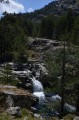
Corsica Stage 1: Corte to the Refuge de Sega
 7.68 mi
+3,271 ft
-951 ft
6h 25
Average
Departure from Corte (Haute-Corse)
7.68 mi
+3,271 ft
-951 ft
6h 25
Average
Departure from Corte (Haute-Corse)
First stage of the hike from Corte to the sea, at Marine de Porto.
This first day is a steady climb up to the Refuge de A Sega.
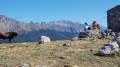
From Col de Vergio to Lac Nino
 11.29 mi
+3,064 ft
-3,064 ft
7h 50
Average
Departure from Albertacce (Haute-Corse)
11.29 mi
+3,064 ft
-3,064 ft
7h 50
Average
Departure from Albertacce (Haute-Corse)
A very beautiful hike that allows you to walk along the ridges and discover Lake Nino in a beautiful valley surrounded by stone mountains.
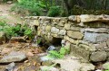
Corsica Stage 5: Col de Vergio to Evisa
 7.12 mi
+597 ft
-2,470 ft
3h 50
Average
Departure from Albertacce (Haute-Corse)
7.12 mi
+597 ft
-2,470 ft
3h 50
Average
Departure from Albertacce (Haute-Corse)
After our break at the Col de Vergio, we head back towards the sea.
During this stage, we will cross the beautiful Aîtone forest with its swimming pools and paved paths in some places.
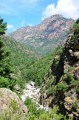
From Evisa to Porto
 6.37 mi
+584 ft
-3,068 ft
3h 25
Easy
Departure from Évisa (Corse-du-Sud)
6.37 mi
+584 ft
-3,068 ft
3h 25
Easy
Departure from Évisa (Corse-du-Sud)
For this last stage, as soon as you leave Evisa, take the discovery trail and descend the beautiful Spelunca Gorges. After the Genoese bridge at Pianella, you will arrive at the beautiful village of Ota and descend towards the marina at Porto.
Corsica between the mountains and the sea
50.04 mi
+11,854 ft
-13,110 ft
6 days
Average
Departure from Corte (Haute-Corse)
This hike is a variation (in terms of the route and starting point) of the Mare à Mare Nord. We set off from Corte, a very pretty town, and arrived at the Gulf of Porto.
We stopped at the Refuge de Sega, the Gite d'Albertacce, the Col de Vergio (where we stayed for two days to explore Lake Nino) and Evisa before arriving in Porto.
Acciolu Beach
 8.87 mi
+771 ft
-751 ft
4h 45
Easy
Departure from Palasca (Haute-Corse)
8.87 mi
+771 ft
-751 ft
4h 45
Easy
Departure from Palasca (Haute-Corse)
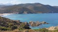
A beautiful hike that allows you to discover some stunning beaches, starting with Ostriconi beach. After this beach, take the coastal path, which is the start of the Agriate Desert tour, and head back up to Acciolu Bay.
There are several beautiful coves along the way.
Bois Bourgerel
 6.31 mi
+112 ft
-108 ft
3h 00
Easy
Departure from Baden (Morbihan)
6.31 mi
+112 ft
-108 ft
3h 00
Easy
Departure from Baden (Morbihan)
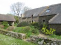
A short hike that will allow you to discover the shores of the Gulf of Bois Bas, passing along Anse de Moustran, Toulindac Beach and Anse de Kerledan.
Girolata
 6.85 mi
+2,142 ft
-2,139 ft
5h 00
Average
Departure from Osani (Corse-du-Sud)
6.85 mi
+2,142 ft
-2,139 ft
5h 00
Average
Departure from Osani (Corse-du-Sud)
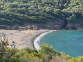
One of the most beautiful hikes on the west coast. It allows you to discover the Gulf of Girolata from the mountains.
Many visitors arrive by boat, which drops tourists off on the beach for half an hour. This route takes you along the coast, where you can discover the gulf, the fort and the beach as you turn the corner.
Take the time to explore Girolata, see the narrow streets and have a picnic on the beaches behind Girolata.
Soccia at Lake Creno
 4.02 mi
+1,004 ft
-997 ft
2h 45
Easy
Departure from Soccia (Corse-du-Sud)
4.02 mi
+1,004 ft
-997 ft
2h 45
Easy
Departure from Soccia (Corse-du-Sud)
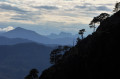
One of the most beautiful hikes in Corsica. The path is pleasant, with part of it in the woods. The arrival at the lake is a magical moment. The lake appears in a setting, even if there are a few people around, the place is conducive to quiet conversation.
A very beautiful place for a picnic.
From Pointe du Blair to Baden Golf Club
 8.26 mi
+213 ft
-217 ft
4h 00
Average
Departure from Baden (Morbihan)
8.26 mi
+213 ft
-217 ft
4h 00
Average
Departure from Baden (Morbihan)
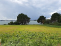
This hike allows you to discover the small village of Mériadec (with some beautiful stone houses), Pointe du Blair (with beautiful villas on a protected estate) and to walk along part of the Rivière d'Auray.
Rochefort-en-Terre and the slate quarries of Pluherlin
 9.32 mi
+577 ft
-551 ft
4h 45
Average
Departure from Malansac (Morbihan)
9.32 mi
+577 ft
-551 ft
4h 45
Average
Departure from Malansac (Morbihan)
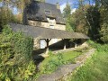
Set amidst moors and woods, Rochefort-en-Terre, perched on a rocky outcrop, is one of the most beautiful villages in France. With its cobbled streets and stylish shop signs, the town is a little gem nestled in the heart of Morbihan. Starting from this village, enjoy a lovely walk along the ridges and through the old slate quarries of Pluherlin.The route is very varied, taking in moorland, woodland and ridges.Passing through the villages of Rochefort-en-Terre and Pluherlin.
The Kerzerho Alignments
 10.53 mi
+43 ft
-43 ft
4h 55
Average
Departure from Erdeven (Morbihan)
10.53 mi
+43 ft
-43 ft
4h 55
Average
Departure from Erdeven (Morbihan)
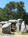
This hike allows you to discover many monuments from the distant Neolithic period (5000 to 2500 BC). Dolmens, menhirs and cromlechs can be found throughout this very pretty hike.
The River Étel and Saint Cado
 9.07 mi
+69 ft
-66 ft
4h 15
Average
Departure from Belz (Morbihan)
9.07 mi
+69 ft
-66 ft
4h 15
Average
Departure from Belz (Morbihan)
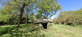
A beautiful walk along part of the Rivière d'Étel, taking in the Île de Saint-Cado and the little house on the Île de Nichtarguer.
Capo Rosso
 4.89 mi
+1,650 ft
-1,640 ft
3h 40
Average
Departure from Piana (Corse-du-Sud)
4.89 mi
+1,650 ft
-1,640 ft
3h 40
Average
Departure from Piana (Corse-du-Sud)
This beautiful hike allows you to discover the Capo Rosso coastline up to the top of the Genoese tower overlooking the cape.
The easy path at the beginning ends on the rocks that form Capo Rosso.
The hike is a round trip from the car park to the top of the Genoese tower at Turghiu.
Foce d'Orto
 7.39 mi
+1,932 ft
-1,932 ft
5h 05
Average
Departure from Piana (Corse-du-Sud)
7.39 mi
+1,932 ft
-1,932 ft
5h 05
Average
Departure from Piana (Corse-du-Sud)
A lovely walk through the woods offering views of the villages of Ota and Evisa. It starts from Piana, a very pretty village with the famous Calanches.
This path is the old route from Piana to Ota.
From Porto to Portu di a Castagna
 3.83 mi
+266 ft
-302 ft
2h 00
Easy
Departure from Ota (Corse-du-Sud)
3.83 mi
+266 ft
-302 ft
2h 00
Easy
Departure from Ota (Corse-du-Sud)
This short hike allows you to explore the Marine de Porto (its streets, shops, mainly restaurants and boat trip sales, its Genoese tower), its port and beach, then follow this path to Portu di a Castagna.
The view from the pier allows you to see the whole of Porto Bay and, on the horizon, the coast of the Scandola Nature Reserve.
Pointe du Bil to Port Anna, Brittany
 7.97 mi
+135 ft
-131 ft
3h 45
Average
Departure from Séné (Morbihan)
7.97 mi
+135 ft
-131 ft
3h 45
Average
Departure from Séné (Morbihan)
Dog-friendly circular walk to discover the start of Vannes river, at the end of the Gulf of Morbihan.
Nice view on the marshes of Séné and some beautiful houses.
Part of a birds sanctuary.
La Vraie-Croix
7.37 mi
+344 ft
-354 ft
3h 40
Average
Departure from La Vraie-Croix (Morbihan)
La Vraie-Croix comes from the Breton "Lan Groez" (cross of the moor).
A lovely walk that allows you to discover the countryside around the very pretty village of La Vraie-Croix.
The tip of the Quiberon peninsula
 10.18 mi
+108 ft
-102 ft
4h 45
Average
Departure from Quiberon (Morbihan)
10.18 mi
+108 ft
-102 ft
4h 45
Average
Departure from Quiberon (Morbihan)
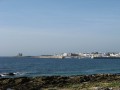
A very beautiful hike that allows you to discover both sides of the Quiberon coast: the wild west coast and the bay on the east side. Cross the large beach and return via Port Haliguen.
After the large beach, pass in front of the thalassotherapy centre and continue to the Pointe du Conguel where, in good weather, you can see the islands of Houat and Hoedic beyond the Teignouse lighthouse.
Arzon - Port Navalo
 10.27 mi
+98 ft
-98 ft
4h 50
Average
Departure from Arzon (Morbihan)
10.27 mi
+98 ft
-98 ft
4h 50
Average
Departure from Arzon (Morbihan)
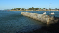
A very pretty loop that takes you around Pointe de Arzon.
Discover Port du Crouesty and Pointe de Port Navalo, with a possible connection to Locmariaquer to cross to the other side of the gulf.
Brillac - Pen Castel
 10.51 mi
+102 ft
-105 ft
4h 55
Average
Departure from Sarzeau (Morbihan)
10.51 mi
+102 ft
-105 ft
4h 55
Average
Departure from Sarzeau (Morbihan)
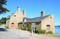
A lovely circular walk linking the village of Brillac to the old Pen Castel tide mill. The first part is in the countryside, often close to the coast. The next part follows the coast along a mostly shaded path offering pleasant views of the gulf (the islands) and passing through a few small villages, including the little port of Logéo.
The Monvert Bridge: towards the Tarn bridge
 11.04 mi
+1,568 ft
-1,549 ft
6h 25
Average
Departure from Saint-Maurice-de-Ventalon (Lozère)
11.04 mi
+1,568 ft
-1,549 ft
6h 25
Average
Departure from Saint-Maurice-de-Ventalon (Lozère)
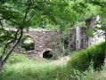
A very beautiful hike that takes you from the undergrowth of the Bougès National Forest up to the Tarn plain and the foothills of Mont Lozère.
From Conleau to Arradon Penboc'h
 6.91 mi
+112 ft
-69 ft
3h 15
Average
Departure from Arradon (Morbihan)
6.91 mi
+112 ft
-69 ft
3h 15
Average
Departure from Arradon (Morbihan)
A beautiful walk that takes you from the Conleau peninsula to discover the mouth of the River Vannes. The final stretch of the route takes you down the River Vincin.
Arradon Penboc'h - Arradon Moulin de Pomper
 6.81 mi
+82 ft
-141 ft
3h 10
Average
Departure from Arradon (Morbihan)
6.81 mi
+82 ft
-141 ft
3h 10
Average
Departure from Arradon (Morbihan)
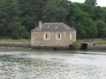
From Benalo, head to Moulin de Pomper (small flea market shop in an old tide mill). We will follow coastal paths throughout (GR®34, tour of the Gulf of Morbihan). View of the coast and the islands of the gulf: Arz, Drenec, Logodec, aux Moines, d'Irus.
Baden Moulin de Pomper – Larmor-Baden
 6.47 mi
+167 ft
-131 ft
3h 05
Average
Departure from Arradon (Morbihan)
6.47 mi
+167 ft
-131 ft
3h 05
Average
Departure from Arradon (Morbihan)
From the Moulin de Pomper (a small second-hand shop housed in a former tide mill) to Larmor-Baden.
Much of the route will follow coastal paths (GR®34).
Views of the coast and the islands in the gulf.
Larmor-Baden - Baden The Seven Islands
 6.32 mi
+33 ft
-72 ft
2h 55
Easy
Departure from Larmor-Baden (Morbihan)
6.32 mi
+33 ft
-72 ft
2h 55
Easy
Departure from Larmor-Baden (Morbihan)
From the village of Larmor-Baden, the route takes us to the Île des Sept Îles in the commune of Baden.
Most of the route follows coastal paths (GR®34).
Views of the coast, the entrance to the gulf and the islands (Île aux Moines, Île de Berder, Île de Gavrinis).
Option to add a tour of Île de Berder to this route.
Arradon: Keranna - Bourgerel
 5.62 mi
+85 ft
-85 ft
2h 40
Easy
Departure from Arradon (Morbihan)
5.62 mi
+85 ft
-85 ft
2h 40
Easy
Departure from Arradon (Morbihan)
A beautiful walk from which you'll get to discover in the distance the island of Conleau, the port "Port Anna" and the entrance to the Vannes river. The inland section reveals some beautiful residences.
⚠️Check tide times and coefficients.
From the summit of La Rhune to Sare
 4.30 mi
+36 ft
-2,772 ft
2h 00
Easy
Departure from Ascain (Pyrénées-Atlantiques)
4.30 mi
+36 ft
-2,772 ft
2h 00
Easy
Departure from Ascain (Pyrénées-Atlantiques)
After reaching the summit of La Rhune via the little train (a lovely climb), we head back down towards the village of Sare. A lovely stretch through the woodland, occasionally passing horses roaming freely.