Roche Plate – Grand Place

Stage 4 of the 6-day route in the Cirque de Mafate.
On this stage, we set off from Roche Plate and head for Grand Place les Hauts, passing through the hamlets of Les Orangers, Les Lataniers and Cayenne.
At a place known as La Brèche, we’ll cross the path leading up to Le Maïdo.

This walk is part of a multi-day hike: Tour du cirque de Mafate en 6 jours

Details

41658
Creation:
Last update:
Last review:
  • Walking
    Activity: Walking
  • ↔
    Distance: 6.56 mi
  • ◔
    Average duration: 5h 30 
  • ▲
    Difficulty: Moderate

  • ⚐
    Back to start: No
  • ↗
    Ascent: + 2,897 ft
  • ↘
    Descent: - 4,016 ft

  • ▲
    Highest point: 4,308 ft
  • ▼
    Lowest point: 1,125 ft

Photos

Description of the walk

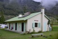
(S) We set off again from our lodge, Le Mahafaty, retracing the path in the opposite direction to our arrival until we reach the entrance to Roche Plate, which we will cross. We follow the GRR2 to Roche Plate, then join the GRR3.

(1) Cross Roche Plate and continue on to La Brèche.

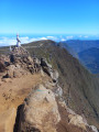
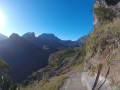
(2) Carry on straight ahead, ignoring the path on the left which climbs up to Maïdo. Before reaching La Brèche, watch out for a slightly ‘technical’ section (there is a cable to secure yourself when passing near the drop-off).

(3) Carry on to the Îlet des Orangers, where there are two possible routes:
- before the islet, take the path on the right to cross the Orangers,
- continue along theGR® and walk alongside the islet; the two paths rejoin at the exit. Continue on to the Îlet des Lataniers.
Leave the Orangers pipeline path on your left (closed when we were there).
Before reaching Îlet des Lataniers, there are two further options:
- cross the Îlet des Lataniers, which is what we did,
- carry on straight ahead.

(4) We set off again towards Cayenne, which means heading back down to reach the Rivière des Galets.

(5). Cross the river, then take the path on the right and head uphill; pass another path on the left and continue uphill until you reach theGR® R2, which you follow to the right.
Carry on to a junction where you have two options:
- left to head straight back up to Grand Place,
- turn right to head towards Cayenne. We chose the second option, which takes you through the very pretty hamlet of Cayenne.

(6) On leaving Cayenne, turn left to continue on to Grand Place les Hauts.

(7) After the nature trail, turn left to reach the lodge Le Pavillon (E), where we’ll be spending the night.


Waypoints

  1. S : mi 0 - alt. 3,632 ft - Le Mahafaty lodge
  2. 1 : mi 0.33 - alt. 3,671 ft - Roche Plate
  3. 2 : mi 1.46 - alt. 4,245 ft - La Brèche
  4. 3 : mi 3.11 - alt. 3,215 ft - Ilet des Orangers
  5. 4 : mi 4.3 - alt. 2,001 ft - Ilet des Lataniers
  6. 5 : mi 4.96 - alt. 1,129 ft - Rivière des Galets
  7. 6 : mi 5.92 - alt. 1,804 ft - Cayenne
  8. 7 : mi 6.44 - alt. 2,497 ft - Grand Place les Hauts
  9. E : mi 6.56 - alt. 2,497 ft - The Pavillon lodge

Notes

We spend the night at the Pavillon de Grand Place les Hauts lodge. This lodge is more commercial than the stopover lodges on our previous stages. The shop is impressive for the range of products on offer (pretty much everything).
A very good meal in pleasant surroundings.
There are several water points and shelters along the route.
Please alsobe aware that the calculated ascents and descents on this route are overestimated. This is likely due to the Maïdo rampart, which we walk alongside. The altitude (highest point) given is incorrect; the highest point of this stage is at La Brèche at 1,293 metres.

Worth a visit

(4) The Îlet des Lataniers and the path leading out from it are very pleasant; we recommend them (plus you can enjoy some refreshments there).
Depending on your fitness level, there are several options on this route, including the climb from La Brèche to the viewpoint or to Maïdo.

Always be cautious and plan ahead when you're outdoors. Visorando and the author of this route cannot be held responsible for any accidents occurring on this route.

The GR® and PR® markings are the intellectual property of the Fédération Française de Randonnée Pédestre.

Reviews and comments

4.8 / 5
Based on 2 reviews

Reliability of the description
5 / 5
Ease of following the route
5 / 5
Route interest
4.5 / 5
johan33510
johan33510
• Edited:

Overall rating : 4.7 / 5

Date of your route : Jun 17, 2025
Reliability of the description : ★★★★★ Very good
Ease of following the route : ★★★★★ Very good
Route interest : ★★★★☆ Good
Very busy route : No

A pleasant route, don't hesitate to take breaks in the islets where you can find locally grown fruit depending on the season.

Machine-translated

papywata
papywata

Overall rating : 5 / 5

Date of your route : Nov 14, 2023
Reliability of the description : ★★★★★ Very good
Ease of following the route : ★★★★★ Very good
Route interest : ★★★★★ Very good
Very busy route : No

A lovely route.
Overall, it’s mostly downhill (so it took us longer than the estimated time).
A few dizzying sections, but they’re short and well-secured.
A lovely stretch through the gap, followed by a very pleasant descent over the pebbles alongside the culvert.
Ilet des Orangers and Ilet Cayenne offer lovely spots to take a break in beautiful surroundings (especially Cayenne).
Then it’s an ascent to Grand Place les Hauts.

Machine-translated

Other walks in the area

For more walks, use our search engine .

The GPS track and description are the property of this route's author. Please do not copy them without permission.