


JPED

 Visorando Member
 Premium user
 - Gender: man
Sign up:
Published route(s)
 The banks of the Rance near Saint-Samson and the Menhir de la Pierre Longue
 4.80 mi
 +190 ft
 -213 ft
 2h 20
2h 20
 Easy
Easy
 Departure from Saint-Samson-sur-Rance (Côtes-d'Armor)
From the village of Saint-Samson, make your way to the Rance at Le Petit Lyvet via the Voie Verte and the Gallo-Roman track. Take a short detour to the menhir known as ‘La Pierre Longue’: standing 8.5 metres tall, it has stood there since 2,500 to 3,000 years before our era.
In the footsteps of Vauban in Saint-Malo
5.74 mi
+341 ft
-315 ft
2h 55
Easy
Departure from Saint-Malo (Ille-et-Vilaine)
Vauban erected numerous military structures along the Breton coastline, and they are very often built on remarkable sites. Here are two notable examples: the Fort de la Cité d’Alet at the summit of the Saint-Servan peninsula, and the Fort National, which faces the Plage de l’Éventail in Saint-Malo.
The Pointe de la Varde from the ramparts of Saint-Malo
 7.74 mi
+171 ft
-141 ft
3h 40
7.74 mi
+171 ft
-141 ft
3h 40
 Moderate
Departure from Saint-Malo (Ille-et-Vilaine)
Moderate
Departure from Saint-Malo (Ille-et-Vilaine)
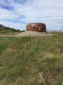
The autumn equinox tides (coefficient of 92) allow you to make a return trip from the ramparts of Saint-Malo to the Pointe de la Varde, across the foreshore and with dry feet. You walk alongside theGRP®® Tour du Pays Malouin at a distance.
Quinard Mill and the Quelmer Boat Graveyard
 6.85 mi
+259 ft
-266 ft
3h 25
Moderate
Departure from Saint-Jouan-des-Guérets (Ille-et-Vilaine)
6.85 mi
+259 ft
-266 ft
3h 25
Moderate
Departure from Saint-Jouan-des-Guérets (Ille-et-Vilaine)
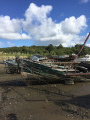
This section ofthe GRP®® Tour du Pays Malouin takes you to two sites emblematic of the historic activities along the banks of the Rance: the Quinard tide mill and the Quelmer boat graveyard.There are beautiful views of the Harteau and Chevet Islands, the anchorages and the left bank of the Rance.
Pointe de Cancaval and La Malouinière du Montmarin
 3.52 mi
+105 ft
-108 ft
1h 45
Easy
Departure from Pleurtuit (Ille-et-Vilaine)
3.52 mi
+105 ft
-108 ft
1h 45
Easy
Departure from Pleurtuit (Ille-et-Vilaine)
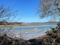
Jutting out into the Rance estuary, Pointe de Cancaval offers beautiful views of the right bank: from Saint-Servan to Saint-Malo, the dam and the moorings dotted along the coast.
During the walk, you will notice La Malouinière de Montmarin and its remarkable garden, which is one of the most beautiful private residences, and two tidal mill sites that bear witness to the industrial past linked to the tidal range.
The hedgerows and ponds of the Frémur at the start of the Rues
 6.68 mi
+210 ft
-217 ft
3h 15
Moderate
Departure from Ploubalay (Côtes-d'Armor)
6.68 mi
+210 ft
-217 ft
3h 15
Moderate
Departure from Ploubalay (Côtes-d'Armor)
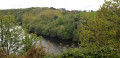
The Pleurtuit ponds, fed by the Frémur, are a delight for anglers and stretch out in deep meanders through peaceful countryside, just a few kilometres from the Dinard-Saint Malo conurbation.
They provide the drinking water supply for the entire urban area thanks to the Bois Joli dam, which was filled in 1992
The path marked in yellow circles the area; it can be accessed from various starting points, including the hamlet of Les Rues.
The garden of Minihic-sur-Rance and its dry dock at La Landriais
 5.26 mi
+272 ft
-285 ft
2h 40
Easy
Departure from Le Minihic-sur-Rance (Ille-et-Vilaine)
5.26 mi
+272 ft
-285 ft
2h 40
Easy
Departure from Le Minihic-sur-Rance (Ille-et-Vilaine)
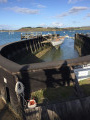
From the beautifully landscaped public garden, there is a remarkable view of the Rance and its right bank, from which the village of Saint-Suliac stands out. From the garden, you can easily reach Garel Beach and the Landriais shipyard with its specific equipment: the above-ground wooden dry dock, via the cliff-top path.
The wet Guérouse valley winds through the undergrowth that makes up the Domaine du Pièton.
La Pointe du Chevet in Saint-Jacut-de-la-Mer
 5.28 mi
+171 ft
-148 ft
2h 35
Easy
Departure from Saint-Jacut-de-la-Mer (Côtes-d'Armor)
5.28 mi
+171 ft
-148 ft
2h 35
Easy
Departure from Saint-Jacut-de-la-Mer (Côtes-d'Armor)
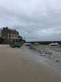
The Pointe du Chevet tour is easy to do and offers two types of coastline. On the west side: a wild coastline opening onto the Baie de l'Arguenon and the Hébihens archipelago that extends beyond it. On the east side: the Bay of Lancieux: the polders and small ports of La Houlle Causseul and Le Châtelet. The coastline of Saint-Jacut-de-le-Mer is bordered by 11 beaches, which you can discover by straying from the suggested route, which follows theGR® 34 to (8).
The Bay of Mont-Saint-Michel from Saint-Méloir-des-Ondes to Cancale
 5.39 mi
+131 ft
-135 ft
2h 35
Easy
Departure from Saint-Méloir-des-Ondes (Ille-et-Vilaine)
5.39 mi
+131 ft
-135 ft
2h 35
Easy
Departure from Saint-Méloir-des-Ondes (Ille-et-Vilaine)
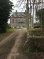
Discover the Bay of Mont-Saint-Michel along the coast from the village of Saint-Méloir-des-Ondes to Cancale. Choose a day when the tide is ebbing or at low tide to walk the outward leg along the foreshore; the return journey follows theGR® 34, which overlooks the bay and offers stunning views of its vast expanse, its oyster beds and Mont-Saint-Michel in the distance.
La Rance at Quelmer, La Passagère and the boat graveyard.
 4.14 mi
+154 ft
-141 ft
2h 00
Easy
Departure from Saint-Malo (Ille-et-Vilaine)
4.14 mi
+154 ft
-141 ft
2h 00
Easy
Departure from Saint-Malo (Ille-et-Vilaine)
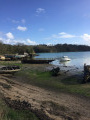
The path runs along the right bank of the Rance, overlooking its rocky coves, which resemble Mediterranean calanques. Along the way, stop at La Passagère, where you can see the Maison du Passeur and the house of Commander Jean Charcot. In the cove, you will find the boat graveyard, the only place where old hulls from the Rance valley are beached.
The banks of the Frémur from Saint-Briac-sur-Mer
 5.13 mi
+105 ft
-108 ft
2h 25
Easy
Departure from Saint-Briac-sur-Mer (Ille-et-Vilaine)
5.13 mi
+105 ft
-108 ft
2h 25
Easy
Departure from Saint-Briac-sur-Mer (Ille-et-Vilaine)
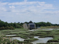
The Frémur estuary has two different aspects: the right bank is lined with mudflats and polders, which provide refuge for many species of birds during migration. The path is lined with hedges and undergrowth, providing a cool environment for walking.
The left bank is sandy, ideal for beach games in summer. It is also where boats moor. There is a beautiful view of the Roche-Good tide mill, nestled at the end of the estuary.
The Guesclin Cove from Pointe des Grands Nez to Pointe du Nid
 5.90 mi
+312 ft
-295 ft
3h 00
Moderate
Departure from Saint-Coulomb (Ille-et-Vilaine)
5.90 mi
+312 ft
-295 ft
3h 00
Moderate
Departure from Saint-Coulomb (Ille-et-Vilaine)
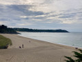
This section ofthe GR® 34trail, which leads to the legendary Pointe du Grouin, has been used by some of the great names in French history: the family of Constable Bertrand du Guesclin, the writer Colette and the singer Léo Ferré.
Follow in their footsteps from Touesse Beach along theGR® 34 from Pointe des Grands Nez to Pointe du Nid.
On the way back, you will pass by the Malouinière La Motte aux Chauff.
Lancieux via the Chemin des Poissonniers
 4.70 mi
+69 ft
-69 ft
2h 15
Easy
Departure from Lancieux (Côtes-d'Armor)
4.70 mi
+69 ft
-69 ft
2h 15
Easy
Departure from Lancieux (Côtes-d'Armor)
It is the morning light that reveals the full charm of Lancieux Bay, with its panoramic view of the Îles des Ebihens and the east coast of Saint-Jacut-de-la-Mer, as you walk along the lively beaches of Saint-Sieu and Les Briantais. The coastal path (GR® 34) overlooks the rocky shore, leading to the highest point on the coast at Tertre de Cordieu. The return journey takes you beneath a canopy of greenery that covers the Chemin des Poissonniers.
In the footsteps of our Neolithic ancestors in Créhen and Trégon
 5.34 mi
+102 ft
-105 ft
2h 35
Easy
Departure from Trégon (Côtes-d'Armor)
5.34 mi
+102 ft
-105 ft
2h 35
Easy
Departure from Trégon (Côtes-d'Armor)
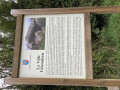
The megaliths you will encounter along the way – menhirs, dolmens and covered passageways – were erected by our distant ancestors during the Neolithic period, some 3,000 years before our era. As such, they could be better showcased.
This is an easy walk suitable for families in spring or autumn; much of it follows roads running alongside farmland. The route is signposted with yellow and/or blue markers.
The Druid Cemetery at Pleslin-Trigavou
 3.92 mi
+174 ft
-200 ft
1h 55
Easy
Departure from Pleslin-Trigavou (Côtes-d'Armor)
3.92 mi
+174 ft
-200 ft
1h 55
Easy
Departure from Pleslin-Trigavou (Côtes-d'Armor)
Legend has it that fairies, who were supposed to deliver these stones to Mont Saint-Michel but were too tired, abandoned them here in the Champ des Roches, where the druids used to gather.Sixty-five menhirs dating from 2000 BC are gathered here, forming Brittany’sthird-largest megalithic site, which has been a listed site since 1887.The site has been planted with 60 different species of oak.
Following Lawrence of Arabia to Dinard
4.23 mi
+207 ft
-220 ft
2h 10
Easy
Departure from Dinard (Ille-et-Vilaine)
The environment we are taking you to is no longer the one that Thomas Edward Lawrence, known as Lawrence of Arabia, explored by bicycle. But although urbanisation has developed considerably, the charm of the Emerald Coast remains. Let's head to the village of Saint-Énogat, the birthplace of the tourist town of Dinard, and take the coastal path around the two headlands that frame it: Pointe de la Malouine and Pointe du Moulinet.
A balcony overlooking the Bay of Saint-Malo - La Cité d'Alet
 2.28 mi
+151 ft
-144 ft
1h 10
Easy
Departure from Saint-Malo (Ille-et-Vilaine)
2.28 mi
+151 ft
-144 ft
1h 10
Easy
Departure from Saint-Malo (Ille-et-Vilaine)
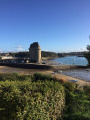
The Cité d'Alet is a family-friendly walk, with an exceptional promontory, offering 270° panorama of the Cité Corsaire, the fortified rocks of La Conchée, Petit Bé, Île Harbour, Grand Bé (Chateaubriand's burial place), the Rance estuary and its dam, and Dinard and its beaches.
It's also Saint-Malo birthplace, with the remains of the first human settlements.
A picturesque walk past the Bois Joli dam
 3.94 mi
+135 ft
-131 ft
1h 55
Easy
Departure from Pleurtuit (Ille-et-Vilaine)
3.94 mi
+135 ft
-131 ft
1h 55
Easy
Departure from Pleurtuit (Ille-et-Vilaine)
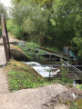
Located 5 km from Dinard, this route – which is easily suitable for families – runs along the western bank of the Bois Joli Dam reservoir. The route starts at the foot of a concrete embankment fitted with an eel ladder; the reservoir is a popular spot for anglers.After following the lower reaches of the Frémur, the route winds through the Breton bocage, passing through the pretty hamlet of La Ruais and its wash house. You then return to the riverbanks, against which the massive dam stands out. The idyllic path follows the contours of the reservoir.
Pointe du Meinga and Roz Ven Beach
 4.24 mi
+289 ft
-299 ft
2h 10
Moderate
Departure from Saint-Coulomb (Ille-et-Vilaine)
4.24 mi
+289 ft
-299 ft
2h 10
Moderate
Departure from Saint-Coulomb (Ille-et-Vilaine)
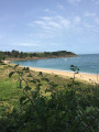
This section ofthe GR® 34 leading to Pointe du Meinga is a must-do walk when staying in the Saint-Malo–Saint-Coulomb area.
From the top of the 46-metre cliff, the view stretches from Cap Fréhel to the Pointe du Grouin, with the Chausey Islands on the horizon.
Pointe du Meinga is bordered to the west by the large beach of La Guimorais (part of which is a naturist beach) and to the east, in the Anse de la Touesse, by Roz Ven beach.
The marshes and polders of Beaussais-sur-Mer
 4.40 mi
+98 ft
-102 ft
2h 05
Easy
Departure from Ploubalay (Côtes-d'Armor)
4.40 mi
+98 ft
-102 ft
2h 05
Easy
Departure from Ploubalay (Côtes-d'Armor)
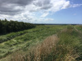
In a bucolic setting, follow the course of the Ru Le Floubalay, which flows into the polders of the Bay of Beaussais-sur-Mer. In Ville-ès-Prêtres, see the sculpture at the foot of the Ferme du Maris: "À l'abri dans le Marais"(Sheltered in the Marsh). It symbolises the work undertaken to regulate the devastating effects of the tides on this submersible area.
The Fort of Saint-Père-Marc-en-Poulet
 4.56 mi
+167 ft
-171 ft
2h 15
Easy
Departure from Saint-Père (Ille-et-Vilaine)
4.56 mi
+167 ft
-171 ft
2h 15
Easy
Departure from Saint-Père (Ille-et-Vilaine)
Built in the 18th century, the fort completes the coastal fortifications designed by Vauban to protect the bay of Saint-Malo from English attacks. With a capacity of 3,000 men, 26 casemates and a 46-metre-long powder magazine, it was delivered too late to play a defensive role. During the 1914-1918 war, it housed German prisoners and, during the last war, it was converted into an ammunition depot by the Germans, who blew up part of the casemates during their evacuation. Decommissioned in 1988, it is now owned by the municipality of Saint-Père-Marc-en-Poulet, which has restored it; shows are organised there.
A viewpoint overlooking the Haut Frémur in Tréméreuc
 4.32 mi
+279 ft
-292 ft
2h 15
Easy
Departure from Tréméreuc (Côtes-d'Armor)
4.32 mi
+279 ft
-292 ft
2h 15
Easy
Departure from Tréméreuc (Côtes-d'Armor)
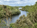
The upper reaches of the Frémur flow at the bottom of a lush green valley where, from a mere trickle, it transforms into a pretty river that feeds the Bois Joli dam, which serves as the water reservoir for the Dinard conurbation.The path descends to the valley floor, then climbs to form a balcony overlooking the valley, offering lovely views.The setting is peaceful, with its meadows, shaded paths and the golf course, just a few kilometres from Dinard.
The banks of the Frémur from Ploubalay
 4.56 mi
+89 ft
-102 ft
2h 10
Easy
Departure from Ploubalay (Côtes-d'Armor)
4.56 mi
+89 ft
-102 ft
2h 10
Easy
Departure from Ploubalay (Côtes-d'Armor)
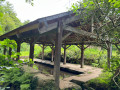
Starting from the centre of Ploubalay, this walk will take you through fields and woodland to the pretty hamlet of La Ruais with its wash house pond, a haven for frogs. You will then reach the left bank of the Frémur, a small coastal river that marks the boundary between the departments of Ille-et-Vilaine and Côtes-d’Armor, and which feeds the Bois Joli dam. At the entrance to Ploubalay, another (well-preserved) wash house is still supplied with running water diverted from another small coastal river, the Floubalay.
The forts of Saint-Malo at low tide with a high tidal range
4.54 mi
+66 ft
-89 ft
2h 10
Easy
Departure from Saint-Malo (Ille-et-Vilaine)
We invite you to explore the three main fortified islets in the Bay of Saint-Malo: Fort du Petit Bé, Grand Bé—which houses Chateaubriand’s tomb—and Fort National. Access to these islets is only safe at low tide and when the tidal range is at least 80. Extend your exploration with a stroll along the foreshore and its wooden breakwaters, admiring the beautiful buildings and hotels lining the Sillon.Before setting off on the walk, check the day’s weather forecast.
The medieval walls from Ville-es-Nonais
 4.11 mi
+171 ft
-177 ft
2h 00
Easy
Departure from La Ville-ès-Nonais (Ille-et-Vilaine)
4.11 mi
+171 ft
-177 ft
2h 00
Easy
Departure from La Ville-ès-Nonais (Ille-et-Vilaine)
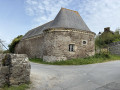
Did the Vikings settle in the Rance valley at the foot of Mont Garot? Nothing is less certain, but in any case, this is a theory put forward by the guides. From La Ville-es-Nonais, along the right bank of the Rance, make your way to the site of the supposed Viking camp. At low tide, you can see the site, covered in short vegetation.