Country:
 City:
City:


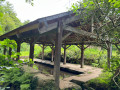
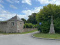
Park in the Place de l’Église in Ploubalay.
(S/E) With your back to the square, head towards the roundabout at the entrance to the village, cross carefullyand take Rue de Dinan (D2). This road runs alongside the town hall grounds, and a wayside cross marks the end of it.
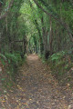
(1) At the wayside cross, turn left at the foot of the tower marking the corner of an estate, onto the small “Rue de Dinan”. At the end of the street, before the greenhouses of a nursery, turn left onto the grassy path. The path climbs through the woodland, crosses the Ruisseau de Floubalay and splits into two branches.
(2) Take the path on the right until it joins a small road. Follow this road to the right for about 200 m.
(3) Leave the road via the path on the left. At the end of the path, continue along the track on the left. This is a sunken track which may be damp depending on the weather. Follow it to the junction with a road, then turn left towards the hamlet of La Ruais.
(4) At the wayside cross, turn right onto the road that runs through the hamlet (note the old wash house). On leaving the hamlet of La Ruais, at the junction, take the path on the left towards the River Frémur.
(5) At the end of the track, turn left onto the path that runs alongside the winding course of the Frémur. Follow the path until it joins a road. Follow this road to the right. It runs alongside the buildings of a large farm at a place called La Comerière. Continue until you reach the bend in the road to the right.
(6) Leave the road here and take the track that opens up on the left, following it as far as the hamlet of Les Tourelles. Take the road on the left, then, at the first junction, turn right onto the road, which climbs slightly.
(7) At the electricity pole, leave the road and take the path on the left. It is lined by a hedge and runs along the edge of a field. Depending on the season, it may blend in with the crops. Follow the path as it passes through the undergrowth and emerges onto a grassy area, below the D768.
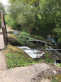
(8) Turn left onto the road and cross the road bridge over the Ruisseau de Floubalay. Immediately after crossing the bridge, take the path on the left, which descends towards the restored wash house. Return to the main road to reach the Place de l’Église (S/E).
 Visorando Member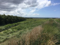

 Moderate