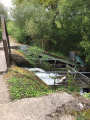
A picturesque walk past the Bois Joli dam

Located 5 km from Dinard, this route – which is easily suitable for families – runs along the western bank of the Bois Joli Dam reservoir. The route starts at the foot of a concrete embankment fitted with an eel ladder; the reservoir is a popular spot for anglers.
After following the lower reaches of the Frémur, the route winds through the Breton bocage, passing through the pretty hamlet of La Ruais and its wash house. You then return to the riverbanks, against which the massive dam stands out. The idyllic path follows the contours of the reservoir.

Details

33420179
Creation:
Last update:
Last review:
  • Walking
    Activity: Walking
  • ↔
    Distance: 3.94 mi
  • ◔
    Average duration: 1h 55 
  • ▲
    Difficulty: Easy

  • ⚐
    Back to start: Yes
  • ↗
    Ascent: + 135 ft
  • ↘
    Descent: - 131 ft

  • ▲
    Highest point: 174 ft
  • ▼
    Lowest point: 39 ft
  • ⚐ Country: France
  • ⚐ City: Pleurtuit (35730|35870)
  • ⚑
    Start/End: N 48.577914° / W 2.102752°
  • ❏
    IGN map(s): Ref. 1016ET, 1116ET
  • Hour-by-hour weather

Photos

Description of the walk

Park at a place called Le Bois Menard, in the municipality of Pleurtuit, opposite the concrete embankment.

(S/E) Take the road on the left, cross the Pont-es-Omnès bridge, and continue for about 200 m.

(1) Leave the road via the path on the right, which follows the Frémur downstream through the woods. Continue until you reach a Fork in the road.

(2) Take the right-hand branch of the path running alongside the Frémur and follow it to where it joins a stony track.

(3) Turn left onto this track. It runs straight ahead. At the crossroads in the hamlet of La Ruais, take a moment to look around and appreciate the charm of this spot. Carry on until you reach a road.

(4) At the crossroads, turn right onto the road and leave it after 150 m to take a track on the left. Follow it until it joins a road, then turn left onto it.

(5) At the foot of the large oak tree, leave the road via the path on the right. After 150 m, it leads onto a road. Turn right onto it. It ends in a path leading to the riverbank.

(6) Walk past the technical installations of the Bois Joli dam on your left. Follow the riverbank to reach the concrete reservoir and the car park (S/E).


Waypoints

  1. S/E : mi 0 - alt. 49 ft - Le Bois Menard
  2. 1 : mi 0.2 - alt. 85 ft - Junction on the footpath - Frémur (cours d'eau)
  3. 2 : mi 0.45 - alt. 82 ft - Fork in the road
  4. 3 : mi 0.79 - alt. 69 ft - Gravel track
  5. 4 : mi 1.78 - alt. 171 ft - Crossroads
  6. 5 : mi 2.4 - alt. 174 ft - Great Oak
  7. 6 : mi 3 - alt. 92 ft - Bois Joli Dam
  8. S/E : mi 3.94 - alt. 49 ft - Le Bois Menard

Notes

The route straddles the two municipalities: Pleurtuit and Le Beaussais-sur-Mer (formerly Ploubalay).

Worth a visit

At Pont-es-Omnès, see the information board on eel conservation and the fish ladder.
The Bois Joli dam was built in 1993. It is 195 metres long and 17 metres high, with a storage capacity of 3 billioncubic metres. It supplies water to the Saint-Malo region.

Reviews and comments

4.2 / 5
Based on 3 reviews

Reliability of the description
4.7 / 5
Ease of following the route
4.7 / 5
Route interest
3.3 / 5
User 27253859

Overall rating : 4 / 5

Date of your route : Oct 13, 2025
Reliability of the description : ★★★★☆ Good
Ease of following the route : ★★★★☆ Good
Route interest : ★★★★☆ Good
Very busy route : No

A pleasant and easy walk, alternating between the water's edge and fields. Also suitable for dogs, with very little tarmac road. The only downside at this time of year is the large number of hunters on Sunday mornings

Machine-translated

Ricou et Domi
Ricou et Domi

Overall rating : 4.7 / 5

Date of your route : Apr 21, 2025
Reliability of the description : ★★★★★ Very good
Ease of following the route : ★★★★★ Very good
Route interest : ★★★★☆ Good
Very busy route : No

A pleasant, easy route; there may be some wet patches.

Machine-translated

David annie
David annie

A very easy walk

Machine-translated

Yves 35
Yves 35

Overall rating : 4 / 5

Date of your route : Oct 02, 2023
Reliability of the description : ★★★★★ Very good
Ease of following the route : ★★★★★ Very good
Route interest : ★★☆☆☆ Disappointing
Very busy route : No

This is the first Visorando walk that’s let me down: the start and the end are nice, but in between: roads and maize fields!!!

Machine-translated

Other walks in the area

For more walks, use our search engine .

The GPS track and description are the property of this route's author. Please do not copy them without permission.