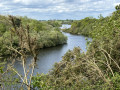
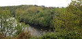
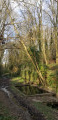
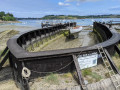
A viewpoint overlooking the Haut Frémur in Tréméreuc

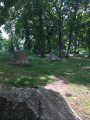
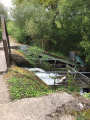
The upper reaches of the Frémur flow at the bottom of a lush green valley where, from a mere trickle, it transforms into a pretty river that feeds the Bois Joli dam, which serves as the water reservoir for the Dinard conurbation.
The path descends to the valley floor, then climbs to form a balcony overlooking the valley, offering lovely views.
The setting is peaceful, with its meadows, shaded paths and the golf course, just a few kilometres from Dinard.

Details

49590550
Creation:
Last update:
Last review:
  • Walking
    Activity: Walking
  • ↔
    Distance: 4.32 mi
  • ◔
    Average duration: 2h 15 
  • ▲
    Difficulty: Easy

  • ⚐
    Back to start: Yes
  • ↗
    Ascent: + 279 ft
  • ↘
    Descent: - 292 ft

  • ▲
    Highest point: 240 ft
  • ▼
    Lowest point: 95 ft
  • ⚐ Country: France
  • ⚐ City: Tréméreuc (22490)
  • ⚑
    Start/End: N 48.558912° / W 2.063315°
  • ❏
    IGN map(s): Ref. 1016ET, 1116ET
  • Hour-by-hour weather

Photos

Description of the walk

Park in the car park at Tréméreuc Town Hall, Rue de la Ville Patouard.

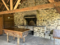
(S/E) Set off along this street, then turn right onto Rue André Foubert to reach the Place de l’Église, passing the Parc du Presbytère and its bread oven.

(1) Turn right to walk alongside the church and, at the end of the street, turn left; immediately at the corner house, take the grassy path on the left, Chemin des Cimereaux. After 100 m, it joins Rue de la Forge, which you follow to the right. This street bends; after 30 m, take the track on the right at the sign for La Bosserais. Leave the hamlet on your right.

(2) Leave the road via the gravel track on the left. Follow it. It branches off to the right at the sign for ‘Vallée du Frémur’ and then descends steeply towards the valley floor.

(3) At the bottom, turn right and follow the path until you reach the sign for “steep section”.

(4) To avoid the steep section, take this bypass path which leads onto the D118.

(5) Turn left immediately to take the return path (do not go onto the road). This leads back to the path running along the Frémur.

(6) Follow this path to the right until you reach a junction.

(7) Leave the balcony path on the right, cross a road and head into the wooded area. You’ll come out onto a clearing near the hamlet of La Rogerais.

(8) At the clearing, turn right and, after a few metres, at the corner house, take the grassy path opposite it. The path crosses meadows, then cuts across a road where you must rejoin it, 10 metres further on, on the left-hand side. Continue along the path until it crosses the D118.

(5) Cross the road carefully to take the path opposite, heading in the opposite direction to the outward journey.
Follow the path, which leads to the bottom of the valley and takes you back to the junction you passed on the way there.

(4) Turn left, in the opposite direction to the outward journey, to follow the valley floor and reach another junction you passed on the outward journey.

(3) Two options:
- take the path on the left which climbs, thereby retracing the route taken on the outward journey but in the opposite direction.
- continue along the path. It climbs gently through the woods and joins the road at a bridge over a stream.

(9) Look for the narrow path on the left which climbs and joins the path you took on the way there. You’ll reach a junction you passed on the way there.

(2) Turn right, heading in the opposite direction to the outward journey, onto the gravel path. Then continue straight ahead along Rue de la Forge, without passing the church, and arrive at the original fork in the path.

(1) Follow the route back in the opposite direction to the outward journey to return to the Town Hall car park on Rue de la Ville Patouard (S/E).

Waypoints

  1. S/E : mi 0 - alt. 240 ft - Car park next to the Town Hall
  2. 1 : mi 0.13 - alt. 230 ft - Church Square
  3. 2 : mi 0.54 - alt. 180 ft - Junction. Return route
  4. 3 : mi 0.82 - alt. 98 ft - Bottom of the valley. Common junction. Return
  5. 4 : mi 0.98 - alt. 108 ft - Junction. Return - Frémur (cours d'eau)
  6. 5 : mi 1.27 - alt. 187 ft - Crossing the D118
  7. 6 : mi 1.44 - alt. 161 ft - Balcony path
  8. 7 : mi 2 - alt. 157 ft - Junction
  9. 8 : mi 2.38 - alt. 233 ft - Small clearing near La Rogerais
  10. 9 : mi 3.68 - alt. 144 ft - Narrow path
  11. S/E : mi 4.32 - alt. 240 ft - Car park next to the Town Hall

Notes

The route follows the ‘Sentiers de Pays’ (marked in yellow); signposts mark the route.
Between (3) and (5), the path is very steep for 50 metres. This steep section can be avoided by taking this easy detour.

Worth a visit

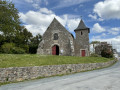
Don’t miss Saint Laurent Church in Tréméreuc, whose origins date back to 1163 and which has undergone numerous alterations: in the 12th century with the addition of the nave, during the Revolution, in 1913 with the construction of the tower, and finally restored in 1995–1996.
Don’t miss the Presbytery Park and its communal oven.

Reviews and comments

4.6 / 5
Based on 3 reviews

Reliability of the description
4.7 / 5
Ease of following the route
5 / 5
Route interest
4 / 5
promaim
promaim

Overall rating : 4.7 / 5

Date of your route : Jul 27, 2026
Reliability of the description : ★★★★★ Very good
Ease of following the route : ★★★★★ Very good
Route interest : ★★★★☆ Good
Very busy route : No

A short, pleasant walk, mostly through woodland, which is easy and well signposted

Machine-translated

Mamie Noisette
Mamie Noisette

Overall rating : 4.7 / 5

Date of your route : Mar 06, 2025
Reliability of the description : ★★★★★ Very good
Ease of following the route : ★★★★★ Very good
Route interest : ★★★★☆ Good
Very busy route : Yes

A route to avoid after a spell of rain, as there are many dirt tracks, which may therefore be muddy.

Machine-translated

Thérèse et J-C
Thérèse et J-C

Overall rating : 4.3 / 5

Date of your route : Jun 17, 2024
Reliability of the description : ★★★★☆ Good
Ease of following the route : ★★★★★ Very good
Route interest : ★★★★☆ Good
Very busy route : No

You need to be in good physical shape at the age of 75.

Machine-translated

Other walks in the area

For more walks, use our search engine .

The GPS track and description are the property of this route's author. Please do not copy them without permission.