


FJ6888

 Visorando Member
 Moderator
 Premium user
 - Gender: man
Sign up:
Published route(s)
 The battlefields of Linge and the glacial cirque of Lake Forlet
 12.30 mi
 +2,316 ft
 -2,313 ft
 7h 40
7h 40
 Difficult
 Departure from Orbey (Haut-Rhin)
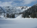
A very varied hike possible in all seasons, which first crosses the Linge battlefield to discover the geography and remains of one of the deadliest places of the 1914-18 war.
After this moving start, you can enjoy magnificent panoramic views as you head towards the highest lake in the Vosges mountains: Lake Forlet. Walking through its majestic glacial cirque, you can admire the exceptional views offered by the ridges overlooking the lake.
From the Étang de Machais to the Rainkopf via the Blanchemer and La Lande lakes
 9.36 mi
+1,650 ft
-1,627 ft
5h 45
9.36 mi
+1,650 ft
-1,627 ft
5h 45
 Moderate
Departure from La Bresse (Vosges)
Moderate
Departure from La Bresse (Vosges)
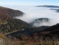
Where the ridge splits in two, one towards the Grand Ballon and the other towards the Grand Ventron, the Rainkopf offers an exceptional 360° panorama. There are many points of interest along the route, including Lac de Blanchemer and its floating peat bog, Lac de La Lande and its dam, Chaume du Firsmiss, the beautiful Machais peat bog, the glacial cirques and their scree slopes, and views of the Vosges and Alsace peaks and the Fecht and Thur valleys.
 The Rainkopf via Lac de Blanchemer on snowshoes
 8.24 mi
+1,627 ft
-1,614 ft
6 hrs
Difficult
Departure from La Bresse (Vosges)
8.24 mi
+1,627 ft
-1,614 ft
6 hrs
Difficult
Departure from La Bresse (Vosges)
This route is a little way from the La Bresse ski resorts. It is easy up to Lac de Blanchemer, but becomes more challenging as you approach Rainkopf. However, the exceptional panoramic view from the summit makes it well worth the effort.
Belchenflue mountain through the "Devil" gorges
 9.13 mi
+2,562 ft
-2,533 ft
6h 25
Moderate
Departure from Hägendorf (Canton of Solothurn)
9.13 mi
+2,562 ft
-2,533 ft
6h 25
Moderate
Departure from Hägendorf (Canton of Solothurn)
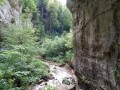
The Swiss Jura Belchen, the Alsatian Belchen (Ballon d'Alsace) and the Black Forest Belchen all form the peaks of a right-angle triangle, mystical sunrise observation point dating back to Celtic times (Belchen comes from "Belenus" the celtic god of sun). You'll gain access to this exceptional viewpoint through the "Devil's" gorges lined with steep walls, waterfalls, caves and caverns. The way back, along the "military path" is full of vestiges and ends with typical Jura landscapes.
Around point 48°North - 7°East
 8.49 mi
+2,283 ft
-2,283 ft
5h 55
Moderate
Departure from Mittlach (Haut-Rhin)
8.49 mi
+2,283 ft
-2,283 ft
5h 55
Moderate
Departure from Mittlach (Haut-Rhin)
48°00'00'' North / 07°00'00'' East, starting point for this hike around Lake Altenweiher. This highly varied hike alternates between forest paths, "alpine" passages and scree slopes in glacial cirques, offering panoramic views of the Alsace and Vosges slopes from the hilltops and summits, as well as the opportunity to stop for refreshments at authentic farmhouse inns.
Along the former bed of the Rhine: from the drawbridge to the Ecluse
 4.18 mi
+36 ft
-36 ft
1h 55
4.18 mi
+36 ft
-36 ft
1h 55
 Easy
Departure from Kembs (Haut-Rhin)
Easy
Departure from Kembs (Haut-Rhin)
Before the construction of the Canal of Alsace (1928), the Rhine extended its arms east of the Huningue Canal (1806) over a wide area of 1km to 2km. From the Rhone Canal on the North Rhine to the Barre d'Istein on the Old Rhine, along paths and trails often in the protected areas of the "Little Alsatian Camargue.", you'll discover numerous natural and industrial sites related to the history of the Rhine.
Begin with a stroll between the drawbridge of Kembs (1831) and l'Ecluse Le Corbusier (1961).
Walk along the old bed of the Rhine: from the Huningue Canal to the Old Rhine
 6.31 mi
+253 ft
-256 ft
3h 05
Easy
Departure from Kembs (Haut-Rhin)
6.31 mi
+253 ft
-256 ft
3h 05
Easy
Departure from Kembs (Haut-Rhin)
Two centuries ago, the Rhine flowed in braids. From 1842, with the construction of dykes by Tulla, then around 1930 with the construction of the Grand Canal, the river was brought back into a single channel and the Rhine ecosystem was profoundly altered.
Today, there is a stark contrast between nature, which is becoming re-vegetated and adapting to the drying up of the river with diverse and unique flora and fauna, and the intense industrial activity surrounding navigation and hydroelectric power.
Walk along the old bed of the Rhine: from Pont-levis to Ferme du Moulin
 2.77 mi
+16 ft
-16 ft
1h 15
Easy
Departure from Kembs (Haut-Rhin)
2.77 mi
+16 ft
-16 ft
1h 15
Easy
Departure from Kembs (Haut-Rhin)
Between the marina and the Ferme du Moulin, this unpretentious little walk allows you to enjoy the tranquillity of the banks of the Canal de Huningue, the Grand Canal d'Alsace and the Augraben, which still feature a few oxbow lakes and ponds, natural remnants of the old bed of the Rhine.
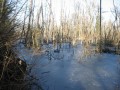
Walk in the old bed of the Rhine: the Petite Camargue Alsacienne
 4.36 mi
+30 ft
-30 ft
2h 00
Easy
Departure from Bartenheim (Haut-Rhin)
4.36 mi
+30 ft
-30 ft
2h 00
Easy
Departure from Bartenheim (Haut-Rhin)
A national nature reserve, the Petite Camargue Alsacienne now covers 904 hectares, including nearly 200 hectares of water. Originally, in 1982, it covered 120 hectares around the buildings of the Imperial Fish Farm (1852). It is here, in the wild heart of the Au wetland plain, that you can walk along some of its most beautiful paths and discover the exceptional flora and fauna of this marshland landscape, thanks to the groundwater.
Chaumes and forests of Lauchen
 10.29 mi
+1,995 ft
-1,985 ft
6h 30
Moderate
Departure from Linthal (Haut-Rhin)
10.29 mi
+1,995 ft
-1,985 ft
6h 30
Moderate
Departure from Linthal (Haut-Rhin)
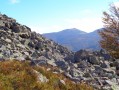
Near the source of the Lauch, on the secondary ridge between Breitfirst and Petit Ballon, Lauchen is an area of stubble fields with remarkable views and forests, including the most beautiful and highest altitude beech forests in the Vosges mountains. It is also a peaceful area, within the Guebwiller integral biological reserves, dominated by the Klintzkopf, home to the emblematic animal of the Vosges, the capercaillie or wood grouse.
Walk in the old bed of the Rhine: around the Petit Rhin
 6.80 mi
+157 ft
-154 ft
3h 15
Easy
Departure from Weil am Rhein (Regierungsbezirk Freiburg)
6.80 mi
+157 ft
-154 ft
3h 15
Easy
Departure from Weil am Rhein (Regierungsbezirk Freiburg)
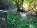
The vast renaturation project on the Rhine Island, which began in 2013, is nearing completion. A new river, the Little Rhine, has appeared between the Grand Canal and the Old Rhine. The land and water around it has been completely transformed, allowing many plant and animal species to return or remain.
This walk takes place in a rapidly changing natural environment, where everything is set to change for the greater benefit of biodiversity.
Lakes and glacial cirques around Kastelberg
 6.76 mi
+2,057 ft
-2,070 ft
4h 55
Difficult
Departure from Mittlach (Haut-Rhin)
6.76 mi
+2,057 ft
-2,070 ft
4h 55
Difficult
Departure from Mittlach (Haut-Rhin)
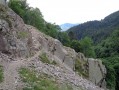
The gentle, rounded shapes of the Vosges mountains sometimes conceal the harsh and authentic remains of the Ice Age: rocky chaos, turbulent streams, scree, lakes and cliffs.
This hike follows paths that are sometimes difficult but well secured, and the wild beauty of the glacial cirques around Kastelberg is well worth the effort. However, it should be avoided in winter. Good footwear is essential.
The Seebach waterfalls and Lac du Ballon
 7.45 mi
+1,785 ft
-1,781 ft
5h 00
Moderate
Departure from Lautenbachzell (Haut-Rhin)
7.45 mi
+1,785 ft
-1,781 ft
5h 00
Moderate
Departure from Lautenbachzell (Haut-Rhin)
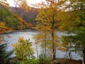
This walk, mainly through woodland, follows the River Lauch before climbing through the Belchenseebach Gorge, past a succession of magnificent waterfalls, to reach the romantic Lac du Ballon.The path is sometimes steep and some sections are slippery, but they are safe and the view is well worth the effort. A relaxing return journey with the option of stopping for a bite to eat at a farmhouse inn.
The Lauch and the Lauchen
 8.56 mi
+2,277 ft
-2,247 ft
5h 55
Moderate
Departure from Linthal (Haut-Rhin)
8.56 mi
+2,277 ft
-2,247 ft
5h 55
Moderate
Departure from Linthal (Haut-Rhin)
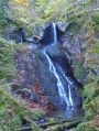
Lakes and waterfalls, stubble fields and forests, peat bogs and scree slopes, springs, high-altitude beech forests... the Hautes Vosges sometimes offer a remarkable variety of landscapes within just a few kilometres, provided you are willing to climb a few slopes.
The Wissgrut stubble fields via the Wagenstall waterfalls
 10.17 mi
+2,746 ft
-2,726 ft
7h 05
Difficult
Departure from Sewen (Haut-Rhin)
10.17 mi
+2,746 ft
-2,726 ft
7h 05
Difficult
Departure from Sewen (Haut-Rhin)
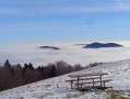
The summit peaks of the Vosges are always a delight for hikers because of the magnificent views they offer. Those of the Wissgrut (or Wisskritt) between the Belfort gap and the Masevaux valley are remarkable. You will reach them via the beautiful Wagenstall waterfalls and continue along the ridge and the upper Fennematt valley, where the Doller river has its source, and its beautiful panoramic trail.
At the bottom of Florival
 5.32 mi
+1,184 ft
-1,198 ft
3h 30
Moderate
Departure from Linthal (Haut-Rhin)
5.32 mi
+1,184 ft
-1,198 ft
3h 30
Moderate
Departure from Linthal (Haut-Rhin)
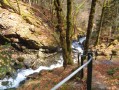
With its lake, forests, scree slopes, waterfalls, peat bogs and rushing streams, the Florival valley floor, around the River Lauch, is home to many wonders.A short hike which nevertheless requires a good level of fitness to tackle a few steep slopes and tricky sections.
On the banks of the Rhine in Rheinfelden
 5.93 mi
+167 ft
-171 ft
2h 50
Easy
Departure from Rheinfelden (Baden) (Regierungsbezirk Freiburg)
5.93 mi
+167 ft
-171 ft
2h 50
Easy
Departure from Rheinfelden (Baden) (Regierungsbezirk Freiburg)
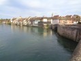
In 1805, Napoleon and Francis I of Austria imposed the border on the Rhine. Rheinfelden then became Rheinfelden Baden, a German industrial town, and Rheinfelden Argovie, a Swiss spa town.The route runs along the German bank, which is equipped with viewing platforms and benches, to the hydroelectric dam and then along the more wooded Swiss bank. Return via the historic town and its old bridge, the Altebrücke.
On the slopes of the Grand Langenberg
 7.39 mi
+1,631 ft
-1,637 ft
4h 50
Moderate
Departure from Sewen (Haut-Rhin)
7.39 mi
+1,631 ft
-1,637 ft
4h 50
Moderate
Departure from Sewen (Haut-Rhin)
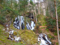
Along the banks of the Doller and then the Wagenstall waterfalls, reach the peaceful stubble fields of the narrow Grand Langenberg valley near an authentic farmhouse inn. Then descend to the foot of the Ballon d'Alsace towards the impressive glacial basin of Lake Alfeld, which dominates the Doller valley. Finally, return along the tumultuous Seebach, which calms down in a wet and marshy meadow, before dying in the peat bogs of Lake Sewen.
Please note that theGR®®531is sometimes obstructed (forestry work, overgrown vegetation, fallen trees, etc.) and maintenance is sometimes delayed. In this case, take the Fennematt path along the left bank of the Doller (marked with triangles and red trestles) and rejoin the route at point (1) or point (3).
Le Petit Hohneck via the Stolz-Ablass Waterfalls
 10.24 mi
+2,900 ft
-2,890 ft
7h 15
Difficult
Departure from Stosswihr (Haut-Rhin)
10.24 mi
+2,900 ft
-2,890 ft
7h 15
Difficult
Departure from Stosswihr (Haut-Rhin)
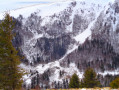
Near the magnificent Hohneck glacial cirque, this hike (not recommended in winter conditions) alternates between little-known wild trails and busy tourist paths, sections through forest and bare ridges, alpine landscapes and damp woodlands. Of particular interest are the Petite Fecht waterfalls, the Franquenthal glacial cirque and the exceptional views from the summit of the Petit Hohneck.
Hiking prohibited in winter; see practical information.
Chaumes and forests of the Rossberg massif
 8.67 mi
+2,087 ft
-2,064 ft
5h 50
Moderate
Departure from Bourbach-le-Haut (Haut-Rhin)
8.67 mi
+2,087 ft
-2,064 ft
5h 50
Moderate
Departure from Bourbach-le-Haut (Haut-Rhin)
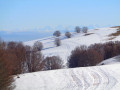
The protected Rossberg massif boasts some of the most beautiful pastoral pastures in the Vosges mountains. They were once home to numerous marcairies(1), of which several farmhouse inns(2) remain today. With their magnificent views of the neighbouring valleys, the southern Alsace plain, the Jura, the Black Forest and the Alps, they are sure to delight hikers.
The Wegscheid Volcano Forest
 10.13 mi
+2,457 ft
-2,448 ft
6h 50
Difficult
Departure from Rimbach-près-Masevaux (Haut-Rhin)
10.13 mi
+2,457 ft
-2,448 ft
6h 50
Difficult
Departure from Rimbach-près-Masevaux (Haut-Rhin)
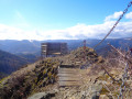
The Wegscheid Forest(1), a regional nature reserve, features a landscape inherited from its volcanic past. Beech, fir, oak and maple trees grow in tiers or mingle among the scree on a steep, rugged slope dotted with volcanic rocks and overlooked by the Vogelstein Rocks.
After winding paths to discover these curiosities, the hike leads into wide open spaces in the light of the Rossberg and Belacker hilltops with exceptional panoramic views.
Reykjadalsá, the hot river
 6.76 mi
+1,276 ft
-1,247 ft
4h 15
Moderate
Departure from Iceland
6.76 mi
+1,276 ft
-1,247 ft
4h 15
Moderate
Departure from Iceland
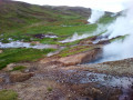
North of the town of Hveragarði (hot garden in Icelandic), 45 km east of Reykjavik, this hike climbs the Reykjadalur valley (valley of smoke), encountering bubbling holes, steam jets, fumaroles, hot water streams, waterfalls, multi-coloured terrain and rocks, until you reach a spot where you can relax and bathe in the warm waters of the Reykjadalsá.
Solheimajökull, the icy tongue of a fire monster
 1.62 mi
+463 ft
-463 ft
1h 10
Easy
Departure from Iceland
1.62 mi
+463 ft
-463 ft
1h 10
Easy
Departure from Iceland
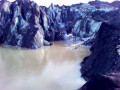
Neighbouring the famous Eyjafjallajökull, which paralysed air traffic in 2010, the Solheimajökull glacier is the southernmost tongue of the great Mýrdalsjökull glacier, which caps a "monster", the much-feared Katla volcano. It flows southwards and gives rise to a torrent that empties into the Atlantic Ocean.
This short walk is accessible to all and makes for a pleasant diversion during a visit to Iceland's south coast.
The banks of the Thur and Old Thur rivers in the potash region
 6.22 mi
+43 ft
-43 ft
2h 55
Easy
Departure from Ensisheim (Haut-Rhin)
6.22 mi
+43 ft
-43 ft
2h 55
Easy
Departure from Ensisheim (Haut-Rhin)
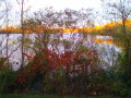
For a long time, the Thur was used as a dumping ground for the dye works in the Thann-Cernay valley and beyond, as far as Ensisheim, for chlorides from the potash mines.Today, these industries have disappeared, which is regrettable, but the polluted ditch has regained its wild beauty and the trout have returned. Starting from the Ensisheim Pond, this route offers a tour of the river, its tributary the Old Thur and its forest, the Thurwald.
Please note: Japaneseknotweed invades the banks of the Thur every year, obstructing the view of the river between May and November.It is best to do this hike between November and early May.
The heights of Blotzheim via the snail hills
 8.25 mi
+623 ft
-604 ft
4h 20
Moderate
Departure from Bartenheim (Haut-Rhin)
8.25 mi
+623 ft
-604 ft
4h 20
Moderate
Departure from Bartenheim (Haut-Rhin)
On the heights of Blotzheim, the Grand and Petit Schneckenberg (snail hills) form a wooded area close to its natural state, criss-crossed by streams and surrounded by fields, copses and a few vineyards.A multitude of trails and paths offer beautiful walks in the hills, where you can enjoy the peace and quiet and a few views of the neighbouring mountain ranges, the Vosges, the Black Forest and the Jura.Two versions are available, 10 or 13 km.
Circular route in the southern Hardt Forest
 3.83 mi
+30 ft
-30 ft
1h 45
Easy
Departure from Kembs (Haut-Rhin)
3.83 mi
+30 ft
-30 ft
1h 45
Easy
Departure from Kembs (Haut-Rhin)
A short family walk through a pleasant woodland setting, in stark contrast to the neighbouring urban development. In fine weather, a playground and a picnic area will make for an enjoyable day out.
In wet seasons, the paths are often muddy or overgrown with vegetation, whilst others are rutted due to forestry work.
The Schweisel, flowing along the banks of the Pfahlrunz and the Salzbach
 7.81 mi
+2,119 ft
-2,106 ft
5h 25
Moderate
Departure from Metzeral (Haut-Rhin)
7.81 mi
+2,119 ft
-2,106 ft
5h 25
Moderate
Departure from Metzeral (Haut-Rhin)
The Schweisel is a peak on the main ridge of the Vosges between the Thann valley to the west and the Munster valley to the east.
It is renowned for its exceptional views, as well as for its moorland, forest and wetland area, the Schweiselwasen, on the eastern side. It is this eastern side, criss-crossed by numerous streams, that this route takes you to explore.
The Schneckenberg Forest
 4.72 mi
+371 ft
-374 ft
2h 30
Easy
Departure from Bartenheim (Haut-Rhin)
4.72 mi
+371 ft
-374 ft
2h 30
Easy
Departure from Bartenheim (Haut-Rhin)
Overlooking the Rhine’s alluvial plain—a barren landscape where the Hardt Forest struggles to survive—the hills of the Bartenheim heights enjoy very rich soil. Set upon this fertile silt, on either side of the ridge between Helfrantzkirch and Bartenheim, lies the most beautiful forest in the Sundgau: the Schneckenberg Forest (see Practical Information).
A short walk through the forest or along the forest edge for tree lovers.
On the banks of the Ill, the Thur and the Vieille Thur
 8.52 mi
+49 ft
-49 ft
4h 00
Moderate
Departure from Ensisheim (Haut-Rhin)
8.52 mi
+49 ft
-49 ft
4h 00
Moderate
Departure from Ensisheim (Haut-Rhin)
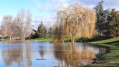
Water is ever-present throughout this route; starting from the lovely Eiblen Nature and Leisure Park, it follows the edges of the large pond, the tree-lined banks of the Ill and then the water body of the former gravel pit. It then enters the tranquillity of the Thur Forest and its banks to reach the Little Prince Park. Return along the banks of the Vieille Thur, then back along the Thur to its confluence with the Ill, ending with a final glimpse of the park’s waterbird ponds.
Please note : Japanese knotweed, an invasive plant, regrows every year along the banks of the Thur from its rhizome, starting in March–April. Its growth accelerates (2 to 8 cm per day) and the plant can reach 2 or 3 m by July, obstructing the view of the river. It flowers in September–October (beautiful colours) and dies off by November.To enjoy the view of the waterways, it is best to undertake this walk between November and early May.
The hills of Schlierbach via the Croix and Deux Chênes trails.
 5.60 mi
+289 ft
-305 ft
2h 50
Easy
Departure from Haut-Rhin
5.60 mi
+289 ft
-305 ft
2h 50
Easy
Departure from Haut-Rhin
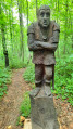
A family hike that follows the Sentier des Croix to the Chapelle des Malgré-nous, then climbs the hills to follow the Sentier des Deux Chênes, decorated with wooden sculptures and dotted with educational panels.
Between Le Homberg and the Bruchberg, in the heart of the Bas-Sundgau hills
 8.71 mi
+505 ft
-502 ft
4h 25
Moderate
Departure from Kœtzingue (Haut-Rhin)
8.71 mi
+505 ft
-502 ft
4h 25
Moderate
Departure from Kœtzingue (Haut-Rhin)
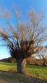
A varied family walk that climbs towards the Forêt des Deux Chênes, dotted with wooden sculptures and educational panels. The Schlierbach discovery trails, the return route via the Homberg and the Kœtzingue ecological pond, as well as the beautiful views of the surrounding mountains, will make you forget a few short but sometimes steep climbs.
The Big Oak Tree via the Raedersdorf Discovery Trail
 3.77 mi
+499 ft
-472 ft
2h 10
Easy
Departure from Raedersdorf (Haut-Rhin)
3.77 mi
+499 ft
-472 ft
2h 10
Easy
Departure from Raedersdorf (Haut-Rhin)
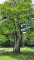
This family hike takes you to the majestic Gros Chêne de Sondersdorf. Entirely in the forest, it passes through the Raedersdorf Discovery Trail, decorated with around fifty (or more) wooden sculptures and dotted with educational panels that are sure to interest children. Best done in dry weather in any season.If you only want to do the discovery trail and see the sculptures, see Practical Information.
A short tour of Brestenberg through fields and forests
 2.51 mi
+174 ft
-174 ft
1h 20
Easy
Departure from Bartenheim (Haut-Rhin)
2.51 mi
+174 ft
-174 ft
1h 20
Easy
Departure from Bartenheim (Haut-Rhin)
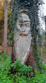
Family walk around Brestenberg hill between Bartenheim and Brinckheim, passing through sunken lanes typical of the Sundgau hills. Enjoy the forest and the view of the Vosges mountains and the Black Forest.
From the Pleigne plateau to Lake Lucelle
 9.34 mi
+1,007 ft
-1,010 ft
5h 10
Moderate
Departure from Pleigne (Canton of Jura)
9.34 mi
+1,007 ft
-1,010 ft
5h 10
Moderate
Departure from Pleigne (Canton of Jura)
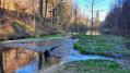
The peaceful village of Pleigne is located on a Jura plateau at an altitude of around 800 metres. It is the centre of a commune that stretches north to the French-Swiss border marked by the Lucelle, the river that gave its name to the lake and the small town famous for its Cistercian abbey.The route begins with the Pleigne panoramic trail and observation tower, then leaves the plateau, its pastures and farms, to descend around Lake Lucelle. Return along the river, passing close to the caves, to climb back up to the plateau through the Côte de May forest and its legendary Rocher de la Fille de Mai (Rock of the May Girl).
Walk along the old bed of the Rhine: along the Au
 3.86 mi
+69 ft
-39 ft
1h 50
Easy
Departure from Kembs (Haut-Rhin)
3.86 mi
+69 ft
-39 ft
1h 50
Easy
Departure from Kembs (Haut-Rhin)
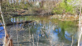
In the heart of the Au, the alluvial terrace of the Rhine between Huningue and Kembs, the history of Rosenau is closely linked to that of the Rhine. Throughout this route, between the Grand Canal d’Alsace and the Huningue Canal, by a pond or a lock, on the banks of canals or streams, water is ever-present.
In the heart of the Au plain, Rosenau, daughter of the Rhine
 8.42 mi
+98 ft
-98 ft
3h 55
Moderate
Departure from Kembs (Haut-Rhin)
8.42 mi
+98 ft
-98 ft
3h 55
Moderate
Departure from Kembs (Haut-Rhin)
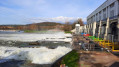
The Plaine de l’Au is this wetland region on the Rhine’s floodplain in the Land of the Three Borders, where the river, before its course was straightened by dykes (19th century) and then channelled (early 20th century), spread out into multiple branches.Between the Kembs hydroelectric power station to the north and the Grand Marais trail to the south, water accompanies us throughout this route, where biodiversity and human activities strive to coexist harmoniously.The time given does not include stops at the five observation points and other points of interest along the route.
Lutterbach, its basilica and its woods
 5.32 mi
+52 ft
-52 ft
2h 30
Easy
Departure from Lutterbach (Haut-Rhin)
5.32 mi
+52 ft
-52 ft
2h 30
Easy
Departure from Lutterbach (Haut-Rhin)
A family walk offering the chance to discover some of the attractions of Lutterbach, a town steeped in history and culture, home to one of the four basilicas of Alsace and a famous brewery rich in history, before enjoying the Bois de Lutterbach, the south-western part of the Forêt du Nonnenbruch (Marais des Nonnes), criss-crossed by numerous walking trails and serving as the urban area’s green lung.
This walk is accessible via Lutterbach railway station (Haut-Rhin).