Refine your search for walks in Varennes-sur-Seine
Varennes-sur-Seine walks
 Where the Seine and Yonne rivers meet, passing through Marolles-sur-Seine
 Visorando Member
 12.55 mi
 +39 ft
 -39 ft
 5h 50
5h 50
 Difficult
 Departure from Montereau-Fault-Yonne (Seine-et-Marne)
Passing through the Seiglats Regional Nature Reserve on this hike, you will see a variety of birds, including birds of prey and passerines, as well as locks along the banks of the Seine and Yonne rivers and ponds.
At the confluence of the Seine and Yonne rivers
7.38 mi
+16 ft
-16 ft
3h 25
 Moderate
Departure from Montereau-Fault-Yonne (Seine-et-Marne)
Moderate
Departure from Montereau-Fault-Yonne (Seine-et-Marne)
Hiking around Varenne-sur-Seine. The trails leading to springs, mills and wash houses complete this circuit, passing by the Noue Notre-Dame leisure centre and the botanical garden with its castle.
From Montereau-Fault-Yonne to Moret-sur-Loing, from one confluence to another.
 15.76 mi
+492 ft
-456 ft
7h 40
Difficult
Departure from Montereau-Fault-Yonne (Seine-et-Marne)
15.76 mi
+492 ft
-456 ft
7h 40
Difficult
Departure from Montereau-Fault-Yonne (Seine-et-Marne)
This is the twenty-fifth stage of the Grand Tour of Île-de-France via the GR®11, starting from Montereau station, not far from the confluence of the Seine and the Yonne, and ending at Moret-Veneux-les-Sablons station, not far from the confluence of the Seine and the Loing. The stage, entirely on the GR®11, follows a route on the left bank of the Seine, joining the Orvanne valley a little further south, and returns to Moret-sur-Loing and its beautiful historic centre, following the Canal du Loing on its towpath.
Along the River Yonne from Montereau-Fault-Yonne
11.58 mi
+43 ft
-23 ft
5h 20
Moderate
Departure from Montereau-Fault-Yonne (Seine-et-Marne)
A walking route from station to station, starting at Montereau Fault-Yonne station and ending at Villeneuve-la-Guyard along the River Yonne, allowing you to explore the ponds and marshes near the finish. A peaceful, quiet walk along the water’s edge, passing through the village of Misy-sur-Yonne, which is known for its historic site.
From Montereau to Vernou-sur-Seine via the towpath and the plateau
 8.52 mi
+249 ft
-207 ft
4h 10
Moderate
Departure from Montereau-Fault-Yonne (Seine-et-Marne)
8.52 mi
+249 ft
-207 ft
4h 10
Moderate
Departure from Montereau-Fault-Yonne (Seine-et-Marne)
A three-stage walk from station to station. First, you cross the town of Montereau, the highlight being the Gothic collegiate church and the double bridge at the confluence of the Seine and the Yonne. Next, you follow the towpath, which is mostly shaded. Finally, you climb to a higher elevation before descending to Vernou-sur-Seine station.
(Please note) Just before (9), the underpass beneath the railway line is closed (see the comment posted on 21 July 2026). Until this obstruction is cleared, one option is to turn right to find a level crossing. Once you have crossed the tracks safely, follow the D39 to the left until you reach point (9).
 A family walk along the River Yonne from Cannes-Écluses
 20.29 mi
+36 ft
-39 ft
4 hrs
Moderate
Departure from Cannes-Écluse (Seine-et-Marne)
20.29 mi
+36 ft
-39 ft
4 hrs
Moderate
Departure from Cannes-Écluse (Seine-et-Marne)
Circular mountain bike route along the banks of the Yonne, starting from Cannes-Écluses.Ideal for families as it runs alongside the river, is flat and features numerous picnic tables and benches along the route.The route alternates between tarmac roads (a minority), gravel roads and dirt tracks.
From Vernou-sur-Seine to Fontainebleau via Saint-Mamès and Thomery
 10.25 mi
+495 ft
-463 ft
5h 10
Moderate
Departure from Vernou-la-Celle-sur-Seine (Seine-et-Marne)
10.25 mi
+495 ft
-463 ft
5h 10
Moderate
Departure from Vernou-la-Celle-sur-Seine (Seine-et-Marne)
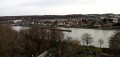
A very varied hike from station to station. The Chemin des Herces, high up, offers beautiful views of the Seine and the town of Saint-Mammès, where you will find a beautiful Romanesque church. After walking along the Seine, you stroll between the old vine walls of Thomery. You return to the banks of the Seine and the hike ends with a detour into the Fontainebleau National Forest.
Three Romanesque churches and five crosses around the Orvanne
 10.88 mi
+400 ft
-400 ft
5h 20
Moderate
Departure from Flagy (Seine-et-Marne) (Seine-et-Marne)
10.88 mi
+400 ft
-400 ft
5h 20
Moderate
Departure from Flagy (Seine-et-Marne) (Seine-et-Marne)
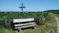
A hike through fields for the most part, which conceals a very rich heritage: three Romanesque churches, an old mill, an old watchtower, a castle and a menhir. Five metal crosses mark the route around the pretty, flower-filled village of Flagy.
La Montagne de Trin
 3.68 mi
+223 ft
-217 ft
1h 55
3.68 mi
+223 ft
-217 ft
1h 55
 Easy
Departure from Villecerf (Seine-et-Marne)
Easy
Departure from Villecerf (Seine-et-Marne)
A short walk in the hills above Villecerf in the Montagne du Trin and its tower.
Moderator’s note: sections marked as off-limits on the route (see comments dated 15 June 2020 and 4 September 2022).
The Bois de la Bondue
 6.97 mi
+295 ft
-295 ft
3h 30
Moderate
Departure from La Brosse-Montceaux (Seine-et-Marne)
6.97 mi
+295 ft
-295 ft
3h 30
Moderate
Departure from La Brosse-Montceaux (Seine-et-Marne)
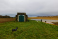
A circular route through the plains and some woodland of La Brosse-Montceau. Here you can admire the Château de La Brosse and a few historic wells. The route runs alongside part of the aqueduct, some of which is buried and some of which is above ground.
Tour of Île aux Moines and a stroll along the banks of the Seine
 4.14 mi
+23 ft
-23 ft
1h 55
Easy
Departure from Marolles-sur-Seine (Seine-et-Marne)
4.14 mi
+23 ft
-23 ft
1h 55
Easy
Departure from Marolles-sur-Seine (Seine-et-Marne)
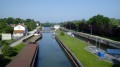
A short walk starting from the beautiful church in Marolles-sur-Seine, an excuse for a leisurely stroll or a picnic by the water.
The Orvanne between Écuelles and Montarlot
 9.09 mi
+328 ft
-358 ft
4h 30
Moderate
Departure from Écuelles (Seine-et-Marne) (Seine-et-Marne)
9.09 mi
+328 ft
-358 ft
4h 30
Moderate
Departure from Écuelles (Seine-et-Marne) (Seine-et-Marne)
Running parallel to the Orvanne river, this hike takes place mainly through fields, with sections along the edge of woods and through pretty villages.
At the confluence of the Seine and the Loing
 5.52 mi
+194 ft
-217 ft
2h 45
Moderate
Departure from Saint-Mammès (Seine-et-Marne)
5.52 mi
+194 ft
-217 ft
2h 45
Moderate
Departure from Saint-Mammès (Seine-et-Marne)
Rising between Forterre and Puisaye, and after a course of more than 150 kilometres, the Loing flows into the Seine to the south-east of the Forest of Fontainebleau. This rather short route runs alongside these two rivers and the Canal du Loing for much of its length. A section through the forest adds variety to the landscape. The beautiful old Saint-Mammès Church and a few reproductions of paintings by Alfred Sisley add an undeniable touch of heritage to this walk.
The Pierre Cornoise Menhir between Thoury and Flagy
 5.24 mi
+98 ft
-66 ft
2h 30
Easy
Departure from Thoury-Férottes (Seine-et-Marne)
5.24 mi
+98 ft
-66 ft
2h 30
Easy
Departure from Thoury-Férottes (Seine-et-Marne)
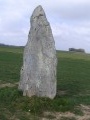
Hike along the banks of the Orvanne from Thoury to Flagy. Discover Flagy and the Pierre Cornoise menhir.
The wash houses of Voulx and Diant
 3.84 mi
+187 ft
-174 ft
1h 55
Easy
Departure from Voulx (Seine-et-Marne)
3.84 mi
+187 ft
-174 ft
1h 55
Easy
Departure from Voulx (Seine-et-Marne)
This is an easy, short hike, offering the opportunity to discover some beautiful wash houses and the banks of the Orvanne. Children who are used to walking and older people can keep up.
The Villeron Pond and its springs
 5.93 mi
+121 ft
-98 ft
2h 50
Easy
Departure from Villemer (Seine-et-Marne)
5.93 mi
+121 ft
-98 ft
2h 50
Easy
Departure from Villemer (Seine-et-Marne)
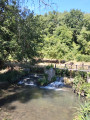
This circular walk, starting from Rebours in the hamlet of Villemer – nestled between countryside and woodland – circles the private Villeron pond and follows the Villeron springs (Puits). This walk follows several sections ofthe PR® andGRP® trails. Please note that at certain times of year, the wetland area is often home to a few biting friends (mosquitoes). Apart from a fairly damp section, most of this circular walk follows small tarmac roads and fairly dry paths.
Around the Bois Boucher Grignon
 4.75 mi
+164 ft
-161 ft
2h 20
Easy
Departure from Voulx (Seine-et-Marne)
4.75 mi
+164 ft
-161 ft
2h 20
Easy
Departure from Voulx (Seine-et-Marne)
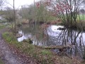
A circular loop in the hills above Voulx, a mix of open countryside and woodland...
Diant circular route via Blennes
 5.73 mi
+135 ft
-135 ft
2h 45
Easy
Departure from Diant (Seine-et-Marne)
5.73 mi
+135 ft
-135 ft
2h 45
Easy
Departure from Diant (Seine-et-Marne)
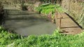
A circular walk following theGRP® “Tour de l’Orvanne”, crossing from the right bank to the left bank from Blennes. This 9.4 km walk can be extended by adding the “Blennes – Vallery” walk (approx. 10 km). We pass the start of the other walk.