From Moret-Loing-et-Orvanne to Montcourt-Fromonville

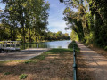
This route, running alongside the Loing Canal from Moret-Loing-et-Orvanne to Montcourt-Fromonville, is a real feast for the eyes, set against a serene waterside backdrop. Swans, grey herons, cormorants and moorhens all add to this sense of tranquillity.

Details

n°109071944
Creation:
Last update:
Last review:
–
  • Touring/Gravel
    Activity: Touring/Gravel
  • ↔
    Distance: 17.65 mi
  • ◔
    Duration according to the author: 2 hrs 
  • ▲
    Difficulty: Easy

  • ⚐
    Back to start: Yes
  • ↗
    Ascent: + 30 ft
  • ↘
    Descent: - 30 ft

  • ▲
    Highest point: 194 ft
  • ▼
    Lowest point: 161 ft
  • ⚐ Country: France
  • ⚐ City: Moret-sur-Loing (77250)
  • ⚑
    Start/End: N 48.37013° / E 2.825616°
  • ❏
    IGN map(s): Ref. 2417OT, 2417OTR, M2417OT

  • ◶
    Type of surface:
  •  
     
    ■ 4% Road ■ 96% Byway
  • Hour-by-hour weather

Photos

Description of the route

To get to Moret-Loing and Orvanne in the Seine-et-Marne department: coming from the east via Avenue De Sens, cross the canal and, just after the bridge, turn left onto Rue du Faubourg de Moret, where you’ll find free parking.
Coming from the west via Rue du Peintre Sisley, just before the bridge over the Canal du Loing, turn right onto Rue du Faubourg de Moret, where you’ll find free parking. If this car park is full, you can park at the Centre Aquatique du Grand Jardin car park, 9 Route de Saint-Mammès, which is to the north.

(S/E) Set off from the car park on Rue du Faubourg de Moret, heading south. Take the Quai du Canal, which runs alongside the Canal du Loing on your left. The cycle route is the Scandibérique or the EV3. Pass under the road bridge (D606) and continue straight on along the Chemin de Halage. Pass the village of Les Écuelles on your left, Lock No. 17 at Les Écuelles, and ride alongside Moret-Épisy aerodrome on your left.

(1) At Épisy, at the junction with the Route de Sorques, turn left, cross the bridge, then immediately turn right to rejoin the EV3 route. Pass Épisy Lock No. 16. The greenway continues along the Sentier des Jardins between the Canal de Loing on your right and the branch of the Loing on your left. Carry on straight ahead, passing Berville Castle on your left, then pass Berville Lock No. 15.

(2) In the village of La Genevraye, go under the road bridge spanning the canal and carry on straight ahead. Pass Lock No. 14 at Les Bordes, in the hamlet of the same name. Carry on straight ahead, go under the road bridge, and reach Lock No. 13 at Fromonville, where there is a metal footbridge.

(3) Turn round and head back along the same route you took on the way there, until you reach the car park on Rue du Faubourg de Moret in Moret-Loing and Orvanne (S/E).


Waypoints

  1. S/E : mi 0 - alt. 164 ft - Car park on Rue du Faubourg de Moret - Canal du Loing
  2. 1 : mi 3.46 - alt. 177 ft - Épisy Lock No. 16 - Marais d'Episy
  3. 2 : mi 5.37 - alt. 187 ft - Genevraye village - Château de Berville
  4. 3 : mi 8.83 - alt. 194 ft - Fromonville Lock No. 13 - Loing (le)
  5. S/E : mi 17.65 - alt. 164 ft - Car park on Rue du Faubourg de Moret

Notes

No specialequipment required , other than that needed for acycleride .

There are no water points along the route.

Between (S/E) and (1), just before reaching Épisy, there is a large picnic area

Between (2) and (3), there is a picnic area in the grounds of Montcourt Castle, open to the public

Worth a visit

Information boards on the history of the canal and its surroundings are dotted along the route.

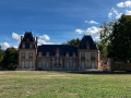
Between (2) and (3), the Château de Montcourt, which houses the town hall of Montcourt-Fromonville.

For more walks, use our search engine .

The GPS track and description are the property of this route's author. Please do not copy them without permission.