Country:
 City:
City:




The ‘official’ starting point is at the foot of the statue of Napoleon, at the confluence of the Yonne and the Seine. However, for those wishing to reach the starting point by public transport, the route is described from Montereau station.
(S) On leaving the station, cross Place Pierre Semard diagonally to the right and take Avenue du Général de Gaulle, which continues from there. Follow this avenue straight on until it ends at Place Jacques Lepesme. Then take thesecond left onto Rue Jean Jaurès. Go straight on, past the Town Hall, continue along Rue Jean Jaurès and you will reach the Collegiate Church of Notre-Dame.
(1) Carry on straight ahead and cross the bridge over the River Yonne. You’ll arrive at the foot of the equestrian statue of Napoleon, at the confluence of the Yonne and the Seine.
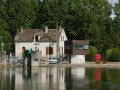
(2) Turn right and pass under the bridge you have just crossed, then follow the Yonne upstream, passing by the foot of the old castle. Follow the path to the harbour master’s office.
(3) To the right of this, take the towpath running alongside the Yonne. Walk along the river on your right-hand side and follow theGR® 2 and 11 (red and white markings). Pass under a road bridge and then, after a factory, under a railway bridge. Continue along the towpath between large ponds and the course of the Yonne as far as the dam that regulates it.
(4) Carry on for about 200 m and take the bridge over the Yonne, keeping to the right-hand footpath. At the end of the bridge, turn right to go under the bridge. Follow a path which soon turns right to cross a street and pass through a small tunnel under the railway line. Continue along Rue du Cimetière, which leads back up towards the village centre.
(5) At the junction, turn left. Cross Rue Chaude on the right-hand side and walk past the church. Continue straight on along Rue Désiré Theison (D124). When the road bends to the right, turn left into Rue Saint-Georges. At the next junction, turn right into Rue des Vignes.
(6) At the junction, turn left, staying on Rue des Vignes. At the next junction, go straight on into Rue des Plantes. At the end of the tarmac road, continue along a field path (GR®2, marked in white and red). Walk alongside a woodland and then enter it.
(7) At the T-junction, turn left, then right at a pond. Pass a pumping station and walk alongside the railway line on your left for about 1 km until you reach a road (antenna).
(8) Leave theGR®2, cross the road and turn left onto the service track which descends towards a second aerial. After this, turn right and continue along the railway line and the edge of the field. Pass a pumping station on your right and go straight on along a pond on your left.
(9) At the junction, go straight on along a small tarmac road. Continue along Rue Saint-Jean to reach the centre of the village of Bichain.
(10) Take thefirst left, into Rue du Lavoir. At a Fork in the road, keep left. Pass under the railway line, cross a small canal and immediately ignore a road on the left. At the junction, turn left until you reach the edge of a wood.
(11) Take a path on the right and walk alongside the woodland on your left. You’ll come out onto a track and follow it to the left between two ponds. Ignore a path on the left and you’ll soon reach another junction.
(12) Then turn right between two ponds. Carry on straight ahead, ignoring any side paths.
(13) At the junction near a recycling centre, turn right and walk past the recycling centre on your left.
(14) At the next junction, you have two options:
- continue straight on to Villeneuve-la-Guyard station to return to Montereau station by TER.
- as shown on the map, turn left onto a tarmac track that runs alongside the recycling centre. Cross the D103 and continue straight ahead along a field track. Join a field path.
(15) Follow a wide track to the right. Turn left at a pond. Ignore a turn-off to the left, then one to the right. Walk alongside a pond on your left until you reach a T-junction.
(16) Then turn right. At the next junction (with a barrier on the left), go straight on along a tarmac track. You’ll come back to the River Yonne and follow it on your left.
(17) At a place called Le Ponceau, carry on straight ahead and move away from the river. Stay on the main path, between the ponds, and ignore the side paths. Return to the banks of the Yonne, then follow the path as it makes a first turn right then left. Walk alongside a pond on your left and you’ll come to a junction.
(18) Here too, there are two options:
- turn right to quickly reach Champigny-sur-Yonne station and return to Montereau station by TER.
- as shown on the map, go straight on and, when the road bends to the left, continue straight on along a track. You’ll come out onto the D70; follow it to the left as far as the hamlet of La Tuilerie.
(19) In the centre of the hamlet, take the first street on the right. After the last houses, the street gives way to a path that veers to the left, leaving a pond on the right. Take the next path on the right (marker 57) and pass between the ponds.
(20) At the T-junction, first turn right then left to cross a short stretch of woodland. Soon after, first turn left then right and walk alongside a pond on your right.
(21) After the pond, when the main path turns right, take a smaller path on the left at the edge of the copse. Continue between the fields and ignore a path on the left.
(22) At the end of the path, turn right. After about 200 m, you’ll come out onto a wider path (marker 58) and follow it as it continues. Then take the first path on the left, heading towards the Yonne, which you can just make out nearby.
(23) After about 200 m, turn right. Ignore a path on the right. At the T-junction, first turn left then right. Walk between the fields, heading south-east then south-south-east to reach the banks of the Yonne.
(24) Veer to the right and follow the river on your left. Further on, the path moves away from the Yonne and runs alongside a woodland. Continue straight on to rejoin the Yonne at a control dam.
(25) Turn right and walk past the dam. Follow the river on your left and ignore all turn-offs to the right. Pass under a road bridge.
(26) Just after the bridge, turn right onto Rue Nouvelle. At the end, turn left. Take thesecond left, Rue de l’Église. At the end, you’ll reach the church forecourt (E).


 Visorando Member
 Moderate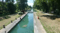
 Difficult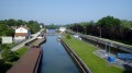
 Easy
Easy