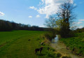
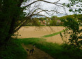
Diant circular route via Blennes

A circular walk following theGRP® “Tour de l’Orvanne”, crossing from the right bank to the left bank from Blennes. This 9.4 km walk can be extended by adding the “Blennes – Vallery” walk (approx. 10 km). We pass the start of the other walk.

Details

525956
Creation:
Last update:
Last review:
  • Walking
    Activity: Walking
  • ↔
    Distance: 5.73 mi
  • ◔
    Average duration: 2h 45 
  • ▲
    Difficulty: Easy

  • ⚐
    Back to start: Yes
  • ↗
    Ascent: + 135 ft
  • ↘
    Descent: - 135 ft

  • ▲
    Highest point: 417 ft
  • ▼
    Lowest point: 315 ft
  • ⚐ Country: France
  • ⚐ City: Diant (77940)
  • ⚑
    Start/End: N 48.281928° / E 2.991899°
  • Hour-by-hour weather

Photos

Description of the walk

The walk starts at the car park by the church in Diant.

(S/E) Take the D92 eastwards (yellow and red and yellow signposts)

(1) At the crossroads by the town hall, carry on straight ahead. At the fork, turn right towards Bonval – Villethierry. Then take the first path on the right.

(2) On reaching Cornoy, turn right onto the road, then immediately left.

(3) As you reach Launoy, the tarmac gives way to a track; carry on straight ahead. Follow the Orvanne valley and ignore a few side tracks.

(4) At Blennes, turn right, pass the church car park and turn right again onto the D145

(5) On the D219, cross the road, turn right and immediately take the small lane on the left.

(6) Take the path opposite, to the left of the school playground. Ignore a path coming from the left and, at the next junction, carry straight on.

(7) In Launoy, take the road on the right, then the first road on the left.

(8) In Épigny, carry on along the path opposite. Head north-west and ignore a turn-off on the right.

(9) At the four-way junction, turn right onto the D219b.

(10) Follow the road to the right and then immediately take the road on the left. Carry on straight ahead until you reach the church car park (S/E).

Waypoints

  1. S/E : mi 0 - alt. 338 ft - Diant Church
  2. 1 : mi 0.3 - alt. 358 ft - Turn right towards Villethierry
  3. 2 : mi 1.25 - alt. 354 ft - Cornoy
  4. 3 : mi 1.63 - alt. 331 ft - Launoy
  5. 4 : mi 2.6 - alt. 377 ft - Blennes, turn right towards the church car park
  6. 5 : mi 2.92 - alt. 351 ft - Junction with the D219
  7. 6 : mi 3.15 - alt. 354 ft - Rue des Écoles
  8. 7 : mi 4.01 - alt. 354 ft - Launoy
  9. 8 : mi 4.49 - alt. 361 ft - Épigny
  10. 9 : mi 5.07 - alt. 364 ft - Crossroads with four paths
  11. 10 : mi 5.31 - alt. 325 ft - Turn right and then immediately left towards the - Orvanne (rivière)
  12. S/E : mi 5.73 - alt. 338 ft - Diant Church

Reviews and comments

3.8 / 5
Based on 4 reviews

Reliability of the description
4 / 5
Ease of following the route
4.3 / 5
Route interest
3.3 / 5
SundarR
SundarR

Overall rating : 4.7 / 5

Date of your route : Apr 20, 2021
Reliability of the description : ★★★★★ Very good
Ease of following the route : ★★★★★ Very good
Route interest : ★★★★☆ Good
Very busy route : No

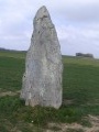
It’s a real shame I forgot to suggest a detour to the Pierre aux Couteaux. It’s just after the junction (stage 1), on the left (the menhir is 4 metres high, so you can’t miss it).

Machine-translated

papeto
papeto

Overall rating : 4.7 / 5

Date of your route : Dec 07, 2020
Reliability of the description : ★★★★★ Very good
Ease of following the route : ★★★★★ Very good
Route interest : ★★★★☆ Good
Very busy route : No

I know this region well and often go hiking there, including on this route, which is a fine example of a walk through the Gâtinais bocage, both in terms of the scenery and the heritage – churches, castles and villages.

Machine-translated

pb77
pb77

Overall rating : 4.7 / 5

Date of your route : Apr 14, 2019
Reliability of the description : ★★★★★ Very good
Ease of following the route : ★★★★★ Very good
Route interest : ★★★★☆ Good

As you leave Diant, don’t miss a visit to ‘La Pierre aux Couteaux’, a 4.20-metre-high menhir.

Machine-translated

henri57
henri57 ★

Hello,

Thank you for taking the time to give your feedback.

By ‘Route on map’, we mean assessing whether the route as shown on the map corresponds to the actual terrain.

Did the description and the route cause any problems? If so, how can this be resolved? Could you suggest some solutions?

See you soon

Machine-translated

lacombe_herve
lacombe_herve

Overall rating : 1.3 / 5

Date of your route : Feb 04, 2019
Reliability of the description : ★☆☆☆☆ Very disappointing
Ease of following the route : ★★☆☆☆ Disappointing
Route interest : ★☆☆☆☆ Very disappointing

Nothing of interest, nothing to discover, as it’s always just in the middle of the plain, surrounded by fields. A monotonous route that quickly becomes tedious.

Machine-translated

Other walks in the area

For more walks, use our search engine .

The GPS track and description are the property of this route's author. Please do not copy them without permission.