


 Country:
 City:
City:


The route starts from the car park behind the Collegiate Church of Montereau, on Rue de la Tannerie.
(S/E) Go round the collegiate church on the right, then turn right and cross the bridge over the River Yonne.
(1) At the foot of the equestrian statue of Napoleon, turn right. Take the first right onto Rue des Pâtures.
(2) At the end, first turn right then left to join the Yonne towpath. Follow this path for a long way, keeping the river on your right. Pass under a road bridge, then under a railway bridge.
3) Pass the Cannes-Écluse dam and carry on straight ahead.
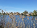
(4) Go straight on, staying on the towpath. Follow the meandering course of the Yonne.
(5) When you come to a ‘dead end’ sign, leave the towpath and take another path on the left. Walk alongside a stretch of water on your left, and ignore the turnings on the right.
(6) At the sign for “Au bord de l’Yonne”, turn sharply right. At the T-junction, turn right and you’ll immediately come to another junction.
(7) Return to the banks of the Yonne, turn sharply left and follow the river on your right.
(8) Pass the Barbey lock and continue along the banks of the Yonne to the next bridge.
(9) Then turn left (do not go under the bridge). Join the D75, follow it to the right and cross the bridge over the Yonne.
(10) At the first junction, turn right. At the next junction, turn left.
(11) As you approach the D75, take a track on the right (Route du Port). Ride past several lakes on your right, and ignore the turn-offs on the left.
(12) At a T-junction, turn left, then immediately right to go round a riding centre.
(13) At the next junction, go straight on. Go round a sand quarry on the right.
(14) At the junction, continue along a tarmac road which, further on, turns left and then right.
(15) At a junction before a level crossing, take a small road on the right (signposted ‘Dead end’). Go round a few bends and pass a campsite on the left. Then follow the railway line on your left until you reach the next bridge.
(16) Turn right to cross the Yonne, then turn right again with the road. At the junction, turn right to rejoin the towpath.
(4) Turn right and follow the river on your left (the same route as on the way there, but in the opposite direction).
(2) At the end, turn right onto Boulevard des Fossés Saint-Maurice. At the junction, turn left onto the D411.
(1) At the foot of the statue of Napoleon, turn left and cross the River Yonne one last time. Go round the collegiate church on the left to return to the car park (S/E).
 Visorando Member
 Moderate
 Tourist office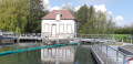
 Difficult
