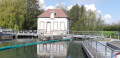
A family walk along the River Yonne from Cannes-Écluses

Circular mountain bike route along the banks of the Yonne, starting from Cannes-Écluses.
Ideal for families as it runs alongside the river, is flat and features numerous picnic tables and benches along the route.
The route alternates between tarmac roads (a minority), gravel roads and dirt tracks.

Details

21037587
Creation:
Last update:
Last review:
  • Mountain biking
    Activity: Mountain biking
  • ↔
    Distance: 20.29 mi
  • ◔
    Duration according to the author: 4 hrs 
  • ▲
    Difficulty: Moderate

  • ⚐
    Back to start: Yes
  • ↗
    Ascent: + 36 ft
  • ↘
    Descent: - 39 ft

  • ▲
    Highest point: 203 ft
  • ▼
    Lowest point: 164 ft
  • ⚐ Country: France
  • ⚐ City: Cannes-Écluse (77130)
  • ⚑
    Start/End: N 48.365686° / E 2.985792°

  • ◶
    Type of surface:
  •  
     
     
     10% Road  70% Byway  20% Path
  • ⇧
    Bike carrying: No
  • ▲
    Difficulty: Moderate
  • Hour-by-hour weather

Photos

Description of the route

Start from the car park on the banks of the Yonne in Cannes-Écluses.

(S/E) From the car park, near the playground, cross the River Yonne, turn right and follow the riverbank.

(1) Before reaching the first lock, turn left onto the dirt track running alongside a field, as access to the riverbank is prohibited at the lock. Join another track and follow it to the right to reach the banks of the Yonne.

(2) Join the towpath by turning left to take the path below.
You will come to Rue Haute (D29).

(3) Follow it to the right and turn right to continue along the banks of the Yonne. You’ll reach the D75.

(4) Carry on straight ahead, continuing to follow the right bank of the Yonne.
After Lock No. 14 at Port-Renard, carry on via the Courlon Bypass until you reach a junction at Lock No. 13 at Vinneuf.

(5) Cross the bridge at the lock and continue to the left, onto the opposite bank. You’ll come to a road.

(6) Follow it to the right for about 400 m, then turn right to follow a wide bend to the left between the River Yonne and a pond. You will reach a junction.

(7) Go up onto the bridge to cross the River Yonne. At La Tuilerie, turn right and reach a crossroads.

(8) Turn right and continue straight on to reach the banks of the Yonne. Keep a safe distance from the railway line. You’ll come to the Route de Misy (D103).

(9) Cross it and carry on straight ahead.

(10) When you reach the tarmac, first turn left then right, leave this road and carry on straight ahead along the path. Walk past a quarry on your right, and after this, in the woodland, turn right (do not go as far as the railway tracks).

(11) When you reach the railway line, turn right and follow it to reach the car park at Cannes-Écluses (S/E).

Waypoints

  1. S/E : mi 0 - alt. 167 ft - Start: Car park – Cannes-Écluses - Yonne (l')
  2. 1 : mi 2.4 - alt. 167 ft - Lock No. 16
  3. 2 : mi 4.16 - alt. 174 ft - Towpath
  4. 3 : mi 6.35 - alt. 177 ft - D29
  5. 4 : mi 6.88 - alt. 180 ft - Misy-sur-Yonne
  6. 5 : mi 9.04 - alt. 203 ft - Lock No. 13
  7. 6 : mi 10.15 - alt. 190 ft - Junction with the D 70
  8. 7 : mi 11.27 - alt. 194 ft - Bridge – D70
  9. 8 : mi 11.81 - alt. 187 ft - Crossroads
  10. 9 : mi 15.18 - alt. 180 ft - D103
  11. 10 : mi 16.12 - alt. 174 ft - Road, left/right
  12. 11 : mi 18.35 - alt. 174 ft - See railway line
  13. S/E : mi 20.29 - alt. 164 ft - Finish – Cannes-Écluses car park

Notes

(4) First opportunity to cross the Yonne. If you wish to shorten the route: turn right onto this road and head straight to (9).

Reviews and comments

4.7 / 5
Based on 2 reviews

Reliability of the description
4.5 / 5
Ease of following the route
4.5 / 5
Route interest
5 / 5
DaAgBa
DaAgBa

Overall rating : 4.3 / 5

Date of your route : Aug 28, 2023
Reliability of the description : ★★★★☆ Good
Ease of following the route : ★★★★☆ Good
Route interest : ★★★★★ Very good
Very busy route : No

Hello
A pleasant and varied route which I really enjoyed thanks to the diverse scenery. I’d recommend this fairly easy route, but it’s best tackled on a mountain bike or hybrid bike – not a road bike – as the paths are sometimes gravelly or stony. The signposting at changes of direction could be improved to be more precise, as there’s sometimes a lack of signs at certain junctions.
The final stretch along the railway line and through the woodland isn’t great, but thankfully it isn’t too long!
Overall, I recommend this route.

Machine-translated

Johnny junior Lévis
Johnny junior Lévis

Overall rating : 5 / 5

Date of your route : Aug 22, 2022
Reliability of the description : ★★★★★ Very good
Ease of following the route : ★★★★★ Very good
Route interest : ★★★★★ Very good
Very busy route : No

Hello

The route is very good apart from the final stretch along the railway line at the edge of the woodland, which is completely unkempt (branches and brambles in the middle of the path – you need to be careful as there are trees that might fall). Otherwise, it’s spot on 👍🏻

Machine-translated

For more walks, use our search engine .

The GPS track and description are the property of this route's author. Please do not copy them without permission.