


Refine your search for walks in Saint-Aignan-sur-Roë
Saint-Aignan-sur-Roë walks


 Saint-Aignan Route and the Caves – Congier – La Rouaudière Circular Routes
 Tourist office
 15.03 mi
 +322 ft
 -315 ft
 7h 10
 Difficult
 Departure from Saint-Aignan-sur-Roë (Mayenne)
This long route will take you through the countryside of southern Mayenne around Saint-Aignan-sur-Roë.
The La Rincerie route
3.26 mi
+20 ft
-20 ft
1h 30
 Easy
Departure from La Selle-Craonnaise (Mayenne)
A short, easy walk suitable for families around the La Rincerie lake. A pair of binoculars might be useful for exploring the birdwatching area (western part of the lake).
Route of the three ponds in Pouancé
 Visorando Member
 5.59 mi
+233 ft
-243 ft
2h 45
Easy
Departure from Pouancé (Maine-et-Loire)
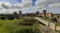
A pleasant route that takes you along paths to discover the pretty countryside of Pouancé, its ponds, its castle and the charming village with its narrow streets and beautiful bourgeois houses. A superb family walk with lovely views.
Route des Poachers, Drouges
 Local authority
 7.30 mi
+200 ft
-174 ft
3h 30
 Moderate
Departure from Drouges (Ille-et-Vilaine)
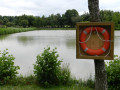
The Guerche Forest is ever-present on this route, whether you follow its southern edge or it closes off the horizon to the north. Beautiful architecture typical of the Pays Guerchais in Drouges and its many villages.
Route des Onze Villages from Rannée
 6.95 mi
+138 ft
-135 ft
3h 20
Moderate
Departure from Rannée (Ille-et-Vilaine)
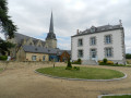
This route consists mainly of dirt tracks that were preserved during land consolidation, allowing you to discover the richness of the built heritage, particularly in the hamlets of La Perrière (17th-century manor house) and La Rinjardière. The southern section also follows the Roman road that linked Angers to Rennes. Magnificent stone bridges bear witness to this rich past.
This route has been awarded the FFRandonnée label.
Route de Craon West
 5.99 mi
+89 ft
-98 ft
2h 50
Easy
Departure from Craon (Mayenne)
The Craon West route will take you through part of the old town centre, offering a lovely view of Craon Castle and its grounds. You’ll also walk alongside the River Oudon and the allotments, which are particularly pleasant in spring. Finally, you’ll enjoy the tranquillity of the former Laval–Renazé railway line, now a lovely greenway.
Martigné-Ferchaud Pond
 6.52 mi
+30 ft
-30 ft
3h 00
Easy
Departure from Martigné-Ferchaud (Ille-et-Vilaine)
A beautiful and very pleasant hike, mostly along a wide, shaded stone path. The trail goes around the pond. Best done in dry weather.
Route Robert d’Arbrissel, Moussé
 6.42 mi
+135 ft
-135 ft
3h 05
Moderate
Departure from Moussé (Ille-et-Vilaine)
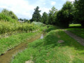
The name of the village comes from the Breton word ‘mouës’, meaning ‘wet place’. The southern part of the village is crossed by the Ruisseau de Drouges, whilst the Ardennes form a natural boundary to the north between Arbrissel and Moussé.
Don’t miss the Romanesque church of Arbrissel (12th century), the altarpiece and the life-size wooden statue of Robert d’Arbrissel, both dating from the 16th century.
Robert d’Arbrissel founded the Abbey of La Roë in 1096 and the Abbey of Fontevrault in 1101; his relics are on display at the monastery of Martigné-Briand in Maine-et-Loire.
This route is certified by the FFRandonnée.
Suitable for both walking and cycling.
Between the pond and the forest in Martigné-Ferchaud
 11.77 mi
+272 ft
-256 ft
5h 40
Moderate
Departure from Martigné-Ferchaud (Ille-et-Vilaine)
A very pleasant walk between forest and lake with no difficulty except, for some, the distance. After enjoying the tranquillity of the Araize Forest at the start, you will then experience the calm and serenity of the Étang de la Forge lake.
Cuillé Route
8.00 mi
+233 ft
-236 ft
3h 55
Moderate
Departure from Cuillé (Mayenne)
This new route, created in 2018 and taking approximately 3 hours 40 minutes to complete, will take you on a tour of the countryside of southern Mayenne in Cuillé.
Eastern Craon Route
 4.88 mi
+128 ft
-125 ft
2h 20
Easy
Departure from Craon (Mayenne)
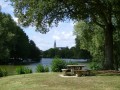
A short circular route that takes you along the paths through the Craon countryside. You’ll also follow the old railway line, now the Laval–Renazé Greenway.
At the Mûrier lake (the start and finish of the route), there are a few benches and picnic tables. There are also plenty of children’s play equipment and water play facilities (in July and August).
Route de Craon South
5.70 mi
+184 ft
-184 ft
2h 45
Easy
Departure from Craon (Mayenne)
The Craon South route, starting from the equestrian centre, will take you along the old railway line, now converted into a greenway. You’ll also ride alongside the River Oudon and discover the countryside of the Craon region, as well as the beautiful La Touche racecourse.
Combrée Forest and Lake
7.23 mi
+236 ft
-233 ft
3h 30
Moderate
Departure from Combrée (Maine-et-Loire)
Discover Combrée’s heritage: Saint-Joseph Chapel, Saint-Pierre Church, Château des Hommeaux, Château du Plessis, Combrée secondary school, not to mention the Ombrée Forest and the leisure centre. The route follows tarmac and gravel paths, including a ‘Voie Verte’ cycle path and a lovely sunken lane. Suitable for all seasons.
The lake by the umbrella pines in Combrée
5.60 mi
+177 ft
-164 ft
2h 45
Easy
Departure from Combrée (Maine-et-Loire)
Hike accessible all year round. Pleasant paths in the countryside with views of the forest, where you can see deer roaming. Pass through an avenue of umbrella pines, unique in the region.
Méral Route
6.80 mi
+108 ft
-115 ft
3h 15
Easy
Departure from Méral (Mayenne)
This family-friendly walk, lasting just over 3 hours, will take you on a tour of the village of Méral and its surroundings.
La route de la Crossonière in Brielles
 10.18 mi
+331 ft
-308 ft
5h 00
Moderate
Departure from Brielles (Ille-et-Vilaine)
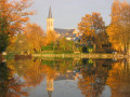
Although the high-speed rail line (LGV) runs through Brielles from east to west, the town, together with the neighbouring commune of Le Pertre, offers a network of beautiful trails.Suitable for both walking and mountain biking.
The Salé to Brielles route
7.11 mi
+131 ft
-105 ft
3h 25
Moderate
Departure from Brielles (Ille-et-Vilaine)
Centred around its church and the square surrounding it, the village of Brielles has largely retained the layout it had in 1810, the year the so-called ‘Napoleonic’ land register was drawn up.
Also worth mentioning in the commune is the breeding of Kobe cattle (a Japanese breed), whose meat is highly prized by gourmets.
This route can be tackled on foot or by mountain bike.
Route in Cossé-le-Vivien
9.62 mi
+233 ft
-256 ft
4h 40
Moderate
Departure from Cossé-le-Vivien (Mayenne)
This lovely walk in Cossé-le-Vivien is all about water: you’ll discover the Cossé wetland as well as a small pond where you can stop for a pleasant break.
The Cinq Chemins route in Argentré-du-Plessis
3.57 mi
+164 ft
-164 ft
1h 45
Easy
Departure from Argentré-du-Plessis (Ille-et-Vilaine)
A short circular route through the countryside between Argentré-du-Plessis and Le Pertre.
La Vigne route
 8.96 mi
+269 ft
-262 ft
4h 20
Moderate
Departure from Bais (Ille-et-Vilaine)
Unfortunately, they have since disappeared, but in the 17th century, the region’s vineyards produced a wine of some renown. Madame de Sévigné, in fact, mentions it in several of her letters. Today, the only traces that remain are the names of local hamlets: Les Bourgeons, La Vigne, etc.
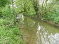
Over the final few kilometres, the route runs alongside the Quincampoix, a small river teeming with wildlife.
Vineyard Route No. 57 on the RANDO’ maps of the Vitré Community
Route du Bois de Clermont, Le Pertre
 7.66 mi
+390 ft
-374 ft
3h 50
Moderate
Departure from Le Pertre (Ille-et-Vilaine)
Horses reign supreme in Le Pertre: there are numerous stud farms specialising in draught, riding and racehorses, and the racecourse, situated at the foot of the village which has been perched on the hill since the 11th century, is emblematic of the area.
Le Pertre lies on the border between Maine and Brittany, so much so that the young children from Saint-Cyr-le-Gravelais in Maine walk along a pleasant path to get to the school in Le Pertre.
FFRP-certified.
Suitable for both walking and mountain biking.
Route from Saint-Joseph Chapel to Le Pertre
 2.34 mi
+85 ft
-89 ft
1h 10
Easy
Departure from Le Pertre (Ille-et-Vilaine)
As you wander along the shaded dirt tracks, you’ll come across numerous wooden or stone crosses and, always open for visitors to rest, the charming Saint-Joseph Chapel (dating from 1870) with its surprising bestiary: lions, deer, sheep… situated next to the village of Les Lardries, a former hospital for plague victims.
The Vau Follet to Le Pertre route
 5.40 mi
+217 ft
-217 ft
2h 40
Easy
Departure from Le Pertre (Ille-et-Vilaine)
A welcoming destination on the edge of the Mayenne region and a true paradise for walkers, the village and countryside of Le Pertre offer stunning panoramic views: from the viewing platform behind the church, you can see 39 church spires.
Towards the ponds of the Saint-Blaise Leisure Park
 7.04 mi
+453 ft
-476 ft
3h 40
Easy
Departure from Nyoiseau (Maine-et-Loire)
A lovely, very pleasant walk that goes round the Saint-Blaise ponds and tells the story of the miners’ lives.
Passing by the old lime kilns at Erbray
 6.47 mi
+144 ft
-144 ft
3h 05
Easy
Departure from Erbray (Loire-Atlantique)
A pleasant walk in the countryside that takes us past old lime kilns.
The Chestnut Tree Route in Moulins
 8.38 mi
+213 ft
-210 ft
4h 00
Moderate
Departure from Moulins (Ille-et-Vilaine) (Ille-et-Vilaine)
Enjoy the charm of the church square in Moulins, unspoilt by any overhead cables or aerials. This square served as the setting for the television series directed by Hervé Baslé in 2002: *Le Champ Dolent*.
Can be enjoyed on foot or by mountain bike.