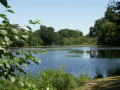
Route from Saint-Joseph Chapel to Le Pertre

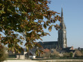
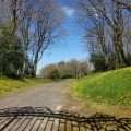
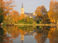
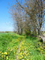
As you wander along the shaded dirt tracks, you’ll come across numerous wooden or stone crosses and, always open for visitors to rest, the charming Saint-Joseph Chapel (dating from 1870) with its surprising bestiary: lions, deer, sheep… situated next to the village of Les Lardries, a former hospital for plague victims.

Details

n°30325640
Creation:
Last update:
Last review:
  • Walking
    Activity: Walking
  • ↔
    Distance: 2.34 mi
  • ◔
    Average duration: 1h 10 
  • ▲
    Difficulty: Easy

  • ⚐
    Back to start: Yes
  • ↗
    Ascent: + 85 ft
  • ↘
    Descent: - 89 ft

  • ▲
    Highest point: 591 ft
  • ▼
    Lowest point: 482 ft
  • ⚐ Country: France
  • ⚐ City: Le Pertre (35370)
  • ⚑
    Start/End: N 48.034641° / W 1.039983°
  • ❏
    IGN map(s): Ref. 1419SB
  • Hour-by-hour weather

Photos

Description of the walk

Car park by the lake, Rue du Calvaire.

YellowPR® signposting supplemented by green arrows marked with the number 34.

(S/E) From the car park, head towards the football pitch and carry on straight ahead. Just before the bend, turn left into the housing estate, then immediately turn right onto a small path. Carry on straight ahead until you reach the road.

(1) Cross over and take the path opposite, which leads onto the D43. Cross the road and take the road opposite.

(2) Pass Saint-Joseph Chapel and carry on straight ahead along a path which then turns right and then left. Pass the hamlet of Drubles and carry on for 250 m.

(3) Take the first left, pass the farm and then turn left. Follow the track straight on until you reach the hamlet of La Croix de Bois.

(4) Follow the road to the right and carry on until you reach the crossroads by the campsite. Then turn left onto Rue du Chardonneret, then turn right onto Rue Théophile Pare and follow the road to return to the starting car park (S/E).

Waypoints

  1. S/E : mi 0 - alt. 568 ft - Car park by the lake
  2. 1 : mi 0.64 - alt. 525 ft - Crossing the Route des Martyrs - Seiche (rivière)
  3. 2 : mi 1.05 - alt. 561 ft - Saint Joseph’s Chapel
  4. 3 : mi 1.32 - alt. 538 ft - Les Mortiers
  5. 4 : mi 1.97 - alt. 538 ft - La Croix de Bois
  6. S/E : mi 2.34 - alt. 568 ft - Car park by the lake

Notes

Signposted route running anti-clockwise.
Suitable for both walking and cycling.

Car park, picnic area, drinking water point, toilets and swimming area near the starting point.

Worth a visit

Always be cautious and plan ahead when you're outdoors. Visorando and the author of this route cannot be held responsible for any accidents occurring on this route.

The GR® and PR® markings are the intellectual property of the Fédération Française de Randonnée Pédestre.

Reviews and comments

5 / 5
Based on 1 review

Reliability of the description
5 / 5
Ease of following the route
5 / 5
Route interest
5 / 5
User 26782238

Overall rating : 5 / 5

Date of your route : Jul 28, 2025
Reliability of the description : ★★★★★ Very good
Ease of following the route : ★★★★★ Very good
Route interest : ★★★★★ Very good
Very busy route : No

A lovely, bucolic hour-long walk. I highly recommend it.

Machine-translated

Other walks in the area

For more walks, use our search engine .

The GPS track and description are the property of this route's author. Please do not copy them without permission.