


 Country:
 City:


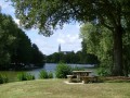
(S/E) From the ‘Lotissement du Pin’ car park on Chemin de Romé, head towards the far end of the car park to reach the lake. Walk along its left-hand side to reach the D25. Turn right and head towards the centre of Craon. At the roundabout, turn left and enjoy the view of Craon Castle. Opposite the château, turn right onto Rue de Zikisso, then turn left onto Impasse de la Liberté. At the end of the street, turn right into the car park, then continue straight on to pass under the archway and emerge onto Rue de la Libération. Turn left and walk 50 metres to reach a pedestrian crossing.
(1) Cross the pedestrian crossing and take Rue du Vieux Pont. Cross the bridge, then turn right onto Rue de l’Éperon. Continue straight on for about until you reach Rue de la Gauvernerie (on the left).
(2) Turn right onto the path that runs between numbers 14 and 16. Head towards the banks of the River Oudon, then turn left to walk alongside it. Walk to the footbridge, cross the river, then turn left to pass under the ring road bridge. Walk back up to road level, turn right to cross the bridge, then turn right again to reach the bank of the Oudon. Follow the Oudon to the next bridge.
(3) Take the path that leads uphill to join the Voie Verte and turn right onto it. Continue along the Voie Verte and, about 500m after the 4th junction, a path branches off to the right.
(4) Take this path on the right (not shown on the map), then continue along the field and through the sunken lane for about until you reach a junction with another path. There, turn left onto a small tarmac road, then carry on straight ahead until you reach the junction with the D771.
(5) Cross the D771 (caution: very busy road; vehicles travel at high speed) and take the path opposite. Right at the start of the path, turn right onto the green path that runs alongside the road (caution: path not shown on the map) and continue until you reach the Naturea company. Just under 200 metres further on, the path branches off to the left. Follow it and continue along this path, leaving the shopping centre on your right. You will then reach a row of trees, where the green path crosses the Chemin des Cartries (tarmac).
(6) Cross the Chemin des Cartries and take the path opposite. Follow this path (please note: this is not shown on the map) until you come out onto the D111.
(7) Cross the D11 (take care) and head towards Le Cruchardière and La Mercerie. Walk for about 650 metres. The road curves to the left towards La Mercerie, and a path branches off opposite at the bend. Take this path and follow it until you come out onto a small tarmac road at a place called La Glanerie. Carry on straight ahead for 450m until you reach the junction with the D25.
(8) Turn right onto the D25 and keep well to the hard shoulder (be careful: the D25 is very busy and vehicles travel at high speed). Follow the D25 for 400 metres.
(9) Then turn right just after the wayside cross onto the tree-lined avenue of La Galtière. Continue straight on to reach the entrance to the château. Turn left and take the path that runs between the boundary wall and the houses in the housing estate until you come out onto a small gravel road.
(10) Turn left and head back to the car park where you started (S/E).

 Tourist office

 Moderate

