


Refine your search for walks in Roffiac
Roffiac walks
 The Ramparts Trail and the old town of Saint-Flour
 Visorando Member
 2.05 mi
 +197 ft
 -213 ft
 1h 05
1h 05
 Easy
Easy
 Departure from Saint-Flour (Cantal)
A walk that allows you to explore the old town of Saint-Flour, perched on its volcanic rocky outcrop, which forms a natural rampart.
Short tour of the Planèze de Saint-Flour in three days
37.92 mi
+4,419 ft
-4,446 ft
3 days
 Difficult
Departure from Saint-Flour (Cantal)
Difficult
Departure from Saint-Flour (Cantal)
Starting from Saint-Flour, this tour of the northern part of the Planèze de Saint-Flour allows you to appreciate the diversity of the landscapes of this high basalt plateau in just three days of walking.
The stages in Paulhac and Valuéjols offer accommodation in stopover lodges.
The route follows part of a variant of the GR® de Pays de Saint-Flour and part of the GR®4.
Saint-Flour - Paulhac
15.30 mi
+1,460 ft
-745 ft
8h 20
Difficult
Departure from Saint-Flour (Cantal)
This is the first of three stages of the Saint-Flour Planèze tour. It is the longest stage, passing through several small villages typical of the Planèze with their bread ovens, which provide welcome shelter for a short break in rainy weather. The very quiet paths and small roads run alongside meadows grazed by numerous herds of cattle in season.
Upper town of Saint-Flour via the Montée des Chèvres
2.23 mi
+354 ft
-354 ft
1h 20
Easy
Departure from Saint-Flour (Cantal)
Passing through Auvergne? Take the opportunity to enjoy a pleasant break in Saint-Flour. From the banks of the Anver, climb up to discover the upper town via the Chemin des Chèvres and don't forget to stock up on cheese!
Valuéjols - Saint-Flour
13.01 mi
+974 ft
-1,608 ft
6h 50
Difficult
Departure from Valuéjols (Cantal)
Third and final stage of the Planèze tour. Entirely on the GR®4. This stage crosses varied environments and allows you to discover some very interesting, albeit little-known, sites. In particular, the route runs alongside the Narse de Nouvialle (a remarkable wetland) and passes close to the Château du Sailhant and the Babory waterfall.
Les Fonds de la Salesse
 3.87 mi
+262 ft
-240 ft
2h 00
Easy
Departure from Paulhac (Cantal)
3.87 mi
+262 ft
-240 ft
2h 00
Easy
Departure from Paulhac (Cantal)
Discovery hike around Paulhac, very easy and ideal for those new to mountain biking, especially children. It is also accessible to pedestrians, horses and even people with all-terrain pushchairs (3 wheels).
The Mercou Woods
 6.79 mi
+558 ft
-574 ft
3h 35
6.79 mi
+558 ft
-574 ft
3h 35
 Moderate
Departure from Paulhac (Cantal)
Moderate
Departure from Paulhac (Cantal)
Circuit no. 1 in the guidebook of walking, horse riding and mountain biking routes in the commune of Paulhac.
Paulhac - Valuéjols
9.60 mi
+2,005 ft
-1,916 ft
6h 10
Moderate
Departure from Paulhac (Cantal)
Second stage of the Saint-Flour Planèze tour. This is the shortest and highest stage. It takes place in the foothills of the Plomb du Cantal and crosses the wildest parts of the circuit.
Lavergne and Belinay Woods
 8.21 mi
+1,086 ft
-1,086 ft
4h 45
Moderate
Departure from Paulhac (Cantal)
8.21 mi
+1,086 ft
-1,086 ft
4h 45
Moderate
Departure from Paulhac (Cantal)
An encounter with nature in the heart of the Monts du Cantal, with a complete change of scenery guaranteed.
The historical heritage of Neussargues en Pinatelle
9.06 mi
+1,056 ft
-1,033 ft
5h 05
Moderate
Departure from Chalinargues (Cantal)
Discover the history of this part of the Cézalier through the archaeological and historical remains that dot this route. Prehistoric rock shelters, tumuli, Merovingian sarcophagi, medieval forest trails, 12th-century churches, a monumental 15th-century cross, a communal oven, a wash house and beautiful old houses.
Chapelle Saint-Antoine via Rocher de Bonnevie, starting from Murat
 5.16 mi
+1,148 ft
-1,138 ft
3h 20
Easy
Departure from Murat (Cantal) (Cantal)
5.16 mi
+1,148 ft
-1,138 ft
3h 20
Easy
Departure from Murat (Cantal) (Cantal)
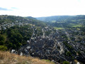
The route passes through the old town of Murat and then two religious buildings on their respective promontories. These offer views of the town of Murat and the Cantal mountains.
The Church of Bredons
4.75 mi
+938 ft
-935 ft
3h 00
Easy
Departure from Murat (Cantal) (Cantal)
Walk in the hills above Murat. Beautiful views over the Alagnon and Benet valleys. Beautiful old houses in the village of Bredons and the remarkable site of Bredons Church, an 11th-century Cluniac site.
Murat – Prat de Bouc
 10.24 mi
+2,474 ft
-899 ft
6h 50
Difficult
Departure from Murat (Cantal) (Cantal)
10.24 mi
+2,474 ft
-899 ft
6h 50
Difficult
Departure from Murat (Cantal) (Cantal)
First stage ofthe GR® 400 walking clockwise (the official guidebook follows the opposite direction).
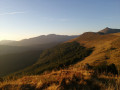
The landscape gradually takes on its typical Cantalian character, particularly in the Cirque de Chamalière and, of course, beneath the Plomb du Cantal at Prat de Bouc.
Circuit of the Cantalien volcano via the GR®400, clockwise
 88.49 mi
+21,634 ft
-21,604 ft
8 days
Difficult
Departure from Murat (Cantal) (Cantal)
88.49 mi
+21,634 ft
-21,604 ft
8 days
Difficult
Departure from Murat (Cantal) (Cantal)
This 8-day route covers the entireGR®®400, in a clockwise direction (the FFRP guidebook describes it in the opposite direction).
The Grandval Dam via La Mourache
 5.76 mi
+1,168 ft
-1,184 ft
3h 40
Moderate
Departure from Fridefont (Cantal)
5.76 mi
+1,168 ft
-1,184 ft
3h 40
Moderate
Departure from Fridefont (Cantal)
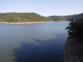
Over the centuries, the Truyère has carved out deep gorges which, with the rising water levels caused by the construction of the Grandval and Lanau dams, have given way to a natural landscape of surprising and contrasting beauty: islands and peninsulas, cirques with distant shores, mysterious meanders, narrow gorges opening onto vast expanses of water, a wooded valley… Following the PR la Mourache route, the walk offers magnificent views from the embankment supporting the Alleuze road.
Walking the route in the opposite direction offers more shade, but do keep an eye out for the signposting – which, to be honest, is rather sparse.
The Recoux Calvary and the Wobbly Rock at La Roche
 8.14 mi
+712 ft
-728 ft
4h 20
Moderate
Departure from Faverolles (Cantal) (Cantal)
8.14 mi
+712 ft
-728 ft
4h 20
Moderate
Departure from Faverolles (Cantal) (Cantal)
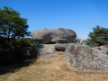
From Montchanson, with a rucksack on your back – in place of the schoolbag that children of yesteryear used to carry on their backs to get to school in one of the villages of the Arcomie Valley – let’s follow in their footsteps to discover the hamlets and local heritage. On the way, don’t forget to climb up to the Trois Croix du Bloc du Recoux for an exceptional view, before trying your hand at making the Pierre Branlante de la Roche wobble, north of Saint-Marc.
The Valadour Footbridge in Chaliers
 6.19 mi
+1,007 ft
-981 ft
3h 45
Moderate
Departure from Loubaresse (Cantal) (Cantal)
6.19 mi
+1,007 ft
-981 ft
3h 45
Moderate
Departure from Loubaresse (Cantal) (Cantal)
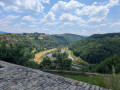
Starting from Loubaresse, near an exit from the A75 motorway, this route follows the GR® de Pays circular Boucle de la Truyère and a variant that "turns" around the Truyère river to the village of Chaliers, which is well worth taking the time to explore. The route takes small local roads on both the left and right banks of this river with its wild gorges, crossing it twice via footbridges at Valadour and Terran.
The actual duration of the route is 4 hours and 40 minutes (GPS watch data), including a short stop in Chaliers.
The Loup trail starting from Fortuniès
 9.12 mi
+751 ft
-748 ft
4h 50
Moderate
Departure from Dienne (Cantal)
9.12 mi
+751 ft
-748 ft
4h 50
Moderate
Departure from Dienne (Cantal)
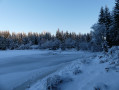
This route takes you to Lac du Pêcher, La Roche du Pic, the Frau de Collanges peat bog and Lac de Sauvages. I encountered a wolf in this area in the winter of 2017. Then I forgot about it until early 2025. It then reappeared, attacking livestock multiple times between winter and summer. I tracked it down and know its favourite spots. This does not guarantee that you will see it, but it may increase your chances of an encounter.