Murat – Prat de Bouc

First stage ofthe GR® 400 walking clockwise (the official guidebook follows the opposite direction).
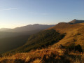
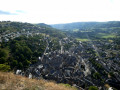
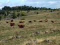
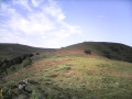
The landscape gradually takes on its typical Cantalian character, particularly in the Cirque de Chamalière and, of course, beneath the Plomb du Cantal at Prat de Bouc.

This walk is part of a multi-day hike: Circuit of the Cantalien volcano via the GR®400, clockwise

Details

n°2229025
Creation:
Last update:
Last review:
  • Walking
    Activity: Walking
  • ↔
    Distance: 10.24 mi
  • ◔
    Average duration: 6h 50 
  • ▲
    Difficulty: Difficult

  • ⚐
    Back to start: No
  • ↗
    Ascent: + 2,474 ft
  • ↘
    Descent: - 899 ft

  • ▲
    Highest point: 4,590 ft
  • ▼
    Lowest point: 2,884 ft

Photos

Description of the walk

(S) Start from Murat station. Head up towards the bridge over the railway line, then take the street leading down to the right.

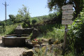
(1) After the bridge over the river, take the shaded path on the right which climbs steeply towards the Romanesque chapel at Bredons. A shortcut on the left leads directly there. Otherwise, the path joins the small tarmac road a little further on past the church. Walk through the village and you’ll arrive near a pretty fountain.

(2) Opposite and to the right of this fountain, take the path that climbs slightly. This path continues more or less level along the hillside and joins the D39 road.

(3) Head down the road to the right, then at the next junction, turn left. TheGR® begins a steep climb through woodland and emerges onto a more open plateau, then a wide track near an old quarry.

(4) Follow this track to the left and, a little further on, turn left until you reach the edge of the woods.

(5) Leave the track by taking a path downhill to the left, heading towards the hamlet of La Molède.

(6) Turn right and you’ll come to a fountain. Continue to the right and, at the next crossroads, take the path on the left. Walk uphill along the edge of the fields to the Col de la Molède.

(7) Turn left, then keep left onto the track which continues along the hillside. Climb gradually, then begin a gentle descent to reach another crossroads at a hairpin bend.

(8) Keep to the left on theGR® to continue down a steeper descent. You’ll soon come to a three-way junction at the bottom of the descent.

(9) At this point, take care as theGR® heads off to the right. Head back up towards the hamlet of Raveyrol, reaching the hamlet and the junction of theGR® 400 and 4.

(10) Turn right along the hillside. Then head steeply uphill alongside the Lagnon (waterfall) and join the D39 road. Follow it to the right with care to reach the Col de Prat de Bouc, today’s stage (E).

Waypoints

  1. S : mi 0 - alt. 2,959 ft - Murat railway station
  2. 1 : mi 0.44 - alt. 2,884 ft - Path towards Bredons. Bridge over the - Alagnon (rivière)
  3. 2 : mi 0.93 - alt. 3,133 ft - Bredons fountain
  4. 3 : mi 2.35 - alt. 3,245 ft - D39 junction
  5. 4 : mi 3.64 - alt. 3,858 ft - Former quarry
  6. 5 : mi 4.69 - alt. 4,183 ft - Junction towards Molède
  7. 6 : mi 5.26 - alt. 4,032 ft - Molède
  8. 7 : mi 5.75 - alt. 4,370 ft - Col de la Molède (1330m)
  9. 8 : mi 7.55 - alt. 4,446 ft - Crossroads with a hairpin bend
  10. 9 : mi 8.19 - alt. 4,108 ft - Junction in the woods
  11. 10 : mi 9.02 - alt. 4,295 ft - Raveyrol
  12. E : mi 10.24 - alt. 4,564 ft - Col de Prat de Bouc

Notes

Park at Murat railway station.
Water available at Bredons and Raveyrol.
A fairly shaded route, except on the plateau before La Molède.
There are no explicitGR®400signposts, but there are signs indicating either a general direction or the next destination, along with the white and red markings, of course.
Take care with these markings, as they are not always very visible (for example, at (8) where it is very easy to carry on straight ahead)
(7) At the Col de la Molède, there is a picnic table.
(E) A stopover lodge at Prat de Bouc, which can provide a packed lunch for the following day.

Worth a visit

(2) Bredons Chapel (unfortunately usually closed).
(E) Stopover lodge

Always be cautious and plan ahead when you're outdoors. Visorando and the author of this route cannot be held responsible for any accidents occurring on this route.

The GR® and PR® markings are the intellectual property of the Fédération Française de Randonnée Pédestre.

Reviews and comments

4 / 5
Based on 3 reviews

Reliability of the description
4.3 / 5
Ease of following the route
4 / 5
Route interest
3.7 / 5
Jacqed
Jacqed

Overall rating : 4.7 / 5

Date of your route : Jun 18, 2026
Reliability of the description : ★★★★★ Very good
Ease of following the route : ★★★★★ Very good
Route interest : ★★★★☆ Good
Very busy route : No

Stage 1 of our GR 400 Tour of the Cantal Volcano.
A pleasant route, mostly through woodland, which is a real bonus in hot or wet weather.
Signposting is excellent throughout the route.
The guidebook is complicated and not very easy to read, especially if you’re doing the full circular circuit and particularly if you’re doing it clockwise. We never actually used it at all during the whole circular loop.
The estimated time is overestimated; it took us 5 hours 15 minutes (excluding stops), at a leisurely pace, given the heat.
The ‘DIFFICULT’ rating is exaggerated, as there are no difficulties on the route, which is of limited length and elevation gain.
The ‘MEDIUM’ rating would be more appropriate.
The PRAT DE BOUC site is very beautiful, at the foot of the Plomb de Cantal.

Machine-translated

danielrollet
danielrollet

Overall rating : 3.7 / 5

Date of your route : Jun 14, 2021
Reliability of the description : ★★★★☆ Good
Ease of following the route : ★★★☆☆ Average
Route interest : ★★★★☆ Good
Very busy route : No

A pleasant warm-up before the climb up to the Plomb du Cantal
The Bredons Chapel is inaccessible due to building works
There’s a problem with the route to reach point 4 (Les Cunes); the signposting doesn’t match the IGN route
Daniel Rollet

Machine-translated

bernardgemenos
bernardgemenos

Overall rating : 3.7 / 5

Date of your route : Jun 15, 2021
Reliability of the description : ★★★★☆ Good
Ease of following the route : ★★★★☆ Good
Route interest : ★★★☆☆ Average
Very busy route : No

A short connecting walk taken in the opposite direction to that described
A pleasant walk through the woods, with time on arrival to visit Murat

Machine-translated

Other walks in the area

For more walks, use our search engine .

The GPS track and description are the property of this route's author. Please do not copy them without permission.