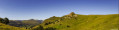
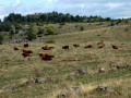
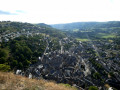
The Loup trail starting from Fortuniès

This route takes you to Lac du Pêcher, La Roche du Pic, the Frau de Collanges peat bog and Lac de Sauvages. I encountered a wolf in this area in the winter of 2017. Then I forgot about it until early 2025. It then reappeared, attacking livestock multiple times between winter and summer. I tracked it down and know its favourite spots. This does not guarantee that you will see it, but it may increase your chances of an encounter.

Details

86422479
Creation:
Last update:
Last review:
  • Walking
    Activity: Walking
  • ↔
    Distance: 9.12 mi
  • ◔
    Average duration: 4h 50 
  • ▲
    Difficulty: Moderate

  • ⚐
    Back to start: Yes
  • ↗
    Ascent: + 751 ft
  • ↘
    Descent: - 748 ft

  • ▲
    Highest point: 4,137 ft
  • ▼
    Lowest point: 3,688 ft

Photos

Description of the walk

Park on the right-hand side of the D31 towards Le Jolan, just outside the village of Fortuniès, at the edge of a track marked "Lac du Pêcher"

(S/E). After the metal barrier to the left of the farm buildings, take the pleasant path towards Lac du Pêcher.

(1) After a while, turn right for a round trip to the bird watching site (original architecture), near the Chantelouve stream. Then retrace your steps, and through a metal barrier, join the tarmac road, then walk along the left bank of Lac du Pêcher for a few hundred metres.

(2) Just before the dyke, take a path on your left to enter the forest. Pass by the foot of an imposing deer observation post. Shortly afterwards, turn right and go down the path to cross the Ruisseau de Fons Nostre. After crossing the tarmac road, take a new path at the Font des Chazeaux (watering hole). Walk through the forest for a while (avoid the detour through the village of La Boissonnière) until you cross the D23 again. Follow it to the right until you reach a car park on the other side of the road. At the far end of the car park, on the right, take a path up to the Roche du Pic

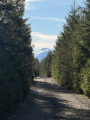
(3). From Roche du Pic and its orientation marker (where I encountered the wolf in winter 2017), follow a path downhill. At the crossroads below, take the path on the right to rejoin the D23 road, near Lac Grand (bog). Follow this road for about two kilometres, then leave it at a new car park on the left-hand side of the road, with a hunters' hut From this car park, take the "Chemin du Frau" opposite. After a short stretch through the woods, you will come to a wide, very long track, which you should take on the left.

(4) This will take you to the edge of the woods, to the peat bogs and Lac du Frau de Collanges.

(5) Just before you reach the lake, take a wide track on the left, which will take you to the dyke in a very unspoilt area. Take advantage of this break to enjoy your snack and let yourself be lulled by the magic of the place. Return to the junction with the main track, at the edge of the lake, and continue for a few more metres before a crossroads on the right.

(6) This new 4x4 track descends towards the Santoire valley. Leave it quickly as soon as you see the Péjouzou farms on your right . Go through a barbed wire fence and follow a very rough path through the meadows to find a tarmac road in front of the farm. This will take you uphill to the Sauvages farm and then to the lake's dyke.

(7) Then pass in front of the lake refreshment bar and quickly turn right onto a path that is tarmacked at the start. This path starts to the left of large metal gates and then crosses meadows, but it is very poorly marked at the start. It becomes clearer as you climb a little higher. You will need to cross two fences in succession. The village of Fortuniès will be visible as soon as you pass the second fence. This small path will lead you downhill to the junction with the D23 at the entrance to Fortuniès (S/E).

Waypoints

  1. S/E : mi 0 - alt. 3,773 ft - Parking at Fortunies
  2. 1 : mi 0.93 - alt. 3,780 ft - Round trip to the bird observatory
  3. 2 : mi 1.45 - alt. 3,753 ft - Departure into the forest towards La Boissonnière
  4. 3 : mi 3.67 - alt. 4,121 ft - Departure from La Roche du Pic
  5. 4 : mi 5.62 - alt. 4,042 ft - Take the track on the left towards Frau de Collanges.
  6. 5 : mi 6.1 - alt. 4,049 ft - Path on the left to go to and from the lake dyke.
  7. 6 : mi 6.52 - alt. 3,973 ft - Path between Le Frau and Lac de Sauvages
  8. 7 : mi 7.86 - alt. 3,855 ft - Path between Lac de Sauvages and Fortuniès
  9. S/E : mi 9.12 - alt. 3,776 ft - Parking at Fortunies

Notes

In snowy or foggy weather, be very careful if you want to do the route on snowshoes, as the duration of the route can vary greatly depending on the thickness and condition of the snow. Please note that the passage through Frau de Collanges is not easy in snowy weather and can add at least 2 hours to the time. However, there is an alternative route that shortens the length of the route. (You go directly from (4) to (7). After leaving the car park with the hunters' hut, follow the "Chemin du Frau" trail through the woods and then, at the edge of the woods, cross a wide path and turn right towards Lac de Sauvages. Continue until you reach a series of large metal barriers. Behind these, you will find a small path at the edge of the woods, marked Lac de Sauvages, which will lead you to the lake's dyke.

Remember to set your phone to location mode. This will help you find your position on your phone's map in case of fog. Make sure you have a headlamp and spare batteries, as night falls early in winter.

Worth a visit

Various locations (such as the Chantelouve stream) attest to the former presence of wolves in this area. I personally encountered one chasing a young deer at La Roche du Pic in the winter of 2017. I was unable to photograph it, but two days after this encounter, the local newspaper "La Montagne" published a photo of the same wolf, taken at Col d'Entremont by the manager of the Lake Sauvages refreshment bar. After a few quiet years, the situation deteriorated in January 2025: a pair of wolves with cubs were seen around Le Jolan (a village quite close to the car park), then during the spring, farmers in the area reported numerous wolf attacks on their flocks of sheep around Chavagnac (almost below La Roche du Pic). Finally, in early September, in the pastures and peat bogs of Lapsou (two wolves devouring the carcass of a calf in these pastures not far from the Collanges peat bogs). I think the lone wolf seen in 2017 left for a while to meet other packs and find a mate. At the end of 2024, he brought her back here to his territory, which is rich in game and which he knows by heart. The birth of two cubs in the spring turned their daily life upside down and forced them to search for more and more meat for the greedy cubs and their nursing mother. In September, the prefecture, gendarmerie, gamekeepers and authorities aware of the wolf problem promised the imminent intervention of wolf hunting teams. Since then, numerous camera traps have been installed. No details have been given about the fate of the wolf family. In any case, more and more rural areas are now facing the same problem with wolves, and this is increasing over the years.

To distinguish between wolf tracks and dog tracks: wolves generally place their paws directly under their bodies, and their footsteps are aligned in a straight line from the first step onwards. Dogs take steps that are spread out to the right and left.

Reviews and comments

4.3 / 5
Based on 1 review

Reliability of the description
5 / 5
Ease of following the route
4 / 5
Route interest
4 / 5
Nerpson
Nerpson

Overall rating : 4.3 / 5

Date of your route : Mar 02, 2026
Reliability of the description : ★★★★★ Very good
Ease of following the route : ★★★★☆ Good
Route interest : ★★★★☆ Good
Very busy route : No

Summary

Good route, beautiful scenery, but somewhat lacklustre layout.

Points of interest

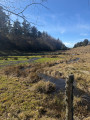
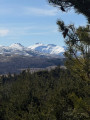
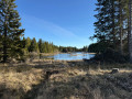
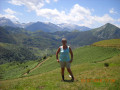
Very beautiful views of Lake Pêcher and the Cantal mountains, with an honourable mention for the unnamed lake/marsh at Frau de Collanges with its small islands and numerous reeds.

Some criticisms

The path to the observatory is not on the GPX track and is poorly signposted on site. There are posts that appear to mark the route, but the signs are blank. You will need to make a detour and follow these posts from the watering hole.

There are a significant number of sections on tarmac roads, some of which can be replaced by slightly longer alternatives:

  • At the intersection between the path and the D23 in the Buissonnière forest, you can go straight ahead instead of turning right to take a path parallel to the road, which rejoins the original route at the Roche du Pic car park.
  • On the way back from La Roche du Pic, before the second intersection with the D23, you can cut across the pasture just after Lac Grand. The path is not marked on IGN maps, but it runs diagonally and rejoins the second car park. On the other side, this path appears to be official.
  • Be careful, as the start of the path after point 7 is upstream; do not enter the field. The GPX is incorrect at this point. The start is hidden by the left barrier at the entrance to the field.

In February 2026, at the exit of the D23 towards Frau de Sauvages, the path is impassable because hundreds of fir trees (without exaggeration) have fallen across it. I tried to make a small detour to the right and climb over a few fir trees, but I would not recommend doing the same. Take a wider detour to the left, where there is an almost parallel path, and then turn back further on.

Machine-translated

Other walks in the area

For more walks, use our search engine .

The GPS track and description are the property of this route's author. Please do not copy them without permission.